 | Ljubelj - Loibler Baba/Košutica (via koča na Ljubelju)
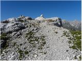
Košutica (also known as Ljubeljska Baba) is a panoramic mountain north of the western ridge of Košuta. From the summit, marked by a small cross a...
2 h 45 min |
 | Bučan - Loibler Baba/Košutica
Košutica (also known as Ljubeljska Baba) is a panoramic mountain north of the western ridge of Košuta. From the summit, marked by a small cross a...
2 h 45 min |
 | Dom pod Storžičem - Storžič (via Škarjev rob)
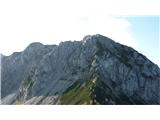
Storžič is a 2132 m high mountain located in the western part of the Kamnik-Savinja Alps. From the summit, where there is a cross, a beautiful vi...
3 h 5 min |
 | Laško (obračališče nad vasjo) - Storžič (via Kališče)
Storžič is a 2132 m high mountain located in the western part of the Kamnik-Savinja Alps. From the summit, where there is a cross, a beautiful vi...
3 h 20 min |
| Jekarica - Storžič
Storžič is a 2132 m high mountain located in the western part of the Kamnik-Savinja Alps. From the summit, where there is a cross, a beautiful vi...
3 h |
| Tržiški graben - Storžič (via Javorniški preval)
Storžič is a 2132 m high mountain located in the western part of the Kamnik-Savinja Alps. From the summit, where there is a cross, a beautiful vi...
3 h 40 min |
| MHE Zabukovec - Storžič (via Bašeljski preval)
Storžič is a 2132 m high mountain located in the western part of the Kamnik-Savinja Alps. From the summit, where there is a cross, a beautiful vi...
4 h |
 | Jermanca - Brana (via Kamniško sedlo)
Brana is a mountain above Kamniško sedlo. From the spacious summit, which has a registration box and a small cross, there is a very beautiful vie...
3 h 45 min |
| Koča pod slapom Rinka - Brana
Brana is a mountain above Kamniško sedlo. From the spacious summit, which has a registration box and a small cross, there is a very beautiful vie...
3 h 45 min |
 | Erjavčev rovt - Mittagskogel/Kepa
Kepa (also Jepa, German: Mittagskogel) is a panoramic mountain in the western Karavanke, located on the border ridge between Slovenia and Austria...
3 h 50 min |
 | Iličev rovt / Illitsch Rauth - Mittagskogel/Kepa (path 680)
Kepa (also Jepa, German: Mittagskogel) is a panoramic mountain in the western Karavanke, located on the border ridge between Slovenia and Austria...
3 h |
 | V Koncu - Kalška gora
Kalška gora lies between the Kalški greben and Kokrsko sedlo. From the grassy summit there is a beautiful view towards the nearby Kalški greben. ...
3 h 15 min |
| Suhadolnik - Kalška gora
Kalška gora lies between the Kalški greben and Kokrsko sedlo. From the grassy summit there is a beautiful view towards the nearby Kalški greben. ...
3 h 30 min |
 | Ravenska Kočna - Vratca (past the cableway)
The peak of Vratca stands west of Češka koča and is recognisable by its tower-like shape. There is little space on the very summit, but it offers...
2 h 15 min |
| Ravenska Kočna - Vratca (umik Žrela)
The peak of Vratca stands west of Češka koča and is recognisable by its tower-like shape. There is little space on the very summit, but it offers...
2 h 20 min |
| Ravenska Kočna - Vratca (via Štularjeva planina)
The peak of Vratca stands west of Češka koča and is recognisable by its tower-like shape. There is little space on the very summit, but it offers...
2 h 15 min |
| Makekova Kočna - Vratca
The peak of Vratca stands west of Češka koča and is recognisable by its tower-like shape. There is little space on the very summit, but it offers...
2 h 45 min |
 | Bodenbauer - Ovčji vrh (Kozjak) / Geissberg (Kosiak) (direct way)
Ovčji Vrh or Kozjak, known in German as Geissberg or Kosiak, is a 2024 m high peak located north of the main Karawanks ridge. Rising above Celovš...
3 h |
| Bodenbauer - Ovčji vrh (Kozjak) / Geissberg (Kosiak) (via Klagenfurter Hütte)
Ovčji Vrh or Kozjak, known in German as Geissberg or Kosiak, is a 2024 m high peak located north of the main Karawanks ridge. Rising above Celovš...
3 h 15 min |
 | Bodenbauer - Bielschitza/Svačica
Svačica is a less prominent peak in the main ridge of the Karawanks. It lies between Vrtača and Stol, slightly offset to the north. The summit, m...
3 h 15 min |
 | Tolminske Ravne - Vogel (steep path)
Many associate the name Vogel first with the Vogel ski resort near the eponymous peak. From the north, it is recognizable by its pyramidal shape,...
3 h |
| Tolminske Ravne - Vogel (steep path and over Globoko)
Many associate the name Vogel first with the Vogel ski resort near the eponymous peak. From the north, it is recognizable by its pyramidal shape,...
3 h 45 min |
 | Valbruna - Jof di Miezegnot/Poldašnja špica (via Planina Ravne)
Poldašnja špica is the easternmost two-thousander in the Malborghetto mountains group (Monti di Malborgheto). From the mountain, which has many r...
3 h 45 min |
| Valbruna - Jof di Miezegnot/Poldašnja špica (via Planina Strehica)
Poldašnja špica is the easternmost two-thousander in the Malborghetto mountains group (Monti di Malborgheto). From the mountain, which has many r...
4 h |
 | Malborghetto - Jof di Miezegnot/Poldašnja špica
Poldašnja špica is the easternmost two-thousander in the Malborghetto mountains group (Monti di Malborgheto). From the mountain, which has many r...
4 h |
 | Žabnice / Camporosso in Valcanale - Kamniti lovec / Cima del Cacciatore
Kamniti lovec is a popular excursion point above Trbiž. Due to the short approach, shortened by the cable car to Višarje, it is well visited. Two...
3 h 30 min |
 | Ravenska Kočna - Velika (Koroška) Baba (via Jenkova planina)
Velika (Koroška) Baba is a 2127 m high mountain on the border ridge above the Ravenska Kočna valley on the Slovenian side and above the Bela (Bel...
3 h 30 min |
 | Tolminske Ravne - Vrh nad Škrbino (on steep and direct path)
Vrh nad Škrbino is the easternmost two-thousander in the ridge of the Lower Bohinj Mountains. From the summit, there are excellent views of the n...
3 h 30 min |
 | Goldberg - Torkofel
Torkofel is the highest peak of the panoramic Jauken ridge, which extends north of the Gailtal valley. From the summit cross, there is a nice vie...
3 h 45 min |
 | Reißkofelbad - Kleiner Reißkofel
Kleiner Reißkofel is a 2,161-meter-high mountain east of Reißkofel. From the summit, where a cross stands, there are fine views of the nearby Rei...
3 h 30 min |
 | Na Razpotju - Krofička (marked way)
Krofička (or Grofička according to some records) is a peak located northeast of Ojstrica. From the summit, which steeply descends towards Logarsk...
3 h 40 min |
| Dom Planincev v Logarski dolini - Krofička (marked path)
Krofička (or Grofička according to some records) is a peak located northeast of Ojstrica. From the summit, which steeply descends towards Logarsk...
3 h 35 min |
 | Belopeška jezera - Mala Ponca / Ponza Piccola
Mala Ponca is a 1,925 m high peak between Planica and the Belopeška lakes. Though lower than neighboring Visoka Ponca, it offers fine viewsespeci...
2 h 45 min |
 | Spodnje Belopeško jezero - Mala Ponca / Ponza Piccola (on ridge)
Mala Ponca is a 1,925 m high peak between Planica and the Belopeška lakes. Though lower than neighboring Visoka Ponca, it offers fine viewsespeci...
3 h |
 | NC Planica - Srednja Ponca / Ponza di Mezze
Srednja Ponca is a 2,228-meter-high peak rising steeply above Tamar, Planica, and Mangartska Dolina. From the summit, which has a stamp, there ar...
4 h |
 | Sella Nevea - Monte Bila pec
Bela peč (Italian: Monte Bila pec) is a 2,146-meter-high mountain located north of the main Kanin ridge. From the summit, which has a logbook box...
2 h 45 min |
 | Ljubelj - Lokovnikov Grintovec / Grintoutz (via Koča na Ljubelju)
Lokovnikov Grintovec is a dwarf pine-covered peak north of Košutica, separated from it by Dovjakovo sedlo saddle (1,728 m). Its southwestern and ...
2 h 45 min |
 | Bučan - Lokovnikov Grintovec / Grintoutz
Lokovnikov Grintovec is a dwarf pine-covered peak north of Košutica, separated from it by Dovjakovo sedlo saddle (1,728 m). Its southwestern and ...
2 h 45 min |
 | Planina Zapleč - Krnčica
Krnčica is a peak in the undulating ridge stretching from Bovec to Krn. It is actually Krn's northwestern ridge. It is comfortably accessible alo...
2 h 40 min |
 | Coot Parking Lot - Velika Baba (Kanin) (over Zg. Brda and saddle Med Baban)
Velika Baba is the southernmost two-thousander of the Kanin mountains. It is separated from the main ridge to the north by the saddle Med Baban, ...
3 h 15 min |
 | Planina Zapleč - Srednji vrh (at Krn)
Srednji vrh is a 2134-meter-high peak located in the ridge between Krn and Krnčica. A marked path leads to the summit, which offers very nice vie...
3 h 10 min |
 | La AleGra - Bivacco Dino Brollo
The Bivacco Dino Brollo bivouac is located on a panoramic ridge near the Monte Ruscie summit south of the main Muzci ridge. It offers 4 sleeping ...
2 h 45 min |