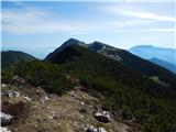
 | Urbas - Hochstuhl/Stol
Stol is, at 2236 m, the highest peak of the Karavanke. From the summit, which has a registration box and a stamp, we have a beautiful view of the...
3 h 15 min |
 | Planina Jezerca - Veliki Zvoh (on unmarked path via Razor)
Veliki Zvoh is the highest point of the Krvavec ski resort. The cable car does not quite reach the top, missing only a few metres. A few metres b...
2 h 15 min |
 | Zavetišče na planini Šija - Veliki vrh (Košuta) (Kačja pot)
Veliki vrh, with a height of 2088 m, is the westernmost two-thousander in the longest Slovenian ridge Košuta. From the summit, where there is a ...
2 h |
 | End of road on Pokljuka - Viševnik (via Gola Ravan)
Viševnik is a 2050 m high mountain rising northwest of Rudno polje on Pokljuka. From the summit, where the stamp is located, a beautiful view ope...
2 h 15 min |
| Rudno polje - Viševnik (via Gola Ravan)
Viševnik is a 2050 m high mountain rising northwest of Rudno polje on Pokljuka. From the summit, where the stamp is located, a beautiful view ope...
2 h 15 min |
 | End of road on Pokljuka - Viševnik (via source of Zlata voda)
Viševnik is a 2050 m high mountain rising northwest of Rudno polje on Pokljuka. From the summit, where the stamp is located, a beautiful view ope...
2 h 20 min |
| Rudno polje - Viševnik (via source of Zlata voda)
Viševnik is a 2050 m high mountain rising northwest of Rudno polje on Pokljuka. From the summit, where the stamp is located, a beautiful view ope...
2 h 20 min |
| Uskovnica (Razpotje) - Viševnik (via source of Zlata voda)
Viševnik is a 2050 m high mountain rising northwest of Rudno polje on Pokljuka. From the summit, where the stamp is located, a beautiful view ope...
2 h 55 min |
| Uskovnica (Lom) - Viševnik (via source of Zlata voda)
Viševnik is a 2050 m high mountain rising northwest of Rudno polje on Pokljuka. From the summit, where the stamp is located, a beautiful view ope...
3 h 15 min |
| Uskovnica (Lom) - Viševnik (via Gola Ravan)
Viševnik is a 2050 m high mountain rising northwest of Rudno polje on Pokljuka. From the summit, where the stamp is located, a beautiful view ope...
3 h 10 min |
| Uskovnica (Razpotje) - Viševnik (via Gola Ravan)
Viševnik is a 2050 m high mountain rising northwest of Rudno polje on Pokljuka. From the summit, where the stamp is located, a beautiful view ope...
2 h 50 min |
 | Rudno polje - Mrežce (via Zgornji Razor)
Mrežce is a panoramic peak near Lipanski vrh, which is visible on the other side of the gully between the two peaks. Since the slopes towards Pok...
2 h |
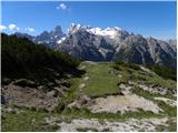
 | end of road on Pokljuka - Tosc
Tosc is located in the heart of the Julian Alps between Veliki Draški vrh and Mišelj vrh. The grassy peak offers a very nice view of Triglav and ...
3 h 25 min |
 | Križovec - Barentaler Kotschna/Struška (footpath)
Barentaler Kotschna is a small mountain range located between Stolo or Belščica and Golica. From Veliki vrh, as the highest peak of the mountain ...
2 h 30 min |
| Križovec - Barentaler Kotschna/Struška (by road)
Barentaler Kotschna is a small mountain range located between Stolo or Belščica and Golica. From Veliki vrh, as the highest peak of the mountain ...
2 h 15 min |
 | Križovec - Kahlkogel/Golica (on ridge)
Kahlkogel is an unvegetated peak located north of Jesenice. From the top, which has a registration box, there is a beautiful view of the western ...
2 h |
 | Erjavčev rovt - Frauenkogel/Dovška Baba (direct way)
Frauenkogel is an 1891 m high peak located on the border ridge between Slovenia and Austria. The summit, which has a registration box and a stamp...
2 h 15 min |
 | Rogarjev rovt - Frauenkogel/Dovška Baba (via Rožca and Hruški vrh)
Frauenkogel is an 1891 m high peak located on the border ridge between Slovenia and Austria. The summit, which has a registration box and a stamp...
2 h 30 min |
 | Tinčkova koča - Srednji vrh (above Završnica) (via Zagon)
Srednji vrh is a scenic and dwarf pines mountain located between Stol, Vertatscha and Begunjščica. From the summit, which descends precipitously ...
2 h |
 | Jezerski vrh - Plešivec
Plešivec is an 1801 m high peak located south of the eastern part of Košuta. The summit, on which the border signpost stands, offers a beautiful ...
3 h 30 min |
 | Javorje - Rodica (via Lepa Suha)
The mountain is located above Bohinj in the Lower Bohinj Mountains. From the top there is a beautiful view of Julian Alps and Škofjeloško and the...
2 h 30 min |
 | Planina Blato - Ogradi
Ogradi are located between mountain pasture Laz and mountain pasture Krstnica. The summit is grassy with plenty of space. A small cross stands on...
2 h 45 min |
 | Rudno polje - Debeli vrh above Lipanca (via Zgornji Razor)
Debeli vrh is a 1962 m high mountain located in a ridge of mountains rising steeply above the Krma valley. From the top, where a stamp is attache...
2 h 15 min |
 | Ravne - Rosenkogel/Hruški vrh (via Dovška Baba)
Rosenkogel is a 1776 m high mountain located between Frauenkogel and the slightly less known Klek. From the top, where there is a small chapel de...
2 h 25 min |
 | Ravne - Klek (via Hruški vrh)
Klek is a 1753 m high mountain located between Rosenkogel and the more famous Golica. The summit, which borders between Slovenia and Austria, off...
2 h 30 min |
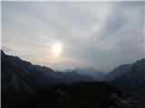
 | Urbas - Weinasch/Vajnež
Weinasch is the highest peak of Belščice, a mountain range located to the west of the better known Stoľa. From the top, where the cross and the S...
2 h 25 min |
| Olipova planina - Weinasch/Vajnež (via Hrašenska planina)
Weinasch is the highest peak of Belščice, a mountain range located to the west of the better known Stoľa. From the top, where the cross and the S...
2 h 50 min |
 | Javorje - Šija (via Kratki plaz)
The peak is located above the Vogel ski slope in the Lower Bohinj Mountains. From the top there is a beautiful view of the neighbouring peaks in ...
2 h 40 min |
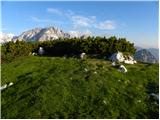
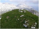
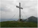
 | Urbas - Potoški Stol
Potoški Stol is located between Hochstuhl and Weinasch on the border with Austria. Just a few metres below the grassy peak, a cross is erected. T...
2 h 15 min |
| Olipova planina - Potoški Stol
Potoški Stol is located between Hochstuhl and Weinasch on the border with Austria. Just a few metres below the grassy peak, a cross is erected. T...
2 h 40 min |
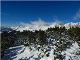
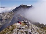
 | Podnar / Bodenbauer - Ovčji vrh (Kozjak) / Geissberg (Kosiak) (via Karweg and southeast path)
Ovčji vrh or Kozjak, or Geissberg or Kosiak in German, is a 2024 m high peak located north of the main ridge of the Karavanke Mountains. The peak...
2 h 45 min |
 | Tonnerhütte - Zirbitzkogel (winter path)
At 2396m, Zirbitzkogel is the highest peak in the Seetaler Alps. The summit, on which stands a cross and a viewing platform, offers a beautiful v...
2 h 27 min |
 | Tonnerhütte - Scharfes Eck (winter path)
Scharfes Eck is the peak on which the Austrian meteorological radar station stands. The unpopular peak offers a beautiful view of the neighbourin...
2 h 45 min |
 | Planina Kuk - Žabiški Kuk (via planina Razor)
Žabiški Kuk is located on the southern side ridge of the Lower Bohinj Mountains near the better known Vogel and above mountain pasture Razor. Fro...
3 h |
 | Planina Kuk - Vrh Planje (above Globoko)
Vrh Planje is a less distinct peak in the ridge of the Lower Bohinj Mountains, which has recently become more and more visited. Vrh Planje (above...
2 h 45 min |
 | Pecol - Cima di Terrarossa
Cima di Terrarossa is a scenic peak located between Jôf di Montasio and Viš. From the summit, which is often full of ibex, you can admire the hig...
2 h 45 min |
 | Ravne - Kleiner Frauenkogel/Koprivnjak
Kleiner Frauenkogel (Little Frauenkogel) is a 1754 m high peak located on the Austrian side of the Karavanke Mountains. From the top, where the c...
2 h 20 min |
 | Rudnik v Topli - Končnikov vrh (Peca)
Končnikov vrh is a 2109 m high mountain located in the central part of Pec. The grassy peak offers a beautiful view along the Pec ridge and the m...
2 h 30 min |
 | Rudnik v Topli - Velika glava (Peca)
Velika glava is a peak in the Peć mountain range, located between Petzen and Končnik's Peak. The summit, which borders Austria, offers a beautifu...
2 h 30 min |
| Koprivna (Kumer) - Velika glava (Peca) (via Knipsovo sedlo)
Velika glava is a peak in the Peć mountain range, located between Petzen and Končnik's Peak. The summit, which borders Austria, offers a beautifu...
3 h 10 min |
 | Mangartska planina - Šober / Monte Sciober Grande (via Dren)
Šober is a 1845 m high peak located between Remšendol and the Jezersko Valley. From the top you can enjoy a beautiful view of the nearby Rabeljsk...
2 h 35 min |
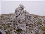
 | Planina Blato - Krsteniški Stog (čez Krsteniški preval)
Krsteniški or Little Stog is a 1879 m high mountain rising steeply above mountain pasture Krstenica. From the top, on which stands a stone cairn,...
2 h 25 min |
 | Vrh Bače - Rušni vrh
Rušni vrh is a 1786 m high peak located to the east of Črna prsti. From the summit, which is the boundary stone of the old Rapallo border, we hav...
3 h |
 | Carbonin - Knollkopf / Col Rotondo dei Canope
The 2204-metre-high mountain is located in the Fanes Sennes Prags Nature Park. The mountain is mostly covered with dwarf pines and has a cross at...
3 h |
 | Šajda / Schaidasattel - Kravji vrh / Kuhberg (via Obirsko sedlo)
Kravji vrh is a two-thousand-metre peak on the Obir, with two peaks of approximately the same height. There is nothing on the higher one except d...
2 h 45 min |
 | Šajda / Schaidasattel - Kravji vrh / Kuhberg (steep path)
Kravji vrh is a two-thousand-metre peak on the Obir, with two peaks of approximately the same height. There is nothing on the higher one except d...
2 h 30 min |
 | Vodel - Gradovec
Gradovec is a 1692 m high peak located north of the ridge of the Lower Bohinj Mountains, above mountain pasture Poljana. From the summit, where d...
1 h 55 min |
| Javorje - Gradovec (path over Glin)
Gradovec is a 1692 m high peak located north of the ridge of the Lower Bohinj Mountains, above mountain pasture Poljana. From the summit, where d...
3 h 10 min |
 | Alpengasthof Scheikl - Hohe Veitsch (up along the southern ridge)
...
2 h 35 min |