Rogarjev rovt - Frauenkogel/Dovška Baba (via Rožca and Hruški vrh)
Starting point: Rogarjev rovt (1175 m)
| Lat/Lon: | 46,464°N 14,0111°E |
| |
Name of path: via Rožca and Hruški vrh
Time of walking: 2 h 30 min
Difficulty: easy unmarked way
Altitude difference: 716 m
Altitude difference po putu: 780 m
Map: Karavanke - osrednji del 1:50.000
Recommended equipment (summer):
Recommended equipment (winter): ice axe, crampons
Views: 5.720
 | 2 people like this post |
Access to the starting point:
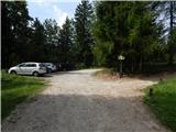
a) From the motorway Ljubljana - Jesenice, take the exit Jesenice - East (Lipce), then continue driving towards Jeseniceam. At the traffic lights at Slovenski Javornik, turn left towards the centre of Jesenice and Kranjska Gora, and follow the main road to the junction where the signs for Kahlkogel and Mountain pasture under Kahlkogel direct you right onto the ascending road. Follow the road towards Mountain pasture below Kahlkogel until a sharp right turn where you turn left towards Plavški Rovto. Above Plavški Rovt the asphalt ends and the road even descends a little. A little higher, you reach a crossroads where the signs for Dovje 9 km direct you sharp left onto another steeper dirt road. From the crossroads onwards, follow the road for another 2 km, or more precisely to Rogarjev rovt, which is recognisable by a few cottages. Park in a suitable place at a small crossroads, where the unmarked and worse forest road towards Hruška mountain pasture branches off to the right.
b) First drive to Kranjska Gora, then continue driving towards Jesenice. At Dovje, leave the main road and turn left towards the centre of the village, from where follow the signs for Dovško Baba. The road leads to a crossroads shortly after the village, where you continue along the road on the right (sharp left Mittagskogel and Borovje). Continue for some time to the next crossroads, where the road to the left branches off towards mountain pasture Dovška Rosenbachsattel (in the descriptions, the starting point is Ravne), and we continue straight on towards Plavskem Rovto. Shortly after the crossroads we cross the Presušnik stream, and then the road climbs a little more. When the road is laid, it continues to cross the slopes to the right, and then leads to a small saddle, after which it begins to descend crosswise. Then cross the Dobršnik stream, and then pay attention, because you will soon come to Rogarjev rovt, which you can recognise by a larger hayfield, a small parking lot and a wall of the cart track to the left.
Path description:
From the starting point, take the worse macadam road, which first climbs gently over Rogarjev rovt. On the other side of the ravine, the road enters the forest and starts to climb steeply after the ramp. Higher up, the road leads to a ridge north of the lesser-known Suhega vrh (1339 m), from where a view briefly opens up towards Stol, Weinasch and Struška. The road quickly returns to the forest, through which we walk for a few minutes, and then arrive at the vast pastures of Hruška mountain pasture. From here, continue along a rather winding road, which, with a view of Rosenkogel, leads to the nearby shepherd's hut at Hruška planina (also Hruščanska mountain pasture).
From the hut, continue right past a large watering point for animals and across a large pasture to the edge of the forest, where you continue for a short distance along the wide cart track. Immediately after the path enters the forest, leave cart track and continue the ascent along a well-trodden but still unmarked path which branches off to the left with cart track. The way forward begins to climb steeply through the forest and quickly leads us to a larger ravine, which we cross and then on the other side of which we begin to climb more steeply. A little higher up, we leave the forest and turn slightly to the right, and then climb up over the increasingly scenic grassy slopes. Higher up, the track lays down and leads to the hut at Rožca.
From the hunting lodge, continue along one of the paths, which ascends in a transverse ascent to the border ridge between Slovenia and Austria.
Once on the ridge, follow the well-trodden path as it continues westwards (Klek on the right). On the way along the border ridge, instead of Slovenian markings, you will see Austrian markings (markings in the colour of the Austrian flag). Follow this increasingly scenic and easy path, which sometimes climbs quite steeply, all the way to Rosenkogel, where there is a small chapel.
From Rosenkogel, where the chapel of St Isidore is located, we start descending along the ridge, and when the descent ends, we are joined by a marked trail on the left, which bypasses Rosenkogel, and a few steps further on, we are joined by a marked Austrian trail on the right, which leads over the Koprivnjak peak. Walk along the marked path for a few steps, then continue slightly to the right, on an unmarked path that continues along the ridge (the path that recedes slightly to the left of the ridge leads to mountain pasture Dovška Rosenbachsattel). The ascent is mainly moderate and follows a relatively wide ridge, in some parts covered with dwarf pines. Higher up, as we approach Baba (1849 m) - Baba is the eastern headland of Frauenkogel - the ridge retreats slightly to the left, where it crosses a short, steeper and, especially in the wet, dangerously slippery slope. When the crossing is over, the path returns to the ridge and we climb to the top of Dovška Baba in a few minutes of further walking.
Rogarjev rovt - Hruška planina 30 minutes, Hruška planina - Rosenbachsattel 40 minutes, Rosenbachsattel - Rosenkogel 30 minutes, Rosenkogel - Frauenkogel 50 minutes.

Pictures:
 1
1 2
2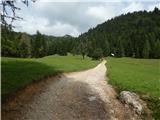 3
3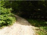 4
4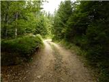 5
5 6
6 7
7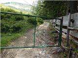 8
8 9
9 10
10 11
11 12
12 13
13 14
14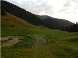 15
15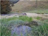 16
16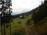 17
17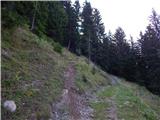 18
18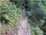 19
19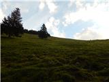 20
20 21
21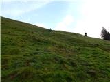 22
22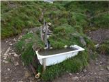 23
23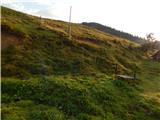 24
24 25
25 26
26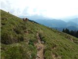 27
27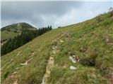 28
28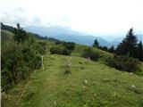 29
29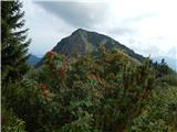 30
30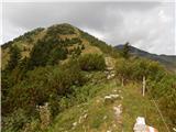 31
31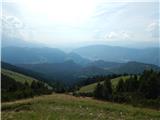 32
32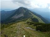 33
33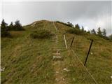 34
34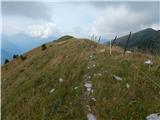 35
35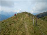 36
36 37
37 38
38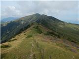 39
39 40
40 41
41 42
42 43
43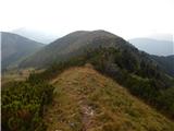 44
44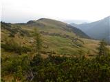 45
45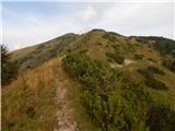 46
46 47
47 48
48 49
49 50
50 51
51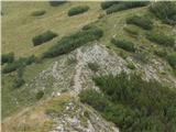 52
52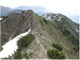 53
53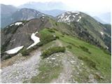 54
54 55
55
Discussion about the trail Rogarjev rovt - Frauenkogel/Dovška Baba (via Rožca and Hruški vrh)