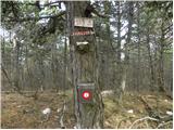
 | Dvor - Polhograjska Grmada (Dvor - Grmada - Belica)
Polhograjska Grmada is an 898 m high peak located in the heart of the Polhograjski Dolomites. From the summit, where there is a registration box ...
2 h 10 min |
 | Preval - Polhograjska Grmada
Polhograjska Grmada is an 898 m high peak located in the heart of the Polhograjski Dolomites. From the summit, where there is a registration box ...
2 h 45 min |
 | Gabrje - Polhograjska Grmada
Polhograjska Grmada is an 898 m high peak located in the heart of the Polhograjski Dolomites. From the summit, where there is a registration box ...
2 h 20 min |
 | Preska - Sveti Jakob (via Turnice)
The Church of St. James is located on a scenic hill north of the village of Topol pri Medvodah. From the summit, which features a registration bo...
3 h |
| Preska - Sveti Jakob (via Jeterbenk)
The Church of St. James is located on a scenic hill north of the village of Topol pri Medvodah. From the summit, which features a registration bo...
3 h 15 min |
| Žlebe - Sveti Jakob (via Jeterbenk)
The Church of St. James is located on a scenic hill north of the village of Topol pri Medvodah. From the summit, which features a registration bo...
2 h 15 min |
 | Topole - Rašica (Vrh Staneta Kosca) (ridge path)
Vrh Staneta Kosca, better known as Rašica, is located north of Ljubljana, more precisely above the villages of Rašica and Dobeno. From the summit...
2 h 10 min |
 | Zgornja Besnica (Podrovnik) - Sveti Jošt above Kranj (via Gaber)
Sveti Jošt above Kranj is a hill located west of the slightly lower Šmarjetna gora. From the summit, where the Church of St Jošt stands alongside...
2 h 30 min |
 | Puštal - Osolnik
Osolnik is an 858-metre-high mountain located south of Škofja Loka and west of Medvode. From the summit, where the Church of St Mohor and Fortuna...
2 h 15 min |
 | Preska - Jeterbenk (via Turnice)
Jeterbenk is a 774-meter-high peak located between the Slavkov dom hut on Golo Brdo and Katarina (the village of Topol). From the summit, where t...
2 h 15 min |
 | Preska - Jeterbenk (on ridge)
Jeterbenk is a 774-meter-high peak located between the Slavkov dom hut on Golo Brdo and Katarina (the village of Topol). From the summit, where t...
2 h 15 min |
| Blagovica - Limbarska gora (Blagovica - Limbarska gora - Blagovica)
Limbarska gora is located northeast of Moravče. From the summit, there is a beautiful view of the surrounding peaks, and in good weather, the Kam...
2 h 9 min |
 | Puštal (Na Dobravi) - Sveti Ožbolt (above Zminec)
Sveti Ožbolt is situated on a panoramic rise in the north of the Polhograjski Dolomiti. There is a beautiful view toward the Škofjeloško hribovje...
2 h 15 min |
 | Rakovica - Archangel Gabriel (Planica)
Planica is an 824-meter-high peak located north of Škofja Loka, more precisely between Križna gora and Planica. From the summit, where the church...
2 h 30 min |
 | Vrhnika-Tankovska cesta - Koča na Planini nad Vrhniko (Circular path Vrhnika-Planina-Lintvern-Vrhnika)
Planina nad Vrhniko is for Vrhnika locals something like Šmarna gora for those from Ljubljana. It is 733 m high, reachable by several paths from ...
2 h 20 min |
 | Besnica - Janče
Janče is a 792-meter-high peak situated between the Sava River and the Besnica stream valley. From the summit, where a mountain hut stands and th...
2 h 15 min |
 | Laze pri Dolskem - Janče
Janče is a 792-meter-high peak situated between the Sava River and the Besnica stream valley. From the summit, where a mountain hut stands and th...
2 h 15 min |
 | Moravče - Slivna (Pivkelj)
Slivna, also known as Pivkelj (or Pivkelj turn), lies south of Limbarska gora. Pivkelj is the highest point of the Moravška planinska pot and at ...
2 h 30 min |
 | Polzela - Gora Oljka (via Vimperk)
Gora Oljka is a hill located east of Šmartno ob Paki. On the summit stands the Church of the Holy Cross, built in the mid-18th century. Just a fe...
2 h 15 min |
 | Zvodno - Tolsti vrh above Celjska koča (via Srebotnik on CPP)
Tolsti vrh (also recorded as Tovsti vrh in some sources) is situated above the Celjska koča ski area. The summit has a logbook box and stamp, but...
2 h 15 min |
| Hayrack (Laška vas - Pečovje) - Tolsti vrh above Celjska koča (via Srebotnik on CPP)
Tolsti vrh (also recorded as Tovsti vrh in some sources) is situated above the Celjska koča ski area. The summit has a logbook box and stamp, but...
2 h 15 min |
 | Preska - Rog (via Turnice)
Rog is an 798-meter peak above the village of Topol, just 10 minutes from St. Katarina's Church. From the summit, where a large cross once stood,...
2 h 30 min |
| Preska - Rog (via Jeterbenk)
Rog is an 798-meter peak above the village of Topol, just 10 minutes from St. Katarina's Church. From the summit, where a large cross once stood,...
2 h 45 min |
 | Hrastnik - Klobuk (via Ravne)
Klobuk is a scenic peak located northeast of Hrastnik. From the summit, which has a logbox and stamp, there are fine views of the valley and surr...
2 h 25 min |
| Dol pri Hrastniku - Klobuk
Klobuk is a scenic peak located northeast of Hrastnik. From the summit, which has a logbox and stamp, there are fine views of the valley and surr...
2 h 10 min |
 | Gorjuša - Murovica (via Dobovlje)
Murovica is a popular excursion point, accessible from the Posavje side, Domžale, or the Moravška Valley. On the summit there is a bench and a lo...
2 h 40 min |
 | Lokvica - Stol (Črni hribi)
Stol, at 629 m, is the second-highest peak in the Črnih hribov ridge. Only its eastern neighbor, the 643 m high Trstelj, rises higher. From the s...
3 h 40 min |
 | Zazid - Golič (via Lipnik)
Golič is a grassy ridge extending from Kojnik to the Slovenian-Croatian border and continuing as the Žbevnica ridge on the Croatian side. Due to ...
2 h 30 min |
 | Zazid - Golič (via Kojnik)
Golič is a grassy ridge extending from Kojnik to the Slovenian-Croatian border and continuing as the Žbevnica ridge on the Croatian side. Due to ...
2 h 30 min |
 | Rakovica - Špičasti hrib
Špičasti hrib (known as Špičasti vrh on maps) is an 837-meter-high hill located west of Sveti Jošt above Kranj. The summit, which has a few bench...
2 h 20 min |
 | Zazid - Kavčič (via Lipnik)
Kavčič is a grassy peak located above the village Rakitovec on the Slovenian-Croatian border. From the summit, where two crosses stand with a sum...
2 h 30 min |
 | Zazid - Nadglavinjak (via Lipnik)
Nadglavinjak is a lesser-known peak located southeast of Golič. From its indistinct grassy summit, nice views open up on Slavnik, Čičarija, Žbevn...
2 h 10 min |
 | Sveti Mavricij - Sveti Socerb (Artviže)
The Church of St. Socerb is located on a panoramic hill above the village of Artviže, which at 817 meters is the highest peak of the Brkini. From...
2 h 15 min |
 | Mlinše - Pleše (via Zasavska Sveta gora)
Pleše is an 866-meter-high peak situated between the Marela ski slope and Zasavska Sveta gora. From the summit, which features a NOB monument, th...
2 h 30 min |
 | Izlake - Pleše (via Grobovščica)
Pleše is an 866-meter-high peak situated between the Marela ski slope and Zasavska Sveta gora. From the summit, which features a NOB monument, th...
2 h 15 min |
 | Braslovško jezero - Grmada (Dobrovlje)
Grmada is a 898 m high, forest-covered peak located on the southeastern part of the Dobroveljska planota plateau. From the summit, where there is...
2 h 25 min |
| Letuš - Grmada (Dobrovlje)
Grmada is a 898 m high, forest-covered peak located on the southeastern part of the Dobroveljska planota plateau. From the summit, where there is...
2 h 25 min |
 | Kozje - Oslica (Bohor) (via Vetrnik)
Oslica is one of Bohor's peaks, located in the eastern part of the range. Unlike some higher Bohor peaks such as Veliki Javornik, Koprivnik, Debe...
2 h 10 min |
 | Gorica pri Slivnici - Žusem (Panoramska pot)
Žusem is a 669-meter-high hill with a rich history and great potential for the future. It forms the northern edge of Kozjansko, and its name deri...
3 h 20 min |
 | Brezno - Sveti Pankracij (Radelca) (by Remšniški potok)
The Church of St. Pankracij on Radelca lies on the border ridge between Slovenia and Austria; since 1966, following an interstate agreement, it h...
2 h 50 min |
 | Muta (Spodnja Muta) - Sveti Trije Kralji (above Radlje ob Dravi)
The Church of the Holy Three Kings is located on an 820-meter-high hill rising above the right bank of the Radeljski Stream. From the church, a n...
2 h 30 min |
 | Rechnitz (Badesee) - Irrotkő / Geschriebenstein
Irrotkő is the highest peak of the Kőszeg Mountains (Kőszegi Hegység) and also the highest peak of western Hungary and the Austrian federal state...
2 h 30 min |
 | Lockenhaus - Irrotkő / Geschriebenstein (via Weidriegel)
Irrotkő is the highest peak of the Kőszeg Mountains (Kőszegi Hegység) and also the highest peak of western Hungary and the Austrian federal state...
2 h 45 min |
| Lockenhaus - Irrotkő / Geschriebenstein (through Marchgraben)
Irrotkő is the highest peak of the Kőszeg Mountains (Kőszegi Hegység) and also the highest peak of western Hungary and the Austrian federal state...
2 h 40 min |
 | Puščava - Klančnik (Glančnik)
Klančnik (Glančnik on some maps) is an 877-meter-high peak situated above the right bank of the Drava River, just a few minutes' walk from the Hu...
2 h 15 min |
 | Lovrenc na Pohorju - Klančnik (Glančnik) (via Povh, Brabar and Hudej)
Klančnik (Glančnik on some maps) is an 877-meter-high peak situated above the right bank of the Drava River, just a few minutes' walk from the Hu...
2 h 25 min |
| HE Ožbalt - Klančnik (Glančnik)
Klančnik (Glančnik on some maps) is an 877-meter-high peak situated above the right bank of the Drava River, just a few minutes' walk from the Hu...
2 h 10 min |
| Podvelka - Klančnik (Glančnik) (via Sveti Ignacij)
Klančnik (Glančnik on some maps) is an 877-meter-high peak situated above the right bank of the Drava River, just a few minutes' walk from the Hu...
2 h 30 min |