 | Topol - Tošč (via Grmada)
Tošč, which became the highest peak of Polhograjsko hribovje decades ago when Pasja ravan was lowered by 9 m by the Yugoslav army, is located nor...
2 h 15 min |
| Topol - Tošč (direct way)
Tošč, which became the highest peak of Polhograjsko hribovje decades ago when Pasja ravan was lowered by 9 m by the Yugoslav army, is located nor...
2 h |
 | Na Poklonu - Lubnik
Lubnik is a 1025 m high mountain rising steeply to the west of Škofja Loka. From the summit, on which the mountain lodge stands, you can enjoy a ...
2 h 15 min |
 | Hunting cottage Plehanov laz - Krim
Krim is a 1107 m high mountain rising south of the Ljubljana Marshes. From the top of the mountain, where the mountain lodge and a number of tran...
2 h 15 min |
 | Rakitna - Krim
Krim is a 1107 m high mountain rising south of the Ljubljana Marshes. From the top of the mountain, where the mountain lodge and a number of tran...
2 h |
 | Sopota - Kum (Nežina pot)
At 1220 metres, Kum is the highest peak of Posavsko hribovje. Because it rises above Zasavje, some people call it the Zasavje Triglav. On the sum...
2 h |
 | Brezje - Slivnica
Slivnica is a 1114 m high peak located north of Cerknica polje. The view from the summit, where the entry box is located, is rather limited due t...
2 h 15 min |
 | Razdrto - Vojkova koča na Nanosu (gentle path)
Vojkova koča is located on the southern edge of the Nanoše plateau, close to Pleše, a peak that is clearly visible from the motorway. From the hu...
2 h 20 min |
 | Strane - Vojkova koča na Nanosu
Vojkova koča is located on the southern edge of the Nanoše plateau, close to Pleše, a peak that is clearly visible from the motorway. From the hu...
2 h 15 min |
 | Furlanovo zavetišče pri Abramu - Vojkova koča na Nanosu
Vojkova koča is located on the southern edge of the Nanoše plateau, close to Pleše, a peak that is clearly visible from the motorway. From the hu...
2 h |
 | Selo - Pasja ravan (via Ostrež)
Pasja ravan is the second highest peak in the Polhograje Hills. A few decades ago, at 1029 m, it was the highest peak, but the Yugoslav army flat...
2 h 15 min |
 | Predmeja - Kucelj na Čavnu
Kucelj is located on the southern slopes of Trnovo Forest, north-west of the Vipava valley. From the uncultivated summit on which the cross stand...
2 h |
| Predmeja (tunnels) - Kucelj na Čavnu (via Koča na Čavnu)
Kucelj is located on the southern slopes of Trnovo Forest, north-west of the Vipava valley. From the uncultivated summit on which the cross stand...
2 h 15 min |
 | Gabrče - Vremščica
Vremščica is a mountain chain, stretching between Senožeče, Pivka and Divača. The highest top is also called Vremščica and the view from it is am...
2 h |
 | Dom na Paškem Kozjaku - Basališče (Paški Kozjak)
Basališče is the highest peak of Paško Kozjak. There is a bench and a registration box at the top. Due to the forest, there is no view....
2 h |
 | Trojane - Črni vrh (Čemšeniška planina)
Črni vrh is the highest peak of Čemšeniška mountain pasture and with a height of 1204 m it is the second highest peak in the Posavje - Zasavje hi...
2 h 45 min |
 | Slovenska vas - Sveta Trojica
Sveta Trojica is a scenic peak located south-west of Javorniki. From the top, where the ruins of the former church are well preserved, you can en...
2 h 15 min |
 | Jeršiče - Sveta Trojica
Sveta Trojica is a scenic peak located south-west of Javorniki. From the top, where the ruins of the former church are well preserved, you can en...
2 h 40 min |
 | Črni vrh - Javornik above Črni vrh (via Šajsna Ravan)
Javornik is a forested peak located southeast of Črnji Vrho. In 1972, a lookout tower was erected on the summit, which reaches above the treetops...
2 h 30 min |
| Kampelc - Javornik above Črni vrh
Javornik is a forested peak located southeast of Črnji Vrho. In 1972, a lookout tower was erected on the summit, which reaches above the treetops...
2 h 15 min |
 | Podkraj - Javornik above Črni vrh
Javornik is a forested peak located southeast of Črnji Vrho. In 1972, a lookout tower was erected on the summit, which reaches above the treetops...
2 h 30 min |
 | Col - Javornik above Črni vrh
Javornik is a forested peak located southeast of Črnji Vrho. In 1972, a lookout tower was erected on the summit, which reaches above the treetops...
3 h |
 | Col - Sinji vrh (via Črne stene)
Sinji vrh is a scenic mountain located between Col, Ajdovščina and Predmeja. From the top, you can enjoy a beautiful view over most of western Sl...
3 h 25 min |
 | Predmeja - Sinji vrh (Pot po Robu)
Sinji vrh is a scenic mountain located between Col, Ajdovščina and Predmeja. From the top, you can enjoy a beautiful view over most of western Sl...
2 h 55 min |
 | Col - Sinji vrh (eastern path via Škraplje)
Sinji vrh is a scenic mountain located between Col, Ajdovščina and Predmeja. From the top, you can enjoy a beautiful view over most of western Sl...
3 h 20 min |
| Col - Sinji vrh (west path)
Sinji vrh is a scenic mountain located between Col, Ajdovščina and Predmeja. From the top, you can enjoy a beautiful view over most of western Sl...
3 h 10 min |
 | Jeršiče - Veliki Javornik (Javorniki)
Veliki Javornik is a 1,268-metre-high peak in the forested hills called the Javorniki. The vast forests of the Javorniki stretch from Postojna to...
2 h 20 min |
 | Sovodenj - Sivka
Sivka is a forested peak located west of Žiri and north of Idrija. On the summit there is a stamp of the Slovenian mountain trail and a registrat...
2 h |
 | Brezje - Galetovec
Galetovec is an undistinguished peak in the south-eastern part of the Pokljuka plateau. From the summit, which has a registration box, there is a...
2 h |
 | Planina pri Sevnici - Skalica (Bohor) (via hunting lodge Bohor)
Skalica is a less known peak in the western part of Bohor. From the summit, which has a registration box, there is a beautiful view to the south ...
2 h |
 | Planina pri Sevnici - Veliki Javornik (Bohor) (via hunting lodge Bohor)
Veliki Javornik is the highest peak of Bohor at 1023m. Although the peak is unspoilt and there are no higher hills far around, there is no view f...
2 h 30 min |
| Planina pri Sevnici - Veliki Javornik (Bohor)
Veliki Javornik is the highest peak of Bohor at 1023m. Although the peak is unspoilt and there are no higher hills far around, there is no view f...
2 h 30 min |
 | Planina pri Sevnici - Koprivnik (Bohor) (via Hunting lodge Bohor and Veliki Javornik)
Koprivnik or Veliki Koprivnik is one of the many peaks in Bohor. It is located between Koča na Bohorju and Veliki Koprivnik. From the top of the ...
3 h 5 min |
| Planina pri Sevnici - Koprivnik (Bohor)
Koprivnik or Veliki Koprivnik is one of the many peaks in Bohor. It is located between Koča na Bohorju and Veliki Koprivnik. From the top of the ...
2 h |
 | Dom planincev Farbanca - Tolsti vrh (Dobrovlje)
Tolsti vrh is, together with Šentjoški vrh (1077m), the highest peak of the Dobrovelj Plateau. The view from the summit, which has a registration...
2 h |
 | Sovodenj - Ermanovec (razgledna pot)
Ermanovec is a 1026 m high peak located between Cerkno and Gorenjska vasja, specifically above Sovodnje and Trebija. Just a few steps away from t...
2 h |
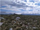
 | Dule - Grmada on Mala gora
Grmada (also Grmada nad Ortnek) is an 887 m high peak located above the village of Vrh pri Poljanah in the Mala Gora mountain range. Just a few m...
2 h |
| Velike Lašče - Grmada on Mala gora (čez Kamen vrh)
Grmada (also Grmada nad Ortnek) is an 887 m high peak located above the village of Vrh pri Poljanah in the Mala Gora mountain range. Just a few m...
2 h |
 | Ortnek - Stene svete Ane
Stene svete Ane is a vegetated peak located near the mountain hut at Sveti Anna on Mali gora. A small observation tower stands on the summit, whi...
2 h 30 min |
 | Col - Križna gora (Hrušica)
Križna gora is a 1162 m high peak located north of the village of Podkraj. From the top of the lookout tower, you can enjoy a beautiful view over...
2 h 20 min |
 | Col - Sveti Duh (Hrušica)
The Sveti Duh Church is located just a few metres below the eponymous peak on the slopes of the forested Hrušice, a mountain range between Col, L...
2 h 15 min |
 | Predmeja - Veliki Rob
Veliki Rob is a scenic peak located between Kuclje (1237m) and Čavno (1185m). From the summit on which the cross is located, there is a beautiful...
3 h |
 | Dom pod Reško planino - Sveta planina (Partizanski vrh)
Sveta planina, also Partizanski vrh, is a 1011 m high mountain located between Čemšeniška mountain pasture and Mrzlica. From the top, where a sma...
2 h 5 min |
 | 18th hairpin turn of road on Strma Reber - Cerk
At 1192 m, Cerk is the highest peak of Borovška Gora, a mountain range located between the Kolpa River valley and Goteniškje Snežnik. From the to...
2 h 40 min |
 | border crossing Remšnik - Kapunar / Kapunerkogel (via Sveti Urban)
Kapunar is a 1051 m high peak above Radlje ob Dravi. Just below the peak is an old caravan and border guardhouse, which is now used by radio amat...
2 h 20 min |
| Sveti Jurij (Remšnik) - Kapunar / Kapunerkogel
Kapunar is a 1051 m high peak above Radlje ob Dravi. Just below the peak is an old caravan and border guardhouse, which is now used by radio amat...
2 h |
 | Trojane - Špilk
Špilk is a 956 m high peak located north of Blagovica. On the summit, which is mostly forested, PD Blagovica has built a small bivouac with a ben...
2 h 30 min |
 | Trojane - Špilk (past the cross Na Kočni)
Špilk is a 956 m high peak located north of Blagovica. On the summit, which is mostly forested, PD Blagovica has built a small bivouac with a ben...
2 h 15 min |
 | Sovodenj - Škofje (through Miklavževa grapa)
Škofje is a 973 m high peak located above the villages of Čeplez, Planina pri Cerknem and Podpleče. The peak itself, on which stands a small conc...
2 h 55 min |
| Sovodenj - Škofje (razgledna pot)
Škofje is a 973 m high peak located above the villages of Čeplez, Planina pri Cerknem and Podpleče. The peak itself, on which stands a small conc...
3 h 15 min |
 | Sovodenj - Loncmanova Sivka (Mrzli Vrh)
Loncmanova Sivka is a scenic peak located above the village of Mrzli Vrh above Žirmi. From the uncultivated peak, in good weather, we can enjoy v...
2 h |
 | Planina pri Sevnici - Debeli vrh (Bohor)
Debeli vrh is a 921-metre-high peak on Bohor between Veliki Koprivnik and Oslice. It is overgrown with dense forest, so there are no views. There...
2 h 30 min |
 | Bezgovica - Loška stena
Loška stena is located above the Upper Kolpa Valley, specifically above the villages of Grintovec pri Osilnici, Ložec and Ribjek. From the top of...
2 h 40 min |
| 18th hairpin turn of road on Strma Reber - Loška stena
Loška stena is located above the Upper Kolpa Valley, specifically above the villages of Grintovec pri Osilnici, Ložec and Ribjek. From the top of...
2 h 25 min |
 | Kuna Konavoska - Ilijin vrh
Ilijin vrh or St. Ilija is the main peak of the Sniježnica Konavoska mountain ridge, which is also the southernmost mountain ridge of the Dinaric...
2 h 30 min |
 | Radeljski prelaz - Sveti Pankracij (Radelca) (Austrian path)
The Church of St Pancras on Radelca is located on the border ridge between Slovenia and Austria, but since 1966, following an inter-state agreeme...
3 h |
| Radeljski prelaz - Sveti Pankracij (Radelca) (via Sveti Urban)
The Church of St Pancras on Radelca is located on the border ridge between Slovenia and Austria, but since 1966, following an inter-state agreeme...
3 h 15 min |
| Sveta Katarina (Zgornja Kapla) - Sveti Pankracij (Radelca) (slovenska pot)
The Church of St Pancras on Radelca is located on the border ridge between Slovenia and Austria, but since 1966, following an inter-state agreeme...
3 h 15 min |
 | Malovan - Čardak (Tremzina)
...
2 h |
 | Malovan - Oklinak
...
2 h 30 min |