Sovodenj - Ermanovec (razgledna pot)
Starting point: Sovodenj (592 m)
| Lat/Lon: | 46,085°N 14,0386°E |
| |
Name of path: razgledna pot
Time of walking: 2 h
Difficulty: easy marked way
Altitude difference: 434 m
Altitude difference po putu: 470 m
Map: Škofjeloško in Cerljansko hribovje 1:50.000
Recommended equipment (summer):
Recommended equipment (winter):
Views: 25.814
 | 3 people like this post |
Access to the starting point:
a) From Ljubljana or Kranj, drive to Škofja Loka, from where you continue to Gorenjska vas. In Gorenjska vas, turn right in the direction of Cerkno and Žiri. The road then takes you past the village of Trebija, after which you turn right in the direction of Cerkno (on the left Žiri). You then follow this road to the village of Sovodenj, where you park in the parking lot between the shop and the firemen's lodge.
b) From Tolmin, take Cerkno and follow the road towards Škofja Loka. When you get to the village Sovodenj, park in the parking lot between the shop and the fire station.
Path description:
From the parking lot, continue along the asphalted road towards Ermanovec and Cerkno. After a few minutes of climbing along the main road, you will come to a marked crossroads where the road to Ermanovec branches off to the right. Take this road, which runs alongside a picturesque stream, and after a few minutes of further walking, you will reach the next crossroads.
Continue straight on (right on Ermanovec) along the road which continues along the aforementioned stream. The road then crosses the stream via a small bridge and leads us past a small hamlet to a marked crossroads.
Continue sharp left in the direction of Ermanovec along the scenic route (straight Ermanovec through the Miklavže ravine). Continue along the cart track, which soon passes out of the forest onto the grassy slopes. Slightly higher up, the path leads us to a small hamlet at which we also step onto a road along which we then continue our ascent. The road then leads us past a small cross to a crossroads where we continue right in the direction of Ermanovec. The road, which continues to climb slightly, quickly leads us to the next crossroads, where we continue straight on (direction Ermanovec).
From the deteriorating road, just a little further on, a marked cart track branches off to the right, crossing a shorter lane of forest. The cart track, which only crosses the slopes, then passes into a slightly larger clearing beyond which it leads into a dense forest. Cart track then starts to climb, passes higher out of the forest and leads us to a tarmac road which we then climb.
Here, the path through Miklavževo grapo soon joins us from the right. The road then leads us past a small hamlet to a crossroads near the Ermanovec hut.
Here we continue to the right (left hut on Ermanovcu 1 minute) along the road, which after 5 minutes of further walking leads us to the chapel next to which there is a larger bell. At the chapel there is also a crossroads where we continue along the cart track in the direction of Ermanovec to which we have a further 15 minute walk. The way forward is to climb steeply up the cart track, which, with beautiful views, leads us in 10 minutes to the other side of this scenic slope. Here the path turns left and climbs more steeply. Follow this dirt track all the way to the top of Ermanovec. Just a few steps before the top, we will see a beautiful viewpoint on the left side from which a beautiful view opens up.

We can extend the trip to the following destinations: Štor
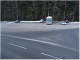
Pictures:
 1
1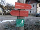 2
2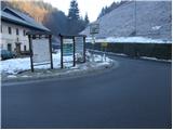 3
3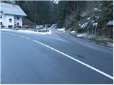 4
4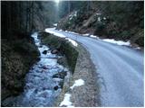 5
5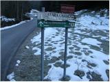 6
6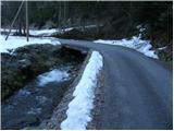 7
7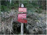 8
8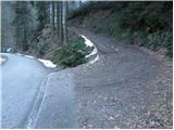 9
9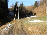 10
10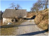 11
11 12
12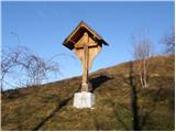 13
13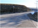 14
14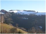 15
15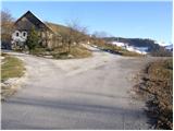 16
16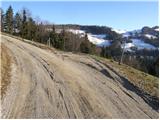 17
17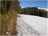 18
18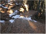 19
19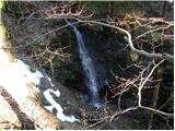 20
20 21
21 22
22 23
23 24
24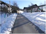 25
25 26
26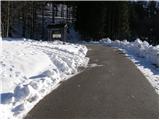 27
27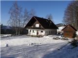 28
28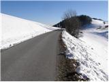 29
29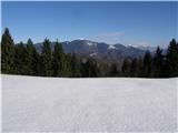 30
30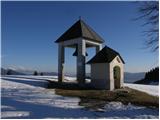 31
31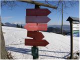 32
32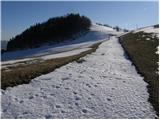 33
33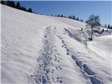 34
34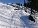 35
35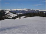 36
36 37
37
Discussion about the trail Sovodenj - Ermanovec (razgledna pot)
|
| Tadej23. 12. 2008 |
Ermanovec nam kljub skromni nadmorski višini ob lepem vremenu nudi lep razgled. Ker je pot lahka je primerna tudi za manjše otroke.
|
|
|
|
| niki27. 12. 2008 |
Mene pa zanima krožna pot iz Sovodnja na Ermanovec in nato preko Bevkovega vrha do izhodišča. Ali je pot shojena in približno koliko časa je potrebno, da jo prehodiš? Lp, niki
|
|
|
|
| Kokta7. 04. 2012 |
Iz Sovodnja do koče na čaj potem pa na Štor. Še obisk do vrha Ermanovca in nazaj. Pod vrhom Ermanovca vpisna kjiga in žig. Celo pot je rahlo deževalo 
|
|
|
|
| Lisica30. 04. 2012 |
Na Ermanovec sem šla po razgledni poti, ki je ne priporočam, raje pojdite po grapi gor. Pot po razgledni poti je večinoma asfaltna...
Na poti zelo malo ljudi, glede na to da so v SPP sem na nedeljo in lep dan pričakovala več obiska, isto je bilo na poti na Bevkov vrh in Sivko.
|
|
|
|
| slavkovoda15. 06. 2014 |
Danes obiskali Kočo na Ermanovc po tej razgledni poti - pot po Miklavževem grebenu ZAPRTA - PODRTO DREVJE ( žled)!! Lepo vreme, lep razgled, obilo borovnic,izjemna suha klobasa z zaseko.
|
|
|