 | Sežanje - Snežnik
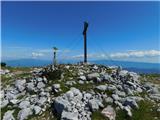
Snežnik, or Veliki Snežnik, at 1796 metres is the highest peak in the near and far surroundings, offering a beautiful view over a large part of S...
1 h 40 min |
 | Podhočar - Porezen
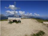
Porezen is a 1,630 m high mountain situated between Davča and Baška Grapa. From the summit, where a large Partisan monument stands, a beautiful v...
1 h 50 min |
 | Dom pod Storžičem - Bela peč
The mountain, known mainly among climbers, is located north of Storžič on the slopes of Konjščica. From the summit there is a beautiful view of t...
2 h |
 | Bohinjsko sedlo - Kobla
The summit is located in the Lower Bohinj Mountains between Črna prst and Soriška planina. Directly below it is a railway tunnel connecting Bohin...
2 h 35 min |
 | Bohinjsko sedlo - Šavnik (by Lajnar)
Šavnik is a grassy peak situated between the ski resorts of Soriška Planina and Kobla. From the summit, which has a registration box with a stamp...
2 h |
 | Golte (Alpine garden) - Smrekovec
Smrekovec is a mountain of volcanic origin on the eastern edge of the Smrekovec mountain range. The wide grassy summit features a pyramid with a ...
2 h 30 min |
 | Dom na Smrekovcu - Komen (Direct way)
At 1684 meters, Komen is the highest peak in the Smrekovec mountain range, which borders between Styria and Carinthia. In good weather, the summi...
2 h |
 | Planina Vodol - Veliki Travnik (Turnovka)
Veliki Travnik, also known as Turnovka by the locals, is located on the western edge of the Smrekovec mountain range. From the summit, which has ...
2 h |
 | Škrbina - Mali Golak
Mali Golak is the highest of the Golaki. It did not get its name because it is supposed to be the smallest, but because it had the smallest mount...
2 h |
 | Koča na Klopnem vrhu - Rogla
Rogla is a peak in the middle of the eponymous ski resort. The peak is forested with a small clearing on which stands a lookout tower. The tower ...
2 h 45 min |
 | Ribniška koča - Lovrenška jezera
The Lovrenška jezera are located on a high bog in the middle of Pohorje between Rogla and Ribniško Pohorje. The smaller lakes, which receive wate...
2 h 5 min |
 | Sviščaki - Mali Snežnik
Mali Snežnik is a peak on the western ridge of Snežnik. Covered with dwarf pines, the summit offers beautiful views of the neighboring Veliki Sne...
1 h 50 min |
 | Ski hotel Vogel - Vogel (via planina Zadnji Vogel)
Many associate the name Vogel first with the Vogel ski resort near the eponymous peak. From the north, it is recognizable by its pyramidal shape,...
2 h 30 min |
 | Walischeben - Hofalmkogel (Packalpe) (past the cross)
Hofalmkogel is a less distinct peak in the ridge from Großenberg to Speikkogel. The summit is broad and mostly grassy. From the top, there is a b...
2 h 5 min |
 | Walischeben - Speikkogel (Packalpe)
Speikkogel is a spacious and grassy summit in the Packalpe mountain group. From the top, there is a beautiful view towards the Slovenian mountain...
2 h |
 | Panoramarestaurant Oben - Petzen (Kordeschkopf) (Peca (Kordeževa glava))
Kordeževa glava, better known as Peca, is the highest peak of the Peca range. It is located on the border with Austria above the Mežiška dolina v...
2 h 5 min |
 | Panoramarestaurant Oben - Petzen (Kordeschkopf) (Peca (Kordeževa glava)) (past old cotage)
Kordeževa glava, better known as Peca, is the highest peak of the Peca range. It is located on the border with Austria above the Mežiška dolina v...
2 h 5 min |
 | Rosstratte - Dobratsch / Dobrač (by road)
Dobrač, or in German Dobratsch and also known as Villacher Alpen, is a 2166-meter-high mountain situated on the far eastern edge of the Gailtal A...
2 h |
 | Panoramarestaurant Oben - Feistritzer Spitze
Bistriška špica is a 2113 m high peak located on the Austrian side of Peca. From the summit, which features a cross, there is a fine view of the ...
2 h 5 min |
 | Panoramarestaurant Oben - Feistritzer Spitze (past old cotage)
Bistriška špica is a 2113 m high peak located on the Austrian side of Peca. From the summit, which features a cross, there is a fine view of the ...
2 h |
 | Ledine - Gladki vrh (Ratitovec) (via planina Klom)
Gladki vrh (Ratitovec), at 1,667 meters, is the most visited peak in the Ratitovec range. From its bare summit, which features a panorama board, ...
1 h 55 min |
 | Torka - Altemaver (Ratitovec)
Altemaver (Ratitovec), at 1,678 meters, is the highest peak of Ratitovec. From its grassy summit, there is a beautiful view of the Julian Alps, J...
1 h 35 min |
 | Koprivna (Kumer) - Topitza
Topica, or Topitza in German, is a 1649-meter-high peak situated northeast of Železna Kapla. From the summit, where a cross stands, a nice view o...
2 h 10 min |
 | Heidi Alm - Schwarzkofel (ridge path)
Schwarzkofel is a 2168 m high peak located south of the Heidialm pasture. From the summit, where a small cross stands, a fine panorama opens up o...
2 h |
| Heidi Alm - Schwarzkofel (via Falkertscharte)
Schwarzkofel is a 2168 m high peak located south of the Heidialm pasture. From the summit, where a small cross stands, a fine panorama opens up o...
2 h 5 min |
 | Soriška peč - Kremant (Ratitovec)
Kremant is a 1,654 m high peak located on the western part of Ratitovec. From the summit, where a stamp is attached to a metal pole, a nice view ...
2 h 30 min |
 | Bohinjsko sedlo - Kremant (Ratitovec)
Kremant is a 1,654 m high peak located on the western part of Ratitovec. From the summit, where a stamp is attached to a metal pole, a nice view ...
2 h 45 min |
 | Bohinjsko sedlo - Kačji rob (Ovharn)
Kačji rob (Ovharn) is a 1,552 m high peak situated between the Zgornji Jirn mountain pasture and the lesser-known Žbanjek peak. From the summit, ...
2 h |
| Soriška peč - Kačji rob (Ovharn)
Kačji rob (Ovharn) is a 1,552 m high peak situated between the Zgornji Jirn mountain pasture and the lesser-known Žbanjek peak. From the summit, ...
2 h 30 min |
 | Weinebene - Hühnerstütze (Golica/Koralpe)
Hühnerstütze is a 1989 m high peak in the Golica / Koralpe range. From the indistinct, mostly grassy summit, nice views open up on Großer Speikko...
2 h |
 | parking below Weinebene - Hühnerstütze (Golica/Koralpe) (panoramic path)
Hühnerstütze is a 1989 m high peak in the Golica / Koralpe range. From the indistinct, mostly grassy summit, nice views open up on Großer Speikko...
2 h |
 | Gasthof Pfeifferstocker - Handalm
Handalm is a 1853-meter-high peak located north to northeast of the alpine pass Weinebene. From the grassy summit, which features small granite r...
2 h 15 min |
 | Hebalm (Gasthaus Zur Rehbockhütte) - Weberkogel
Weberkogel is a less prominent peak located north to northwest of the alpine pass Weinebene. On the 1805-meter-high summit stands a medium-sized ...
2 h 35 min |
| Gasthof Pfeifferstocker - Weberkogel
Weberkogel is a less prominent peak located north to northwest of the alpine pass Weinebene. On the 1805-meter-high summit stands a medium-sized ...
1 h 50 min |
 | Parking Muritzen - Source of Mur / Murusprung (via Sticklerhütte)
The source of the Mur lies at 1,898 m elevation in the Muhrtal (Murwinkel) valley on the eastern foothills of Mureck mountain (2,402 m) in the An...
2 h 15 min |
 | Klippitztörl - Forstalpe (Saualpe) (via Geierkogel)
Forstalpe is an indistinct peak in the massif of Svinška planina / Saualpe. The stamp for Forstalpe is located in an interesting natural window, ...
2 h 10 min |
| Klippitztörl - Forstalpe (Saualpe)
Forstalpe is an indistinct peak in the massif of Svinška planina / Saualpe. The stamp for Forstalpe is located in an interesting natural window, ...
1 h 40 min |
 | Klippitztörl - Kienberg (Saualpe)
Kienberg is a 2,050-meter-high peak in the massif of Svinška planina / Saualpe. From the grassy summit, a beautiful view opens up over a larger p...
2 h 20 min |
 | Passo Campolongo - Stores
Stores is a 2,185-meter-high peak on the southeastern part of the Pralongia plateau. From the grassy summit where a cross stands, there is a very...
2 h |
 | Teichalm (Teichalmsee) - Rote Wand (lower path)
Rote Wand is a 1,505-meter-high mountain in the Graz Mountains in Styria, Austria. The name "Rote Wand" (red wall) comes from its southeast-facin...
2 h 15 min |
| Teichalm (Teichalmsee) - Rote Wand (upper path)
Rote Wand is a 1,505-meter-high mountain in the Graz Mountains in Styria, Austria. The name "Rote Wand" (red wall) comes from its southeast-facin...
2 h 15 min |
 | parking below Weinebene - Steinmandl (Golica / Koralpe) (via Grünangerhütte)
Steinmandl is a panoramic peak in the Golica/Koralpe range, where numerous stone cairns have been built....
1 h 40 min |
 | Pfaffensattel - Grazer Stuhleck
Grazer Stuhleck is a 1,635-meter-high peak located southwest of Stuhleck, the highest summit of the Fischbacher Alpen mountain group. Numerous wi...
2 h 15 min |
 | Pfaffensattel - Geiereck
Geiereck is a panoramic peak located northeast of the Roseggerhaus hut and southeast of the Geiereckalm alpine pasture....
2 h 30 min |
 | Pfaffensattel - Peter-Bergner-Warte (Pretul)
The Peter-Bergner-Warte viewpoint is located on the 1,656-meter-high Pretul summit above the settlement of Rettenegg....
2 h 40 min |
 | Pfaffensattel - Amundsenhöhe
Amundsenhöhe is a 1,666-meter-high panoramic peak in the Fischbacher Alpen mountain group. From the summit there is a nice view of the hill count...
2 h 55 min |
 | Feistritzsattel - Grabmayr-Kogel
Grabmayr-Kogel is a lesser-known peak located southeast of the Pfaffensattel pass. From the partly vegetated summit, views open up toward the sum...
1 h 40 min |
 | St. Vinzenz (St. Vinzenz) - Dreieckkogel
Dreieckkogel is a 1,528-meter-high peak in the Golica/Koralpe range, north of Sobota Lake/Stausee Soboth. At the summit there is a cairn with a s...
1 h 35 min |
 | Knödelhütte - Hirschegger Alm (southern peak)
The southern peak in the Hirschegger Alm ridge is located west of the settlement of Hirschegg. From the summit, where a cross stands, a beautiful...
1 h 35 min |
 | Knödelhütte - Hirschegger Alm (northern peak)
Hirschegger Alm (northern peak) is a 1,871-meter-high peak in the Packalpe mountain group. From the grassy summit, a beautiful view opens up all ...
2 h 25 min |
| Unterauerlinger Hütte - Hirschegger Alm (northern peak)
Hirschegger Alm (northern peak) is a 1,871-meter-high peak in the Packalpe mountain group. From the grassy summit, a beautiful view opens up all ...
2 h 15 min |
 | Salzstiegelhaus - Peterer Riegel
Peterer Riegel is a panoramic peak above the Peterer Sattel saddle. From the summit, where a cross stands and a bench sits below it, a beautiful ...
1 h 45 min |
 | Knödelhütte - Seinerkreuz
Seinerkreuz is a panoramic peak located above the Saureishütte hut and the settlement of Hirschegg. From the summit, a beautiful view opens up of...
2 h 40 min |
 | Brandlucken - Plankogel
Plankogel is a 1531-meter-high mountain situated in the Almenland nature park. From the panoramic summit, where a cross stands, a beautiful view ...
2 h |
 | Sommeralm - Osser
Osser is a 1548-meter-high peak situated above the Teichalm plateau. From the summit, where a cross stands, a beautiful view opens up over the su...
2 h |
| Teichalm (Harrerhütte) - Osser
Osser is a 1548-meter-high peak situated above the Teichalm plateau. From the summit, where a cross stands, a beautiful view opens up over the su...
1 h 35 min |
 | Straßegg - Hochschlag
Hochschlag is a 1580-meter-high panoramic peak located in the Fischbacher Alpen mountain group. From the summit, where a cross and a summit regis...
1 h 45 min |
 | Hebalm (Gasthaus Zur Rehbockhütte) - Barofen
Barofen is a panoramic peak between the Weinebene Pass and the mountain road to Hebalm. On its 1,720 m high summit stands a cross with a summit r...
2 h |
 | Weinebene Straße - Barofen
Barofen is a panoramic peak between the Weinebene Pass and the mountain road to Hebalm. On its 1,720 m high summit stands a cross with a summit r...
1 h 40 min |
| Gasthof Pfeifferstocker - Barofen
Barofen is a panoramic peak between the Weinebene Pass and the mountain road to Hebalm. On its 1,720 m high summit stands a cross with a summit r...
2 h |
 | Gasthof Pfeifferstocker - Renneiskogel
Renneiskogel is a lesser-known pathless peak in the Lavanttal Alps, north of the Weinebene Pass....
1 h 45 min |
 | Zeller Kreuz - Stanglalpe
Stanglalpe is a peak in the Fischabacher Alpen mountain group, which lies in the hills east of the Mur. The peak itself is situated beside a road...
2 h 50 min |
| Schanzsattel - Stanglalpe
Stanglalpe is a peak in the Fischabacher Alpen mountain group, which lies in the hills east of the Mur. The peak itself is situated beside a road...
2 h 20 min |
 | Nassfeld - Javornik / Auernig (via Auernig Alm)
Javornik (Italian Monte Auernig, German Auernig) is a 1864-meter-high peak above Mokrine on the border between Austria and Italy. The summit, cov...
1 h 35 min |
 | Nassfeld - Garnitzenberg / Monte Carnizza (via Auernig Alm)
Krniška gora (Italian Monte Carnizza, German Garnitzenberg) is a 1950-meter-high mountain east of the Mokrine mountain pass. It is located on the...
1 h 50 min |
| Nassfeld - Garnitzenberg / Monte Carnizza (Auernig Höhenweg)
Krniška gora (Italian Monte Carnizza, German Garnitzenberg) is a 1950-meter-high mountain east of the Mokrine mountain pass. It is located on the...
2 h |
 | Kohlebnerstand - Windberg (northern path)
Windberg is a 1903-meter-high peak in the Schneealpe mountain group and, with its elevation, the highest peak of the group. From the summit, wher...
1 h 50 min |
| Kohlebnerstand - Windberg (southern path)
Windberg is a 1903-meter-high peak in the Schneealpe mountain group and, with its elevation, the highest peak of the group. From the summit, wher...
1 h 50 min |
 | Kohlebnerstand - Hoher Klapf
Hoher Klapf is a panoramic pathless peak in the Schneealpe mountain group, located near the group's highest peak, Windberg....
1 h 40 min |
 | Nassfeld - Kronalpe / Monte Corona
Koren (Italian Monte Corona, German Kronalpe) is a 1,832-meter-high peak east of the Mokrine Pass, more precisely above the Vrh Krnice saddle on ...
1 h 35 min |
 | Panoramarestaurant Oben - Križnik (Peca)
Križnik is a 2,109-meter-high peak on Peca, located on the Austrian side of the mountain. From the summit, just a short way above the marked path...
1 h 40 min |
 | Kugina kuća - Šatorina
Šatorina is the highest peak in Central Velebit. A geodetic point is on the summit. The peak is a checkpoint for HPO and the Velebit Mountain Tra...
2 h 30 min |
 | Schwarzkogelhütte - Angerlkogel
Angerlkogel is a 1,774-meter-high peak located along the marked trail from Klippitztörl to Zirbitzkogel....
2 h 45 min |