Starting point: Sežanje (1317 m)
| Lat/Lon: | 45,5702°N 14,4542°E |
| |
Time of walking: 1 h 40 min
Difficulty: easy marked way
Altitude difference: 479 m
Altitude difference po putu: 525 m
Map: Snežnik 1:50.000
Recommended equipment (summer):
Recommended equipment (winter): ice axe, crampons
Views: 23.292
 | 1 person likes this post |
Access to the starting point:
a) From Cerknica or Nová vas na Bloki, first drive to Bloška Police and from there continue in the direction of Loš and Babne Polje. At Pudob, turn right in the direction of Snežnik, Ilirska Bistrica, Knežak and the nearby settlement of Kozarišče. In Kozarišče, turn slightly left in the direction of Snežnik and follow the road in the direction of Snežnika at the following junctions. When Kozarišče ends, so does the asphalt, and we continue left in the direction of Mašun and Knežak, just after the bridge over the Malá Obrh. A relatively long drive follows on a dirt road, which we follow for about 11 km, or until we reach the Leskov valley. From Leskove dolina, follow the main road for a little less than 1. 5 km, or to the point where the signs for Gašperjev hill 7 km direct you to the left on a slightly steeper road. After a further 5 km we arrive at a marked crossroads where the road to Gašperjevjev hill branches off to the right, and we continue straight ahead on the road which leads us past Meželišča and Vodna draga after a further 5. 5 km to the crossroads at Sežana (on the right-hand side of the crossroads we see a wooden hut). At the crossroads, continue to the right, and we follow the road for only a short distance, as it quickly leads us to a sign prohibiting further driving.
b) We turn into Pivka, and from there we continue driving towards Knežak. In Knežak, at the marked crossroads, turn left in the direction of Masun and the settlements Bač and Koritnicee. A little further on, go right in the direction of Masun and Koritnice (straight ahead Bač). After Koritnice, the road starts to climb more visibly, and then after 18 km from the main crossroads in Knežak, it leads to Masun, from where you continue driving right in the direction of Sviščaky. After about 2 km of dirt road from Mashun, you reach a crossroads, where you continue on the lower left road (the right road leads to Sviščaki), which you follow for about 4 km, or until the crossroads, which is located just after the 12 km road marker. At this junction, turn right onto the forest side road (straight ahead Kozarišče and Leskova dolina) and follow it for approximately 1. 3 km before joining the road from Leskova dolina. There is a further 4 km of driving, and then we arrive at a marked crossroads, where the road to Gašperjevemu hill branches off to the right, and we continue straight ahead, along the road which, after a further 5. 5 km, leads us past Meželišča and Vodna draga to the crossroads in Sežana (on the right side of the crossroads we see a wooden hut). At the crossroads, continue to the right, and we follow the road for only a short distance, as it quickly leads us to a sign prohibiting further driving. c) First take the Ilirska Bistrica, then continue to Sviščaki (the turnoff is in the middle of Ilirska Bistrica and is marked, it may be a little less visible). Initially, the asphalt road is climbed, then after about 12 km of climbing, the asphalt is replaced by macadam. There are about 7 km of macadam, and then you reach a junction near the Mountain Home on Sviščaki, where you continue right in the direction of Snežnik. Continue along the road, which is also the marked path to Snežnik, and follow it to the marked crossroads below Lom, located at 1330 m (another 2. 5 km to here). Turn right here, and then right again after 5. 7 km. The next crossroads is after 1. 7 km, where you continue straight on, then after 1. 2 km turn left towards the area called Sežana. After about 2. 7 km of driving, the road leads to Sežana, where you turn left at the junction by the wooden hut. Continue for a short distance and then you will come to a sign prohibiting further driving.
Path description:
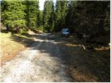
From the starting point, follow the forest road, closed to public traffic, which continues through the forest. After a few minutes of easy walking, it starts to descend moderately and leads us to the large grassy basin of Grčovec. Here, where the road almost ends, continue to the right and follow the path along the valley flor, where you soon come to the older cart track. Along the cart track we see some rare markings, and we soon come to the edge of the forest, where we see the inscription "Snežnik" on a rock.
Continue in the direction of Snežnik and follow the deteriorating cart track, which soon turns into a poorly beaten but well-marked path. We continue to climb through dense forest, and then the path leads into a small valley, which soon leads out of the forest onto slopes covered with dwarf pines. The valley we are climbing is getting narrower and narrower, and the path we are climbing is getting steeper and steeper. Higher up, the path climbs very steeply for a short time through a narrow passage, then gradually widens, but continues to lead us along a smaller valley. The increasingly scenic path, which runs between the dwarf pines, then climbs higher and brings us to a crossroads where we join the path from the Leskov valley.
Continue in the direction of Snežnik and continue the ascent along the marked path from dwarf pines to the unpaved summit slopes of Snežnik. Follow this increasingly scenic route all the way to the summit, which is reached after a few minutes of further walking.

Pictures:
 1
1 2
2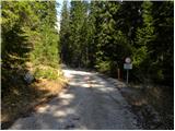 3
3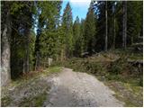 4
4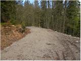 5
5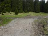 6
6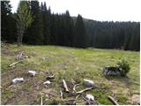 7
7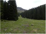 8
8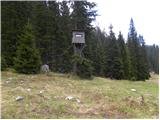 9
9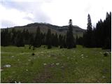 10
10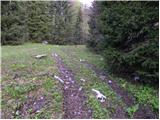 11
11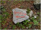 12
12 13
13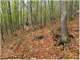 14
14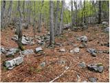 15
15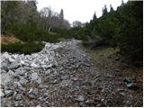 16
16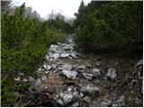 17
17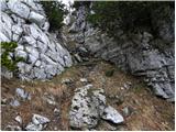 18
18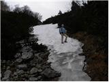 19
19 20
20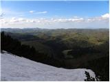 21
21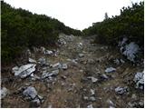 22
22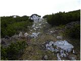 23
23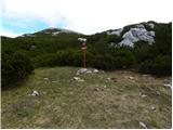 24
24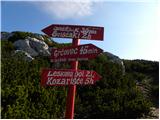 25
25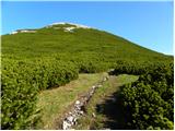 26
26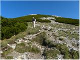 27
27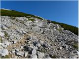 28
28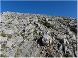 29
29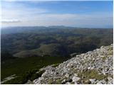 30
30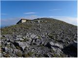 31
31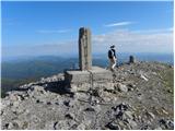 32
32 33
33
Discussion about the trail Sežanje - Snežnik
|
| rs5631. 07. 2011 |
Ko pridemo v travnato dolino Grčovec, se usmerimo desno proti lovski opazovalnici.Tik pred opazovalnico pa gremo levo v hrib po slabo vidni stezi. Oznak čez travnato pobočje ni. Na vrhu travnatega npobočja, tik pred gozdom,pa rahlo skrenemo v levo, kjer opazimo oznake za Snežnik. Te markacije so obnovljene in lepo sledljive do vrha Snežnika. Strmina od Grčarc do razcepa pod Snežnikom pa kar konkretna in ti ne pusti počitka. Čas hoje 1h 44min
Po napornem vzponu pa se nam je v koči lepo prelegel čaj in pa slastni Janjini štrukji
|
|
|