 | Kranj-Stražišče (Šrotenturn) - Šmarjetna gora (east path)
Šmarjetna gora is a panoramic peak rising above Kranj. From the summit, where the Church of St. Margaret and the Hotel Bellevue stand, a beautifu...
45 min |
| Kranj-Stražišče (Šrotenturn) - Šmarjetna gora (by cart track)
Šmarjetna gora is a panoramic peak rising above Kranj. From the summit, where the Church of St. Margaret and the Hotel Bellevue stand, a beautifu...
45 min |
 | Tičnica - Šmarjetna gora
Šmarjetna gora is a panoramic peak rising above Kranj. From the summit, where the Church of St. Margaret and the Hotel Bellevue stand, a beautifu...
50 min |
 | Strmica - Toško Čelo (via Brezarjevo brezno)
Toško Čelo is a 590-metre hill above the village of the same name. From the summit, or slightly below it, a beautiful view opens over part of Lju...
45 min |
 | Šujica (Na Gmajni) - Toško Čelo (along the stream Ostrožnik)
Toško Čelo is a 590-metre hill above the village of the same name. From the summit, or slightly below it, a beautiful view opens over part of Lju...
55 min |
 | Šujica (Na Gmajni) - Toško Čelo
Toško Čelo is a 590-metre hill above the village of the same name. From the summit, or slightly below it, a beautiful view opens over part of Lju...
50 min |
 | Mala voda - Kožljek
Kožljek is a 788 m high peak located west of Koren, more precisely above the village of Samotorica. From the summit, where there are several benc...
1 h 15 min |
 | Mala voda - Koreno
Koreno (also known as Korena) is a 729 m high hill located north of Horjul. From the summit, which features a large cross, the church of St. Moho...
1 h 15 min |
 | Sora - Hom (steep past cemetery)
Hom is a 715 m high peak that rises steeply southwest of the village of Sora. From the summit, which is partly forested, there is a beautiful vie...
50 min |
 | Grgar - Sveta Gora (by road)
Sveta Gora is known mainly among believers and locals. It is a well-known pilgrimage center above Nova Gorica. Believers come here from all over ...
1 h 15 min |
 | Spodnje Pirniče - Grmada (Kovačeva steza)
Grmada is a 676-meter-high mountain located west of the much more visited Šmarna gora. From the summit, which has a small takeoff area, a beautif...
1 h 10 min |
 | Briše - Mali vrh
West of Polhov Gradec, between the rivers Mala voda and Velika Božna, lies the 708-meter-high hill known as Mali vrh. From the grassy summit, whi...
1 h 5 min |
 | Dobrič (Vedet) - Gora Oljka (by road)
Gora Oljka is a hill located east of Šmartno ob Paki. On the summit stands the Church of the Holy Cross, built in the mid-18th century. Just a fe...
50 min |
 | Grgar - Vodice (by road)
Vodice (according to some records also Sveti Jakob) is a peak on the western part of the Banjška planota plateau. From the summit, which features...
1 h 15 min |
 | Podgrad - Debenji vrh
Debenji vrh, also known as Debni or Deben vrh, at 530 m, is the highest peak of Kašeljski grič, a small range located between the Besnica valley ...
1 h |
| Podgrad - Debenji vrh (via old castle Osterberg)
Debenji vrh, also known as Debni or Deben vrh, at 530 m, is the highest peak of Kašeljski grič, a small range located between the Besnica valley ...
50 min |
 | Podlipoglav - Pugled (past the guard post)
Pugled is a 615-meter-high peak situated between Podlipoglav and Veliki Lipoglav. From the summit, where a large NOB monument stands, the view is...
50 min |
 | Podlipoglav - Pugled (on the western ridge)
Pugled is a 615-meter-high peak situated between Podlipoglav and Veliki Lipoglav. From the summit, where a large NOB monument stands, the view is...
50 min |
 | Olševek - Štefanja gora (via Apnišče)
Štefanja gora, where the Church of St. Stephen stands, is located above Cerklje na Gorenjskem. Just a few tens of meters below the summit lies th...
1 h 15 min |
 | Povodje - Veliki vrh (Rašica)
Veliki vrh is a 568-meter-high hill located west of Vrh Staneta Kosca. Just a few meters below the otherwise forested summit lies a small abyss n...
45 min |
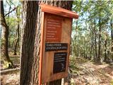
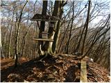 | Zgornja Besnica (Nova vas) - Rovnik (east path)
Rovnik is a 707-meter-high peak located west of Zgornja Besnica. The summit features two benches, a wish bell, and a logbook box, but offers no v...
45 min |
 | Činžat - Lobnikov vrh
Lobnikov vrh is a forested peak above the Dravska dolina valley, located between the settlements of Fala and Ruta. From the east, due to its remo...
1 h |
| Fala Grad - Lobnikov vrh
Lobnikov vrh is a forested peak above the Dravska dolina valley, located between the settlements of Fala and Ruta. From the east, due to its remo...
1 h 15 min |
 | Dobrova - Vrhe above Dobrova
Vrhe is a lesser-known but significant peak at the far southeastern end of the Polhograjsko Hribovje. Several unmarked cart tracks and paths lead...
50 min |
 | Hruševo - Vrhe above Dobrova
Vrhe is a lesser-known but significant peak at the far southeastern end of the Polhograjsko Hribovje. Several unmarked cart tracks and paths lead...
1 h |
 | Izlake (Medijske toplice) - Vrhija (via Podlipovica)
Vrhija is a 648-meter-high hill located west of Izlake and east of Kolovrat. It lies between Kalanov hrib and Kolovraška reber, viewed from the N...
1 h 15 min |
 | Log - Pečke (by road)
Pečke is an easily accessible peak that has seen fewer visitors lately, located north of the main Pohorje ridge. It gets more visits only on May ...
1 h 5 min |
 | Brezovica pri Ljubljani - Vrh (Debeli hrib)
Vrh is a 540-meter-high hill on the Debeli hrib ridge, which lies between the Ljubljana Marshes and the Horjulščica river valley. The view from t...
1 h |
 | Brezje pri Dobrovi - Vrh (Debeli hrib) (past Strmca)
Vrh is a 540-meter-high hill on the Debeli hrib ridge, which lies between the Ljubljana Marshes and the Horjulščica river valley. The view from t...
1 h 10 min |
 | Olševek - Apnišče (west path)
Apnišče is a 740 m high mountain between Možjanca and Štefanja gora. It is the highest point of the Šenčur municipality. The forested summit offe...
55 min |
 | Olševek - Apnišče (via Šterna)
Apnišče is a 740 m high mountain between Možjanca and Štefanja gora. It is the highest point of the Šenčur municipality. The forested summit offe...
55 min |
| Adergas - Apnišče (via Šterna)
Apnišče is a 740 m high mountain between Možjanca and Štefanja gora. It is the highest point of the Šenčur municipality. The forested summit offe...
1 h |
 | Preddvor - Apnišče (on footpath)
Apnišče is a 740 m high mountain between Možjanca and Štefanja gora. It is the highest point of the Šenčur municipality. The forested summit offe...
1 h 15 min |
 | Dvor - Kucelj above Polhov Gradec (on marked path)
Kucelj is a somewhat less known peak located between Polhov Gradec and Dvor pri Polhovem Gradcu. From the 705-meter-high summit, a view opens tow...
1 h |
| Dvor - Kucelj above Polhov Gradec (on unmarked path)
Kucelj is a somewhat less known peak located between Polhov Gradec and Dvor pri Polhovem Gradcu. From the 705-meter-high summit, a view opens tow...
1 h |
| Polhov Gradec - Kucelj above Polhov Gradec (via Ravnek)
Kucelj is a somewhat less known peak located between Polhov Gradec and Dvor pri Polhovem Gradcu. From the 705-meter-high summit, a view opens tow...
1 h |
 | Želimlje - Castle Stari grad above Želimlje
Stari grad above Želimlje is a forest-covered peak located between Želimlje and Rogatec above Želimlje....
50 min |
 | Železniki - Hujska (via Kres)
Hujska is a 706-meter-high peak located above Železniki, more precisely between the Dašnjica and Češnjica streams. At the summit there is a bench...
45 min |
 | Prevalje - Brinjeva gora (above Prevalje) (via Stations of the Cross)
Brinjeva gora is a popular excursion spot for Prevalje locals, located between the Meža River and Zelenbreški Stream. On the summit stands a smal...
1 h |
| Prevalje - Brinjeva gora (above Prevalje) (south path)
Brinjeva gora is a popular excursion spot for Prevalje locals, located between the Meža River and Zelenbreški Stream. On the summit stands a smal...
1 h |
| Ravne na Koroškem - Brinjeva gora (above Prevalje)
Brinjeva gora is a popular excursion spot for Prevalje locals, located between the Meža River and Zelenbreški Stream. On the summit stands a smal...
1 h 10 min |
 | Vešter - Vrh soteske (Križna gora)
Vrh soteske is a 735 meters high peak, which is situated on the southwestern part of Križna gora. From the top, which is overgrown by the forest,...
1 h 15 min |
 | Sveta Barbara (Nova Hrastnica) - Sveti Andrej (above Zminec)
The Church of St. Andrew is located on a panoramic hill in the Sveti Andrej settlement. From the church, there is a fine view of the Škofjeloško ...
50 min |
 | Hotavlje - Vrh Slajke
Vrh Slajke is a 790-metre hill above Hotavlje, specifically above the right bank of the Kopačnica. From the summit, where an antenna tower stands...
1 h 15 min |
 | Selca - Lepo brdo
Lepo brdo is a 778-metre hill rising above the Selca and Studeno settlements....
1 h |
 | Sora - Breznik (Boben)
Breznik, also known as Boben, is a 643-meter-high peak situated above the right bank of the Ločnica, more precisely above Sora, Rakovnik, Goričan...
1 h 5 min |
| Rakovnik - Breznik (Boben)
Breznik, also known as Boben, is a 643-meter-high peak situated above the right bank of the Ločnica, more precisely above Sora, Rakovnik, Goričan...
55 min |
 | Podgrad - Grmadnik
Grmadnik is a 569-meter-high peak above the valley of the Besnica stream between Podgrad and Besnica. The Borovničeva pohodna pot trail runs just...
55 min |
 | Podgrad - Španov vrh (Besnica)
Španov vrh is a 559-meter-high peak above the Besnica stream valley between Podgrad and Besnica. Just below the summit runs the Borovničeva hikin...
50 min |
 | Brzika - Joški vrh
Joški vrh is a 595-meter-high peak located on the northern side of Donačka gora. A short unmarked path leads to the summit, branching off from th...
1 h 15 min |
| Prelaz Vrhe - Joški vrh
Joški vrh is a 595-meter-high peak located on the northern side of Donačka gora. A short unmarked path leads to the summit, branching off from th...
1 h 5 min |
| Sveti Jurij - Joški vrh
Joški vrh is a 595-meter-high peak located on the northern side of Donačka gora. A short unmarked path leads to the summit, branching off from th...
1 h 5 min |
 | Stari Grad (Šega) - Dedni vrh (Šuštarica)
Dedni vrh, also known as Šuštarica, is a lesser-known peak in the Karawanks located north of Plešivec. The summit lies in the forest and offers l...
1 h |
 | Ruše - Lorbekov vrh
Lorbekov vrh is a 578-meter-high peak located southwest of Ruše. The summit lies in the forest, but from a meadow just below it, a nice view open...
45 min |
 | Bad Gleichenberg (Eichgraben Weg) - Bschaidkogel (via Mühlsteinbruch)
Bschaidkogel is a 563-meter-high mountain located northeast of the town of Bad Gleichenberg....
50 min |
 | Ožbalt (dam on stream Črmenica) - Turška peč (on cart track)
Turška peč is a scenic rocky outcrop above the left bank of the Drava River, along the Ožbalt to Grilov vrh path....
1 h |
 | Ruše - Globokarjev vrh
Globokarjev vrh is situated on a small ridge between Drava and Lobnica, only a few minutes away from the Globokar farm. Several antennas stand on...
1 h 15 min |
 | Slovenj Gradec - Rahtelov vrh (eastern path)
Rahtelov vrh is located north of Slovenj Gradec, above the left bank of the Mislinja River. On the summit there is a repeater facility and some t...
45 min |
| Slovenj Gradec - Rahtelov vrh (southeastern path)
Rahtelov vrh is located north of Slovenj Gradec, above the left bank of the Mislinja River. On the summit there is a repeater facility and some t...
45 min |
 | Kisovec - Castle Gamberk
Castle Gamberk (German: Gallenberg) is a castle situated on a hill above the settlement of Ržiše in the Posavsko hribovje....
1 h 10 min |