Izlake (Medijske toplice) - Vrhija (via Podlipovica)
Starting point: Izlake (Medijske toplice) (275 m)
| Latitude/Longitude: | 46,1582°N 14,9241°E |
| |
Route name: via Podlipovica
Walking time: 1 h 15 min
Difficulty: easy unmarked way
Elevation gain: 373 m
Elevation difference along the route: 373 m
Map:
Recommended equipment (summer):
Recommended equipment (winter):
Views: 3.918
 | 2 people like this post |
Access to starting point:
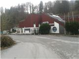
A) We leave the highway at the Trojane exit and follow the road signs towards Izlake. We drive through the settlement of Orehovica, followed by Izlake. As soon as we see the sign by the road that marks the beginning of Izlake, we turn right towards the decaying complex of the Medijske toplice, where there is a large parking lot. Here we leave the car and continue on foot.
B)
From the direction of Zagorje ob Savi: On the regional road Zagorje - Trojane we drive through Izlake, where at the Medijske toplice we turn left and leave the car in the parking lot.
Route description:
The path starts at the Medijske toplice, where we head onto the sidewalk along the main road and walk a few hundred meters along it in the direction of Trojane. On the left side we will see a turn-off that leads to the hamlet Podlipovica. Here we cross the main road and continue along this road towards Podlipovica. The path brings us after approx. 5 minutes of walking to a junction at the cheese dairy Sešlar, where we continue downwards; about ten meters lower than this junction we turn left onto a macadam road that along the foot of Kalanov hrib leads towards Suhi potok. The road brings us again to an asphalt road alongside which stands a shrine. At this junction we continue right (left is the path to Kalanov hrib via Okrog), in the direction of Suhi potok. Here a view already opens up onto Vrhija, which stands directly in front of us. The path then brings us to the hamlet Suhi potok, which is located above the Lipovica quarry. Signs on the house direct us towards the Kolovrat castle, so we follow the road straight uphill. Here we step again onto a macadam road alongside which there is a chapel. At this chapel, the path to Vrhija leads left along the edge of the meadow, which I recommend for the return from Vrhija, as we thus complete a small circular tour.
We continue along the macadam road downhill all the way to a larger meadow across which a forest road runs left uphill. We step onto this forest road, which after a short entry into the forest brings us again to a meadow, where a view opens towards Borje, Kolovrat, Kolovraška reber, and we continue left along the edge of the forest, where we again notice a forest path that leads straight uphill to Vrhija. We follow this road, which after a few minutes of ascent brings us to the summit.
When we reach the summit, we can head to the other side of the hill, where we notice a forest path that brings us back to the chapel.

Along the route: Kalanov hrib(Kalanček) (626m), Grad Kolovrat (400m), Grad Medija (400m), Medijske toplice (275m)
Photos:
 1
1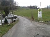 2
2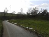 3
3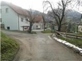 4
4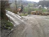 5
5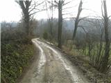 6
6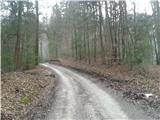 7
7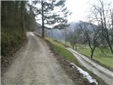 8
8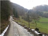 9
9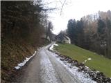 10
10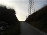 11
11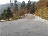 12
12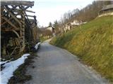 13
13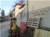 14
14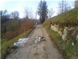 15
15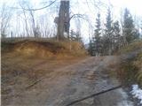 16
16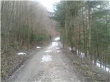 17
17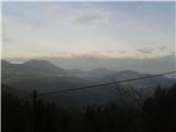 18
18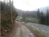 19
19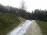 20
20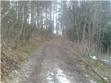 21
21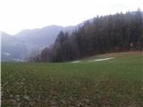 22
22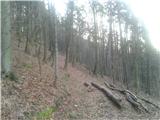 23
23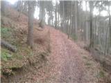 24
24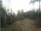 25
25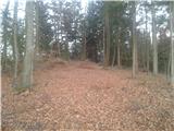 26
26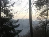 27
27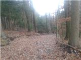 28
28 29
29
Discussion about the trip Izlake (Medijske toplice) - Vrhija (via Podlipovica)
To post a comment you must log in:
If you do not yet have a username, you must first
register.