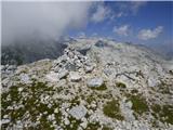
 | Pri Mlinču - Mangart (italijanska pot)
Mangart (also Mangrt; both spellings are grammatically correct) is a mountain that attracts a very large number of visitors in summer. The approa...
4 h 45 min |
 | Aljažev dom v Vratih - Dolkova špica (western way)
Dolkova špica is a 2,591 m high mountain situated between Stenar and Škrlatica. From the summit, where the summit register box is located, a beau...
5 h 15 min |
 | Suhadolnik - Grintovec (via Streha)
Grintovec is the highest peak in the Kamnik and Savinja Alps. It is located above the valley of Kamniška Bistrica, Suhi dol and above the valley ...
4 h 45 min |
 | The Kot Valley - Triglavski dom na Kredarici
Triglavski dom na Kredarici is Slovenia's highest-serviced mountain hut. It is open all year round, but outside the season only on an emergency b...
5 h 10 min |
| end of road on Pokljuka - Triglavski dom na Kredarici
Triglavski dom na Kredarici is Slovenia's highest-serviced mountain hut. It is open all year round, but outside the season only on an emergency b...
5 h |
| Uskovnica (Lom) - Triglavski dom na Kredarici (via Planina Spodnji Tosc)
Triglavski dom na Kredarici is Slovenia's highest-serviced mountain hut. It is open all year round, but outside the season only on an emergency b...
5 h 35 min |
| Uskovnica (Razpotje) - Triglavski dom na Kredarici (via planina Spodnji Tosc)
Triglavski dom na Kredarici is Slovenia's highest-serviced mountain hut. It is open all year round, but outside the season only on an emergency b...
5 h 30 min |
 | V Koncu - Skuta (via Kokrsko sedlo)
Skuta is a 2532 m high mountain located in the heart of the Kamnik-Savinja Alps. From the top, where there is a registration box and a stamp, we ...
5 h 30 min |
| Suhadolnik - Skuta (via Kokrsko sedlo)
Skuta is a 2532 m high mountain located in the heart of the Kamnik-Savinja Alps. From the top, where there is a registration box and a stamp, we ...
5 h 45 min |
 | Gozdec - Prestreljenik (via dom Petra Skalarja)
Prestreljenik is a 2499 m high mountain located in the heart of the Kanin Mountains. From the top, where the Aljaž Tower-shaped registration box ...
5 h 45 min |
| B station - Prestreljenik (via Krnica)
Prestreljenik is a 2499 m high mountain located in the heart of the Kanin Mountains. From the top, where the Aljaž Tower-shaped registration box ...
4 h 25 min |
| Sella Nevea - Prestreljenik (via Rifugio Gilberti)
Prestreljenik is a 2499 m high mountain located in the heart of the Kanin Mountains. From the top, where the Aljaž Tower-shaped registration box ...
4 h 15 min |
| Sella Nevea - Prestreljenik (via 636)
Prestreljenik is a 2499 m high mountain located in the heart of the Kanin Mountains. From the top, where the Aljaž Tower-shaped registration box ...
3 h 45 min |
 | Pišnica - Špik (via Kačji graben)
Špik is a 2472 m high mountain located in the heart of the Martuljek Group. From the top, which is clearly visible from the road leading through ...
4 h 40 min |
| Ruski križ - Špik (via Kačji graben)
Špik is a 2472 m high mountain located in the heart of the Martuljek Group. From the top, which is clearly visible from the road leading through ...
4 h 45 min |
 | The Kot Valley - Begunjski vrh
Begunjski vrh is a 2461 m high mountain located in the heart of the highest mountains in the Julian Alps. From the top, which has a registration ...
4 h 40 min |
 | Bodenbauer - Hochstuhl/Stol
Stol is, at 2236 m, the highest peak of the Karavanke. From the summit, which has a registration box and a stamp, we have a beautiful view of the...
4 h 30 min |
 | Bodenbauer - Vertatscha/Vrtača
Vrtača is a 2181 m high peak located east of Stol. From the summit, where a large peg stands, a beautiful view opens up of parts of the Julian Al...
4 h 45 min |
 | Jermanca - Planjava (via Kamniško sedlo)
Planjava is a small mountain range east of Kamniško sedlo. It has two peaks, eastern and western. A marked trail leads to the eastern peak, which...
4 h 30 min |
| Koča pod slapom Rinka - Planjava
Planjava is a small mountain range east of Kamniško sedlo. It has two peaks, eastern and western. A marked trail leads to the eastern peak, which...
4 h 45 min |
 | Na Razpotju - Planjava
Planjava is a small mountain range east of Kamniško sedlo. It has two peaks, eastern and western. A marked trail leads to the eastern peak, which...
5 h |
| Dom Planincev v Logarski dolini - Planjava
Planjava is a small mountain range east of Kamniško sedlo. It has two peaks, eastern and western. A marked trail leads to the eastern peak, which...
4 h 55 min |
 | Jermanca - Brana (via Kamniško sedlo)
Brana is a mountain above Kamniško sedlo. From the spacious summit, which has a registration box and a small cross, there is a very beautiful vie...
3 h 45 min |
| Koča pod slapom Rinka - Brana
Brana is a mountain above Kamniško sedlo. From the spacious summit, which has a registration box and a small cross, there is a very beautiful vie...
3 h 45 min |
 | Erjavčev rovt - Mittagskogel/Kepa
Kepa, also known as Jepa or Mittagskogel in German, is a panoramic mountain in the western Karawanks, located on the border ridge between Sloveni...
3 h 50 min |
 | Čemernica / Tschemernitzen - Mittagskogel/Kepa
Kepa, also known as Jepa or Mittagskogel in German, is a panoramic mountain in the western Karawanks, located on the border ridge between Sloveni...
5 h 5 min |
 | Na Razpotju - Ojstrica (via Škarje)
Ojstrica, named after its sharp shape, rises steeply above the Korošica River, the Logar Valley and Robanov Kot. From the top, where the registra...
4 h 15 min |
| Dom Planincev v Logarski dolini - Ojstrica (via Škarje)
Ojstrica, named after its sharp shape, rises steeply above the Korošica River, the Logar Valley and Robanov Kot. From the top, where the registra...
4 h 10 min |
 | Planina Zapleč - Krn
At 2244 m, Krn is the highest peak of the Krn Mountains, a mountain range that rises steeply above the central part of the Soča River. From the s...
4 h 30 min |
 | Aljažev dom v Vratih - Križ (via Sovatna)
Križ is a 2140 m high mountain located north-east of the Kriški Podi. From the top, where there is a registration box with a stamp, you have a be...
5 h |
 | Podnar / Bodenbauer - Prešernova koča na Stolu
Prešernova koča na Stolu, is located just a few metres below the summit of the 2198 m high Mali Stol. From the hut or the nearby Mali Stol, we ha...
4 h 25 min |
 | The Kot Valley - Visoka Vrbanova špica (via Staničev dom)
Visoka Vrbanova špica, is located at the extreme south-western part of the ridge rising above the Kot and Vrata valleys, and higher up between th...
4 h 30 min |
 | End of road on Pokljuka - Visoka Vrbanova špica
Visoka Vrbanova špica, is located at the extreme south-western part of the ridge rising above the Kot and Vrata valleys, and higher up between th...
5 h 45 min |
 | Planina Blato - Veliko Špičje (via Štapce)
Veliko Špičje is the highest peak in the ridge from Travnik to Zasavska hut. From the top there is a very nice view over the plateaus of Komna, t...
5 h 45 min |
 | Aljažev dom v Vratih - Bovški Gamsovec (via Luknja)
Bovški Gamsovec is a 2392m high mountain in the immediate vicinity of Triglava. From the top, you can enjoy a magnificent view of Triglav and its...
4 h 35 min |
| Aljažev dom v Vratih - Bovški Gamsovec (via Sovatna)
Bovški Gamsovec is a 2392m high mountain in the immediate vicinity of Triglava. From the top, you can enjoy a magnificent view of Triglav and its...
4 h 45 min |
 | Untere Valentinalm - Monte Coglians (Hohe Warte) (via Wolayer See)
At 2780 metres, Monte Coglians is the highest mountain in the Carnic Alps. From the top, where the cross and the bell stand, you have a very nice...
5 h 30 min |
 | Sella Nevea - Velika Črnelska špica (on ski track)
Velika Črnelska špica is located in the Kanin Mountains on the border between Itali and Slovenia. From the top, you can enjoy a very nice view of...
4 h 30 min |
| Sella Nevea - Velika Črnelska špica (via 636)
Velika Črnelska špica is located in the Kanin Mountains on the border between Itali and Slovenia. From the top, you can enjoy a very nice view of...
4 h 45 min |
 | Goldberg - Torkofel
Torkofel is the highest peak of the Jauken lookout ridge, which stretches north of the Ziljska valley. From the top with a cross there is a beaut...
3 h 45 min |
 | Reißkofelbad - Reißkofel (via east ridge)
Reißkofel is a 2371 metre high mountain in the Zilj Alps. The summit on which the cross stands also has a registration box. The view from the top...
4 h 45 min |
 | Reißkofelbad - Kleiner Reißkofel
Kleiner Reißkofel is a 2161 metre high mountain east of Reißkofl. From the summit on which the cross stands, you can enjoy a beautiful view of th...
3 h 30 min |
 | NC Planica - Srednja Ponca / Ponza di Mezze
Srednja Ponca is a 2228m high peak rising steeply above Tamar, Planica and the Mangart valley. From the summit on which the stamp is located, the...
4 h |
 | Aljažev dom v Vratih - Pihavec (via Sovatna)
Pihavec is a vast and scenic peak located to the south of the Kriški Podovi. From the summit, which has a registration box and a stamp, there is ...
5 h 15 min |
 | Sella Nevea - Koštrunove špice (via Forcella Lavinal dell Orso)
Koštrunove špice is a 2502 m high peak located south-west of Viš (2666 m). The summit offers a beautiful view over most of the western Julian Alp...
4 h 30 min |
 | Parking Alpspitzbahn - Bernadeinkopf (via Osterfelderkopf)
Bernadeinkopf is a 2143 m high peak in the Wetterstein mountain group. From the summit on which the cross stands, you have a very nice view of th...
5 h 30 min |
 | Coot Parking Lot - Velika Baba (Kanin) (via Skutnik)
Velika Baba is the southernmost two-thousand-metre peak of the Kanin Mountains. It is separated from the main ridge to the north by the Med Baban...
4 h 20 min |
 | The Kot Valley - Kredarica
Kredarica is a 2541-metre-high peak located between Triglav and Ržja. From the top, we have a beautiful view towards Triglav and the surrounding ...
5 h 5 min |
 | end of road on Pokljuka - Kredarica
Kredarica is a 2541-metre-high peak located between Triglav and Ržja. From the top, we have a beautiful view towards Triglav and the surrounding ...
5 h 5 min |
 | Cima Sappada - Creta Forata
Creta Forata is a 2462 meter high mountain in a mountain group of the Pesarina Dolomites in the Carnic Alps in Italy, south of a city of Sappada....
4 h |
 | Gschnitz - Kalkwand (western approach from Gschnitza via Pinnisjoch)
Kalkwand is a large mountain in the eastern part of the Habicht group of the central Stubai Alps. Thanks to its attractive views, the low difficu...
3 h 45 min |
 | Sankt Ilgen (Der Bodenbauer) - Hochschwab
...
4 h 25 min |
 | Ruski križ - Lipnica (via Koča v Krnici)
...
4 h 15 min |