 | Mengeška koča na Gobavici - Rašica (Vrh Staneta Kosca) (ridge path)
Vrh Staneta Kosca, better known as Rašica, is located north of Ljubljana, specifically above the village of Rašica and Dobena. From the top of th...
2 h |
 | Mengeška koča na Gobavici - Rašica (Vrh Staneta Kosca) (lower path)
Vrh Staneta Kosca, better known as Rašica, is located north of Ljubljana, specifically above the village of Rašica and Dobena. From the top of th...
2 h |
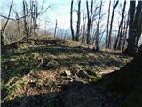
 | Črni hribi - Trstelj
Trstelj is the highest peak in the Black Hills ridge. The view from the vast summit, where the TV transmitters stand, is split in half. From the ...
2 h |
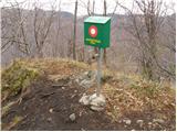
 | Lokev - Kokoš
Koča na Kokoši is located at the top of Jirmanec, just 5 minutes away from the forested Kokoša. The summit, located south of the Lokavsko polje a...
1 h 30 min |
 | Krvavi Potok - Kokoš
Koča na Kokoši is located at the top of Jirmanec, just 5 minutes away from the forested Kokoša. The summit, located south of the Lokavsko polje a...
1 h 30 min |
| Prelože pri Lokvi - Kokoš
Koča na Kokoši is located at the top of Jirmanec, just 5 minutes away from the forested Kokoša. The summit, located south of the Lokavsko polje a...
1 h 30 min |
 | Blečji vrh - Gradišče (via Kucelj)
Gradišče is a lesser-known peak located north of Višnja gora. From the top of the hill, where a large cross stands, there is a beautiful view of ...
1 h 30 min |
 | Straßengel - Generalkogel
...
1 h 30 min |
 | Prelaz Vrhe - Maceljska gora (via source of Sotla)
...
1 h 50 min |
 | Travnarjev gozd (Hotenjsko podolje) - Šenčurjev vrh
Šenčurjev vrh is a 725-metre-high hill located above the settlement Žibrše, between Logatec, Hotedršica and Rovtami. At the top, which offers a b...
1 h 50 min |
 | Preval Prosca - Koreno (gentle path)
Koreno also Koreno is a 729 m high hill located north of Horjul. From the top, where there is a large cross, the Church of St. Mohorj and Fortuna...
1 h 15 min |
 | Rein - Pfaffenkogel
...
1 h 30 min |
 | Hrpelje - Hrpeljska gora
Hrpeljska gora or Mišja šoga is a 737m high peak located south of Hrpelje. The partially vegetated peak offers a beautiful view of the surroundin...
1 h 30 min |
 | Širje - Dom v Gorah
The mountain lodge in Gora is located east of Hrastnik, just a few metres below the 786m-high peak on which the Church of St George stands. From ...
1 h 20 min |
 | Marno - Dom v Gorah
The mountain lodge in Gora is located east of Hrastnik, just a few metres below the 786m-high peak on which the Church of St George stands. From ...
1 h 15 min |
 | Zreče (Terme Zreče) - Golek
Golek is a 769-metre-high peak located north-west of Zreče. At the top there is a registration box with a registration book, a stamp and a bench,...
1 h 25 min |
| Zreče (Terme Zreče) - Golek (via Bork)
Golek is a 769-metre-high peak located north-west of Zreče. At the top there is a registration box with a registration book, a stamp and a bench,...
1 h 30 min |
| Zreče (Terme Zreče) - Golek (via Tourist farm Ančka)
Golek is a 769-metre-high peak located north-west of Zreče. At the top there is a registration box with a registration book, a stamp and a bench,...
1 h 35 min |
| Zreče (cemetery) - Golek
Golek is a 769-metre-high peak located north-west of Zreče. At the top there is a registration box with a registration book, a stamp and a bench,...
1 h 15 min |
 | Zabukovica - Kotečnik
Kotečnik is a peak in Posavsko hribovje, located north of Šmohor. Kotečnik is a peak with two entry boxes. The first one is located on the wester...
1 h 15 min |
 | Blagovica - Limbarska gora
Limbarska gora is located north-east of Moravce. From the top there is a beautiful view of the surrounding peaks and in good weather you can also...
1 h 30 min |
 | Slavkov dom na Golem brdu - Jeterbenk
Jeterbenk is a 774 m high peak located between Slavko's home at Gole Brdo and Katarina (Topol village). From the top, where there is a large cros...
1 h 15 min |
 | Legastja - Jeterbenk
Jeterbenk is a 774 m high peak located between Slavko's home at Gole Brdo and Katarina (Topol village). From the top, where there is a large cros...
1 h 40 min |
 | Veliko Trebeljevo - Obolno
Obolno is a 776m high peak located south-west of the village of the same name. The grassy summit, next to which the radio club hut stands, offers...
1 h 20 min |
 | Mala Goričica - Obolno (by road)
Obolno is a 776m high peak located south-west of the village of the same name. The grassy summit, next to which the radio club hut stands, offers...
1 h 15 min |
 | Škale - Lubela (via hunting lodge)
Lubela is a hill at Velenje, rising north above the Šaleška dolina and belonging to the Šentviška hills or the wider area of the Graška Gora.On t...
1 h 15 min |
 | Marno - Vrhe (pri Gorah)
...
1 h 25 min |
 | Velike Lašče - Kamen vrh
Kamen vrh is a scenic peak located on the northern outskirts of Mala Gora. From the top, surrounded by low bushes, there is a beautiful view of p...
1 h 15 min |
 | Veliko Trebeljevo - Janče
Janče is a 792-metre-high peak located between the Sava River and the valley of the Besnica Stream. From the top, where the mountain lodge stands...
2 h 15 min |
 | Žlebe - Rog (via Turnice)
The Rog is a 798 m high peak located above the village of Topole, just 10 minutes from St Catherine's Church. From the top of the hill, where a l...
1 h 30 min |
| Žlebe - Rog (via Jeterbenk)
The Rog is a 798 m high peak located above the village of Topole, just 10 minutes from St Catherine's Church. From the top of the hill, where a l...
1 h 40 min |
 | Legastja - Rog
The Rog is a 798 m high peak located above the village of Topole, just 10 minutes from St Catherine's Church. From the top of the hill, where a l...
1 h 15 min |
 | Ljubljanica - Sveti Andrej (Planina above Horjul)
The Church of St Andrew is situated on a lookout hill just above the Mountain pasture above Horjul. The church, which was built in 1659, offers a...
1 h 15 min |
 | Šembije - Ahac
Ahac or St. Ahac is a 799 m high peak located east of Ilirska Bistrica. The summit, which is home to a registration box, a cross and the ruins of...
2 h |
 | Zazid - Lipnik
Lipnik is an 804 m high peak located above the village of Rakitovec on the Slovenian Croatian border. From the top, where there is a cross and a ...
1 h 40 min |
 | Hotedršica - Medvedje Brdo
Medvedje Brdo is a small settlement located north of Hotedršice. The highest point of the village is a pleasant lookout point located on Šinkovco...
1 h 15 min |
 | Mislinja - Sveti Rupert (Završe)
St Rupert's Church is situated on a viewpoint, just south of the Frice Hill. From the church or its immediate surroundings, in fine weather, we h...
1 h 25 min |
 | Dolina Radeljskega potoka (Razdevšek) - Sveti Trije Kralji (above Radlje ob Dravi)
The Church of the Three Kings is situated on an 820-metre-high hill rising above the right bank of the Radlje Stream. The church offers a beautif...
1 h 30 min |
 | Mislinja - Časov vrh
Časov vrh (also called Časkov vrh on some maps) is a less distinct hill located between Fričev vrh and Črepič. As the peak is forested, there is ...
1 h 15 min |
 | Zalog - Polhograjska Gora (Sveti Lovrenc) (gentle path)
Polhograjska Gora, also just Gora or Sveti Lovrenc, is an 824 m high hill located north-west of Polhov Gradec. From the top of the hill, where th...
1 h 30 min |
 | Moškrin - Archangel Gabriel (Planica)
Planica is an 824 m high peak located north of Škofja Loka, between Krizna Gora and Planica. From the top, where the Church of St. Gabriel the Ar...
1 h 30 min |
 | Pevno - Archangel Gabriel (Planica)
Planica is an 824 m high peak located north of Škofja Loka, between Krizna Gora and Planica. From the top, where the Church of St. Gabriel the Ar...
1 h 30 min |
 | Rovte - Sveti Primož in Felicijan (Jamnik)
The Church of St. Primož and Felicijan on Jamnik, is situated on a scenic grassy ridge rising between Kropa and Podblica. From the church or its ...
1 h 15 min |
 | Češnjica pri Kropi - Sveti Primož in Felicijan (Jamnik)
The Church of St. Primož and Felicijan on Jamnik, is situated on a scenic grassy ridge rising between Kropa and Podblica. From the church or its ...
1 h 15 min |
 | Matke - Golava
Golava is a peak located north of Mrzlica. From the summit, on which a small bivouac (Blaž's bivouac) stands, there is a beautiful view towards t...
1 h 15 min |
 | Zgornja Besnica (Podrovnik) - Špičasti hrib
Špičasti hrib (Špičasti vrh on maps) is an 837 m high peak located to the west of Sveti Jošto above Kranj. There is no view from the top, which h...
1 h 30 min |
 | Vače - Zasavska Sveta gora
Zasavska Sveta gora is a popular excursion point located between Litija and Izlaki. From the top, where the parish church of the Nativity of the ...
2 h |
 | Kirchdorf - Predigtstuhl
...
1 h 30 min |
 | Col - Podrta gora above Ajdovščina
Podrta gora above Ajdovščina, also called the Broke Mountain above Šturje, is a mountain rising above the Vipava valley. Some time ago, a large c...
1 h 45 min |
 | Bločice - Križna gora
Križna gora is a partially overloked peak located above the village of Sveta Ana and Podlož. From the top of the hill on which the Church of the ...
1 h 15 min |
 | Col - Sončnica (Reber)
Sončnica is a paragliding airstrip on the outskirts of the Gora plateau or Reber Ridge. There are a few benches, an automatic weather station Kov...
1 h 20 min |
 | Bašelj - Gradišče (Pustinjak) (via Sveti Lovrenc)
Gradišče or Pustinjak (also Gradišče above Bašlje) is an 871-metre-high peak located above the Belica stream, which in turn is below the 2132-met...
1 h 15 min |
 | Katarija - Slivna (Pivkelj)
Slivna or Pivkelj (also Pivkelj turn) as this peak is also called is located south of Limbarska Gora. Pivkelj is also the highest point of the Mo...
1 h 55 min |
 | Kandrše (Trata) - Slivna (Pivkelj) (via GEOSS)
Slivna or Pivkelj (also Pivkelj turn) as this peak is also called is located south of Limbarska Gora. Pivkelj is also the highest point of the Mo...
2 h |
 | Mislinja - Fričev vrh (via Črepič)
Fričev vrh is an 881 m high hill located south of Mislinja Dobrava. There is no view from the top, which has a registration box with a registrati...
1 h 35 min |
 | Mislinja - Fričev vrh (via Završe)
Fričev vrh is an 881 m high hill located south of Mislinja Dobrava. There is no view from the top, which has a registration box with a registrati...
2 h |
 | Rovte - Vrh Svetih Treh Kraljev (steep path)
The Church of the Holy Three Kings is situated on a lookout above the village of Vrh Svetih Treh kraljev. From the top, which has an observation ...
1 h 25 min |
| Rovte - Vrh Svetih Treh Kraljev (gentle path)
The Church of the Holy Three Kings is situated on a lookout above the village of Vrh Svetih Treh kraljev. From the top, which has an observation ...
1 h 30 min |
 | Sopot - Vrh Svetih Treh Kraljev
The Church of the Holy Three Kings is situated on a lookout above the village of Vrh Svetih Treh kraljev. From the top, which has an observation ...
1 h 25 min |
 | Dule - Grmada on Mala gora
Grmada (also Grmada nad Ortnek) is an 887 m high peak located above the village of Vrh pri Poljanah in the Mala Gora mountain range. Just a few m...
2 h |
 | Velike Lašče - Grmada on Mala gora (čez Gornje Retje)
Grmada (also Grmada nad Ortnek) is an 887 m high peak located above the village of Vrh pri Poljanah in the Mala Gora mountain range. Just a few m...
2 h |
 | Mrzle doline - Sveti Peter
Sveti Peter is a partially vegetated peak in the Dry Krajina above the village of Dvor. On the top there is a small shelter (usually open on Sund...
1 h 15 min |
 | Jablance - Grmada (Bohor)
The Grmada Peak is located on the slope of Bohor. The summit is not scenic, but it is easily accessible. There is a partisan hospital nearby....
1 h 20 min |
 | Col - Kraguljc
Kraguljc is a mountain located between Podrto gora and Sončnica. A trigonometric point is located on the lookout point, which offers a beautiful ...
1 h 35 min |
 | Topol - Polhograjska Grmada
Polhograjska Grmada is an 898 m high peak located in the heart of the Polhograjski Dolomiti. The summit, which has a registration box with a stam...
1 h 15 min |
| Belo - Polhograjska Grmada
Polhograjska Grmada is an 898 m high peak located in the heart of the Polhograjski Dolomiti. The summit, which has a registration box with a stam...
1 h 20 min |
 | Trnovec - Polhograjska Grmada
Polhograjska Grmada is an 898 m high peak located in the heart of the Polhograjski Dolomiti. The summit, which has a registration box with a stam...
1 h 15 min |
 | Sveti Jurij (Remšnik) - Sveti Pankracij (Radelca)
The Church of St Pancras on Radelca is located on the border ridge between Slovenia and Austria, but since 1966, following an inter-state agreeme...
1 h 15 min |
 | Veliki Boč (Zgornji Kovač) - Žavcarjev vrh
Žavcarjev vrh is a 915m high mountain located north of the River Drava on the slopes of Kozjak. As the peak is completely overgrown, there is no ...
1 h 25 min |
 | Zalog - Planica (Paragliding site Gozd)
Planica is a 926-metre-high peak located above the village of Gozd. From the top, where the JPK Kriška gora hut is located, we have a beautiful v...
1 h 30 min |
| Križe - Planica (Paragliding site Gozd)
Planica is a 926-metre-high peak located above the village of Gozd. From the top, where the JPK Kriška gora hut is located, we have a beautiful v...
1 h 20 min |
| Tržič - Planica (Paragliding site Gozd)
Planica is a 926-metre-high peak located above the village of Gozd. From the top, where the JPK Kriška gora hut is located, we have a beautiful v...
1 h 20 min |
 | Suhi Dol - Sivka (through forest)
Sivka is a grassy peak located in the westernmost part of the Polhograje Hills. In good weather, the peak offers a magnificent view from Snežnik ...
1 h 30 min |
| Suhi Dol - Sivka (by road)
Sivka is a grassy peak located in the westernmost part of the Polhograje Hills. In good weather, the peak offers a magnificent view from Snežnik ...
1 h 40 min |
 | Zagreben (pri Dikcu) - Malič
Malič is a 936 m high peak located between Celje and Laško, above Spodnja Rečica. There is no better view from the top, where the transmitter, be...
1 h 30 min |
 | Stara Fužina - Rudnica (by road)
Rudnica is a scenic mountain located between the Lower and Upper Bohinj Valley. From the top, where there is a registration box with a stamp and ...
1 h 40 min |
 | Čepulje - Sveti Mohor (Zabrekve)
The Church of St. Mohor is situated on a 952 m high hill, between Zgornja Besnica and Selce. From the church, or its immediate surroundings, we h...
1 h 30 min |
 | Podblica - Sveti Mohor (Zabrekve)
The Church of St. Mohor is situated on a 952 m high hill, between Zgornja Besnica and Selce. From the church, or its immediate surroundings, we h...
1 h 40 min |