 | Zadnja Trenta (Flori) - Veliki Ozebnik (via zavetišče pod Špičkom)
Veliki Ozebnik is a mountain with a beautiful view of the neighbouring Jalovec. From the top, you can also enjoy a beautiful view of the entire J...
5 h 30 min |
 | Planina Blato - Debeli vrh (via planina Laz)
The summit is located above mountain pasture in Laz. From the top there is a very nice view towards Triglav, Kanjavac and other surrounding peaks...
4 h |
| Zadnja Trenta (Flori) - Veliki Ozebnik (via Jalovška škrbina)
Veliki Ozebnik is a mountain with a beautiful view of the neighbouring Jalovec. From the top, you can also enjoy a beautiful view of the entire J...
5 h 30 min |
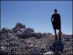
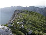
 | Planina Blato - Velika Tičarica
Velika Tičarica is a little-visited peak located north of the more easily accessible and much more visited Mala Tičarica. The summit, located bet...
3 h 50 min |
 | Rudno polje - Cesar
Cesar is a lonely peak located only a few minutes away from one of the most populated Slovenian trails. The peak where we can observe the hustle ...
4 h 10 min |
 | The Krma Valley - Teme
Teme is a nondescript peak located between the Krma valley and the Rjavina. From this little visited peak, however, a beautiful view opens up int...
4 h 20 min |
 | Na Razpotju - Krofička (hunter's way)
Krofička, or Grofička according to some records, is a peak located northeast of Ojstrica. From the summit, which descends steeply towards the Log...
3 h 40 min |
 | Aljažev dom v Vratih - Pihavec (via Luknja)
Pihavec is a vast and scenic peak located to the south of the Kriški Podovi. From the summit, which has a registration box and a stamp, there is ...
4 h 30 min |
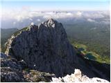
 | Jermanca - Planjava (via Repov kot)
Planjava is a small mountain range to the east of Kamnik saddle. It has two peaks, one eastern and one western. There is a marked trail to the ea...
4 h 30 min |
 | Jermanca - Najvišji rob (Zeleniške špice) (via Repov kot)
Najvišji rob is the highest peak of the Green Spires ridge. Most of them reach the limited summit by the ridge of Zelenický Špice via Staničev Pe...
3 h 45 min |
| End of road on Pokljuka - Veliki Draški vrh (path over north outside corner)
Veliki Draški vrh is a 2243 m high mountain rising steeply above the Krma Valley. From the top, where there is a registration box and a stamp, yo...
3 h 15 min |
 | end of road on Pokljuka - Šmarjetna glava
Šmarjetna glava is a 2358 m high peak located above the upper part of the Velska Valley. From the top, where the Bohinj Mountain Route stamp is l...
5 h 40 min |
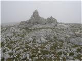
 | Pod Zjabci - Lanževica (po Rapalski meji)
Lanževica is a 2003 m high peak located between Bogatinsko sedlo and Oslovo Stub. The summit, on which the remains of the former Rapallo border s...
4 h |
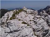
 | Logarski kot - Rjavčki vrh (Planinšca) (via Grlo)
Rjavčki vrh aka Planinšca is a 1898 m high peak located north of the main ridge connecting Ojstrica with Planjava. The peak, which is mostly cove...
3 h 15 min |
| Dom Planincev v Logarski dolini - Krofička (hunting path)
Krofička, or Grofička according to some records, is a peak located northeast of Ojstrica. From the summit, which descends steeply towards the Log...
3 h 35 min |
| End of road on Vogar - Velika Tičarica
Velika Tičarica is a little-visited peak located north of the more easily accessible and much more visited Mala Tičarica. The summit, located bet...
3 h 45 min |
 | Baita Sun Bar - Punta dei Ross
Punta dei Ross is a 2,460-metre peak in the Sorapiss mountain group. Like the other peaks in the mountain group, Punta dei Ross is not reached by...
4 h |