 | border crossing Lipica - Kokoš (by road)
Koča na Kokoši is located at the top of Jirmanec, just 5 minutes away from the forested Kokoša. The summit, located south of the Lokavsko polje a...
1 h |
 | Lokev - Kokoš
Koča na Kokoši is located at the top of Jirmanec, just 5 minutes away from the forested Kokoša. The summit, located south of the Lokavsko polje a...
1 h 30 min |
 | Krvavi Potok - Kokoš
Koča na Kokoši is located at the top of Jirmanec, just 5 minutes away from the forested Kokoša. The summit, located south of the Lokavsko polje a...
1 h 30 min |
| Prelože pri Lokvi - Kokoš
Koča na Kokoši is located at the top of Jirmanec, just 5 minutes away from the forested Kokoša. The summit, located south of the Lokavsko polje a...
1 h 30 min |
 | Straßengel - Frauenkogel
...
1 h 10 min |
 | Mekinje nad Stično - Pristava above Stična
Pristava above Stična is a small village located on a scenic hill north of Stična. A little above the village, by the Partisan House, there is a ...
1 h 5 min |
 | Šober - Tojzlov vrh
Tojzlov vrh is a forested hill located in the eastern part of Kozjak. On the top of the hill stands a small stone monument to the National Libera...
1 h |
 | Blečji vrh - Gradišče (via Kucelj)
Gradišče is a lesser-known peak located north of Višnja gora. From the top of the hill, where a large cross stands, there is a beautiful view of ...
1 h 30 min |
 | Gorenja vas - Jermanca (Jermancov grič)
Jermanca, on maps Jermanca hill, is a lookout point above Gorenjska vasje. In good weather, the summit offers a beautiful view of the peaks above...
55 min |
 | Preval Prosca - Koreno (gentle path)
Koreno also Koreno is a 729 m high hill located north of Horjul. From the top, where there is a large cross, the Church of St. Mohorj and Fortuna...
1 h 15 min |
 | Preval Prosca - Koreno
Koreno also Koreno is a 729 m high hill located north of Horjul. From the top, where there is a large cross, the Church of St. Mohorj and Fortuna...
1 h |
 | Star maln - Koča na Planini nad Vrhniko
Planina above Vrhnika is for hers inhabitants something like Šmarna gora for inhabitants of Ljubljana. It is 733 metres high and is reachable fro...
1 h |
 | Hrpelje - Hrpeljska gora
Hrpeljska gora or Mišja šoga is a 737m high peak located south of Hrpelje. The partially vegetated peak offers a beautiful view of the surroundin...
1 h 30 min |
 | Ortnek - Sveti Gregor on Slemena
Sveti Gregor is a settlement located on the scenic ridges. In the middle of the settlement is the parish church of St. Gregory the Great, and nea...
1 h 10 min |
 | Velesovo - Apnišče (via Šterna)
Apnišče is a 740 m high mountain located between Možjanca and Štefanja gora. It is the highest point of the Šenčur municipality. There is a bench...
1 h 10 min |
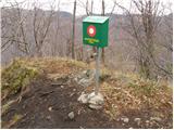
 | Krvavi Potok - Veliko Gradišče
Veliko Gradišče is a 742 m high peak located south of the village of Lokev in the Karst and east of Kokoši. From the top, on which stands a concr...
1 h |
 | Adergas - Štefanja gora (via benches)
Štefanja gora on which the Church of St Stephen stands, is located above Cerkly in Gorenjska. Just 10 metres below the summit, the Pr'Mežnarju ex...
1 h |
 | Adergas - Štefanja gora (via šterna)
Štefanja gora on which the Church of St Stephen stands, is located above Cerkly in Gorenjska. Just 10 metres below the summit, the Pr'Mežnarju ex...
1 h |
 | Olševek - Štefanja gora
Štefanja gora on which the Church of St Stephen stands, is located above Cerkly in Gorenjska. Just 10 metres below the summit, the Pr'Mežnarju ex...
55 min |
 | Velesovo - Štefanja gora (via benches)
Štefanja gora on which the Church of St Stephen stands, is located above Cerkly in Gorenjska. Just 10 metres below the summit, the Pr'Mežnarju ex...
1 h 10 min |
| Velesovo - Štefanja gora (via Šterna)
Štefanja gora on which the Church of St Stephen stands, is located above Cerkly in Gorenjska. Just 10 metres below the summit, the Pr'Mežnarju ex...
1 h 10 min |
 | Pivka - Šilentabor
Šilentabor is a 751 m high peak located just above the village of the same name. From the top, near which there is also a bench and a registratio...
1 h 30 min |
| Narin - Šilentabor
Šilentabor is a 751 m high peak located just above the village of the same name. From the top, near which there is also a bench and a registratio...
1 h |
 | Krnice - Dom v Gorah
The mountain lodge in Gora is located east of Hrastnik, just a few metres below the 786m-high peak on which the Church of St George stands. From ...
1 h 5 min |
 | Zabukovica - Kotečnik
Kotečnik is a peak in Posavsko hribovje, located north of Šmohor. Kotečnik is a peak with two entry boxes. The first one is located on the wester...
1 h 15 min |
 | Leskovec - Obolno
Obolno is a 776m high peak located south-west of the village of the same name. The grassy summit, next to which the radio club hut stands, offers...
1 h |
 | Veliko Trebeljevo - Obolno
Obolno is a 776m high peak located south-west of the village of the same name. The grassy summit, next to which the radio club hut stands, offers...
1 h 20 min |
 | Mala Goričica - Obolno
Obolno is a 776m high peak located south-west of the village of the same name. The grassy summit, next to which the radio club hut stands, offers...
1 h 10 min |
| Mala Goričica - Obolno (by road)
Obolno is a 776m high peak located south-west of the village of the same name. The grassy summit, next to which the radio club hut stands, offers...
1 h 15 min |
 | Velike Lašče - Kamen vrh
Kamen vrh is a scenic peak located on the northern outskirts of Mala Gora. From the top, surrounded by low bushes, there is a beautiful view of p...
1 h 15 min |
 | Ljubljanica - Sveti Andrej (Planina above Horjul)
The Church of St Andrew is situated on a lookout hill just above the Mountain pasture above Horjul. The church, which was built in 1659, offers a...
1 h 15 min |
 | Podgorje - Kojnik (steep path)
Kojnik is a partially vegetated peak located in the southern part of the Podgorje Karst near the Slovenian-Croatian border. From the top of the s...
1 h |
 | Mislinja - Sveti Vid (Završe)
The Church of St.Vid, which has a small cemetery, is located in the middle of the scattered settlement of Završe. From the church, or its immedia...
1 h 10 min |
 | Mislinja - Sveti Rupert (Završe)
St Rupert's Church is situated on a viewpoint, just south of the Frice Hill. From the church or its immediate surroundings, in fine weather, we h...
1 h 25 min |
 | Pivka - Osojnica
Osojnica is a forested hill located west of Pivka. There is no view from the top, which has a registration box, a stamp and a bench....
1 h |
 | Mislinja - Časov vrh
Časov vrh (also called Časkov vrh on some maps) is a less distinct hill located between Fričev vrh and Črepič. As the peak is forested, there is ...
1 h 15 min |
 | Kropa - Sveti Primož in Felicijan (Jamnik)
The Church of St. Primož and Felicijan on Jamnik, is situated on a scenic grassy ridge rising between Kropa and Podblica. From the church or its ...
1 h 10 min |
 | Podjuna / Jaunstein - Gora sv. Eme (Junska gora) / Hemmaberg (umik zaprti poti)
Gora sv. Eme is located south of the village of Podjuna / Jaunstein. The Church of St. Emma (Hema) Krška stands on the top and the ruins of forme...
55 min |
| Globasnica / Globasnitz - Gora sv. Eme (Junska gora) / Hemmaberg
Gora sv. Eme is located south of the village of Podjuna / Jaunstein. The Church of St. Emma (Hema) Krška stands on the top and the ruins of forme...
55 min |
 | Ledinsko Razpotje - Sveta Marija Magdalena (Gore) (east path)
The Church of St Mary Magdalene is situated on a hill above the settlement Gore, which is above Idrija. From the church or its immediate surround...
1 h |
| Ledinsko Razpotje - Sveta Marija Magdalena (Gore) (west path)
The Church of St Mary Magdalene is situated on a hill above the settlement Gore, which is above Idrija. From the church or its immediate surround...
1 h 10 min |
 | Bločice - Križna gora
Križna gora is a partially overloked peak located above the village of Sveta Ana and Podlož. From the top of the hill on which the Church of the ...
1 h 15 min |
 | Selo - Sveti Ožbolt (above Zminec)
Sveti Ožbolt is located on a scenic peak in the north of the Polhograjske Dolomites. It has a beautiful view of the Škofjeloško hribovje and part...
1 h 15 min |
 | Sv. Andrej - Sveti Ožbolt (above Zminec)
Sveti Ožbolt is located on a scenic peak in the north of the Polhograjske Dolomites. It has a beautiful view of the Škofjeloško hribovje and part...
1 h |
 | Škalske Cirkovce - Stropnik
...
1 h |
 | Col - Sončnica (Reber)
Sončnica is a paragliding airstrip on the outskirts of the Gora plateau or Reber Ridge. There are a few benches, an automatic weather station Kov...
1 h 20 min |
 | Tržič - Kamnek (Radetzky way)
Kamnek (Kamnik on maps, but also Kamnjek) is a scenic peak above Tržič....
1 h |
 | Tržič (Slap) - Kamnek (via Ride)
Kamnek (Kamnik on maps, but also Kamnjek) is a scenic peak above Tržič....
55 min |
 | GEOSS - Slivna (Pivkelj)
Slivna or Pivkelj (also Pivkelj turn) as this peak is also called is located south of Limbarska Gora. Pivkelj is also the highest point of the Mo...
1 h |
 | Rebrca / Rechberg - Rokov vrh / Rochusberg (via Bukovnik)
Rokov vrh is an 880 m high peak (according to some data 817 m) located between the settlements of Suha / Zauchen, Rebrca / Rechberg and Podkraj /...
1 h |
 | Škalske Cirkovce - Stropnica (čez Stropnik)
...
1 h 10 min |
 | Škalske Cirkovce - Stropnica
...
1 h |
 | Mislinja - Fričev vrh (via Črepič)
Fričev vrh is an 881 m high hill located south of Mislinja Dobrava. There is no view from the top, which has a registration box with a registrati...
1 h 35 min |
 | Sopot - Vrh Svetih Treh Kraljev
The Church of the Holy Three Kings is situated on a lookout above the village of Vrh Svetih Treh kraljev. From the top, which has an observation ...
1 h 25 min |
 | Ortnek - Grmada on Mala gora
Grmada (also Grmada nad Ortnek) is an 887 m high peak located above the village of Vrh pri Poljanah in the Mala Gora mountain range. Just a few m...
1 h |
 | Topol - Polhograjska Grmada
Polhograjska Grmada is an 898 m high peak located in the heart of the Polhograjski Dolomiti. The summit, which has a registration box with a stam...
1 h 15 min |
| Belo - Polhograjska Grmada
Polhograjska Grmada is an 898 m high peak located in the heart of the Polhograjski Dolomiti. The summit, which has a registration box with a stam...
1 h 20 min |
 | Sveti Jurij (Remšnik) - Sveti Pankracij (Radelca)
The Church of St Pancras on Radelca is located on the border ridge between Slovenia and Austria, but since 1966, following an inter-state agreeme...
1 h 15 min |
 | Selo - Mlaka
Mlaka or Prosen's Hill is a vegetated peak between Pasje ravnja and Tošč. The summit is not visible due to the forest....
1 h 10 min |
 | Suhi Dol - Sivka (through forest)
Sivka is a grassy peak located in the westernmost part of the Polhograje Hills. In good weather, the peak offers a magnificent view from Snežnik ...
1 h 30 min |
 | Čepulje - Sveti Mohor (Zabrekve)
The Church of St. Mohor is situated on a 952 m high hill, between Zgornja Besnica and Selce. From the church, or its immediate surroundings, we h...
1 h 30 min |
 | Komarna vas - Gače
Gače is a popular excursion point for nature lovers and the only ski centre in Dolenjska (SC Bela), which offers pleasant skiing in winter and pl...
1 h |
 | Col - Kovk
Kovk is a scenic peak located to the west of Cola, on a jagged ridge rising steeply above the Vipava valley. From the top with a cross, we have a...
1 h |
 | Suhi Dol - Goli vrh (Uradna markirana pot)
Goli vrh, also known as Golni vrh on maps, is a nondescript forested peak located above the scattered settlement of Goli Vrh. There is no view fr...
1 h |
 | Seljan - Stene svete Ane (gentle path)
Stene svete Ane is a vegetated peak located near the mountain hut at Sveti Anna on Mali gora. A small observation tower stands on the summit, whi...
1 h 5 min |
 | Hunting sports association Vinska Gora - Ramšakov vrh
Ramšakov vrh is the highest point of the circular route around Vinská Gora. On the 970 m high summit, besides the bench, there is a registration ...
1 h |
 | Jazne (Lanišar) - Planinska koča Mrzl'k
Planinska koča Mrzl'k is located just a few metres below the summit of Mrzlik. The hut offers a beautiful view of the neighbouring Mrzli vrh (Lon...
1 h 10 min |
| Ledinsko Razpotje - Planinska koča Mrzl'k
Planinska koča Mrzl'k is located just a few metres below the summit of Mrzlik. The hut offers a beautiful view of the neighbouring Mrzli vrh (Lon...
1 h 25 min |