Podgorje - Kojnik (steep path)
Starting point: Podgorje (518 m)
| Lat/Lon: | 45,5353°N 13,9435°E |
| |
Name of path: steep path
Time of walking: 1 h
Difficulty: easy marked way
Altitude difference: 284 m
Altitude difference po putu: 284 m
Map:
Recommended equipment (summer):
Recommended equipment (winter):
Views: 13.106
 | 3 people like this post |
Access to the starting point:
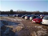
From the motorway Ljubljana - Koper take the exit Kozina. Follow the road towards Koper to the village Petrinje, where turn left towards Podgorje. The road, which climbs steeply at first, soon leads to the next crossroads, where you turn left. Continue to the village Podgorje, where you park in a large parking lot near the sports ground.
Access from Koper. Follow this road until you reach a large parking lot near the sports ground, located in Podgorje village.
Path description:
From the parking lot, turn left along the asphalted road, where after a few metres you will see a signpost pointing to the left. Continue along the cart track, following the signs. After a while, turn off cart track onto the track to which the sign directs you. There is a steep climb through the forest. From the forest we then move on to a clearing, where a wonderful view opens up. Then walk through the forest again for a while and then cross over to the clearing. Continue on the path, just before the summit there is also a small pine grove. After a few metres of walking, we reach the top, where there is a registration book and a stamp.
Pictures:
 1
1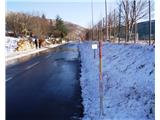 2
2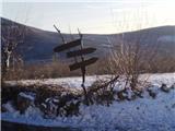 3
3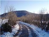 4
4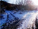 5
5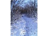 6
6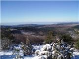 7
7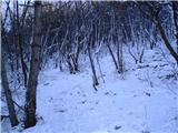 8
8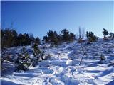 9
9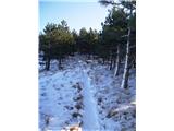 10
10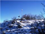 11
11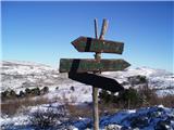 12
12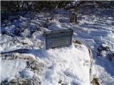 13
13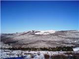 14
14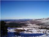 15
15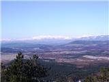 16
16 17
17
Discussion about the trail Podgorje - Kojnik (steep path)
|
| gattina7720. 10. 2014 |
markacij ni.sem sla in u gozdu blo mnogo krizisc,markacij pa ni blo.tako da sem 3ure hodila vsepovsod in sploh ne vem ali sem bla na kojniku.vrha hriba kojnik nisem nasla
|
|
|
|
| Kigeot14. 11. 2014 |
sem reazmišljala, da bi šla te dni na Kojnik. Hm, ima kdo nasvet, kako najti pravo pot? Če kdo pozna pot, vzemite me s seboj 
|
|
|
|
| ana16. 11. 2014 |
Danes sva šla po opisani poti na Kojnik in še naprej na Golič.Pot je zares lepo označena,lepi konci,še se bova vrnila.
|
|
|
|
| Kigeot18. 11. 2014 |
o, super, hvala! zimski čas je super za hribe na Primorskem, v visokogorju je že resen mraz
|
|
|
|
| Kigeot18. 02. 2015 |
Danes sem končno šla na Kojnik po tej poti. Spodnji del je čisto položen (makadamska cesta), več razpotij, oznak malo, ampak če se držiš leve strani oz. ves čas greš nekako proti hribu, ni nobenih težav. Po 15 min. pa prideš na stezo skozi gozd, začne se vzpenjati in tam je zares lepo markirano, ni šans, da bi se zgubil.
Kojnik, kot "manjši brat" Slavnika se mi je vedno zdel nekako brezvezen in danes sem dobila še enkrat potrdilo, da ni brezveznih gora, da je narava zmeraj lepa... Krasna pot, tudi za začetnike in tiste z manj kondicije.
|
|
|
|
| DuŠaN_K4. 02. 2019 |
januar 2018 - pot je na novo, zelo dobro označena s tablami in markacijami, pohvalno !
vrh pa zanemarjen, ni žiga, ni vpisne knjige, polomnjene lesene table ( slika 12), tudi signal ( kovinski drog na vrhu ) geodetke uprave bi lahko pobarvali
|
|
|