Tacen - Šmarna gora (via Spodnja Kuhinja)
Starting point: Tacen (303 m)
| Lat/Lon: | 46,1183°N 14,4615°E |
| |
Name of path: via Spodnja Kuhinja
Time of walking: 55 min
Difficulty: easy marked way
Altitude difference: 366 m
Altitude difference po putu: 366 m
Map: Ljubljana - okolica 1:50.000
Recommended equipment (summer):
Recommended equipment (winter): crampons
Views: 112.627
 | 1 person likes this post |
Access to the starting point:
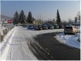
From Celovška cesta in Ljubljana, just after the Gorenjska motorway entrance, the road to Vižmary and Tacen branches off to the right (if you are coming from the Medvo side, just before the motorway entrance, turn left). Continue driving towards Tacen, and park in the large parking lot just after crossing the bridge over the Sava River.
From the Gorenjska motorway, take the Šmartno exit, then follow the road towards Šmartno pod Šmarna gora and later Tacno, where you will park in a large parking lot.
Path description:
At the beginning of the parking lot, you will see the mountain signs for Šmarna gora, which first lead you along the pavement and then direct you to the right onto Thumova Street. After a few minutes of easy walking, we reach the intersection of Thumova Street and Ulica Janeza Rožiča, and we continue straight along the narrow mountain path. After a short, gentle climb, we reach the road, but we just cross it and continue our ascent along the increasingly steep mountain path. The path, which continues through the forest, lies higher and leads us to the plain of Spodnja Kuhinja.
Continue straight ahead (left Mazi's path, right Pilgrim's path) on the so-called "over the rots" path. The path ahead starts to climb steeply again and only gently flattens out when you join the path from Šmartno. Continue in the direction of Šmarna gora along the wider path, which soon makes a sharp right turn and leads to the chapel just a few steps further on. Above the chapel we see the signs for Grmada, and we continue straight ahead and have already emerged from the forest on Sedlo between Grmada on the left and Šmarna gora on the right. Here we come to a road (access from Zavrh) on which we continue our ascent, which soon splits into two parts. You can continue the climb along the road, in which case you will climb to the top past the wishing bell, or continue to the right along the marked footpath, which takes you past the Chapel of St. Sobota, also leading to the top of Šmarna Gora.

Pictures:
 1
1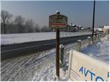 2
2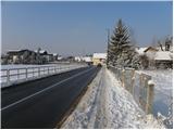 3
3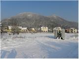 4
4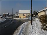 5
5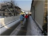 6
6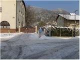 7
7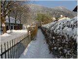 8
8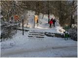 9
9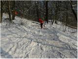 10
10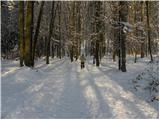 11
11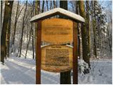 12
12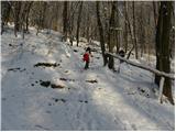 13
13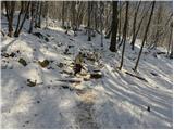 14
14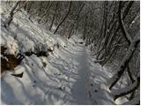 15
15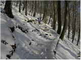 16
16 17
17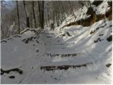 18
18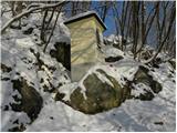 19
19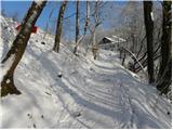 20
20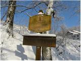 21
21 22
22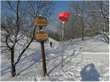 23
23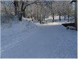 24
24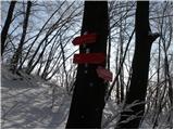 25
25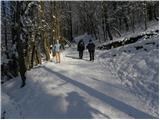 26
26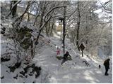 27
27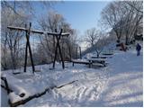 28
28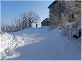 29
29 30
30 31
31
Discussion about the trail Tacen - Šmarna gora (via Spodnja Kuhinja)
|
| miho1130. 03. 2012 |
Mene zanima, kaj pomeni, da je pot "lahka"? Meni se zdi "lahka označena pot" čez Spodnjo Kuhinjo na Šmarno Goro izredno zahtevna, saj je polna skal, korenin in zelo strma je. Mogoče je lahka za vrhunske alpiniste, ne pa zame. Žal. Težavnost bi morali gledati z vidika povprečnih ljudi. 
|
|
|
|
| Kriška30. 03. 2012 |
O klasifikaciji planinskih poti si lahko prebereš v kakšnem planinskem vodniku, najbrž bi se kaj našlo tudi na spletu. Zelo natančno je opisano, kaj predstavlja posamezna oznaka (lahko, zahtevno, zelo zahtevno) in ti opisi niso odvisni od posameznega "povprečnega človeka". Težavnost ni isto kot zahtevnost. Za marsikoga je lahko pot, ki je tehnično lahka, težavna zaradi npr. pomanjkanja kondicije ali drugih subjektivnih razlogov.
|
|
|