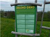
 | Moravci v Slovenskih goricah (Bioterme) - Zeleno okno
...
50 min |
 | Ormož - Kogel (Litmerk)
...
1 h 10 min |
 | Pusztaszentlászló - Hahót hegy
Hahót hegy is the second highest peak of the Zalai dombság. The summit is forested and has no view....
45 min |
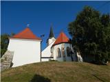
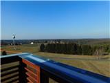
 | Miklavž pri Ormožu - Jeruzalem
Jeruzalem is a 338 m high peak located in the middle of the village of the same name, between Ljutomer and Ormož. From the top, where the Church ...
45 min |
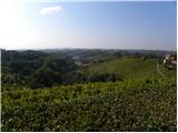
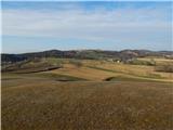
 | Lake Negova - Cerkvenjak
Cerkvenjak is a settlement in the Slovenske gorice mountains and a point on the Pomurje Mountain Route. At the highest point of the settlement, o...
1 h |
 | Lovrenc na Dravskem polju - Ptujska Gora
Ptujska Gora is a settlement located on a scenic peak south of Drava polje. On the top of the hill is the parish church of St. Mary - Mother of G...
1 h 15 min |
 | Nuskova - Beli breg (via Rožičev breg)
Beli breg is a 346-metre-high hill located in Goričko. The grassy peak offers a beautiful view, which, with good visibility, reaches all the way ...
45 min |
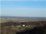
 | Rucmanci - Gomila
Gomila is a 352-metre-high peak in the Slovenske gorice mountains, located between Ptuj and Ljutomer. From the top of the peak, which has an 18-m...
1 h |
 | Kuzma - Zalka
Zalka is a 362-metre-high peak in Goričko, northeast of Kuzma. The peak is located in a forest, but still offers some views....
52 min |
 | Andovci / Orfalu - Katin breg / Katalin-hegy (mimo mejnega kamna A 115)
...
45 min |
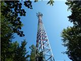 | Kuzma - Bogin breg
Bogin breg is a 371-metre-high hill located between Dolice and Trdkovo. The forest on top of the transmitter gives you a better view....
45 min |
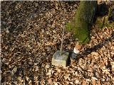
 | border crossing Matjaševci - Tromejnik / Dreiländerecke / Harmashatar
Tromejnik, Dreiländerecke in German or Hármashatár in Hungarian, is a 390 m high hill located on the tri-border between Slovenia, Austria and Hun...
1 h |
 | Eisenberg an der Raab - Tromejnik / Dreiländerecke / Harmashatar (by the border)
Tromejnik, Dreiländerecke in German or Hármashatár in Hungarian, is a 390 m high hill located on the tri-border between Slovenia, Austria and Hun...
1 h 10 min |
 | border crossing Matjaševci - Holzmannkogel
...
1 h 15 min |
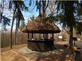
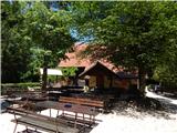 | Phliški bajer - Mengeška koča on Gobavica (lower path)
Gobavica is a hill rising above Mengeš. There is a Mengeš hut on the hill, and they also have a goat stall. It is one of the starting points for ...
1 h |
 | Topole - Mengeška koča on Gobavica
Gobavica is a hill rising above Mengeš. There is a Mengeš hut on the hill, and they also have a goat stall. It is one of the starting points for ...
45 min |
 | Vojnik - Sveti Tomaž above Vojnik
St.Thomas is a church standing on a partially vegetated 444 m high peak near Vojnik. On the top there is a registration book with a stamp. Below ...
1 h |
 | Ljubljana (Sveti Urh) - Orle
Orle is a locality in the municipality of Lavrica, located on a small hill northeast of the Ljubljana Mor. A few metres below the highest point o...
1 h 10 min |
 | Suhadole - Koseški hrib (via Mlinčki)
Koseški hrib is located between Kuharjevi boršt' and Kosezami, the settlement after which the peak is named. From the top, where there is a table...
50 min |
| Bukovica pri Vodicah - Koseški hrib (via Mlinčki)
Koseški hrib is located between Kuharjevi boršt' and Kosezami, the settlement after which the peak is named. From the top, where there is a table...
50 min |
 | Dragomer - Strmca (via Ferjanka)
Strmca is a lesser-known and forested hill located between Brezje pri Dobrovi and Log pri Brezovici. There is no view from the top due to the for...
45 min |