Zgornja Besnica (Nova vas) - Šum waterfall
Starting point: Zgornja Besnica (Nova vas) (468 m)
| Lat/Lon: | 46,2697°N 14,2659°E |
| |
Time of walking: 15 min
Difficulty: easy marked way
Altitude difference: -43 m
Altitude difference po putu: -43 m
Map: Škofjeloško in Cerkljansko hribovje 1:50.000
Recommended equipment (summer):
Recommended equipment (winter): crampons
Views: 24.537
 | 4 people like this post |
Access to the starting point:
a) From Ljubljana, take the old road to Kranj, then follow the main road to the bridge over the Sava River. Just before the bridge, we leave the main road and continue straight ahead towards Besnice. Continue through Rakovica and Spodnja Besnica to Zgornja Besnica, where, at the Zgornja Besnica end sign, you park in a convenient place next to a number of direction signs.
b)From Jesenice or Bled, take the motorway towards Ljubljana, and we follow it to the Kranj - West exit. Continue along the old regional road towards Ljubljana, and we follow it to Kranj, where we turn right towards Besnice, just after the bridge over the Sava River. Continue through Rakovica and Spodnja Besnica to Zgornja Besnica, where, at the sign for the end of Zgornja Besnica, we park in a convenient place next to a number of direction signs.
c) The starting point can also be reached from Železniki by passing through the villages Rudno and Dražgoše towards Kranj. When you reach Zgornja Besnica, park in a suitable place next to the sign, Zgornja Besnica.
Path description:
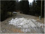
From the starting point, walk along the main road to the hamlet of Nova vas (direction Kranj), where the signs for the Šum waterfall direct you sharp left (from the route of Kranj, right). Continue along the descending asphalt road, which takes you past the Jawa bar to the place where the asphalt ends. From here, continue along the wide cart track for another 10 m, and then the signs for the Šum waterfall direct you sharp left, onto a beautifully maintained path. The path ahead first descends steeply to an information board, then turns left into the forest, where it leads us above the waterfall. From here on, follow the well-guarded path, which will take you under the waterfall in a few minutes.
Pictures:
 1
1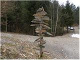 2
2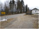 3
3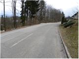 4
4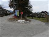 5
5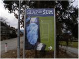 6
6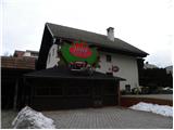 7
7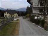 8
8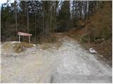 9
9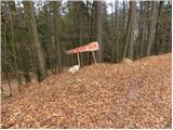 10
10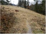 11
11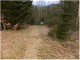 12
12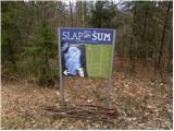 13
13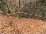 14
14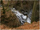 15
15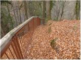 16
16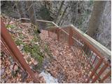 17
17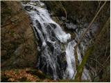 18
18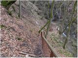 19
19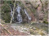 20
20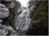 21
21 22
22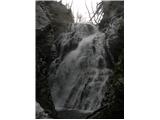 23
23
Discussion about the trail Zgornja Besnica (Nova vas) - Šum waterfall
|
| Skelo20. 10. 2017 |
Najslabše označena in neurejena pot kar sem jih prehodil...
|
|
|
|
| hikingman21. 10. 2017 |
Jaz sem bil spomladi, pa je bilo prav lepo.
|
|
|
|
| heinz2. 04. 2018 |
Zelo dobro označena in odlično varovana, urejena pot. Slap je vreden ogleda.
|
|
|