Zadnjica - Vrh Hribaric (via Dolič)
Starting point: Zadnjica (642 m)
| Lat/Lon: | 46,3824°N 13,7604°E |
| |
Name of path: via Dolič
Time of walking: 6 h 25 min
Difficulty: easy pathless terrain
Altitude difference: 1746 m
Altitude difference po putu: 1790 m
Map: Triglav 1:25.000
Recommended equipment (summer): helmet
Recommended equipment (winter): helmet, ice axe, crampons
Views: 6.640
 | 1 person likes this post |
Access to the starting point:
From Kranjska Gora, drive over the Vršič Pass towards Bovec or vice versa, but only as far as the 50th serpentine of the Vršiška cesta (near the village of Trenta). Here you turn onto a side road, which you follow up a slight incline to a parking lot in the valley of the Zadnjica River.
The road to the parking area by the lock is now closed to public traffic, so you have to park in the parking area at the entrance to the valley of the Zadnjica. This will add a good 15 minutes to the journey.
Path description:
From the parking lot by the lock, turn right on the road towards Doliča and Zasavska hut. Follow the road, which climbs at first gently and then steeply, for 30 minutes to a crossroads, where you continue along the left-hand path in the direction of the hut at Dolič (Prehodavci on the right). Here, the porer road turns into a wide military mulatier, which you then climb. During the ascent, you can observe the steep walls of the surrounding peaks. After two hours of walking, the path leads to the next crossroads, where we continue right in the direction of Doliča (left Luknja). The wide path continues and then crosses some steep slopes in a moderate ascent. Some caution is needed only when crossing ravines where torrents destroy the wide path, but even in these parts there are no problems on land. A little further on, we join the climbing route over Komar, which is closer than ours but also more difficult (for experienced mountaineers). In the further ascent, we join the barely visible route from Kanjavčevih poli, which comes from Prehodavci. There is one last rather rocky climb to the Tržaška hut on Doliču.
From the Hut on Dolič, it takes a few minutes to walk to the Dolič saddle, where there is a marked crossroads. Take the path to the right in the direction of the Hribarice Pass (left to Dom Planika, straight ahead to Vodnikom dom na Velem polju), where you will soon reach the vast scree fields between Mišeljski konec and Kanjavec. After about 30 minutes of climbing, the path is laid, and on the right side we see a fork in the path leading to Kanjavec. We continue straight ahead here and continue our ascent along the gently sloping path, which leads us just a little further on to the Hribarice Preval. We follow the marked path towards the Triglav Lakes for a few minutes, then on the left-hand side we see cairn, which directs us to the left to the pathless world between Hribarice and the valley behind Debelim vrh. After an easier trackless climb to the saddle between Vrh Hribaric on the left and Vršaki on the right. From the indistinct saddle, continue slightly to the left, and our goal is now the ridge between the Mišeljska Valley and the Valley behind Debelim vrh. Without much difficulty, we climb up to the ridge, from where we continue to the right and take the less well-trodden path that leads along the right (west) side of the ridge. Soon you will see the summit of Hribaric Peak in front of you. The Cairns point us slightly right, avoiding the summit, which is only a short climb away. Once around the headland, there is only a final climb along a pathless ridge to the summit.

Pictures:
 1
1 2
2 3
3 4
4 5
5 6
6 7
7 8
8 9
9 10
10 11
11 12
12 13
13 14
14 15
15 16
16 17
17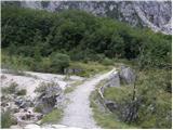 18
18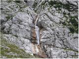 19
19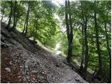 20
20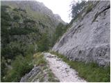 21
21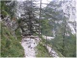 22
22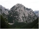 23
23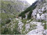 24
24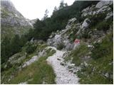 25
25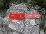 26
26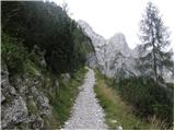 27
27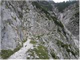 28
28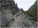 29
29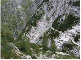 30
30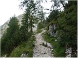 31
31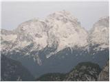 32
32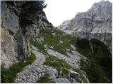 33
33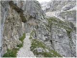 34
34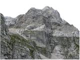 35
35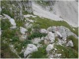 36
36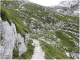 37
37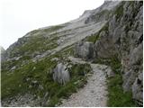 38
38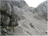 39
39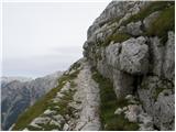 40
40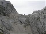 41
41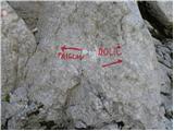 42
42 43
43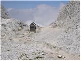 44
44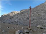 45
45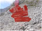 46
46 47
47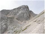 48
48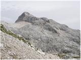 49
49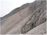 50
50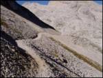 51
51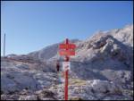 52
52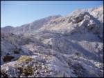 53
53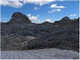 54
54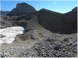 55
55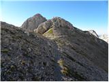 56
56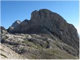 57
57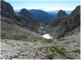 58
58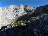 59
59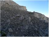 60
60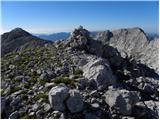 61
61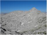 62
62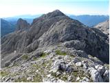 63
63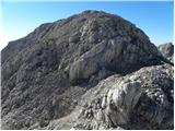 64
64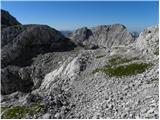 65
65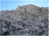 66
66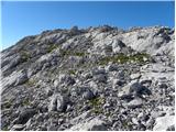 67
67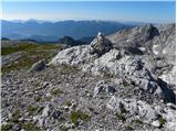 68
68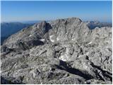 69
69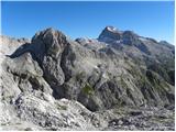 70
70
Discussion about the trail Zadnjica - Vrh Hribaric (via Dolič)