Žabnice / Camporosso in Valcanale - Kamniti lovec / Cima del Cacciatore
Starting point: Žabnice / Camporosso in Valcanale (858 m)
| Lat/Lon: | 46,5044°N 13,5404°E |
| |
Time of walking: 3 h 30 min
Difficulty: difficult marked way
Altitude difference: 1213 m
Altitude difference po putu: 1220 m
Map: Julijske Alpe - zahodni del 1:50.000
Recommended equipment (summer): helmet
Recommended equipment (winter): helmet, ice axe, crampons
Views: 10.890
 | 2 people like this post |
Access to the starting point:
Via Border crossing Rateče or Border crossing Predel, drive to Trbiz / Tarvisio, then continue towards Udine and the settlements of Frogs / Camporosso and Valcanale. When Trbiz ends, just after the Eurospar store (the store is on the right hand side of the road), before the main roundabout, turn left onto Via Lussari. Drive along the street for a few 100 metres, then come to a small crossroads, and continue straight on from the crossroads and park in the parking lot on the right-hand side of the road after the crossroads. Park in the lower part of the parking lot, the upper part is marked no parking with a no parking sign.
Path description:
From the starting point, continue along the asphalt road, which is closed to public traffic and leads past a few houses. Above the hamlet, the path leads us past an information board, and then the asphalt ends. We continue on the macadam road, which leads us through the Višarski graben, through which the Rio Lussari stream flows. Higher up, the road turns into a wide cart track, with the Stations of the Cross appearing alongside.
We continue for some time on the cart track, which only occasionally opens up some views in the direction of Carnic Alps, where we can see Ojstrnik. Higher up, from cart track turn right onto the marked footpath towards the Stone Hunter / Cima del Cacciatore and the Holy Heights / Monte Lussari (straight ahead on cart track Višarska planina / Malga di Lussari). Then climb through the forest, and at the XIIIth station of the Way of the Cross you will be quite close to the ski slope and the service road.
At this station, leave the footpath leading to Sveti Višari and continue along the service road to the Višari saddle. After a few minutes of moderate ascent on the service road, reach the larger chapel on Višarski sedlo, from where you turn left onto the footpath in the direction of Kamnitý hunter (straight ahead Zajzera, right Svete Višarje).
From the saddle, the path climbs slightly, then continues for some time without any major changes in altitude, or climbs only slightly. Further on, the path begins to climb moderately, and higher up it crosses the slopes of the Beraški Križ, a peak visible to the left of the path. After a longer traverse to the right, there is a shorter, slightly steeper section, and then the path leads to cirque in Klobuk, where the path transitively lays down and turns again more to the right. When the path starts to climb again, it turns left and then leads over scree, over which you walk until you enter the more difficult part.
At the beginning of the protected part, an arrow on a rock points to the right, where a rope starts to steeply climb. After a short steep climb, the well-protected path turns right and ascends crosswise to a rubbly ravine, which is reached by a further protected path. We then climb up the gully, where we have to be very careful not to skip stones, as there is a mountain path below us and any stone can be dangerous for the many hikers below us, and we also have to watch out for falling stones skipped by the hikers above us. During the climb up the ravine, which is not particularly difficult technically, we are helped in a few places by a rope. At the top of the ravine, we reach a ridge, where we continue to the right, and then, after a steep path, we reach the scenic summit within a minute of further walking. Žabnice - Višarsko sedlo 2:15, Višarsko sedlo - Kamniti lovec 1:15.
Description and images refer to the situation in 2017 (July).

Pictures:
 1
1 2
2 3
3 4
4 5
5 6
6 7
7 8
8 9
9 10
10 11
11 12
12 13
13 14
14 15
15 16
16 17
17 18
18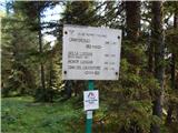 19
19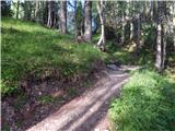 20
20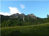 21
21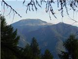 22
22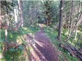 23
23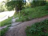 24
24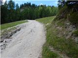 25
25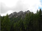 26
26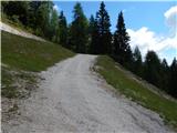 27
27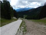 28
28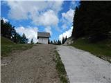 29
29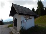 30
30 31
31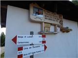 32
32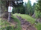 33
33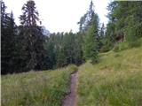 34
34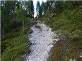 35
35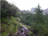 36
36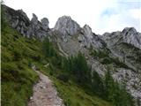 37
37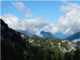 38
38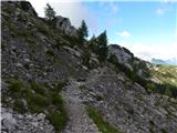 39
39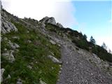 40
40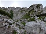 41
41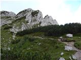 42
42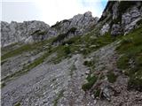 43
43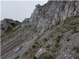 44
44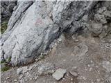 45
45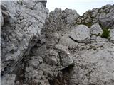 46
46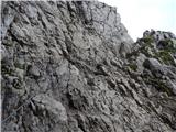 47
47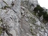 48
48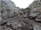 49
49 50
50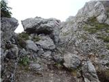 51
51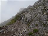 52
52 53
53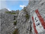 54
54 55
55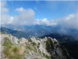 56
56
Discussion about the trail Žabnice / Camporosso in Valcanale - Kamniti lovec / Cima del Cacciatore
|
| J.P.3. 10. 2022 19:16:45 |
Kljub temu ,da ni kaj dosti za videti do sedla - je pot prijetna in lepo drži tempo. Makadam po želji pokrajšamo z bližnjicami. Čelada priporočljiva ob vstopu na par jeklenic. Zelo lepa tura drugače.. Podani čas je precej romarski. LP
|
|
|