Sella Nevea - Prestreljenik (on ski track)
Starting point: Sella Nevea (1170 m)
| Lat/Lon: | 46,3874°N 13,4734°E |
| |
Name of path: on ski track
Time of walking: 3 h 30 min
Difficulty: partly demanding marked way
Altitude difference: 1329 m
Altitude difference po putu: 1329 m
Map: Julijske Alpe - zahodni del 1:50.000
Recommended equipment (summer): helmet
Recommended equipment (winter): helmet, ice axe, crampons
Views: 15.235
 | 2 people like this post |
Access to the starting point:
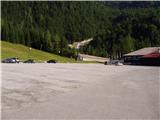
a) First, we drive to Kranjska Gora, then we continue our journey via Border crossing Rateče to Itali. Drive towards Trbiž / Tarvisio, then turn left at the beginning of the town in the direction of Bovec. Continue along the regional road towards Border crossing Predel, and follow the main road to the crossroads near Lake Rabeljsko / Lago del Predil. Here we continue to the right in the direction of the Neveje Pass (V Žlebeh) / Sella Nevea and follow the asphalt road to the aforementioned pass. Park in the large parking lot at the bottom station of the circular cable car leading to the Rifugio Gilberti hut.
b) First drive to Bovec and then continue to Border crossing Predel, via which you will enter Itali. We then descend to Lake Rabel, after which we leave the main road leading to Trbiz and continue driving to the left towards the Nevejski Pass (V Žlebeh). The road then starts to climb again and we follow it to the aforementioned pass. Park in the large parking lot at the bottom station of the circular cable car leading to the Rifugio Gilberti hut.
Path description:
At the end of the parking lot, you will see a sign for the Gilberti mountain lodge, which will direct you to the lower part of the ski slope. Once on the slope, continue left and after a short climb, you will reach a transport rescue road that ascends up the slope. From the relatively steep road, which is closed to traffic, new views open up from one step to the next, the most beautiful of which are of the nearby Belo Pach and the Jôf di Montasio group of mountains. Higher up, the road approaches the cliffs of Bela Peć and leads to the top station of the old cable car.
From the cable car, continue towards the Rifugio Gilberti hut along the gently sloping road, which takes you past the chapel and leads you in a few minutes to the mountain lodge and the upper station of the new circular cable car.
From the Gilberti hut, descend to the Prevalska ravan freezing area, from where you continue to the right along the initially gently sloping ski slope. Continue the ascent along the transport-rescue road, which climbs parallel to the ski slope. Higher up, the road rejoins the ski slope, which climbs between large snowfields. Above the snowfield, the 'path' climbs even steeper, and then, within a few minutes of further walking, leads to the Prevala saddle, where the state border is located.
Continue to the right on the Slovenian side of the ski slope, which, after 30 minutes of further walking, leads to Sedlo (the saddle between Grdi vršič and Prestreljenik).
From Sedlo, where the 4-seater Prevala exit station is also located, you will see a large sign pointing to the west side of Sedlo. Here the marked trail turns right and starts to climb steeply up the steep slope. Higher up, the path transiently lays down and then passes by the foot of Prestreljenik, where it first climbs on rubble. The path continues on to steep slopes where it then ascends transversely to the right. There is a short climb over a grassy slope, and then the path turns to a completely rocky world, where you have to help yourself in a few places. Higher up, the path leads to the main ridge, where we are helped by some injured fixed safety gear. The path then gently lays down and in a few 10 steps of further walking leads us to a scenic peak.

We can extend the trip to the following destinations: Prestreljenik
Pictures:
 1
1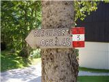 2
2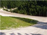 3
3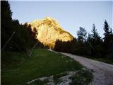 4
4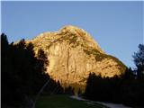 5
5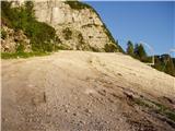 6
6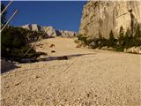 7
7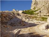 8
8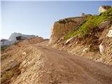 9
9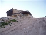 10
10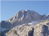 11
11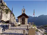 12
12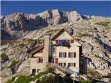 13
13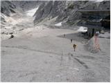 14
14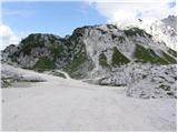 15
15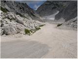 16
16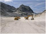 17
17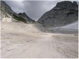 18
18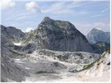 19
19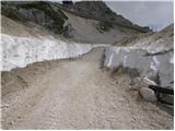 20
20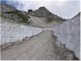 21
21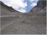 22
22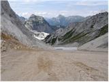 23
23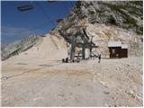 24
24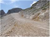 25
25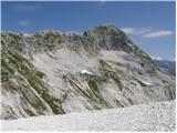 26
26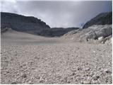 27
27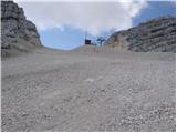 28
28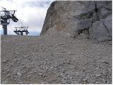 29
29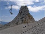 30
30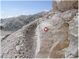 31
31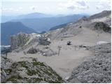 32
32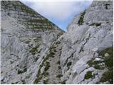 33
33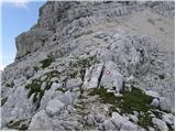 34
34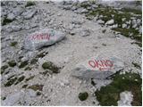 35
35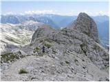 36
36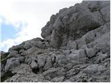 37
37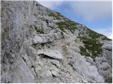 38
38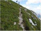 39
39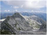 40
40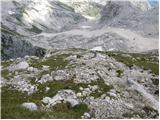 41
41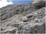 42
42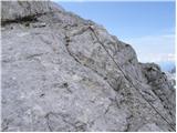 43
43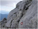 44
44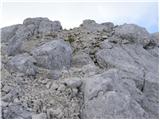 45
45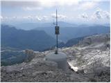 46
46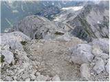 47
47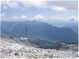 48
48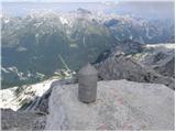 49
49 50
50
Discussion about the trail Sella Nevea - Prestreljenik (on ski track)