Rifugio Pelizzo - Monte Mataiur/Matajur (via Fonte Skrila)
Starting point: Rifugio Pelizzo (1320 m)
| Lat/Lon: | 46,203°N 13,5391°E |
| |
Name of path: via Fonte Skrila
Time of walking: 1 h 15 min
Difficulty: easy marked way
Altitude difference: 322 m
Altitude difference po putu: 400 m
Map: Julijske Alpe - zahodni del 1:50.000
Recommended equipment (summer):
Recommended equipment (winter): ice axe, crampons
Views: 12.551
 | 4 people like this post |
Access to the starting point:
a) On the Slovenian side:
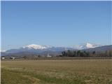
From the Tolmin - Kobarid road, a steep dual carriageway turns left at Idrsko (right from Kobarid) towards the village of Livek (approx. 5 km). From here, continue along the narrower and narrower road into Itali. On the other side of the border, the road starts to descend slightly, and at the village of Polava it widens again, and climbs slightly towards the village of Cepletischis. From here, descend towards a crossroads (0. 5 km), where you continue to the right in the direction of the villages of Monte Mataiur / Montemaggiore and Rifugio Pelizzo. Straight on Sauodnia / Savogna. From Liveco to Monte Mataiur is about 10 km and to Rifugio Pelizzo 13 km.
b) On the Italian side:
From Goriško direction take the regional road towards Udine, to the turn-off for Krmin / Cormons. At the roundabout at the first exit turn towards Krmin / Cormons and Chedad / Cividale and go under the underpass and then immediately turn left. At the large and awkward junction in Cormons, turn towards Chedad / Cividale del Friuli. The drive continues through several towns on the carefully cultivated Friulian plain. In good visibility we will see our destination Monte Mataiur in the company of Krno, first on our right, and from Chedad straight ahead. In Chedad we arrive at a semaphored junction next to a building which houses first a pharmacy (farmacia) and then a bank. Take a sharp right at the junction (straight ahead is the entrance to the old part of the town and a large free parking lot). The famous Devil's Bridge is only a few minutes' walk away.
Continue to a small roundabout, in front of which there are several direction signs, including a brown sign for Kolovrat. From here, follow the signs for Kolovrat. Follow the river Nadija towards Speter Slovenov / San Pietro al Natisone. Approximately 1 km before Speter, you reach the crossroads at Muost/Puint/Ponte San Quirino. Turn right here (straight Speter), and left over the bridge to take the road from Chedad on the other bank of the river Nadija, which leads to the route you can find on Google Maps. Continue following the signs for Kolovrat, but only for about 1. 5 km, where the road for Kolovrat and the former border crossing Solarij / Solarie branches off to the right. We continue straight on to the larger town of Sauodnja / Savogna, also the centre of the municipality of the same name. Here we turn right over a bridge and continue along the main road. You could also go left up after the bridge, but the road is very steep and narrow. On the bridge you can also see the red signs for Rifugio Pelizzo. The path soon starts to climb serpentinely (approx. 3 km and 6 sharp bends). At the top, you reach the next turn-off where you turn left towards the village Monte Mataiur/Montemaggiore and Rifugio Pelizzo. Straight ahead is the village of Cepletischis and about 6 km more to Livko. From the crossroads, the village of Monte Mataiur is about 5. 5 km away on a moderately ascending dual carriageway. Above the village Monte Mataiur the road narrows slightly and after 3,5 km, a gentle climb leads to Rufugio Pelizzo.
Path description:
Park in the parking lot of Rifugio Pelizzo at mountain pasture in Lazee. The word rifugio literally translates as shelter, and in Italian it also means mountain hut or home. Pelizzo is more of the latter in size. In snowy conditions there is a roadblock above the village of Monte Mataiur. The shortest way to Rifugio Pelizzo is along a gently ascending road (about 45 minutes' walk), which can be shortened several times by taking steep shortcuts.
From the parking lot of the Rifugio Pelizzo, walk to the turn under the observatory, where the signpost for Fonte Skrila directs you to the left. The path descends towards the house visible below the observatory and continues past the wall below the house. The path begins to descend a grassy slope towards a small wood on our left. After a few steps you will see an unmarked path branching off to your left. We continue on the marked path, which descends steeply for a few metres and then turns to the left, towards the copse. After a few minutes, the almost level path leads us to a spring. From here, the path begins a gentle cross-climb through the woods to a fork where a signpost for Monte Mataiur and Fonte Skrila directs us left up the hill, and the path continues straight ahead to Palestra di roccia. The path climbs steeply for the next 10-15 minutes. At the end of the climb, an unmarked path joins from the left, which at the beginning of the path, below the house, immediately turns to the left, through a small wood.
The unmarked path climbs moderately all the way to the junction with the marked path, and is therefore less strenuous to walk on than the marked path, which descends initially and then climbs more steeply. However, it requires more care to walk it even in terrestrial conditions, as the path is very narrow and crosses steep slopes in places, which are often icy due to their axial position, and slippery in wet conditions. The unmarked path is mostly unpaved in snowy conditions, but if icy, crampons are essential. If the snow is soft, there is a high risk of triggering an avalanche. If there is more than 0. 5m of snow, you should choose the lower, marked route.
The lower, marked route is not problematic in most snow conditions. However, if the snow is close to 1 m or more, you should be very careful on the part of the trail just before Fonte Skrila, where you cross a few metres of slope above the torrent. In terrestrial conditions, there is a wide flat path and the slope is not noticeable at all. If there is a lot of snow, this part turns into a steep slope ending in the bed of the torrent. More care is needed here, as you can trigger an avalanche or slip into the torrent bed.
When the two paths join, the trail lays down and turns right for a few more steps through the forest, which soon thins out. Ahead you see mountain pasture rising below the eastern slopes of Matajur.
Continue past the stone trough and the water reservoir at Izvir/Fonte Skrila. Skrila is one of the three springs located at Monte Mataiur at an altitude of over 1,400 m, which is very rare. Perhaps it is these springs that give the father mountain of the Venetian Slovenians its special energy.
The path starts from the trough climbing moderately along the right edge of the mountain pasture towards the saddle, where it joins the cart track - the old path from Livko. Here the path joins and shortens the bend. In front of us rises the mighty Krn with its neighbours, and behind us on our left we can clearly see our goal, the Monte Mataiur peak. The route sign says that the summit is 20 minutes away, but feel free to add at least another 10 minutes and enjoy the increasingly beautiful views. We continue a few steps along cart track to a bend where signs direct us to a path that leads straight uphill. Cart track crosses the south-eastern slopes of Monte Mataiur towards Dom na Matajure in a gentle ascent. If the snow is close to 1m, you will not see cart track. If the snow is not transformed, it is not recommended to cross the slopes towards the House on Monte Mataiur, as an avalanche may be triggered from the higher steep slopes above the track.
On the way from Rifugio Pelizzo to Fonte Skrila and further towards the saddle, there is usually much more snow than on the south side. If it is not snowing, snowshoes are usually useful on this part of the route.
From the bend, our route continues along a path that climbs quite steeply to a small saddle where the path from Avsa joins from the right. From here, the views ahead of us widen to the Kanin Mountains and Rombon, Mangrt, Jalovec, and Razor. There is a short climb to the eastern ridge, from which the view extends from Dolomites to the Lower Bohinj Mountains. After crossing the ridge, the path climbs moderately for a few more minutes towards the summit, which can be seen in front of you the whole time.
From the top of Monte Mataiur we can go to Rifugio Pelizzo: - straight down the former ski slope
- along the northern ridge to the mountain pasture route (not recommended in snowy conditions),
- along the west ridge to the Doma na Monte Mataiur and from here:
a) left to Rifugio Pelizzo,
b) right, to the little houses by the lake and then left, towards the start of the mountain pasture route, where it joins the steep path from the Doma na Monte Mataiur, from here left, to the Rifugio Pelizzo, straight on to the village of Matajur.
c) straight down the steep path to the mountain pasture march and continue left to the Rifugio Pelizzo or straight to the village of Matajur.

Pictures:
 1
1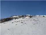 2
2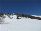 3
3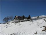 4
4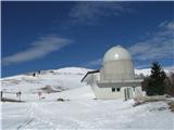 5
5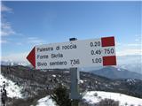 6
6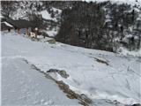 7
7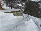 8
8 9
9 10
10 11
11 12
12 13
13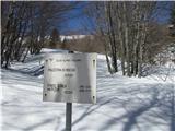 14
14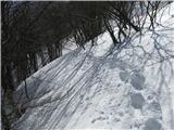 15
15 16
16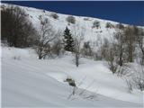 17
17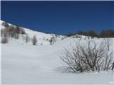 18
18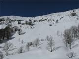 19
19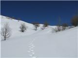 20
20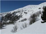 21
21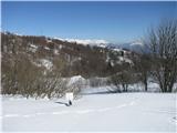 22
22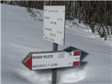 23
23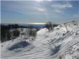 24
24 25
25 26
26 27
27 28
28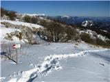 29
29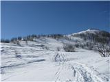 30
30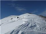 31
31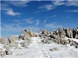 32
32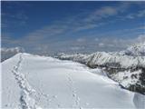 33
33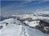 34
34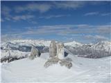 35
35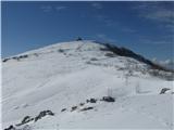 36
36 37
37 38
38 39
39 40
40 41
41 42
42 43
43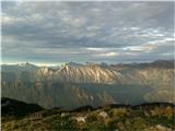 44
44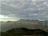 45
45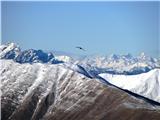 46
46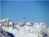 47
47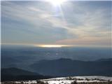 48
48 49
49 50
50
Discussion about the trail Rifugio Pelizzo - Monte Mataiur/Matajur (via Fonte Skrila)