Podhom - Sveta Katarina na Homu
Starting point: Podhom (590 m)
| Lat/Lon: | 46,3903°N 14,085°E |
| |
Time of walking: 45 min
Difficulty: easy unmarked way
Altitude difference: 44 m
Altitude difference po putu: 44 m
Map: TNP 1 : 50.000
Recommended equipment (summer):
Recommended equipment (winter):
Views: 4.127
 | 2 people like this post |
Access to the starting point:
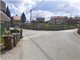
a) From the motorway Ljubljana - Jesenice take the exit Lipce (Jesenice East), where you turn left (direction Blejska Dobrava and Spodnje Gorje). After 100 m of driving, immediately after passing through the railway underpass, you will come to the next junction, where you turn right in the direction of Gorje, Bled (left Blejska Dobrava). After a steeper climb, pass through the village of Kočna and continue towards Spodnje Gorje, where shortly after crossing the river Radovna on a bridge and the road climbs slightly, you will come across a left fork with signs "Zasip, Vintgar, Podhom". Turn left here and after a few 10 m at the crossroads turn left again, in the direction of "Vintgar". Soon we are back at the crossroads, where we do not continue downhill towards Vintgar, but only slightly right or straight uphill to the parking lot (signposted at the roadside at the crossroads). The road on the right leads into the village. Park in the parking lot next to the playground.
b) From Bled, head towards Pokljuka and Spodnje Gorje. In Spodnje Gorje follow the signs Jesenice, Vintgar. At the crossroads a few metres further from the Fortuna Inn, turn right in the direction "Zasip, Vintgar, Podhom". After a few 10 m, turn left at the crossroads in the direction "Vintgar". Soon we are back at the crossroads, where we do not continue downhill towards Vintgar, but only slightly right or straight ahead to the parking area (signposted at the roadside at the crossroads). The road on the right leads into the village. Park in the parking lot next to the playground.
Path description:
From the parking lot, continue across the pasture towards Hom Hill, which you can see ahead. The path across the pasture turns slightly right and soon starts to climb. Shortly, as the path turns sharp right, we see the left-hand fork logging trail uphill towards the forest (the path to Hom), and we continue on our wide and sloping path, which takes us eastwards. As we walk along the open grassy slope, we are soon treated to beautiful views across a significant part of Gorenjska with the Julijci, Pokljuka and Jelovica, and later Karawanks and the Kamnik Alps in the background. On the way we cross a pasture fence several times, and we also encounter benches on which we can rest. When the path takes us above the last village (Zasip) lying below the hillside, we see the church of St Catherine in the distance, and soon we cross the pasture fence for the last time, and enter the larger gravel parking area at St Catherine's on Hom. On the left you will see a guest house, and slightly to the right, or straight ahead along the valley path, an ancient church. You can rest and enjoy the view on the nearby benches.

Pictures:
 1
1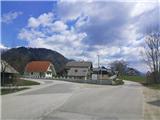 2
2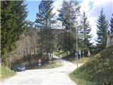 3
3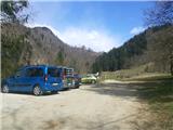 4
4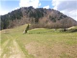 5
5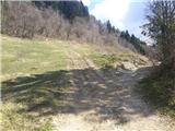 6
6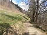 7
7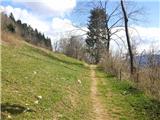 8
8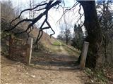 9
9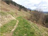 10
10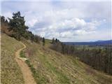 11
11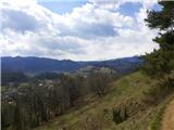 12
12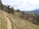 13
13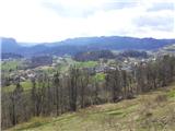 14
14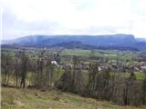 15
15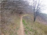 16
16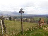 17
17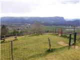 18
18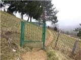 19
19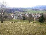 20
20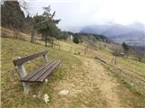 21
21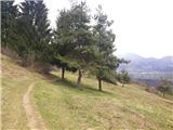 22
22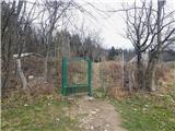 23
23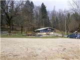 24
24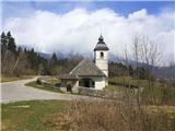 25
25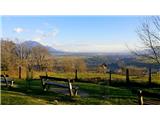 26
26
Discussion about the trail Podhom - Sveta Katarina na Homu