Parking Sulzenauhütte - Becherhaus (via Sulzenauhütte and Seescharte)
Starting point: Parking Sulzenauhütte (1590 m)
| Lat/Lon: | 47,01593°N 11,18084°E |
| |
Name of path: via Sulzenauhütte and Seescharte
Time of walking: 7 h 45 min
Difficulty: very difficult marked way
Altitude difference: 1605 m
Altitude difference po putu: 1950 m
Map: Stubaier Alpen Hochstubai, 31/1 1:25.000; Outdooractive Stubai Wanderkarte
Recommended equipment (summer): ice axe, crampons
Recommended equipment (winter): ice axe, crampons
Views: 471
 | 3 people like this post |
Access to the starting point:
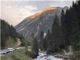
From Ljubljana, take the motorway past Salzburg towards Munich. At the Dreieck Inntal multi-level junction, take the A93 towards Innsbruck/Kufstein/Brenner. On your return to Austria, continue to the Innsbruck-Mitte exit. Here, do not turn towards Innsbruck, but continue on the A13 motorway towards the Brenner Pass. Turn off the motorway at exit 10-Schönberg and follow the comfortable road through the Stubai Valley to Neustift im Stubaital, the centre of the Stubai Valley, and Volderau, where the still wide asphalt road starts to climb a little more steeply towards Mutterbergalm and the Stubaier Gletscher ski resort. Soon on the left we see the large Grawa waterfall and the parking lot of the eponymous mountain pasture; here is the first starting point for the climb up to the Sulzenauhütte. After a few minutes of further driving, we park in a rather spacious dedicated parking lot, which gives us the easiest approach to the hut, and where we see a large information board at the starting point, highlighting the ascent to Sulzenauhütte.
An alternative is to drive through northern Itali: in this case, from central Slovenia, take the A2 motorway to one of the border crossings with Austria and continue to Lienz. Here you continue on the 100 road and pass the Prato alla Drava crossing into Itali. In Itali, follow the SS49 all the way to the junction with the A22 motorway in the direction of the Brenner Pass. After the pass, continue in the direction of Innsbruck to the Schönberg exit. From there, follow the route described above.
Path description:
From the starting point, walk across the little bridge and, following the signs for the Sulzenauhütte and mountain pasture Sulzenau hut, continue along the narrow path that leads you in curves over the forest slope to the south. After about 45 minutes, the moderately steep, rather rough path, which occasionally offers fine views over the Stubai valley, is joined by a slightly steeper version of the path, which crosses the wooded terrain above Grawa Alm at the edge of the large Grawa waterfall. The path turns eastwards at this point and after about 15 minutes leads out onto the great plains, where the mountain pasture Sulzenau is revealed below the cliffs overlooked by the Sulzenauhütte. Reliable signs lead us past the mountain pasture and direct us to a narrow path which crosses the steep slope in curves and, after about two hours' walk from the starting point, leads to the Sulzenauhütte hut.
At the hut, which stands in the middle of the attractive watery world of the High Stubai, look towards the signs for Nürnberger Hütte and Wilder Freiger, which lead eastwards from the hut (towards Route Seescharte and Leo Schöpf's Route; the more difficult and more direct Lübeckerweg soon branches off and turns sharply southwards). Initially quite gentle, the path soon leads to the western edge above the larger Grünausee lake, where there is a beautiful view towards Wilder Freiger and the nearby peaks; here a more difficult unmarked path branches off, leading to the summit via the Freiger Glacier. After a short traverse north over the lake, we find ourselves at a crossroads: the broader track continues towards the Nürnberger Hütte, and we take the slightly less obvious path that leads along the eastern edge above Lake Grünausee. The still fairly easy path leads over a grassy slope into increasingly rocky terrain, where we progress towards our next destination, the Seescharte saddle between the peaks of Urfallspitze (2805 m) and Gamsspitzl (3051 m). After a short, slightly steeper climb on the rocky terrain, after about two hours' walk from the hut, we reach the saddle, where we get a wide view of the mountains and glaciers of the eastern part of the central High Stubai group.
From the saddle, continue along the track which crosses under the Gamsspitzl massif on rough terrain to the south. Soon you reach a crossroads at a large rock, from where it is relatively easy and quick to climb to the Gamsspitzl, which offers a magnificent view of the Wilder Freiger summit; I highly recommend the short ascent of this easily accessible three-thousand-point summit.
From the crossroads, continue along the track, which crosses some of the snowfields that remain all year round, and begins to climb steeply towards the ridge between the two arms of the glacier that clings to the southern face of Wilder Freiger. The rough path continues with a bit of scrambling in places and the terrain is sometimes a little unstable.
Soon we find ourselves on a broad side ridge, which offers an unobstructed view towards the continuation of the trail. The ridge is slightly precipitous in places, and the fixed safety gear (rocks and steps) help us over the most unfavourable spots. At this point, the markings dip and only appear intermittently from here on, and we continue to stick to the ridge; in two places, we take a sharp cut to the east and cross underneath it. A rope ladder helps us to descend to the top of the glacier.
After a short and, as a rule, unproblematic crossing of the glacier in summer, where we are guided by poles, we climb with the help of a fixed rope over the rocky slope below the summit ridge Wilder Freiger, which is reached near the point on the Signalgipfel Pass (3392 m). From here it is possible to make a short climb along the ridge to the summit of Wilder Freiger (approx. 15 minutes; see the description of the climb up the Wilder Freiger).
Our route heads east on the ridge and climbs gently to the small meteorological station on the Signalgipfel. Here we look south and follow the well-marked and protected ridge path, which descends steeply from the Signalgipfl to the Übeltalferner glacier by means of a number of cables and a fixed rope.
After about 20 minutes of descending, we reach the edge of the glacier and continue along the ridge, which is a little more exposed in places, towards the hut that can be seen on the peak ahead. Before the final climb, we join the path ascending from the Übeltalferner glacier. The ridge widens in the last part of the trail and steps carved into the rock lead up to the hut.
The hut, situated in an enticing, high nest-like location, is a good starting point for ascents to some of the highest peaks in the Stubai Alps. Although winter equipment is not normally needed for this approach in high summer and early autumn, in view of the glacial landscape, it should not be missing from your rucksack; this is especially true if you intend to climb any of the nearby peaks.

Pictures:
 1
1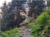 2
2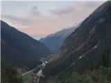 3
3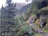 4
4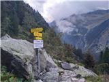 5
5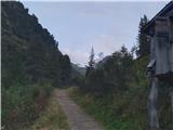 6
6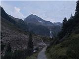 7
7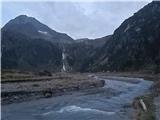 8
8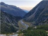 9
9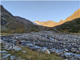 10
10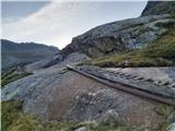 11
11 12
12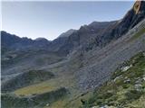 13
13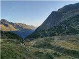 14
14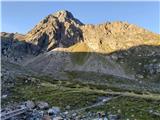 15
15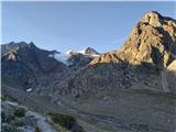 16
16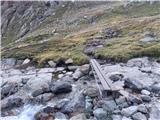 17
17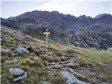 18
18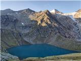 19
19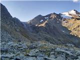 20
20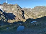 21
21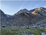 22
22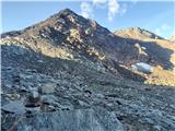 23
23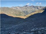 24
24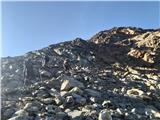 25
25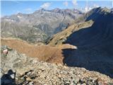 26
26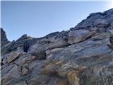 27
27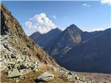 28
28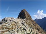 29
29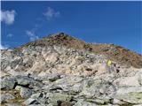 30
30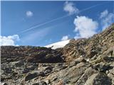 31
31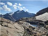 32
32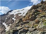 33
33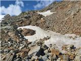 34
34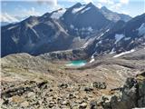 35
35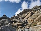 36
36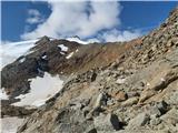 37
37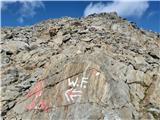 38
38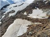 39
39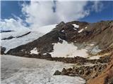 40
40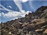 41
41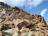 42
42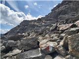 43
43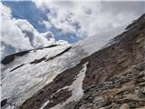 44
44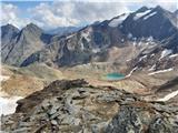 45
45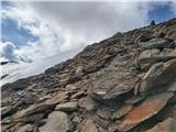 46
46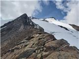 47
47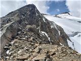 48
48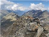 49
49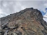 50
50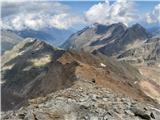 51
51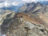 52
52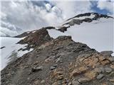 53
53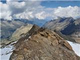 54
54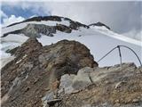 55
55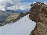 56
56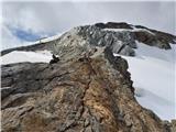 57
57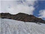 58
58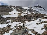 59
59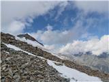 60
60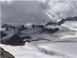 61
61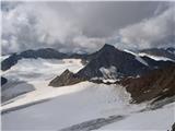 62
62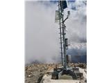 63
63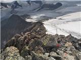 64
64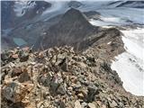 65
65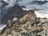 66
66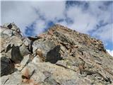 67
67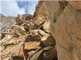 68
68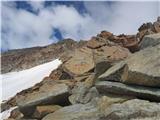 69
69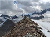 70
70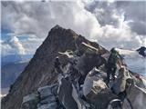 71
71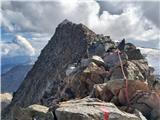 72
72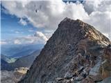 73
73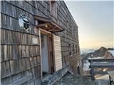 74
74
Discussion about the trail Parking Sulzenauhütte - Becherhaus (via Sulzenauhütte and Seescharte)