NC Planica - Kotovo sedlo (on scree)
Starting point: NC Planica (931 m)
| Lat/Lon: | 46,476°N 13,7241°E |
| |
Name of path: on scree
Time of walking: 3 h 55 min
Difficulty: easy marked way
Altitude difference: 1203 m
Altitude difference po putu: 1220 m
Map: Kranjska Gora 1:30.000
Recommended equipment (summer): helmet
Recommended equipment (winter): helmet, ice axe, crampons
Views: 14.506
 | 1 person likes this post |
Access to the starting point:
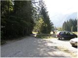
First drive to Kranjska Gora, then continue to Rateče. At the junction where the road to Rateče turns right and the road to Itali continues straight ahead, turn left towards Planica. After a short climb, you will reach the ski jumps in Planica, where there are a few large car parks.
As the road to Dom v Tamarju is now closed to public traffic, we have to park already in Planica, which extends the journey by about 45 minutes.
Path description:
First, walk to Dom v Tamarju, and from there continue along the marked mountain trail in the direction of Jalovec and Ponec (Slemen's Spit on the left). The way forward leads us through the forest, which quickly leads us to the next crossroads, where the path to Ponce branches off to the right. Continue in the direction of Jalovec and continue the ascent along the path, which climbs gently through the forest for a short time. When you come out of the forest, you first climb for a while on extensive partly overgrown gravel, and then gradually arrive at a scree slope that continues towards Jalovec's frost heap. Follow the scree to a marked crossroads, where you continue left (right Kotovo sedlo and Jalovec past the bivouac under Kotovo sedlo) towards the Jalovška notch. The trail continues to climb the scree and then leads to the next crossroads, where it continues to the right in the direction of Kotovo sedlo (slightly left Jalovec over the Jalovška stubble).
The path continues to climb crosswise to the right and gradually changes to less steep slopes. Higher up, the path is further laid and leads us past several large boulders to a crossroads where a slightly more difficult path joins from the right. Continue left and after a few minutes of further ascent, climb up to Kotovo sedlo.

We can extend the trip to the following destinations: Jalovec
Pictures:
 1
1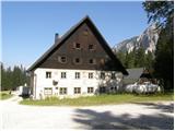 2
2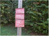 3
3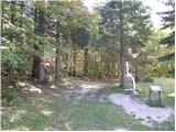 4
4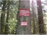 5
5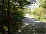 6
6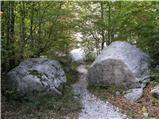 7
7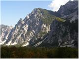 8
8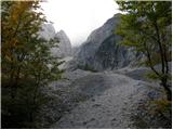 9
9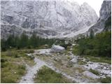 10
10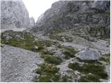 11
11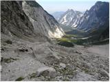 12
12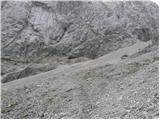 13
13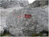 14
14 15
15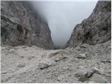 16
16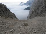 17
17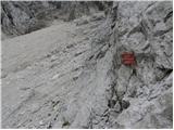 18
18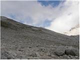 19
19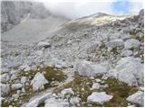 20
20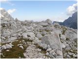 21
21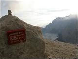 22
22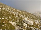 23
23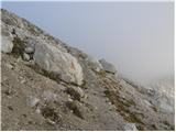 24
24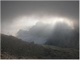 25
25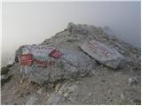 26
26
Discussion about the trail NC Planica - Kotovo sedlo (on scree)
|
| Enka11. 08. 2017 |
Mi lahko kdo pove, je tole melišče bolj sitno kot tisto pod Luknjo nad Vrati?
|
|
|
|
| Lunatixz11. 08. 2017 |
Mislim, da sta si kar podobna. Ga pa lahko večji del preskočiš, če se za pristop odločiš za drugi pristop do Kotovega sedla (v začetnem delu melišča zaviješ desno - glej sliko 14).
|
|
|
|
| Enka11. 08. 2017 |
Mislila sem gor mimo bivaka, dol pa čez melišče. Ampak tisto pod Luknjo se mi je za dol zdelo precej zoprno. Se pravi, da je tole podoben šmorn  ?
|
|
|