Ljubelj - Žleb (Suho ruševje)
Starting point: Ljubelj (1058 m)
| Lat/Lon: | 46,4324°N 14,2602°E |
| |
Time of walking: 2 h 40 min
Difficulty: easy unmarked way
Altitude difference: 858 m
Altitude difference po putu: 920 m
Map: Karavanke - osrednji del 1:50.000
Recommended equipment (summer):
Recommended equipment (winter): ice axe, crampons
Views: 14.609
 | 2 people like this post |
Access to the starting point:
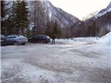
From the Ljubljana - Jesenice motorway, take the Ljubelj exit and follow the road to the border crossing. Just a few metres before the border crossing, the signs for Zelenica direct us to the left and after a few 10 metres of further driving, the road leads to a parking lot under the Zelenica ski centre.
Path description:
From the parking lot, follow the footpath towards Zelenica, Vertatscha and Hochstuhla. The dirt track, which runs along the left-hand side of the ski slope, leads us after about 15 minutes of moderate ascent through the forest to the aforementioned slope along which we then climb. The path, which offers beautiful views of the extensive scree Begunjščica on the left and the ridge Ljubeljščica on the right, then leads us in a gentle ascent to the hut at Vrtača. From the hut, continue straight along the marked path, which slowly turns slightly to the left and, after a short cross-climb, leads us to lane of dwarf pines. The path then climbs steeply for a short time and then leads to cart track (transport-rescue road), which is then followed in a moderate ascent to the mountain home at Zelenica.
From the lodge at Zelenica, continue right towards Hochstuhla and Vertatscha (left Begunjščica) along the path, which turns left immediately after the lodge and climbs by the children's ski lift. Somewhere halfway up the lift you come to a less obvious crossroads, where you continue right and cross over the ski slope (straight ahead to the hut at the source of the Završnice River). Next, cross a short lane of forest and the path leads to the next lift which you cross in a slight downhill. On the other side of the ski slope, you will see a larger rock with a marker on it, which will direct you into the forest. The path then descends gently and after a few minutes of further walking leads us to the outlet of the valley of Suhego dwarf pines, where the unmarked path to Palec branches off to the right upwards.
Continue towards Palec (straight ahead Hochstuhl and Vertatscha) on the path which climbs through the lane of a forest and leads higher up to the scree of Vertatscha and Palec. Here the steepness eases and the path then leads us along the valley of the dwarf pines. Higher up, the path turns slightly to the right and climbs steeply again. After a few minutes of further walking, we reach the border ridge (Žleb 1916m) from where a view of the Austrian side opens up.
Ljubelj - Zelenica 1:20, Zelenica - Žleb 1:20.

Pictures:
 1
1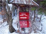 2
2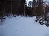 3
3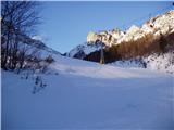 4
4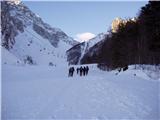 5
5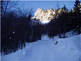 6
6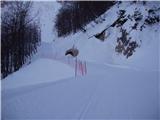 7
7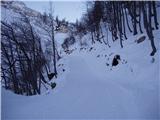 8
8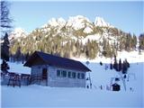 9
9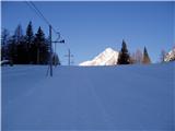 10
10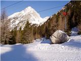 11
11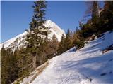 12
12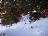 13
13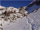 14
14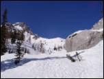 15
15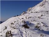 16
16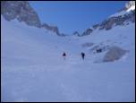 17
17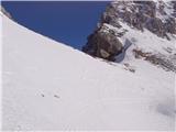 18
18
Discussion about the trail Ljubelj - Žleb (Suho ruševje)
|
| Guest8. 07. 2006 |
Prelep divji svet.Na srečo tudi ne množično obiskan raj.Možici kažejo pot.
|
|
|
|
| heinz26. 06. 2009 |
V obratni smeri je primerneje oz hitreje po melišču, kot skozi ruševje, katero je ravno prav visoko, da ti ves čas zapenja nahrbtnik. Glede lepote se pridružujem gornjemu komentarju.
Odcep za Palec (Žleb) na poti Zelenica- Stol je bolj slabo označen (videl sem samo možica).
|
|
|