Bled (Velika Zaka) - Rečiška planina
Starting point: Bled (Velika Zaka) (480 m)
| Lat/Lon: | 46,3624°N 14,0815°E |
| |
Time of walking: 3 h 45 min
Difficulty: easy marked way
Altitude difference: 785 m
Altitude difference po putu: 900 m
Map: TNP 1:50.000
Recommended equipment (summer):
Recommended equipment (winter): ice axe, crampons
Views: 815
 | 2 people like this post |
Access to the starting point:
Go around the forestry cottage on the right, and then the signs will lead you into the forest, through which you will climb more steeply. A few minutes higher up, we cross a dirt road, and we continue straight ahead, also following the dirt road, and in a few 10 steps we reach the hunting lodge.
Walk around the hunting lodge on the left and continue walking on the worse road. When the road turns slightly to the right, continue straight ahead on the marked cart track, then follow the markings and climb up to the former ski slope XX11XX, where you start descending (if you continue to the right you can climb to the top of the ski slope XX12XX in a minute or two, where you will have a beautiful view that reaches all the way to Triglav). There is a short descent, then cross the forest road and continue along the marked cart track. Cart track soon splits, and we take the upper right path, which continues to climb through the spruce forest. A few minutes higher up, take the marked path cart track to the left, which soon starts to descend to the north-eastern part of Rečiška mountain pasture. Then walk along XX15XX, passing a few huts.
Starting point - Rčitno 2:00, Rčitno - G. k. Mali Vokel 0:50, G. k. Mali Vokel - L. k. Mali Vokel 0:10, L. k. Mali Vokel - XX12XX 0:10, XX12XX - XX18XX 0:35.
Description and figures refer to the situation in 2019 (November).
Path description:
From the starting point, follow the macadam road with signs for Bohinjska Bela, Stan, Rčitno and Pokljuka. At first, walk along the Bled bivouac and the stream, then gradually approach the railway line, and reach the other side via the underpass. After the underpass, go left, and at the nearby marked crossroads, take the right path towards Rčitno (straight ahead Bohinjska Bela. A few steps further, cross a small stream over a bridge, and go right after the bridge, following the signs. Walk through the woods, and we climb cart track, which gives us a view of the torrent over which a larger waterfall falls in the rainy season. Here the path turns slightly more to the left and climbs mostly transversely. Higher up, we once again cross a torrential stream, where the high water level makes crossing quite difficult, but the path turns right just a little further on and leads us to a short lookout, which opens up a beautiful view from Lake Bled to the Kamniško Savinjske Alps. Then crossing to the right, where the markings are lost for a while, when cart track starts to climb, we see them again. When you reach a dirt road a little higher up, follow it to the left (right Bled on the road) and climb moderately. Higher up, pass the trough below Križi, and just ahead, the path joins Bohinjska Bela on the left.
Continue straight on in the direction of "Rčitno" and continue climbing on the dirt road. The road then passes into a valley below the Roof of the Roof, and when we leave the valley we pass onto the slopes of Gač, from where we get a temporary view of the surrounding hills. The way forward is to return to the forest, and when we leave the forest we reach Rčitno, where there are a few huts.
In the middle of the lower part of mountain pasture, continue left in the direction of Bohinjska Bela and follow the road, which soon turns into cart track, ascending in a moderate ascent to the upper southern edge of mountain pasture, where you continue to the right (straight ahead) past the huts and into the woods (straight ahead Bohinjska Bela). In the forest you will quickly see the signs for Pokljuka, and we climb crosswise to the forest road, which we follow to the right (we can reach Galetovec on the left). The road descends slightly, and then signs and markings direct us left onto a path that ascends crossways over a slightly steeper slope. Higher up, we reach cart track, and we follow it up a small valley, where we quickly reach a crossroads by a small hut. After the hut, continue to the right and the marked path leads to Forestry cottage Mali Vokel, situated at an altitude of 1145 m.
Go around the forestry cottage on the right, and then the signs will lead you into the forest, through which you will climb more steeply. A few minutes higher up, we cross a dirt road, and we continue straight ahead, also following the dirt road, and in a few 10 steps we reach the hunting lodge.
Walk around the hunting lodge on the left and continue walking on the worse road. When the road turns slightly to the right, continue straight ahead on the marked cart track, then follow the markings and climb up to the former ski slope Zatrnik, where you start descending (if you continue to the right you can climb to the top of the ski slope Berjanca in a minute or two, where you will have a beautiful view that reaches all the way to Triglav). There is a short descent, then cross the forest road and continue along the marked cart track. Cart track soon splits, and we take the upper right path, which continues to climb through the spruce forest. A few minutes higher up, take the marked path cart track to the left, which soon starts to descend to the north-eastern part of Rečiška mountain pasture. Then walk along Rečiška planina, passing a few huts.
Starting point - Rčitno 2:00, Rčitno - G. k. Mali Vokel 0:50, G. k. Mali Vokel - L. k. Mali Vokel 0:10, L. k. Mali Vokel - Berjanca 0:10, Berjanca - Rečiška planina 0:35.
Description and figures refer to the situation in 2019 (November).

Pictures:
 1
1 2
2 3
3 4
4 5
5 6
6 7
7 8
8 9
9 10
10 11
11 12
12 13
13 14
14 15
15 16
16 17
17 18
18 19
19 20
20 21
21 22
22 23
23 24
24 25
25 26
26 27
27 28
28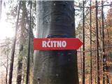 29
29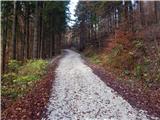 30
30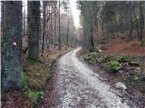 31
31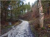 32
32 33
33 34
34 35
35 36
36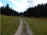 37
37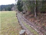 38
38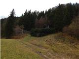 39
39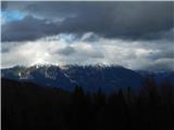 40
40 41
41 42
42 43
43 44
44 45
45 46
46 47
47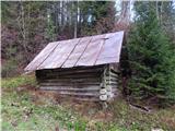 48
48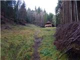 49
49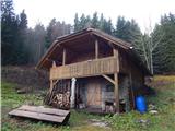 50
50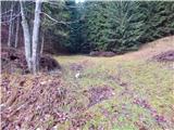 51
51 52
52 53
53 54
54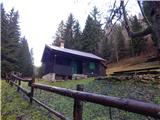 55
55 56
56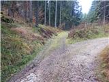 57
57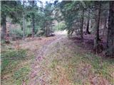 58
58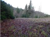 59
59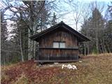 60
60 61
61 62
62 63
63 64
64 65
65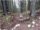 66
66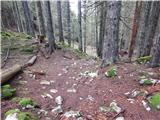 67
67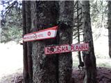 68
68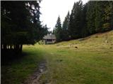 69
69 70
70 71
71 72
72
Discussion about the trail Bled (Velika Zaka) - Rečiška planina