Selo - Pasja ravan (via Ostrež)
Starting point: Selo (710 m)
| Lat/Lon: | 46,1017°N 14,296°E |
| |
Name of path: via Ostrež
Time of walking: 2 h 15 min
Difficulty: easy marked way
Altitude difference: 310 m
Altitude difference po putu: 475 m
Map: Škofjeloško in Cerkljansko hribovje 1:50.000
Recommended equipment (summer):
Recommended equipment (winter):
Views: 16.418
 | 1 person likes this post |
Access to the starting point:
From Horjul or Dobrova, drive to Polhov Gradec, then continue to Črnji vrh. A little above Polhovi Gradec, at the junction at the confluence of the Mala and Velika Bozna, continue straight on towards Sela and Škofja Loka (on the left, Črni Vrh). Continue along the Mala Božna stream, then after a while continue to the right towards the village of Selo (the second turn-off to the right of the town, after leaving the road leading to Črni Vrh). Continue along a fairly steep road, which climbs higher, and then after a short descent leads to Selo. Here, continue to the right (straight on to Sv. Ožbolt) and follow the road for just over 100 m to the parking area next to the chapel.
The starting point can also be reached from Škofja Loka. In this case, take the Puštal at Škofja Loka and then continue towards Sel.
Path description:
From the parking lot at the chapel, take the ascending road in the direction of Sela and Črnega Vrho (if you came to the starting point from Polhov Gradec, this is the road you took to get to the starting point). After a short climb, the road leads us to the first houses, then the road is laid and after a few minutes of further walking it leads us to the open-dor farm Ogrinc, in front of which we see a registration box. We continue a few steps further and the road leads us to a small crossroads where we continue to the left (right Sveti Ožbolt), and we follow the said road only a few steps, as the signs for Črni Vrh direct us to the right to the ascending cart track.
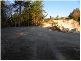
The ascent continues along the well-marked cart track, which initially leads us over a grassy slope with a view, and then continues partly through the wods and partly across grassy hay meadows. After a while the path descends slightly and leads to a marked crossroads where the path from Sveti Ožbolt joins us from the right. Continue left in the direction of Černý Vrch and follow cart track, which gradually starts to descend more steeply. Lower down, the path splits into two parts and we continue along the road, soon turning right onto cart track or a worse road. Cart track is then soon laid and after a few minutes of further walking leads us to a marked crossroads, where we continue in the direction of Črni Vrh - past Ostreža (it is also possible to continue over the top of Mlaka, the latter is approx. 15 minutes longer). The way forward takes us through the forest for some time, and then leads us out of the forest, where on the right hand side we pass by an abandoned homestead.
The road then returns to the forest, where it gradually begins to climb gently. Higher up, we emerge from the forest onto a grassy ridge (here the path over the top of Mlaka joins us from the right), where we also step onto the tarmac. Next, pass a few houses, and then the road starts to descend steeply towards a small pass. During the descent, the path to Črnji Vrh branches off to the left, and we continue straight ahead and follow the road to the aforementioned pass.
At the pass near the Košir agritourism farm, continue straight ahead at first, then at a small crossroads slightly left in the direction of the Pasje Level. Continue along the ascending road, which soon turns into a forest, and we follow it for only a few minutes, as we then see the signs for Pasja ravan along the road, which direct us to the right on a marked footpath. Follow this path, which climbs moderately to steeply through the forest, all the way to the spacious summit.

We can extend the trip to the following destinations: Sivka
Pictures:
 1
1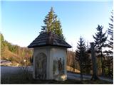 2
2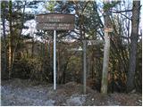 3
3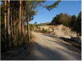 4
4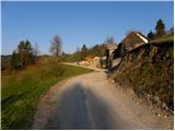 5
5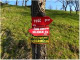 6
6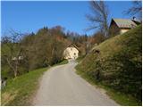 7
7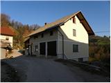 8
8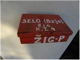 9
9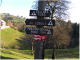 10
10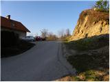 11
11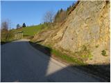 12
12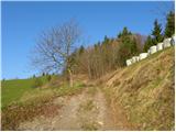 13
13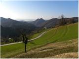 14
14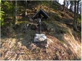 15
15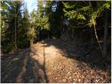 16
16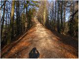 17
17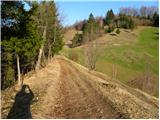 18
18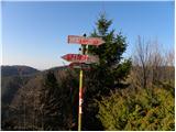 19
19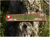 20
20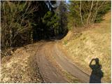 21
21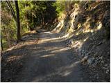 22
22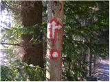 23
23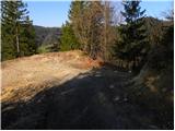 24
24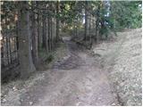 25
25 26
26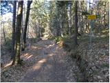 27
27 28
28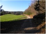 29
29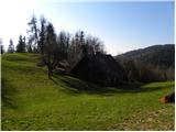 30
30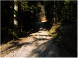 31
31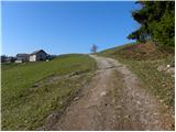 32
32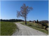 33
33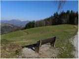 34
34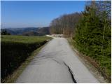 35
35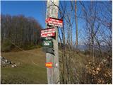 36
36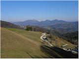 37
37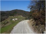 38
38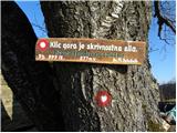 39
39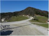 40
40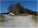 41
41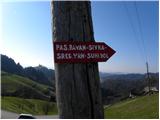 42
42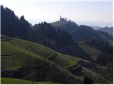 43
43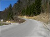 44
44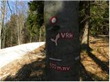 45
45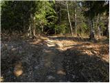 46
46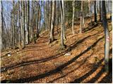 47
47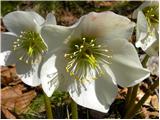 48
48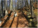 49
49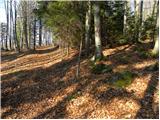 50
50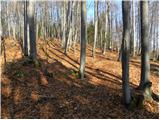 51
51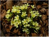 52
52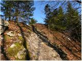 53
53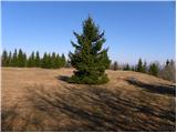 54
54 55
55
Discussion about the trail Selo - Pasja ravan (via Ostrež)
|
| viharnik11. 04. 2010 |
Lepa tura tudi z gorskim kolesom.Baje je Pasja ravan po karti PZS kar 10m višja 1029m,od Tošča 1019m in ne obratno.
|
|
|
|
| ločanka16. 11. 2020 |
Nekaj popravkov po vseh teh letih. Odcep desno na sliki 23 je bolje, da ignorirate. Po dveh markacijah praktično neprehodno oz. vse zaraščeno. Smerne table na sliki 26, kjer je križišče poti, je potrebno poiskati nižje na enem štoru, kjer se usmerimo proti vrhu Mlake. Drugače pa zelo zanimiva pot. Lepša kot sem si predstavljala  . Predlagam gor po zgornji poti preko vrha Mlake (Prosenov grič), nazaj pa po opisani poti.
|
|
|
|
| Ljubljana17. 04. 2021 11:34:32 |
Hvala "ločanki" za objavljen komentar.
Lp,
|
|
|