Izola (Jagodje) - Strunjanski križ
Starting point: Izola (Jagodje) (90 m)
| Lat/Lon: | 45,5299°N 13,6361°E |
| |
Time of walking: 45 min
Difficulty: easy marked way
Altitude difference: -37 m
Altitude difference po putu: 15 m
Map: Primorje in Kras 1:50.000
Recommended equipment (summer):
Recommended equipment (winter):
Views: 11.020
 | 3 people like this post |
Access to the starting point:
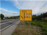
From the coastal expressway, head towards Izola, and when the expressway ends, follow the regional road towards Portorož. When you reach the crossroads where the road to Izola and Belvedere Camp turns off to the right, you are at the start of the route described above. You can park at the pay parking lot near the bivouac, or much earlier at a roadside rest area.
Path description:
At the crossroads where the described route begins, you will notice a red mountain direction sign with the inscription Strunjan, which directs you via a side road. Cross the road carefully, then continue along the side of the main road towards Portorož for a short distance. Before the Hotel Belvedere, leave the main road and continue along the side road to the hotel, and from there follow the signs that lead you past the Camp Belvedere Izola. After the bivouac, turn slightly right off the asphalt road onto a parallel path, which you can follow with beautiful views of the sea and coastal settlements. A little further on, you reach a nature trail, and the path descends slightly through the lane of a forest. At the crossroads, continue to follow the signs and then reach the edge of the cliff above the Bay of the Moon. A scenic walk follows along the edge of the precipice, where a wooden fence has been erected in several places for safety reasons, and we follow the rather winding and occasionally quite scenic path all the way to the Strunjan Cross.
Description and pictures refer to the situation in 2018 (June).

Pictures:
 1
1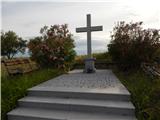 2
2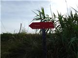 3
3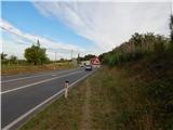 4
4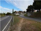 5
5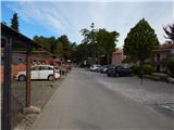 6
6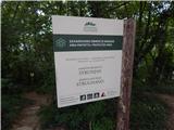 7
7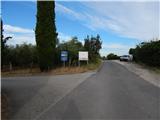 8
8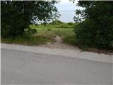 9
9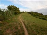 10
10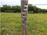 11
11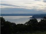 12
12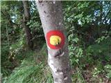 13
13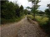 14
14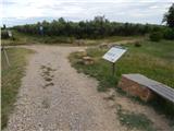 15
15 16
16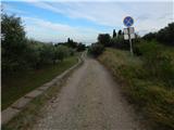 17
17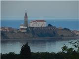 18
18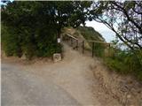 19
19 20
20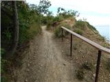 21
21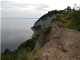 22
22 23
23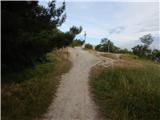 24
24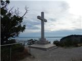 25
25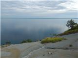 26
26
Discussion about the trail Izola (Jagodje) - Strunjanski križ
|
| Uros2428. 10. 2020 |
Lepa pot  Do Strunjanskega križa se lahko pride tudi po plaži (Bele Skale- plaža Dobrava- Mesečev zaliv) in skupaj z zgoraj opisano potjo, nastane lepa krožna pot. 
|
|
|