Zazid - Golič (via Kojnik)
Starting point: Zazid (390 m)
| Lat/Lon: | 45,4994°N 13,9315°E |
| |
Name of path: via Kojnik
Time of walking: 2 h 30 min
Difficulty: easy marked way
Altitude difference: 500 m
Altitude difference po putu: 650 m
Map: Slovenska Istra - Čičarija, Brkini in Kras 1:50.000
Recommended equipment (summer):
Recommended equipment (winter):
Views: 10.782
 | 1 person likes this post |
Access to the starting point:
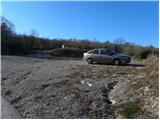
From the motorway Ljubljana - Koper take the exit Črni Kal. From Črni Kal, continue along the old road towards the sea, and we take it only as far as the next slightly larger crossroads, where we turn left towards Border crossing Sočerga. We drive along the road for a short time, and then the signs for Predloka, Loka, Bezovica, Podpeč, Zanigrad, Zazid and Rakitovec direct us to the left onto a slightly narrower local road. Continue to Bezovica, where at a small crossroads in the middle of the village, turn left towards Podpeči. Continue through Podpeč (the road through the village is very narrow) to the village of Zazid, where you park in the parking lot next to the sports ground.
Path description:
From the sports ground, walk to the village, where you will come to an unmarked crossroads with a bench and a water tap. Here, turn right and follow the gently ascending road to the upper part of the village, where you will see the first signs for Golič and Lipnik . Turn right again and continue climbing along the asphalted road leading to the nearby water reservoir. A few 10 m before the water reservoir, you will come to the next unmarked crossroads, where you will continue along the dirt road on the right. The dirt road then leads to a small crossroads, at which the next water trough is located. This time, continue along the wider road on the left, where you will quickly see a sign. Continue along the minor road for a short distance and then a marked shortcut forks off to the right. The path quickly returns to the road and after a few steps splits into two parts again. Wherever you continue, the path will quickly lead you to the railway line and the dilapidated Zazid railway station. Carefully cross the railway line leading to Pula, and we will arrive at a marked crossroads on the other side (it takes about 20 minutes to get here).
Continue left in the direction of the Kraško Edge (right Lipnik) and follow the wide cart track, which climbs crosswise over the railway line. The cart track soon lays down and then starts to descend slightly. After a few minutes of descending, we will see the signs for the Karst Edge, which point us right into the forest. The way ahead climbs through the forest, first moderately and then steeply. Higher up, we climb over the rocky level of the Kraško Edge, from the top of which we get a beautiful view.
Above the steep step is a marked crossroads, and we continue to the right in the direction of Kojnik (left Jampršnik). The way forward continues for some time along the edge of Kraško, then turns left into the forest and after a few minutes of further walking leads us to the forest road, which we follow to the right. The road takes us a little higher to a small crossroads where we continue along the road on the left, which quickly leads us to the Kojnik hunting shelter. A little above the shelter, leave the worse road and continue your ascent to the left into the forest along the marked path. After a short climb, we leave the forest and the path leads us to a grassy slope over which we cross the ascent. Above the viewing slope, the path passes into a pleasant pine groove, through which you climb to the top of Kojnik. From Kojnik continue along the marked path in the direction of Žbevnica, which begins to descend gently. After a few minutes of descent, the path leads us to a stone fence, along which we then continue. The way forward leads us partly along the grassy cart track, and partly along an occasionally less visible and partly overgrown path. The scenic route, which mostly runs through meadows, then climbs gently and leads to the wider cart track. Continue along cart track, passing the summit with the antennae on the left, and then gradually approaching the base of the north-eastern foreland of Goliča. Here, cart track climbs steeply and, after about 15 minutes of further walking, leads to Golič (the apex - the summit with the registration box and the 'cross').
From the summit, descend gently, then in a moderate ascent reach the higher but less distinct summit of Golič.
From the top with the "cross" to Golič is a good 20-minute walk.

Pictures:
 1
1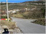 2
2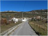 3
3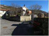 4
4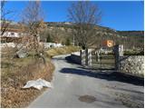 5
5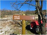 6
6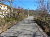 7
7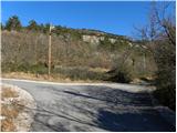 8
8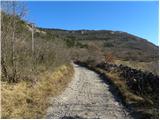 9
9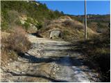 10
10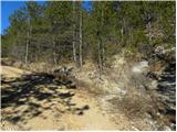 11
11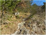 12
12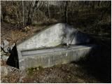 13
13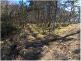 14
14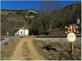 15
15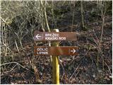 16
16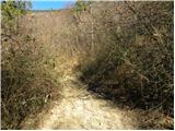 17
17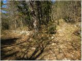 18
18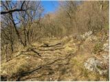 19
19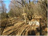 20
20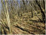 21
21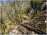 22
22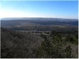 23
23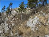 24
24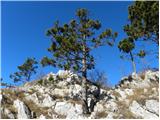 25
25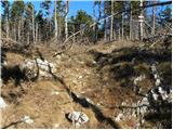 26
26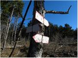 27
27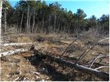 28
28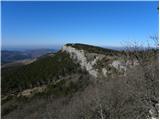 29
29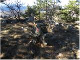 30
30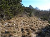 31
31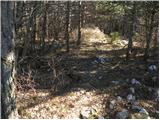 32
32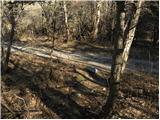 33
33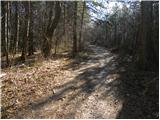 34
34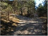 35
35 36
36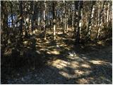 37
37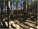 38
38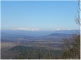 39
39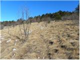 40
40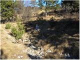 41
41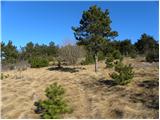 42
42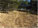 43
43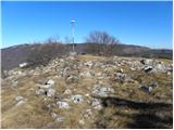 44
44 45
45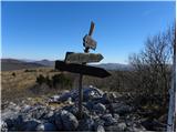 46
46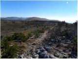 47
47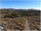 48
48 49
49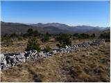 50
50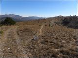 51
51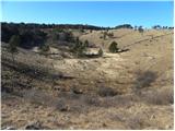 52
52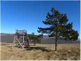 53
53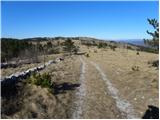 54
54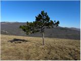 55
55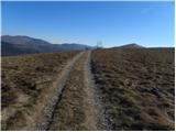 56
56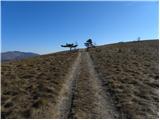 57
57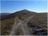 58
58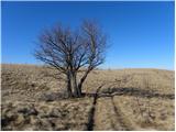 59
59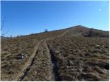 60
60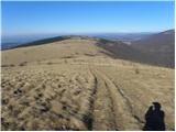 61
61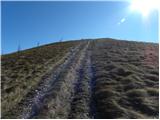 62
62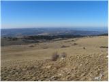 63
63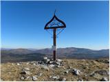 64
64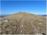 65
65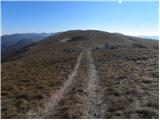 66
66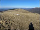 67
67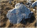 68
68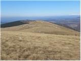 69
69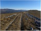 70
70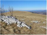 71
71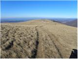 72
72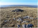 73
73 74
74
Discussion about the trail Zazid - Golič (via Kojnik)
|
| darh26. 12. 2011 |
Po tej poti smo se včeraj vračali z Goliča. Še najbolj težaven je bil spust po pobočju od skrinjice z vpisno knjižico, in sicer zaradi pomrznjenega snega v kolesnicah kolovoza. Preostala pot je bila skoraj v celoti kopna. Nekaj malega pomrznjenega snega je bilo še na travnatem delu poti takoj po spustu s Kojnika. Več podrobnosti.
|
|
|