Zali Log - Blegoš (via Črni Kal)
Starting point: Zali Log (522 m)
| Lat/Lon: | 46,2059°N 14,1109°E |
| |
Name of path: via Črni Kal
Time of walking: 3 h 30 min
Difficulty: partly demanding marked way
Altitude difference: 1040 m
Altitude difference po putu: 1100 m
Map: Škofjeloško in Cerkljansko hribovje 1:50.000
Recommended equipment (summer):
Recommended equipment (winter): ice axe, crampons
Views: 11.979
 | 2 people like this post |
Access to the starting point:
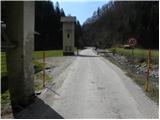
a) First drive to Škofja Loka, then continue to Železniki and on to Zale Log. About 100 m before Zali Log, you will come to a crossroads where the road to Davča branches off to the left. Turn left here, cross the bridge over the Selška Sora River and park in a suitable space next to the transformer.
b) The starting point can also be reached from the route of Tolmin. In this case, first drive to Podbrdo and then continue driving towards Železniki. Turn right at the first junction after Zali Log and then park in a suitable space next to the transformer.
Path description:
On a nearby trestle next to a transformer, we see signs for Blegoš, which direct us to the road we are parked on. The road initially climbs gently along the river Davča and leads us on through the hamlet of Zalega Loga. In the second part of the hamlet we come to a slightly larger crossroads where the road to the right branches off towards Davča, the ski resort Cerkno and Cerkno, and we continue straight across the bridge to the NOB monument. At the monument, a marked cart track (the branch is unmarked) leads to Blegoš (Blegoš across the Potok), and we continue straight along the asphalted road, which climbs moderately further along the Muštrova grapa stream. After a few minutes of further walking, we reach a small crossroads, where signs for a hiking trail and the homesteads of Pr' Muster and Pr' Dobret direct us to the left onto a narrower road, which gradually starts to climb steeper. A little higher up, the asphalted road turns sharp left to the farm Pr' Muster, and we continue slightly right on the macadam road, which climbs steeply in a few serpentines to the farm Pr' Dobret.
From the farm, continue left on the cart track, which climbs over a grassy hayfield. When you reach the edge of the forest, continue to the right and, with views of Ratitovec and the surrounding hills, walk to where the marked path (kolovoz) turns left into the forest. Continue along the short steep cart track, which soon flattens out and then forks several times. (To avoid going astray at the forks, follow the otherwise sparse markings carefully).
From the point where the track lays down, cross the slopes to the left for a while, then climb steeply up the tractor track logging trail, which quickly leads to a small pass. At the precipice, turn right and continue along cart track, which initially climbs a small ridge, splits a few times higher up (follow the markings), and then passes to the left side of a nearby hill (Mrzli vrh). A little further on, the path leads to the Mrznikar farm, from where the ascent continues along the cart track, which starts at the nearby chapel. The path then passes through a forest, through which it continues to the asphalt road at the Čemšišar homestead. From here, go in the direction of Blegoša and Koprivnik and continue along the forest road. After a 10 m walk along the road, we reach a marked crossroads, where a dirt track branches off to the left, leading towards Koprivnik and Romovec, and we continue along the macadam road, which begins to turn more and more to the right. Follow the road to its end, which is next to a large quarry. At the end of the road, you will see a marked path (not marked on the maps), which crosses the relatively steep slopes of Romovec. After a few steps, you will come across the first steel cable, which will help you to cross the steep and slippery slope in the wet. A little beyond the steel cable, the path turns left and climbs steeply for a short time. The steepness eases and the path turns to the right where, after a few further steps, it leads to a second steel cable, which is used to climb up a very steep slope in a traverse. The path then re-lays and leads to an old military bunker, which is located above a small precipice.
The bunker is bypassed on the left, and the path then descends on an exposed ledge (high risk of slipping). Behind the ledge, the path widens, and after a few minutes of further walking, it leads to a large parking lot at Črni Kalo.
From the parking lot, turn onto the road, above which is a sign saying "walk from here on". Just by the sign, the markings for Blegoš direct us right onto a wide footpath which, after a few metres, crosses a forest road leading to a cottage on Blegoš.
Continue on the footpath, which begins to climb steeply through the forest. Higher up, the steep path continues to lead us to the vegetated north-east ridge Blegoš, which we then climb for some time. The way forward leads us past an old military bunker, above which we soon reach a mini lookout point from which we open a beautiful view of the nearby Ratitovec.
At the viewpoint, the steepness eases, and after 5 minutes of further walking, the path leads us out of the forest to an undistinguished saddle between Špik (1538 m) on the left and Blegoš on the right. Here the path turns slightly to the right and after a few further steps leads to a scenic ridge. It is only a short walk past old military tunnels to the top of Blegoš, which is reached after a further 10 steps.

Pictures:
 1
1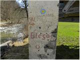 2
2 3
3 4
4 5
5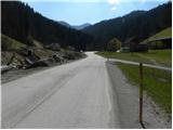 6
6 7
7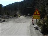 8
8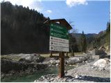 9
9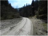 10
10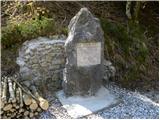 11
11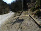 12
12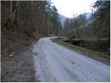 13
13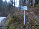 14
14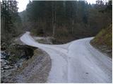 15
15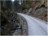 16
16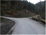 17
17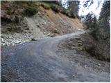 18
18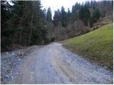 19
19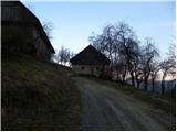 20
20 21
21 22
22 23
23 24
24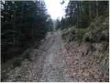 25
25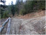 26
26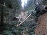 27
27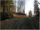 28
28 29
29 30
30 31
31 32
32 33
33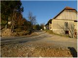 34
34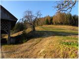 35
35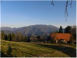 36
36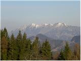 37
37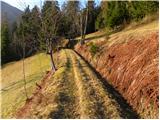 38
38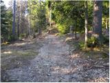 39
39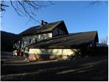 40
40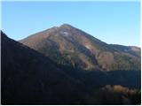 41
41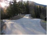 42
42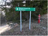 43
43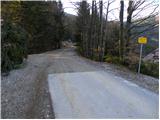 44
44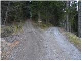 45
45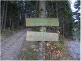 46
46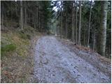 47
47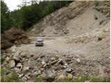 48
48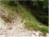 49
49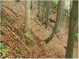 50
50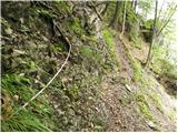 51
51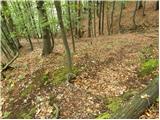 52
52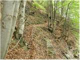 53
53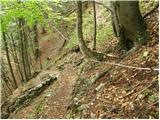 54
54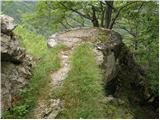 55
55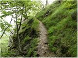 56
56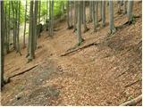 57
57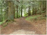 58
58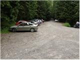 59
59 60
60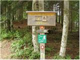 61
61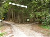 62
62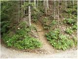 63
63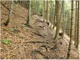 64
64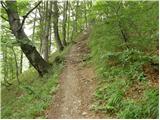 65
65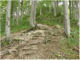 66
66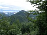 67
67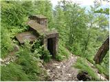 68
68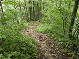 69
69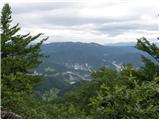 70
70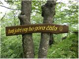 71
71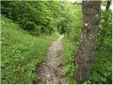 72
72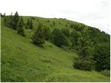 73
73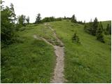 74
74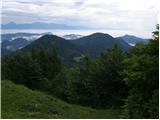 75
75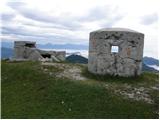 76
76 77
77 78
78 79
79
Discussion about the trail Zali Log - Blegoš (via Črni Kal)