Vršič - Prisank / Prisojnik (Slovenian way)
Starting point: Vršič (1611 m)
| Lat/Lon: | 46,4336°N 13,7435°E |
| |
Name of path: Slovenian way
Time of walking: 3 h 30 min
Difficulty: difficult marked way
Altitude difference: 936 m
Altitude difference po putu: 1000 m
Map: Triglav 1:25.000
Recommended equipment (summer): helmet
Recommended equipment (winter): helmet, ice axe, crampons
Views: 228.450
 | 7 people like this post |
Access to the starting point:
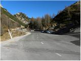
From Kranjska Gora drive towards Bovec or vice versa, but only as far as the Vršič pass, where you park.
Path description:
On the coastal side of the parking lot, you will notice a slightly narrower, initially still asphalted road, which will take you in a few 10 steps to Tičar's house on Vršič.
From Tičar's house, continue along the macadam road, which begins to climb moderately over the slopes. Taking in the view of the surrounding peaks, you will quickly reach a marked crossroads.
Here, continue to the right in the direction of Prisank and Razor (straight along the road Poštarski dom and the top of Vršič) and follow the well-trodden mountain path, which continues for some time along a gently sloping and scenic ridge. After a few minutes the path starts to climb steeply through the rarer lane of dwarf pines, and then lays down and leads us just below the top of the grassy Sovna glava.
From Sovna glava there is a short descent and we are at the next crossroads, where we continue straight ahead or slightly right (to the left the path to Prisank leads through the Front Window). Further on we cross the scree slopes on the west side of Prisank or Prisojnik. The path ahead climbs slightly and leads to a point where the Ridge Path to Prisank branches off to the left and the path leading to Razor, Pogačnikov dom and Prisank (Prisank - South, Slovenian and Jubilee path) continues in a straight direction.
Continue straight ahead, the path becomes less steep and very quickly you are at the crossroads again. This time continue left towards Prisank along the Slovenian Trail (the right path to Kajz notch and then the Jubilee Trail). Continue climbing up the southern slopes of Prisank towards the east. The path then climbs steeply and crosses a ravine here and there or overcomes a rock jump. The path gradually becomes more technically demanding but does not cause any serious problems. The path then starts to turn to the left. The only thing we have to do is to reach the top of a steep hill slope, which we can negotiate without any major problems. Just below the summit, we join the path from the last window, and a little further on, the Ridge Path. The top slope of the mountain is quite steep and sometimes dangerous to slip on.

We can extend the trip to the following destinations: Križ
Pictures:
 1
1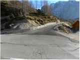 2
2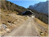 3
3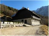 4
4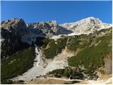 5
5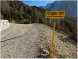 6
6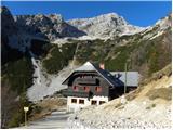 7
7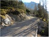 8
8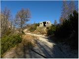 9
9 10
10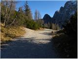 11
11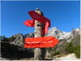 12
12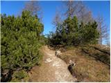 13
13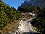 14
14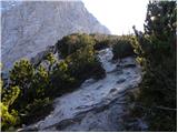 15
15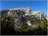 16
16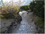 17
17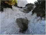 18
18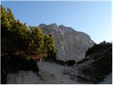 19
19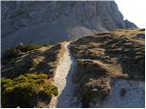 20
20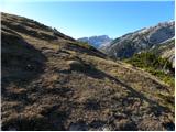 21
21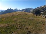 22
22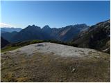 23
23 24
24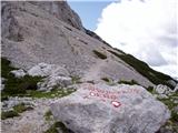 25
25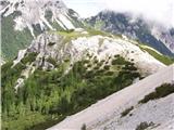 26
26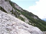 27
27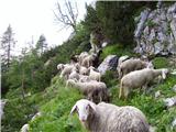 28
28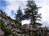 29
29 30
30 31
31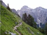 32
32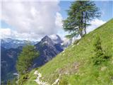 33
33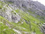 34
34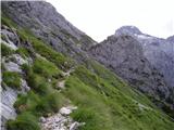 35
35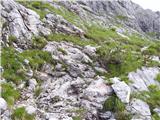 36
36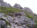 37
37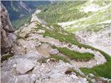 38
38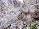 39
39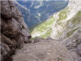 40
40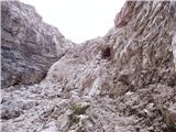 41
41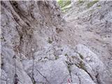 42
42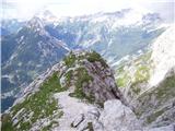 43
43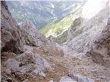 44
44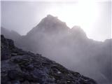 45
45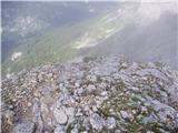 46
46 47
47 48
48 49
49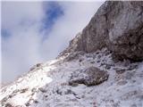 50
50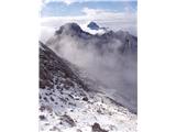 51
51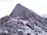 52
52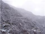 53
53 54
54
Discussion about the trail Vršič - Prisank / Prisojnik (Slovenian way)
Show older messages
|
| Guest13. 05. 2007 |
Kakšne so kaj razmere za na Prisank. Bi šel naslednji teden, pa če ve kdo a je še dost snega gor
|
|
|
|
| Guest13. 05. 2007 |
Ja mene tudi zanima, če je gori še veliko snega?LP
|
|
|
|
| Guest15. 05. 2007 |
Sem bla lih včeri in povem, da je blo enkratno samo pihalo je k pr norcih  glede snega pa ni panike, ga skorajda ni več. Če se pa lotite iti čez okno pa bodite previdni, ga je še kar precej.
Nika
|
|
|
|
| Guest13. 09. 2007 |
lp naslednji teden se odpravljamo na prisank, kdo ve ce je kaj snega gor? hvala
|
|
|
|
| mojcej'724. 07. 2010 |
Danes dne 4.7.2010 sem navsezgodaj zjutraj vrgla ruzak, štrik in palice v avto, šla na Vršič in odtavala v višine proti Prisojniku. Čez Sovno glavo mimo ovc, čez melišča, vseskozi po južnem pobočju Prisanka do dela, kjer se pričnejo zajle in klini, malo naprej prečila cca 130m snežne zaplate, se namučila z vzponi do Zadnjega okna, sestopila nazaj na sedlo in po največjem soncu rinla na Prisojnik. Nazajgrede nekje pri razcepu Grebenska-Slovenska pot se je izza Razorja vreme že poslabšalo in kratka nevihta se je zgodila tik pred mojim sestopom do Tičarjevega doma. Osebno se mi je zdela pot precej naporna, porabila sem 4 ure gor in 3,5 ure dol, saj moje koleno ni preveč stabilno, poleg tega pa sem se še zložila po dolgem in počez ob neki skali, kjer mi je koncentracija že malo padla. V Tičarjevem domu me je presenetila popolna ignoranca, saj se je strežno osebje povsem ukvarjalo s tujci (tistimi, ki pridejo na Vršič z avti/avtobusi in v nemogočih obuvalih od japonk, do petk, nabašejo svoje trebuhe in se nato odpeljejo onesnaževat še Trento), za nas "slovenske" pohodnike pa ni imelo časa. Zadoščenje po hrani sem raje izvedla v Koči na gozdu. Sicer pa JA super dan, ko vsaj ne bi bilo treba jutri v službo.
|
|
|
|
| tonin14. 07. 2010 |
ali gre kdo ta konec tedna na prisank,ali kam drugam pa nima družbe,bi šli skupaj
|
|
|
|
| kamnik14. 07. 2010 |
jest šibam v soboto na prisank
|
|
|
|
| gKavka14. 07. 2010 |
Jaz se tudi odpravljam v soboto po Kopiščarjevi, izgleda da nas bo kar nekaj, štart upam, da čimbolj zgodaj...
|
|
|
|
| NEIC00816. 07. 2010 |
Danes prehodil južno pot. Ne vem zakaj so oznake, da rabiš 4 ure?? Prišel v 2,5 urah, pa ne sodim med ta hitre?? Čudovit razgled.
|
|
|
|
| Sano18. 07. 2010 |
Pozdravljeni! Je mogoče na južni poti še kje kaj snega? Hvala za odgovor.
|
|
|
|
| NEIC00819. 07. 2010 |
Nič.. Manjše snežišče pri vstopu v ''steno'', ki pa ni na poti.
Srečno!
|
|
|
|
| Sano19. 07. 2010 |
Hvala, ampak žal nisem videl pravočasno. Danes sem poskušal iti po slovenski poti, pa sem očitno zgrešil zadnji odcep za slovensko, tako da sem prišel naprej do snega, ki je zapiral pot. Zato sem plezal okoli po skalah, kasneje so bile še jeklenice. Na koncu vzpona sem se obrnil, kjer je bil odcep za zadnje okno in do vrha nisem prišel. Mi lahko kdo pove, katera pot je bila potem ta, po kateri sem šel? Hvala. Po slovenski bom pa poskušal zopet naslednjič.
|
|
|
|
| IgorZlodej19. 07. 2010 |
Na križišču je zelo jasno označeno na skalah. Najprej se desno navzdol odcepi pot Milnarica-Razor, nekaj metrov naprej pa v levo gor Prisojnik in desno naprej Zvoniki oz. proti Zadnjemu oknu. Če si prišel na Škrbino bi samo obrnil v levo in po delu jubiljene dosegel južno pot, ter se po njej povzpel na vrh Prisojnika. Sem pa danes, ko sem okoli 11.00 ure sestopal po južni poti resnično videl kar nekaj ljudi, ki so šli po omenjeni poti pod Zvoniki. Je pa lepo označeno tudi na usmerjevalnih tablah na macesnu na Gladkem robu.
|
|
|
|
| Sano19. 07. 2010 |
Hvala za pojasnilo - očitno nisem bil več tako daleč pa drugič. Sem pa ugotovil, da so ravno na tisti skali, kjer je odcep levo gor za Prisojnik, takrat počivali 3 popotniki, tako da nisem videl odcepa. Tudi oni so potem šli po tej poti naravnost in so mislili, da je to slovenska pot.
|
|
|
|
| Virenque19. 07. 2010 |
@Sano: isto se je zgodilo meni. V megli sem zgrešil odcep levo za južno pot. Potem sem šel po tej poti kot je omenil IgorZlodej, preplezal nek kamin opremljen s klini in skobami navpično pod Prisojnikom in prilezel direktno na južno pot. Šele nato sem ubistvu doumel da sem južno pot zgrešil in sestopil po njej.
|
|
|
|
| Sano22. 07. 2010 |
No, danes sem končno tudi jaz dosegel vrh, tokrat po Slovenski poti Razgled prečudovit!
|
|
|
|
| oiven3. 08. 2010 |
lep dan želim..v četrtek bi se odpravil na prisojnik,če bo vreme kazalo,,kdo kaj ve kakšne so razmere po slovenski poti,po zadnjih padavinah??? hvala.. 
|
|
|
|
| jersy3. 08. 2010 |
razmere so povsem poletne, verjetno pa bo teren precej razmočen zaradi današnjega dežja in jutrišnjih ploh.
|
|
|
|
| Svarun253. 08. 2010 |
Včeraj sem šel po grebenski gor pa po slovenski dol pa ni kakšnih posebnosti. 1m2 snega pod vrhom to je pa to. Če pa bo dež bo pa verjetno precej spolzko tko da previdno.
|
|
|
|
| oiven3. 08. 2010 |
ja nič..hvala za info.bo jutri kaj več jasno najbrž..
|
|
|
|
| kris21. 08. 2010 |
Jutri bi se odpravila po grebenski gor,pa po slovenski dol zanima me ali je pot dobro varovana z jeklenicami,ali je težja kot na Triglav,ker bi vzela s seboj otroka?Hvala..
|
|
|
|
| IgorZlodej21. 08. 2010 |
Težavnost je relativna stvar, če je otrok že bil na Triglavu, potem tudi na tej poti ne bi smel imeti težav, seveda pa je treba računati, da Prisank ni tako zavarovan kot Triglav. Mogoče pa bi pot prej sama opravila, potem pa z otrokom!?
|
|
|
|
| kris22. 08. 2010 |
Bila danes gor brez otroka tko ,da drugo leto bo lahko šel je pa res kar izpostavljena in manj zavarovana kot Triglav
|
|
|
|
| mikkeni2. 06. 2011 |
heeej, a je že kaka varianta, za it na prisojnik, al je še ful snega?!!!
|
|
|
|
| IgorZlodej3. 06. 2011 |
Vsaj dve kopni in dve v zgornjem delu še zasneženi varianti sta na voljo za vzpon na Prisojnik.
|
|
|
|
| JusAvgustin26. 06. 2011 |
veš da ste pametnpo ravnali saj brez ZO ne gre izzivati usode pa tudi če ima flanka 10m.
|
|
|
|
| el rocco13. 08. 2011 |
Danes sem z rahlimi težavami osvojil vrh Prisojnika. Težavami zato ker so me tik pod vrhom pričeli grabiti krči. Nekaj minut sem imel kar probleme ki pa sem jih nato efektivno rešil z snegom ki sem si ga natrl na stegno. No ampak kakorkoli že, hotel sem povedati to da me je presenetilo da si ljudje upajo iti gor brez čelade, oz. celo več, da s sabo vodijo majhne otroke. Ok, saj nočem posploševati..vsak ima svoje mnenje, ampak jaz mislim da majhni otroci na Prisank ne sodijo. Prisank je zahteven in ni za podcenjevanje.
|
|
|
|
| furman13. 08. 2011 |
Jutri grem na Prisank. Oziroma na denasnje razmere, katera pot je bolj varna i lažja: slovenska ali grebenska.
|
|
|
|
| el rocco14. 08. 2011 |
Primoza ne skrbi glede kondicije ). Težave s krči imam že vseskozi... Sicer pa kar se tiče Prisojnika nisem mislil da ga otroci ne bi zmogli fizično osvojiti , ampak ker je dodobra izpostavljen padajočemu kamenju, strm, pa tudi zoprnih prehodov in klinov je kar nekaj. Kljub temu pa kot sem rekel, ima vsak svoj pogled na to kaj je lahko in kaj je težko.
|
|
|
|
| Irina15. 08. 2011 |
Ženska radovednost.Kaj pomenijo te številke?
|
|
|
|
| pikica115. 08. 2011 |
A zdaj bodo morali drugi prestavljat tvojo čačkarijo, ki nima nobene veze z Prisankom. Me prov mal brigajo tvoji višinci, to je čisto tvoja osebna stvar kje hodiš in koliko prehodiš. Že samo to, da nek vrh označiš da je za penzjoniste veliko pove o tebi. Bahač
|
|
|
|
| JusAvgustin15. 08. 2011 |
no, toliko o strpnosti na forumu, ki je postal prava farsa. Živi in pusti tudi DRUGIM živeti. S to mislijo sem zaključil svojo prisotnost na forumu.
Želim Vam veliko lepih in predvsem varnih vzponov.
Juš
|
|
|
|
| IgorZlodej15. 08. 2011 |
Juš pa ja nisi mislil resno, tiste cifre pa tudi meni niso prav nič všeč.
Kar pa se tiče mišičnih krčev, kljub vsej znanosti še najbolj pomaga ustrezna tekočina, ki pa naj ne bo voda, niti alkohol.
|
|
|
|
| IgorZlodej15. 08. 2011 |
Se povsem strinjam z zgornjim zapisom. Na prvem mestu je ustrezna psihofizična kondicija. Žal se ugotovlja, da je večina nima, ne zmorejo niti ene enodnevne ture, pa čeprav so vse naše gore dostopne v enem dnevu in omogočajo tudi vrnitev v dolino. GRS ugotavlja, da jih veliko povsem omaga že pri vzponu in jih je treba dobesedno odpeljati z gore, ker niso sposobni niti koraka več. Celotna telesna aktivnost je tukaj odločilnega pomena in pa seveda postopnost. Kar se tiče tekočin in prehrane je vsak individum zase in si z rednimi pohodi ali treningi oboje izostri do potankosti.
Kar pa se tiče otrok. Nikakor nisem proti, da se jih vodi tudi na bolj zahtevne gore. Odgovorni starši, ki imajo za sabo lastno planinsko ali gorniško pot to zelo dobro obvladajo. Se pa seveda najdejo tudi takšni, ki otroka silijo v nekaj, kar ga sploh ne veseli, ali pa ga na zahtevnih poteh varujejo tako, kot bi sprehajali svojega hišnega ljubljenčka po Tivoliju.
|
|
|
|
| gosser15. 08. 2011 |
Se na slovenski poti tudi odpre pogled na ajdovsko deklico?
Torej za to pot res ni potrebe po samovarovalnem kompletu?
|
|
|
|
| Bojan_A15. 08. 2011 |
Ne, ni potrebe. Pogled na Ajdovsko deklico se odpre le z razgledišča pri Poštarskem domu, na sami poti pa ne.
|
|
|
|
| ruševec26. 08. 2011 |
Boljše kot je Mihelič zapisal v vodniku Julijske Alpe nebi mogel. Napisal je, da je južna-slovenska pot najlažja pot na Prisank, a najbolj dolgočasna. Grebenska pa težja a lepša in zanimivejša. Na slovenski poti je malo varoval, tako da se nimaš kam vpet in varovat. Tudi to ni potrebno. Potrebna pa je pazljivost pri sestopu, saj v zgornjem delu grušča ne manjka.
|
|
|
|
| main24. 09. 2011 |
Danes je spet kar nekaj pohodnikov spregledalo odcep za slovensko oz. južno pot. Zato prosim dotično PD, da odcep označi v višini oči ali nižje. Trenutno je markacija 2,5m nad potjo, kjer je noben ne vidi.
|
|
|
|
| IgorZlodej24. 09. 2011 |
Na turo se je potrebno ustrezno pripraviti, to pomeni se seznaniti z opisom poti, težavnostjo, orientacijo, si nabaviti in se naučiti gledati planinsko karto, ter znati poiskati odcepe poti in njeno nadaljevanje .
|
|
|
|
| Kozorog24. 09. 2011 |
Se poipolnoma strinjam z Igorjem!!! Jaz sem šel gor in dol v megli pa mnisem nič zgrešil!!!! Poznam pa kar nekaj tekih ki bi komot doma zgrešili stranišče... pa brez zamere!
|
|
|
|
| main25. 09. 2011 |
Kaj se ven vlečete, potem vsi hodijo v hribe nepripravljeni. Slovenska pot je v vršnem delu popolnoma neoznačena. Sramota za PD pošta in telekom Ljubljana.
|
|
|
|
| gti27. 09. 2011 |
Odcep je slabše označen in ga je (kljub pripravi)možno spregledati. To dokazujejo številni obiskovalci, ki gredo do konca in pridejo do Jubilejne poti. Glede mnogokrat preveč označenih poti, bi na tem spornem odcepu lahko dodali kakšno bolj vidno oznako, kot npr. na Gladkem robu?!
|
|
|
|
| Meto1. 10. 2011 |
Ne vem o kaksnih slabih oznakah vi govorite, ampak meni se je zdela pot vec ko spodobno oznacena (sploh v zgornjem delu je prakticno nemogoce zgresiti karkoli ker so vse serpentine oznacene), pa sem prisank obiskal prvic. Pa sem (no, sva ) bila precej furjasta glede markacij, tako da nama je uspelo celo zgresiti zajle, cemur je sledilo nekaj metrov prostega plezanja... kar pa se kamenja tice, je celada vec ko priporocljiva in predvsem pazljivost pri sestopu.
|
|
|
|
| dedo2429. 11. 2011 |
Južna pot na Prisank je v glavnem kopna razen grabna, kjer pa ni bilo večjih težav zaradi snega. Slike si lahko ogledate na tej povezavi./www.pdmaticams-drustvo.si/
|
|
|
|
| urbancek30. 11. 2011 |
Moje mnenje je, da so te lažje poti za tistega, ki se prvič povzpne na Prisojnik slabo označene na začetku in na vrhu, sploh ko se spusti z vrha nekdo, ki nima pojma o tem kjer poteka Grebenska oz. Slovenska, le kako za vraga bo zadel eno ali drugo? Ali bo šel mogoče nevede kar proti zadnjemu oknu? Na vrhu in na dnu jasno in z jasnimi smerokazi označiti te poti! To je moje osebno opažanje na tej gori.
Lp!
|
|
|
|
| urbancek30. 11. 2011 |
@main: tako je in na to sem z zgornjim postom želel opozoriti... Šlamparija, ki se za tako obiskano in poljudno goro ne bi smela zgoditi! 
|
|
|
|
| mukica1. 12. 2011 |
se strinjam z urbanckom,zelo slabo označeno.Jaz sem že ena izmed tistih,ki je letos falila,pa nisem šla prvič gor,družba in klepet,nepazljivost in smo šli naprej.Ker imam kar nekaj izkušenj se je lepo izšlo,za mnoge je neprijetno,sitno...sestea je počakala ker ni upala naprej....
|
|
|
|
| ljubitelj gora1. 12. 2011 |
Jaz sem takrat zgrešil že pri odcepu proti Razorju, moral bi rahlo zaviti gor, sem pa nadaljeval naravnost, ampak to je bilo na začetku, ko sem začel hodit v hribe, sedaj se orientacijsko dobro znajdem.
|
|
|
|
| urbancek1. 12. 2011 |
To nima zveze s tem, da se orientacijsko dobro znajdeš.. Gre se za označbo poti, po kateri hodijo nekateri lahko tudi samo enkrat v življenju in pa razni tujci in drugi od daleč, tisti ki se vzpenjajo prvič itn..
Ne glede na osebne gorniške izkušnje, naj bodo nekatere poti zgledno označene, če smo se že tako odločili... Da ne omenjam tistih, katere so bolj oblegane, med katere Prisojnik nedvomno sodi, sploh omenjene poti po južni strani...
Lp!
|
|
|
|
| urbancek1. 12. 2011 |
@primoza: Mislim da ti nisi ravno ciljna populacija te debate... Gre se predvsem za ljudi, ki nimajo pojma o poteh na Prisojniku... in za te je bilo ob mojem zadnjem obisku označeno slabo, potem pa kakorkoli obrnete...
|
|
|
|
| jax3. 12. 2011 |
Kar se tiče Prisojnika in označenosti poti nanj, bi jaz rekel takole: jaz sem bil letos gor in po mislim, da ni tako grozno. Seveda pa bi vedno lahko bilo še boljše. Na primer: ko se z Vršiča odcepi pot dol proti Kopiščarju, na odcepu piše samo Prednje okno. Zdaj, katera je ta pot, Kopiščarjeva ali grebenska? Enako gor tik pod vrhom, kjer se združita grebenska in južna. Na odcepu za južno pot piše samo Vršič. Katera pot za Vršič je to - bogsigavedi. Saj, malo filinga in zemljevid razrešita vse dvome in v splošnem seveda orientacija ni problematična. Idealno pa seveda ni. Kar pa se tiče označenosti južne poti same, pa - jaz res nisem opazil nobenih težav (sem jo sicer prehodil samo v sestopu).
Kar pa se tiče Jalovca do Jezerc - jaz sem nekaj let nazaj šel s Špičke proti Jalovcu v res gosti megli. Ko mi ni bilo več nič jasno, mi je ostalo samo še, da se ravnam po klasičnem načelu za markirano pot po megli - če od markacije ne bom videl naslednje, bom obrnil. In prišel sem do vrha ... Tako da, po mojih izkušnjah ni tako slabo.
|
|
|
|
| JusAvgustin3. 12. 2011 |
če je zemljevid vedno v nahrbtniku in ga znamo uporabljati oznak sploh ne potrebuješ
je pa zemljevid sestavni del opreme! Problem je v tem, ker bi radi imeli vse pomarkirano...
|
|
|
|
| urbancek3. 12. 2011 |
Ja jax, se strinjam, nisem pa edini, ki je na to opozoril, na to pa ste nekateri tudi pozabili... @Jus: Seveda, da ni treba vsega markirati, ampak če smo se že odločili poti markirati, naj bo to zgledno, še posebno v primeru tako obiskanih gora, kamor se ob lepih poletnih dneh res zgrinjajo mase ljudi. Kar se tiče priprave na turo drži vse kar ste napisali... Zemljevid, splet, opis poti, preverba opreme in še kaj... Vse to je čisto pravilno. Pozabili pa ste se edino vprašati, koliko ljudi to res naredi? Pomojem je ta delež za to goro v lepih poletnih mesecih relativno majhen (razni čehi v supergah, pa družine, ki niso najbolj gorniško pismene -> zdi se mi, da je takih bolj priložnostnih obiskov vrha takrat kar veliko) In prav na to ciljno skupino so letele moje opazke... Lp!
|
|
|
|
| joža x3. 12. 2011 |
Kažipoti,opozorila,tlakovana pot...-to imamo že v dolini.Ne čimj manj tega v hribih,če bomo v hribih upoštevali pravilo postopnosti,problemov ko jih ima urbancek ne bo imel nihče.Z brezveznimi turisti,ki ne vedo,kaj bi svojim časom in denerjem,pa gredo pač v hribe,se pa markacisti ja ne bodo ukvarjali.
|
|
|
|
| urbancek3. 12. 2011 |
joža x: če bi dobro bral bi videl, da jaz nimam s tem nobenih problemov, le svoja opažanja sem napisal za druge...
Sicer pa sem za to, da to debato zaključimo, namen je bil dosežen, to pa je izmenjava mnenj o tej poti...
|
|
|
|
| Becar7. 07. 2012 |
15 let nazaj smo trije imeli namen it po južni poti, nekje na južni strani Prisojnika zgrešili zavoj v levo. Nadaljevali smo proti Razorju vendar smo potem našli še eno pot levo navzgor do grebena Prisojnika, se spustili preko na severno stran in prečili nekoliko pod grebenom do vrha. Pot od grebena dalje se mi je takrat zdela kar precej izpostavljena, drobljiva in nič kaj zavarovana, še danes pa ne vem katera pot je to bila  Ali bi kdo tukaj vedel? Nismo pa šli skozi ali mimo nobenega od oken. Hvala. Lp
|
|
|
|
| Becar7. 07. 2012 |
...še to. Med prečenjem pod grebenom se spomnim spominske table nekemu kranjskogorskemu duhovniku če se ne motim.
|
|
|
|
| dprapr7. 07. 2012 |
Predvidevam, da ste pred Zadnjim Prisojnikom prišli na Jubilejno pot, ki vodi desno naprej do zadnjega okna. Vi pa ste šli levo proti Prisojniku! Ta pot je res manj varovana (takšna je vsaj bila, ko sem bil nazadnje tam), vodi pa po zanimivih policah nad prepadi.
Lp
|
|
|
|
| Becar7. 07. 2012 |
Ali je ta delček potem tudi del jubilejne poti, ali katere izmed opisanih poti na hribi.net ali čisto nekaj tretjega?
|
|
|
|
| Becar8. 07. 2012 |
Hvala lepa za odgovor. Lp
|
|
|
|
| el rocco11. 07. 2012 |
Točno tako kot je napisal dprapr. V soboto 7.7.2012, sva šla z ženo gor po slovenski ker me ja lanska izkušnja naučila da zna biti na koncu Jubilejne še snegec. Kolikor sem lahko v soboto videl z razgledne točke pod vrhom je razen majhne zaplate nekje na sredini pot kopna, čeprav nisem videl nikogar ki bi šel po njej. Moram pohvaliti tudi PD ki so na skalo narisali veliko belo puščico ki označuje odcep na Slovensko pot, tako da sedaj pa res ne moreš zgrešiti. Sicer pa razen pihljanja na vrhu odlično.
|
|
|
|
| zvone128. 07. 2012 |
Bi šel kdo 29.7. z Vršiča po Slovenski poti na Prisank? Sem iz LJ.
|
|
|
|
| zvone129. 07. 2012 |
po severni strani Prisanka gor, po južni dol. prijetna tura
|
|
|
|
| Ajda_Zitnik6. 08. 2012 |
Pot sem prehodila včeraj. Ne zdi se mi slabo označena, vendar pa je vseskozi potrebno zelo pazljivo gledati kam kažejo črte (Knafelčevih markacij je bilo po mojem zaznavanju dokaj malo). Predvsem pa bi še enkrat poudarila, da je potrebna previdnost v vršnem delu zaradi šodra na poti.
|
|
|
|
| nominator17. 08. 2012 |
Lahko bi bila označena kot zelo zahtevna.Ni za vsakogar.Moja ocena 3-4.lp
|
|
|
|
| kramarvp1. 09. 2012 |
načrtujem pot od Vršiča do pogačnikovega doma, pa malo naokrog.Mi kaj predlagate.
|
|
|
|
| Benč1. 09. 2012 |
Jaz sem pred parimi dnevi kolovrativ po teh poteh, ki jih omenjaš. Na opisu je tudi GPS poti. Bližnjica do albuma
|
|
|
|
| jetamp23. 09. 2012 |
@kramarvp, če imaš možnost štartaj iz Zadnjice na Luknjo potem na Bovški Gamsovec in do Pogačnikovega doma. Tam prespiš in naslednji dan greš na Razor in Planjo pol se pa proti Vršiču! Iz Sedla Planja imaš dobre 4 ure hoje. Pa srečno!
|
|
|
|
| sebasu18. 10. 2012 |
V soboto 20.10.2012 nameravam na Prisojnik po Slovenski poti.
Zanima me koliko je snega in če so potrebne dereze.
Hvala za odgovor.
|
|
|
|
| SunBurned20. 10. 2012 |
Jaz nameravam jutri iti isto pot, škoda da se ni nihče oglasil s kakšno informacijo.
Je pa tako, da če pa severna na Malo Mojstrovko nima snega, je pomoje tudi južna na Prisank nima.
|
|
|
|
| natfal22. 10. 2012 |
Ima kdo kakšne najnovejše info glede Prisojnika, saj bi šle 3 jutri gor. Hvala in lp
|
|
|
|
| hrib0vc17. 07. 2013 |
Zanima me, če je južna pot na Prisojnik že kopna, ali je bolje še malo počakati če gremo brez derez.
Hvala za odgovor.
|
|
|
|
| pemi8. 07. 2014 |
mi lahko kdo namigne koliko dejansko je zahtevega dela tukaj, v mislih imam zajle ...kline.. :-)
hvala
|
|
|
|
| Macesna8. 07. 2014 |
Zajl in klinov sicer ni prav dosti, je pa kar zoprna pot, saj je precej podrta (krušljiva) in se je treba zanesti na svoj trden in zanesljiv korak. To velja še posebej na vršnem delu, kjer so poševne plošče, posute z gruščem. Ne smeš biti utrujen! Na vršnem delu je treba tudi dobro izbirati pot (v megli zna biti izreden problem), saj se steza mestoma kar izgubi. Enako (ali še bolj) velja za sestop v vršnem delu.
Pač, ni nek bavbav, seveda so težje poti, ni pa tudi povsem preprosto - ravno zato ne, ker skoraj ni zajl in klinov. Zagotovo ni za vsakogar.
|
|
|
|
| pemi8. 07. 2014 |
Hvala, strinjma ja je lažje če je zajla in se lahko primeš, problem so ravno te izpostavljeni deli :-D hvala
|
|
|
|
| kanin44425. 08. 2014 |
Zanima me koliko se kamnine krušijo
|
|
|
|
| Keko25. 08. 2014 |
Če pogledaš malo prejšnje objave, boš našel odgovor.
|
|
|
|
| BlackDiamond10. 05. 2015 |
Kako je z izpostavljenostjo na tej poti? Je pot primerna za začetnika v svetu jeklenic ter skob?
|
|
|
|
| Branee10. 05. 2015 |
Velik lepsa je grebenska tudi manj "nalozena" s kamenjem. pomoje dalec najmanj zanimiva pot na prisojnik. Izpostavljenosti ni velike je nizji razred teh poti pri nas, primerljiva s potjo cez skar. rob iz storzica.
|
|
|
|
| heinz11. 05. 2015 |
BlackDiamond sprašuješ -Je pot primerna za začetnika v svetu jeklenic ter skob?
Mislim da ni za kakršnega koli začetnika. Za okušanje jeklenic bo bolje izbrati kakšno krajšo in zgolj delno zahtevno turo. Sicer pa kot navajajo predhodniki, teh tu ni veliko, bolje rečeno zgolj za vzorec.
|
|
|
|
| ms_primoz11. 05. 2015 |
Za začetnika je pot povsem primerna. Seveda pa mora imeti vsaj nekaj kondicije. Primer, 20 let sedeti na kavču in nato jiti na Prisojnik - odsvetujem. Glede ˝nevarnosti˝pa je povsem priporočljiva, zakaj pa ne?
Le počasi in previdno.
|
|
|
|
| ms_primoz11. 05. 2015 |
ja, je pa res, da ni skoraj nič klinov in jeklenic.
|
|
|
|
| jax11. 05. 2015 |
Če sem čisto iskren, jaz ne vidim posebnega smisla v vzponu na Prisojnik gor-dol po južni poti. Grebenska je samo za dlako težja (resnično, razlika je mnogo manjša, kot mnogi pišejo) in mnogo bolj slikovita. Južna pa je potem čisto simpatična za sestop. Ta kombinacija pa potem že predstavlja čisto spodobno turo.
Kako je z izpostavljenostjo na tej poti? Ja, grebenska ima kar nekaj izpostavljenih mest. Ampak spet - nič posebej zahtevnega. Pojdi enkrat prej na Gradiško turo in če ti tisto ne bo delalo težav, ti jih tudi ta kombinacija ne bo.
|
|
|
|
| darinka412. 05. 2015 |
Če hočeš bolj andrenalinsko ,priporočam Hanzovo, severna, zelo lepa pravi užitek , tam potrebuješ samovarovalni komplet in čelado. Južna je bolj primerna za sestop. Grebenska ,je lepa , najraje grem po njej .
|
|
|
|
| Branee12. 05. 2015 |
dej nehite zacetnika posiljate na hanzovo... Tam rabis se kej vec k celado pa komplet sploh zdele.
|
|
|
|
| ms_primoz12. 05. 2015 |
darinka4 - še bolj adrenalinska je brez čelade in samovarovanja. ter v japonkah. Sploh danes pa jutri bi bilo fajn. V petek pač ne, ker bo baje dež/sneg
|
|
|
|
| darinka412. 05. 2015 |
Hanzova je primerna v poznem poletju ,ko ni več snega ,takrat smo šli mi po njej ,noč posebnega, ne vem zakaj bi bila težka, meni se je zdela čisto nornmalna ,pa nimam ne vem kakšnih izkušenj.
|
|
|
|
| darinka412. 05. 2015 |
Hanzova je primerna v poznem poletju ,ko ni več snega ,takrat smo šli mi po njej ,noč posebnega, ne vem zakaj bi bila težka, meni se je zdela čisto nornmalna ,pa nimam ne vem kakšnih izkušenj.
|
|
|
|
| ms_primoz12. 05. 2015 |
katera pot pa je za vas ˝težka˝?
|
|
|
|
| tinky12. 05. 2015 |
Kopiščarjeva skozi okno ni prav za "sprehod".
|
|
|
|
| Branee12. 05. 2015 |
Darinka zal je razvidno iz komentarjev da si neizkusena. Zgleda se tist kar hodis te nekdo vodi. Zavajat zacetnika na hanzovo in to zgolj s celado in varovalcem je grozno narobe
|
|
|
|
| jax12. 05. 2015 |
Vprašanje, kaj pojmuješ pod začetnike. Jasno, da gre za zahteven visokogorski vzpon, ki gotovo ni primeren za prvo turo človeka, ki je predtem hodil samo od kavča do hladilnika. Mislim pa, da je čisto v redu izbira za nekoga, ki bi se želel prvič srečat z nekoliko zahtevnejšimi potmi.
Ali pa, recimo, če je nekdo šel na Triglav (tja gor rinejo mnogi neizkušeni, kot vsi vemo), pa mu je bila stvar všeč in bi šel probat še kak visokogorski vzpon podobnega formata, potem je Prisojnik čisto solidna izbira.
|
|
|
|
| ljubitelj gora12. 05. 2015 |
Tud grebenska bi bila lahko samo zahtevna označena pot, saj potem vsak misli, da je Kopiščarjeva/Hanzova isto zahtevna kot grebenska, zaradi ocene.
|
|
|
|
| darinka413. 05. 2015 |
Prvič sem slišala od nekoga ,da sem neizkušena .Sem se prav nasmejala.V gore hodim 40 let. Velikokrat grem sama ,ker mi je všeč ,ali pa koga vzamem s sabo .Prisojnik poznam dobro, saj sem bila dostikrat gor in je meni ljuba gora. 
|
|
|
|
| Branee13. 05. 2015 |
Ti lahko se enkrat napisem, da ne bo vec prvic.. Svetovati zacetniku kateri s strahom sprasuje po informacijah za juzno na prisojnik s tem nej gre s celado in varovalcem na hanzovo pa dosti pove o tej "namisljeni" izkusenosti
|
|
|
|
| simon7913. 05. 2015 |
Tudi o mene podpis, branee
|
|
|
|
| Maticc5. 07. 2015 |
Rad bi opozoril, da je na slovenski poti strgana jeklenica na izpostavljenem, prepadnem delu.
S prijateljem sva ocenila, da bi prečkanje po gladki skali brez pravih oprijemišč, predstavljalo preveliko tveganje. Zato sva se obrnila.
V znanje drugim, ki iščejo varen korak.
Srečno.
|
|
|
|
| peterveter3. 08. 2015 |
Mogoce ve kdo kako je sedaj s to jeklenico? Je pot prehodna?
|
|
|
|
| Guest3. 08. 2015 |
Pot je prehodna.
Na mestih, kjer jeklenice ni, je v pomoč pač štrik-vrv. Na to pot, se ne podajat brez čelade, samovarovalni komplet tudi ni odveč, ako pa se tja podajate prvič, je dobro, če gre nekdo poleg, ki pot in razmere pozna. Poglej malo po forumu....boš našel trenutne razmere, pa še fotke so poleg. Srečno
|
|
|
|
| Vanilla13. 06. 2016 |
Mogoce kdo ve, kako je zdaj z jeklenico in s sneznimi razmerami po juzni poti? Hvala!
|
|
|
|
| sid5. 08. 2016 |
Lepa je pot proti Škrbini in naprej po Jubilejni na Vrh. Pogledi, ki jih iz drugi smeri ne vidiš so neprecenljivi. Kljub odlično označenemu delu(slovenska-2okno), mi ga je ratalo zgrešiti...
Ko sem sestopil po slovenski, se prav nisem mogel načudit, da sem spregledal verjetno 5 popisanih skal na enem mestu...
|
|
|
|
| ribnik6. 08. 2016 |
Kakšne so razmere (odgovor na vprašanje Vanille) za jutrišnji vzpon?
Hvala!
|
|
|
|
| vodenjačica5. 06. 2017 |
Jučer 4.6. 2017. prošli smo na silasku s Prisojnika Slovensko pot i još uvijek ima snijega i leda (i nekoliko metara visine mjestimično. Pri silasku smo morali prečili vrlo strma snežišča(dugačka oko 100-ak m) tri puta. Obzirom se snežišča ne mogu proći obilaznim putem, obavezna je upotreba cepina i dereza i oprez svakako.
Grebenskom poti smo se popeli na Prisojnik i na njoj nema snijega i leda, ali je skliska i mokra mjestimično, treba ići oprezno.
|
|
|
|
| navdušena9. 07. 2017 |
Na Slovenski poti ni snega. Pot je "zmerno zahtevna", bi rekla, potrebna pa je pazljivost...Samovarovalni komplet za slovensko pot? Le zelo, zelo redko, ga lahko uporabiš, mislim, da so na vsej poti 3 jeklenice. 
|
|
|
|
| cajer18. 09. 2018 |
Plan za prvi vzpon na Prisojnik je bil gor in dol po Slovenski poti. Stvar se je 'zapletla' po tem, ko sva na juzni strani zgresila razcep. Nadaljevala sva pot, ki je vodila okrog 'cele' gore, tudi po severni strani (II. okno, Kajzljeva skrbina ce se ne morim). Pot je tam neprimerljivo tezja, kot Slovenska.
Bodite pozorni na razcep na juznem pobocju - ni oznacen s tablo, so pa na tleh narisane puscice, ki nazorno kazejo pravo smer.
Sva pa na poti navzdol (tokrat po Slovenski) srecala skupino nemsko govorecih planincev, ki so ravno tako zgresili ta isti razcep.
|
|
|
|
| Anja0075. 06. 2019 |
Zanima me, kako izpostavljena/zračna je tale pot? Že nekaj časa si namreč želim iti, seveda, v poletnem času, pa nisem najbolj prepričana, predvsem zaradi izpostavljenosti.. Imam malo mehka kolena ob pogledu na prepad Za primerjavo, do zdaj sem bila od zahtevnejših poti na Ojstrici (čez Malo Ojstrico), na Storžiču (Škarjev rob), Mangart (italijanska), pa se kaj bi se našlo. Hvala za nasvet
|
|
|
|
| jax5. 06. 2019 |
Ni izpostavljena. Največji problem je strm šoder, ki terja nekaj previdnosti. Posebne zračnosti ali zahtevnosti pa niti ni.
|
|
|
|
| Anja0076. 06. 2019 |
Super, hvala za info. Komaj čakam
|
|
|
|
| Dario GK13. 08. 2019 |
Bili smo jučer....preljepo
|
|
|
|
| Pušjakec6. 08. 2020 |
Pozdravljeni, Mene zanima, če je bil kdo v kratkem na Prisojniku in kako je? Hvala in lep pozdrav
|
|
|
|
| trdi777. 08. 2020 |
Sem prebral le to da je Kopiščarjeva pot zaprta
|
|
|
|
| glorija8. 08. 2020 |
Pozdravljeni,
Jaz sem bila včeraj po slovenski,Kopiščarjeva in Jubilejna sta zaprti(tako sem zasledila pred kratkim)...
Slovenska zelo lepo označena,vse pohvale PD-ju...Gorniški pozdrav,varen korak vsem..
|
|
|
|
| kajla14. 09. 2020 |
Ker sem s Prisojnika vedno sestopal po grebenu, sem se tokrat odločil za Slovensko pot. Ime zazveni prijetno, kar pa za pot ne velja. Bolj bi ustrezalo Slovenski šoder.
Na tistem razcpu zgoraj sem šel tudi jaz mimo, ko sem svojo zmoto ugotovil in se vračal nazaj, sem srečal dva Avstrijca, ki sta ravno tako zgrešila. Kakšna malo boljša oznaka razcepa bi bila še kako dobrodošla. Ko človek gleda pod noge, sploh ni problem zgrešiti puščic.
Sicer pa sem na poti užival v lepih razgledih in v spodnjem delu v planinskem cvetju.
|
|
|
|
| plani narko13. 06. 2023 09:07:15 |
Pozdravljeni, ima li snega oko 20.-30.6. na Prisojniku?
|
|
|
|
| koblihson6. 05. 2024 16:39:58 |
Je na tej poti potrebna čelada?
|
|
|
|
| nejcf6. 05. 2024 19:09:30 |
Kar vzemi ja, je veliko šodra. Nazadnje ko sem bil na tej poti je nek tip s psom veselo prožil kamenje na vse, ki smo bili pod njim.
|
|
|