Uskovnica (Lom) - Veliki Draški vrh (via planina Spodnji Tosc)
Starting point: Uskovnica (Lom) (1076 m)
| Lat/Lon: | 46,3133°N 13,9054°E |
| |
Name of path: via planina Spodnji Tosc
Time of walking: 4 h 35 min
Difficulty: difficult marked way, partly demanding unmarked way
Altitude difference: 1167 m
Altitude difference po putu: 1370 m
Map: TNP 1:50.000
Recommended equipment (summer): helmet
Recommended equipment (winter): helmet, ice axe, crampons
Views: 1.180
 | 1 person likes this post |
Access to the starting point:
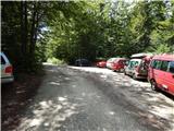
From the motorway Ljubljana - Jesenica take the exit Lesce and follow the road towards Bled and on to Bohinjska Bistrica. Just before Bohinjska Bistrica, at Bitnje, take a sharp right in the direction of Pokljuka. After a short climb, the road flattens out and quickly leads into the Upper Bohinj Valley. Here, at the crossroads, continue left (Pokljuka on the right) and follow the road to Srednja vas. Here, in another part of the village, you will see signs for Uskovnica (7 km), which direct you to the right onto a narrower, initially asphalt road. Follow the road, which climbs most of the time, to the "Lom" parking lot, where there is a sign prohibiting further driving (only landowners are allowed to drive further).
Path description:
From the parking lot, continue in the route Koča na Uskovnici, following the road which leads quickly out of the forest, where you will see signs for cheese, milk and homemade products. A short path branches off the road to the left and leads to the nearby cheese cottage pr Ulčnek, where you can buy the aforementioned products during the grazing season, otherwise continue straight ahead to a marked crossroads a few steps away, where you turn right in the direction of Koča na Uskovnice. The way forward leads us first past the sign (cross) and then on between the pastures. When the pastures end on the right, the marked path from Srednja vas (the "Za Ribnico" path) joins us from the right.
Continue straight on, then pass the cottages to reach a water trough and a few steps further on to a place where the signs for the familiar cottage direct you left to cart track. There is a short climb up the cart track and the path leads to the Cottage on Uskovnica.
From the hut continue in the direction of Tosc, Draškega vrh, Viševnik, Vodnikov dom, Rudni polje and Praprotnice along the path which first crosses the grazing fence and then quickly joins the macadam road, which is followed to the right. The road then leads between bumpy meadows, and after crossing the next fence, you quickly reach a crossroads at the Chapel of Our Lady Queen of Peace at Uskovnica.
After the chapel, continue left (straight mountain pasture Konjščica, right Rudno polje) along a sloping road which leads across the extensive meadows of Uskovnica, and then leads to the edge of the forest, where it begins to turn into an initially wide cart track. The cart track, which then starts to climb moderately, has a few forks, and we follow it in the direction of Vodnikov dom and Triglav. Higher up, the cart track, most of which runs through the forest, turns into a footpath, which quickly leads us to a pleasant small spring. At the well, continue straight ahead (hunting lodge on the right) and continue the ascent along the gently sloping path, which leads us slightly further up the steep slopes. Soon after we have reached the steep slopes, the fixed safety gear are helpful in crossing the steep ravine. The route continues along relatively steep and, especially in wet conditions, slippery slopes. While crossing the steep slopes, the path climbs steeply for a short time and then descends again. In the last part of the crossing, some very steep ravines are crossed, over which the path is damaged in places and where there is a risk of slipping. The crossing ends at a larger torrent where there is usually a small spring, after which you enter a softer world of grasses. A few minutes of easy walking and the path leads to the abandoned mountain pasture Lower Tosc. The way forward begins to climb moderately and soon leads us to a small crossroads where we continue sharp right (straight old, partly abandoned path) along a nice traceable path. Higher up we start to climb steeper and steeper and the path quickly leads us out of a belt of sparse forest between dwarf pines, where it starts to turn more and more to the left. The path soon lays down and leads us from dwarf pines to grassy slopes, over which we climb in a few minutes' further walking to the Pokljuka - Triglav route.
Follow the above-mentioned path to the right, and after a few steps it leads to a place where the path to Tosc branches off to the left. Continue straight ahead along the pleasant cross path, which gradually transitions from the slopes of Tosc to the slopes of Velika Draškega vrh. After a while, the scenic route leads us to the foot of Studorski preval, where it climbs steeply for a short time. After 5 minutes of steeper ascent, we reach Studorski preval, where there is a marked crossroads.
From Studorski preval, continue sharp left (left Srenjski preval, straight ahead Pokljuka, right Ablanca) along the initially gently sloping path, which climbs through the dwarf pines zone. A little further on, the path turns to the left and gradually starts to climb steeper and steeper. After a few minutes of further walking, the path leads under a short but quite steep rock jump, which can be "overcome" with a little help from the hands (mainly for balance). The rock jump is not only a slip hazard, but is also exposed to falling rocks (caution!). Higher up, the path flattens out and turns into a very scenic and technically mostly undemanding ridge. The path, which offers beautiful views of the Lower Bohinj and other Bohinj mountains, starts to climb steeply again just below the summit. The way forward climbs over a short and steep rocky slope, then lays down and leads us to a scenic peak within a few minutes of further walking.
Starting point - Koča na Uskovnici 15 minutes, Koča na Uskovnici - Studorski preval 3:00, Studorski preval - Veliki Draški vrh 1:00.

Pictures:
 1
1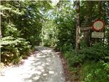 2
2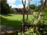 3
3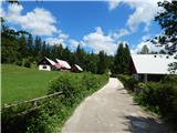 4
4 5
5 6
6 7
7 8
8 9
9 10
10 11
11 12
12 13
13 14
14 15
15 16
16 17
17 18
18 19
19 20
20 21
21 22
22 23
23 24
24 25
25 26
26 27
27 28
28 29
29 30
30 31
31 32
32 33
33 34
34 35
35 36
36 37
37 38
38 39
39 40
40 41
41 42
42 43
43 44
44 45
45 46
46 47
47 48
48 49
49 50
50 51
51 52
52 53
53 54
54 55
55 56
56 57
57 58
58 59
59 60
60 61
61 62
62 63
63 64
64 65
65 66
66 67
67 68
68 69
69 70
70 71
71 72
72 73
73 74
74 75
75 76
76 77
77 78
78 79
79 80
80 81
81 82
82 83
83 84
84 85
85
Discussion about the trail Uskovnica (Lom) - Veliki Draški vrh (via planina Spodnji Tosc)