Tomšičeva cesta (Jesenice) - Jelenkamen (via Šporn)
Starting point: Tomšičeva cesta (Jesenice) (600 m)
Name of path: via Šporn
Time of walking: 1 h 15 min
Difficulty: partly demanding unmarked way
Altitude difference: 496 m
Altitude difference po putu: 496 m
Map: Karavanke - osrednji del 1:50.000
Recommended equipment (summer):
Recommended equipment (winter): ice axe, crampons
Views: 2.993
 | 3 people like this post |
Access to the starting point:
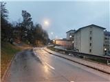
From the Ljubljana - Jesenice motorway, take the Lipce exit and turn right towards Jesenice. In Slovenski Javornik, turn left at the junction with the traffic lights towards the town centre. At the second traffic-controlled junction (by the gymnasium) turn sharp right, back along Tomšičeva cesta, passing the primary school on the left. After less than a kilometre of driving, as the road gently descends, you will come to the vicinity of the former shop on Tomšičeva Street (now a buffet "Čavs bar"). About 20 m before this building, you will see a pedestrian crossing, which you will use on your way to Jelenkamn. Park in a suitable place nearby (or a few 100 m further on, below the incline, near the railway at a large turning point).
Path description:
Cross the road at the pedestrian crossing and continue straight uphill on the steep asphalted road, which leads you past a few houses. As the road levels out and crosses the stream, you will see a path climbing uphill to the north at a right-hand bend by the first house on the left. Leave the road and take this path, which climbs gently towards the woods. Soon you will come across the fenced water reservoir Šporen with the year 1957, and the path (initially logging trail) leads you along the stream bed into the woods, where you cross one of the branches of the stream. At logging trail, our path turns slightly right (the train turns left) and crosses the brook a second time, climbing uphill. Near the source of the stream, the path turns right again and shortly leads to a level crossroads. Here, turn left to the north, following the level terrain, along the edge of the plain, where the left fork is overlooked. As the path begins to climb gently, it keeps slightly to the left at first, but soon turns sharp right and continues to climb in switchbacks. After a while, at the top of the south-eastern rib of the Jelenkamn, the path briefly dips and then continues straight uphill to the north. A little higher up (at the lying trunk) the path turns sharp left, first crossing a slightly steeper slope, and then leading to a small ridge where there is a partially open place offering views of the Julian Mountains and one of the viewpoints on the southern slope of Jelenkamn. Here our path turns right (straight hunting track), quite steeply uphill and after a few switchbacks it completely lays down. Only a few metres later, with a little attention, we will see a left fork, which we take. Now, after a slight descent, a slightly less visible, sloping path between some rocks leads us under the steep south-eastern slope of Jelenkamn, where we also come across some cairn. Then, after a slight and short climb, our path turns a little to the right and soon joins the marked path from Ukova. Here we take a sharp right, steeply following the marked path towards the summit. After a short climb, we are also helped by some 10 m long ropes. Then, when the steepness briefly eases and the views begin to open up, the path climbs steeply one last time towards the top of Jelenkamn, where there is a bench and a box with a register on one of the trees. Here the view opens up towards the Ljubljana basin, Jesenice, Karawanks, Ratitovec and Mežakla, and Julian Alps with Triglav.

Pictures:
 1
1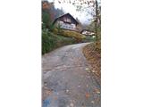 2
2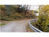 3
3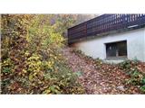 4
4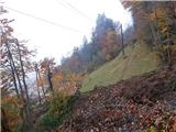 5
5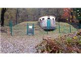 6
6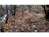 7
7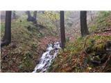 8
8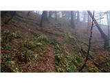 9
9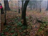 10
10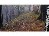 11
11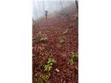 12
12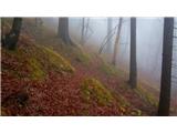 13
13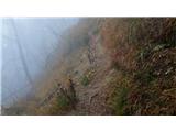 14
14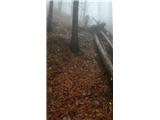 15
15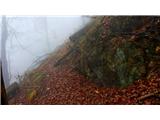 16
16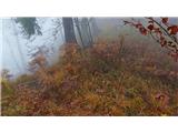 17
17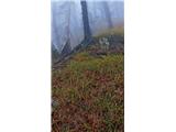 18
18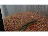 19
19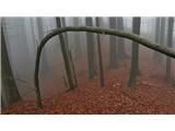 20
20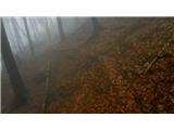 21
21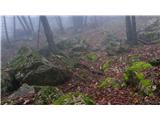 22
22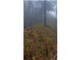 23
23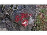 24
24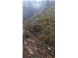 25
25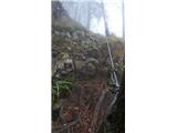 26
26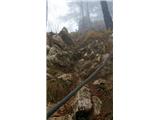 27
27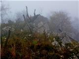 28
28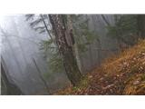 29
29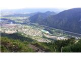 30
30
Discussion about the trail Tomšičeva cesta (Jesenice) - Jelenkamen (via Šporn)
|
| TrmaD19. 04. 2020 |
Danes s Tomšičeve čez Jelenkamen na Pristavo. Vendar po nekoliko drugačnem začetnem delu poti.
Od zajetja Šporn prečimo samo prvo »strugo« potoka in nekaj metrov više zavijemo levo, po vlaki in suhi strugi potoka. Od tu nadaljujemo po dobro shojeni poti do novo nastale gozdne ceste. Na cesti zavijemo levo proti izravnavi s smrekovim gozdom. Izravnavo prečimo proti vzhodu ter mimo zanimivega razglednika po dobro shojeni potki nadaljujemo do označene poti iz Kalvarije. Pot preko izravnave do poti iz Kalvarije je označena z rumenimi pikami – lokalna peš pot.
Na Jelenkamnu je bilo veliko ljudi. Kar nekaj med njimi, s slabo obutvijo, brez palic, očitno nevajenih takšnih poti, je imelo velike težave priti z Jelenkamna v smeri Jesenic. V nadaljevanju, proti Pristavi, nisva srečala nikogar.
Je pa opis poti Tomšičeva cesta (Jesenice) - Jelenkamen (mimo Šporna) z že kar dolgo brado, nekdanjega »Čavs bara« namreč že precej let ni več.
|
|
|
|
| Jusk19. 02. 2021 |
Jelenkamen ima kar nekaj stezic za katere samo nekateri vejo ali pa imaš srečo da jih najdeš  večina pozna "pot po pomolih" ki gre malo naprej od Kalvarije proti Trebežu,je pa še ena stezica okoli 100-150m višincev višje ki je tudi označena z rumenimi pikami kot PPP,začetek poti je skrit ob markirani poti iz Ukove,malo naprej od odcepa poti proti Trebežu,skoraj ravna potka preči strma pobočja Jelenkamna in se kasneje priključi neoznačeni poti od Šporna.. vmes na tej stezici je tudi odcep navzdol proti poti po pomolih(PPP)
|
|
|
|
| Jusk20. 02. 2021 |
pri sliki 21 ni treba iti na levi odcep,lahko gremo tudi naravnost po stezi ki se po nekaj minutah hoje priključi markirani poti Jelenkamen-Pristava. Na to markirano pot pridemo na grebenu nekaj minut naprej od JK,zato se na grebenu usmerimo levo če je cilj JK. Slika 18 pa kaže odcep poti ki sem jo včeraj omenil,ta pot preči pobočje in se sčasoma priključi markirani poti malo naprej od Kalvarije
|
|
|
|
| heinz20. 02. 2021 |
Itak Jusk. Poti je nekaj več kot opisov. Zgoraj opisana je pač ena od variant. Glede na dejstvo, da gre za življensko okolje divjadi, je bilo z moje strani oddanih opisov preveč. Zgodili so se v času, ko tja gor ni mikalo vsakogar, danes je zadeva precej drugačna. Takega navala se takrat ni predvidevalo..
|
|
|
|
| Jusk20. 02. 2021 |
no jaz že kar nekaj let hodim tu okoli in včasih raziskujem stezice,fajn je iti po kakšni kjer ne srečaš ljudi,je pa res da je ljudi vsaj po markiranih poteh zadnje leto veliko več,posledično tudi smeti po gozdu kar me fajn jezi 
|
|
|