Starting point: The Kot Valley (950 m)
| Lat/Lon: | 46,4157°N 13,8977°E |
| |
Time of walking: 6 h 10 min
Difficulty: very difficult marked way
Altitude difference: 1914 m
Altitude difference po putu: 2050 m
Map: Triglav 1:25.000
Recommended equipment (summer): helmet, self belay set
Recommended equipment (winter): helmet, self belay set, ice axe, crampons
Views: 73.399
 | 9 people like this post |
Access to the starting point:
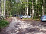
Leave the Gorenjska motorway at the Hrušica exit and follow the road towards Kranjska Gora. Just before the village of Dovje, the road branches off to the left and leads to Mojstrana (Vrata, Kot and Krma). Follow the road in the direction of the village of Radovna and the valleys of Krma and Kot. The relatively steep road then leads us past the TNP signboard, after which the road soon lays down and leads us to a crossroads where a dirt road branches off to the right into the Kot valley (straight ahead to Radovna and Krma). This sometimes slightly worse road is then followed to a parking area, where you will also see mountain signs.
Path description:
From the starting point, continue along the worse road, which after a few minutes leads to a turning point (parking here is not recommended). The path ahead turns slightly left and crosses a torrent. On the other side of the torrent, we climb steeply through the forest for some time. After half an hour's walk, the path starts to climb. There are a few dozen steps of walking on a steep path, where we are helped by wedges, which are not strictly necessary in dry conditions. The steepness then eases and the path leads us to a small spring (which dries up in the dry season) at 1340m. Here an unmarked path branches off to the left to Macesnovec, and we continue on the marked path that crosses the torrent. There is a short steep section where we are helped by a rope ladder (not difficult). The path then crosses the lane of dwarf pines and climbs higher up on rockier slopes, where we see the Thick Stone (a large boulder visible at the top of the slope). We climb up to the Thick Stone on a rough path surrounded by the dwarf pines path (not difficult). Next, the path climbs up along a small scree slope and turns slightly higher to the right, where it leads to a crossroads. Continue left in the direction of Stanič's home and Rjavina (to the right of Vrbanove Špice, a very difficult path). The steepness then eases and there are a few minutes of easy walking to the next crossroads. Continue on the right path towards Stanič's home, passing the Pekel sinkhole, which can be seen on the right below us (the path to the left leads to Rjavina on the climbing route). Continue climbing steadily up to Stanič's home, which offers a fine view of Triglav.
Continue in the direction of Kredarica along the path which climbs steeply under the Rži scree and then crosses the scree to an undistinguished notch in the side ridge of the Rži. The trail then descends slightly using the fixed safety gear and then ascends again. After less than an hour from Stanič's home, the path leads to the top of Kredarica. From the top, it takes a few minutes to descend to the Triglav home on Kredarica.
At the house, the markings for Triglav direct us slightly down to the edge of the glacier (Zeleni sneg), and then up to the start of the climbing part of the route. The route climbs steeply immediately, and the fixed safety gear rungs are particularly helpful. After a half-hour climb, a slightly easier route from Planika joins us from the left. Only a few steps further we reach the unmarked summit of Malega Triglava from which we descend slightly. Follow the exposed but perfectly protected path along the ridge. In the last part, the path climbs steeper and leads us to the Stanič shelter, which is 30 m away from the path. By the top, the steepness eases and the scenic route leads us to the top of Triglav, where the Aljaž Tower stands.
Kot - Staničev shelter 4:00, Staničev shelter - Kredarica 1:00, Kredarica - Triglav 1:10.

Pictures:
 1
1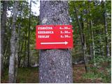 2
2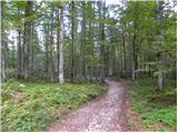 3
3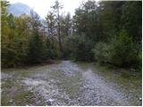 4
4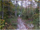 5
5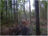 6
6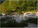 7
7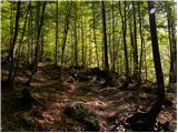 8
8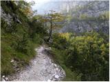 9
9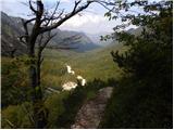 10
10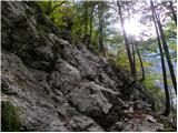 11
11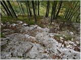 12
12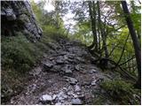 13
13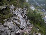 14
14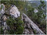 15
15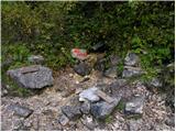 16
16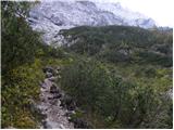 17
17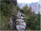 18
18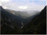 19
19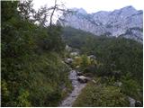 20
20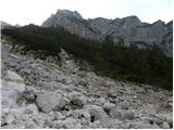 21
21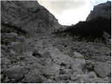 22
22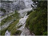 23
23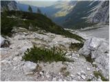 24
24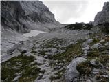 25
25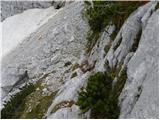 26
26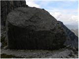 27
27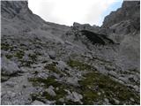 28
28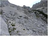 29
29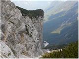 30
30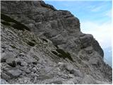 31
31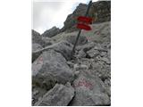 32
32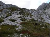 33
33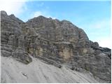 34
34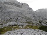 35
35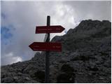 36
36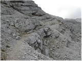 37
37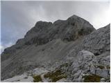 38
38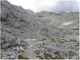 39
39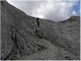 40
40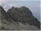 41
41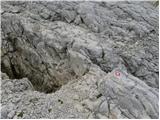 42
42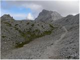 43
43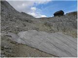 44
44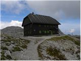 45
45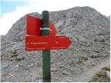 46
46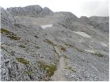 47
47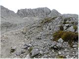 48
48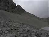 49
49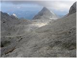 50
50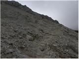 51
51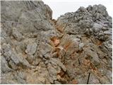 52
52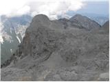 53
53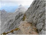 54
54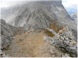 55
55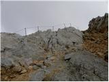 56
56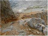 57
57 58
58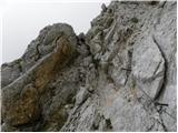 59
59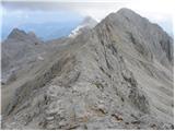 60
60 61
61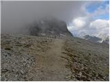 62
62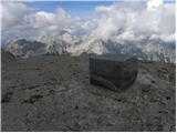 63
63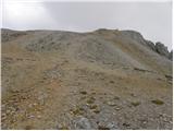 64
64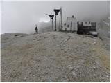 65
65 66
66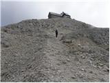 67
67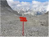 68
68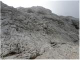 69
69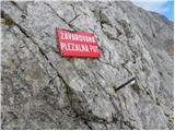 70
70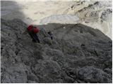 71
71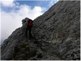 72
72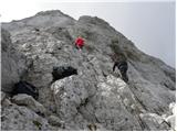 73
73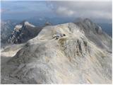 74
74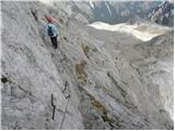 75
75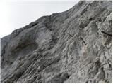 76
76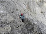 77
77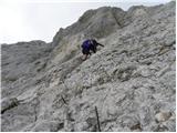 78
78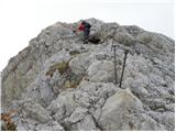 79
79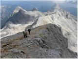 80
80 81
81 82
82 83
83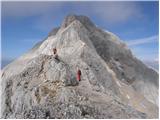 84
84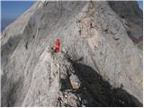 85
85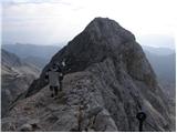 86
86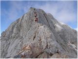 87
87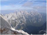 88
88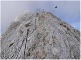 89
89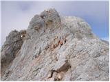 90
90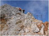 91
91 92
92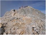 93
93 94
94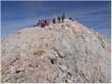 95
95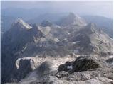 96
96 97
97
Discussion about the trail The Kot Valley - Triglav
|
| Guest13. 07. 2006 |
Lepo.Dobil sem navdih s katere smeri letos obiskati Triglav.
Brane
|
|
|
|
| skespr21. 08. 2006 |
ne bo ti žal . če pa boš ime kaj časa je vredno iti še na rjavino ( gor po grebenski poti nazaj pa po plezalni ) ne bo ti žal . obvezno čelado
|
|
|
|
| Nickster22. 07. 2008 |
Ta pot je meni odlična, razen dela ko hodš po melišču nimam tako rad. Jest sm tud poskusu it še na rjavino pa nism uspel isti dan, saj me je ujela noč. mal hitrej bi mogu jt. Nastale pa so lepe fotografije. lp in veliko užitkov! 
|
|
|
|
| Janiel746. 08. 2011 |
Včeraj opravil s to potjo navzgor , potem pa dol do Krme. Prvič na Triglavu 
|
|
|
|
| kungočan30. 08. 2012 |
V četrtek 23.avgusta smo se odpravili na to pot, startali ob šesti uri,po eni uri in pol nas je zajela nevihta,močan dež in veter,čakali smo proti koncu gozda,pomislili da gremo nazaj,poklicali na Kredarico,dobili vzpodbudno informacijo in nadaljevali proti Staničevemu domu,vreme se je izboljšalo in bilo je lepo.Na vrh smo prispeli okoli druge ure.Vreme jasno.Vračali smo se do Planike,kjer smo prespali,bilo nas je deset.drugi dan čez Škrbino preko Plemenic na Luknjo in do Aljaževega doma v Vratih.Zelo adrenalinsko...
|
|
|
|
| maregol22. 09. 2016 |
Je mogoče kdo že šel po tej poti ponoči? Je primerna za kaj takega? Rad bi prìšel na Triglav okoli 8:00 zjutraj tako da bi vršni del že bil obsijan.
|
|
|
|
| redbull22. 09. 2016 |
dobro lampo imej na glavi pa ni panike  srečno
|
|
|
|
| mukica23. 09. 2016 |
Del poti v spodnjem predelu Kota je vedno malce spolzko, previdno ponoči, sploh če bodo temperature okoli ledišča...
|
|
|
|
| Zdenkob14. 09. 2018 |
V sredo, 12.9. sem šel po tej poti. Nameraval sem iti samo do Staničevega doma, vendar sem potem zaradi zelo lepega vremena podaljšal turo še do Kredarice in Triglava. Gneča je bila znosna. Pot nazaj v Kot se mi je vlekla, še posebej od Debelega kamna naprej, kjer je bila zaradi mokrih skal potrebna dokajšnja mera previdnosti.
|
|
|
|
| fjr23. 09. 2018 |
Včeraj v družbi prijateljev opravil to pot. Ob 7. uri gor in popoldan zaradi napovedi slabega vremena nazaj v dolino. Med potjo nas je dobila tema tako da smo pot nadaljevali s svetilkami. Rad bi napisal in opozoril vse pohodnike, da je pot v spodnjem delu ko prideš v gozd izjemno spolska, prepadna in na izpostavljenih delih premalo varovana.
|
|
|