Sviščaki - Snežnik (by road)
Starting point: Sviščaki (1242 m)
| Lat/Lon: | 45,5742°N 14,401°E |
| |
Name of path: by road
Time of walking: 1 h 55 min
Difficulty: easy marked way
Altitude difference: 554 m
Altitude difference po putu: 560 m
Map: Snežnik 1:50.000
Recommended equipment (summer):
Recommended equipment (winter): ice axe, crampons
Views: 13.160
 | 1 person likes this post |
Access to the starting point:
a) From Cerknica or Nová vas na Bloki, first drive to Bloška Police and from there continue in the direction of Loš and Babne Polje. At Pudob, turn right in the direction of Snežnik, Ilirska Bistrica, Knežak and the nearby settlement of Kozarišče. In Kozarišče, turn slightly left in the direction of Snežnik and follow the road in the direction of Snežnik at the following junctions. When Kozarišče ends, the asphalt also ends, and we continue to the left in the direction of Mašun and Knežak, just after the bridge over the Malá Obrh. A long drive on a dirt road follows, and after about 19 km from Kozarišče we reach a crossroads where the road from Mašun joins from the right. Here, continue left in the direction of Sviščaki, which is about 10 km away on macadam, and at the crossroads follow the signs for Sviščaky. After about 29 km of macadam road, you will reach the Mountain Home at Sviščaki, where you park.
b) Drive to Pivka and from there continue to Knežak. At Knežak, at the marked crossroads, turn left in the direction of Masun and the settlements Bač and Koritnicee. A little further on, go right in the direction of Masun and Koritnice (straight ahead Bač). After Koritnice the road starts to climb more visibly, and then after 18 km from the main crossroads in Knežak it leads to Masun, from where you continue driving right in the direction of Sviščaki, where you have about 12 km of macadam road to go. When you reach the Mountain Home at Sviščaki, park.
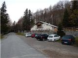
c) First drive to Ilirska Bistrica, then continue to Sviščaki (the turnoff is in the middle of Ilirska Bistrica and is marked, it may be a little less visible). Initially, the asphalt road is climbed, then after about 12 km of climbing, the asphalt is replaced by macadam. There are about 7 km of macadam, and then you reach a junction near the Mountain Home on Sviščaki, where you continue straight towards the nearby Mountain Home, where you park.
Path description:
On the opposite side of the road from the Mountain Lodge at Sviščaki, we see the mountain signs for Snežnik and a view of Snežnik, which direct us to the macadam road, which continues without change in elevation through the meadow. On the other side of the meadow, the path leads past a water reservoir, and beyond it the path turns slightly left into the forest, through which it climbs moderately. After a short climb, you reach another road, which you follow to the right, and after passing a few holiday cottages, you reach a wider macadam road, which you follow to the left (on the right the main road Ilirska Bistrica - Sviščaki). There is an easy climb up the wider macadam road, which is followed for about 10 minutes to a marked crossroads where the path to the viewpoint "View of Snežnik" branches off to the left, and a marked footpath continues to the right, leading to Snežnik.
Continue along the road, which continues to lead through the forest, and quickly pass the abyss to reach the marked crossroads below Lom, located at 1330 metres above sea level.
Here again, continue straight ahead (you can join the aforementioned footpath on the right-hand road or continue to the hunting lodge in Travni dolci, from where it is also possible to climb to Snežnik, but the route is not marked) in the direction of Snežnika along the road. Higher up, some views open up, and then we reach the next crossroads (in the descriptions, the starting point is Snežnik Grda jama), where we continue along the upper right road (slightly left Little Snežnik and Snežnik via Little Snežnika). A few minutes higher, on a small pass, a footpath joins from the right with Sviščaki, where the carriageway ends.
Continue along the minor road, which soon turns sharp left and then turns increasingly right as it ascends. As we climb along the road, we begin to see more and more beautiful views, stretching from the nearby Mali Snežnik, through Notranjska and Primož all the way to the Dolomites. When the road turns a little more to the right, it ends at a nearby turning point.
From the end of the road, where a few benches have been placed, we have a nice view of the Big Snežnik, and we continue along the wide marked path which continues through dwarf pines. The path then ascends to the right, and the views from the path become more and more beautiful, reaching over Gorski Kotar all the way to Velebit, with a good view of the Kvarner islands, Učka, etc. Higher up, the path passes into an indistinct valley between the two Snežnik mountains, where the Matetova trail first branches off to the left, and higher up we are joined from the right by the trail from Grda Draga and Mašun (both trails lead over Mali Snežnik). At both crossroads, continue on the right path, and it takes about 5 minutes of cross-country climbing over a slightly steeper slope to reach the Veliki Snežnik shelter, where there is a greater risk of slipping in the snow.
When you reach the shelter, continue left in front of it and within a minute of further walking you will climb to the highest non-alpine peak in Slovenia, which offers views in all directions.
Description and pictures refer to the situation in 2015 (October).

Pictures:
 1
1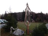 2
2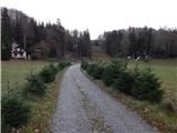 3
3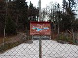 4
4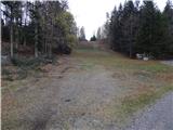 5
5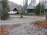 6
6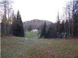 7
7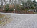 8
8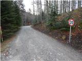 9
9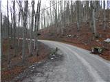 10
10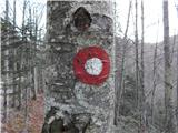 11
11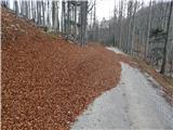 12
12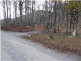 13
13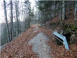 14
14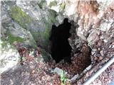 15
15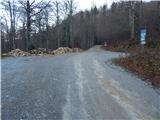 16
16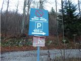 17
17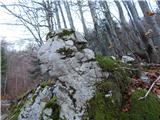 18
18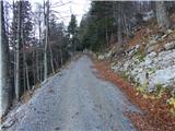 19
19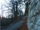 20
20 21
21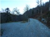 22
22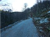 23
23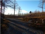 24
24 25
25 26
26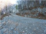 27
27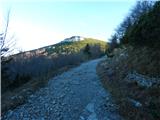 28
28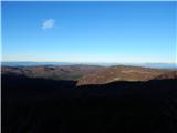 29
29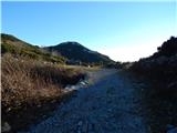 30
30 31
31 32
32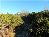 33
33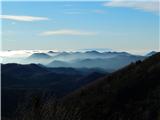 34
34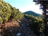 35
35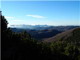 36
36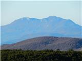 37
37 38
38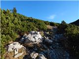 39
39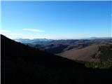 40
40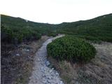 41
41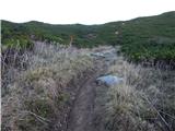 42
42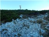 43
43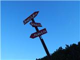 44
44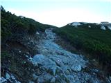 45
45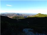 46
46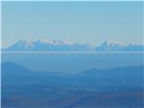 47
47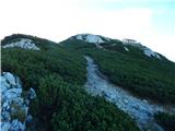 48
48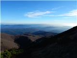 49
49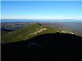 50
50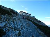 51
51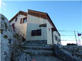 52
52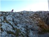 53
53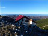 54
54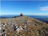 55
55 56
56
Discussion about the trail Sviščaki - Snežnik (by road)