Stara Fužina - Triglav (via Planika and Mali Triglav)
Starting point: Stara Fužina (600 m)
| Lat/Lon: | 46,2903°N 13,8868°E |
| |
Name of path: via Planika and Mali Triglav
Time of walking: 7 h 45 min
Difficulty: very difficult marked way
Altitude difference: 2264 m
Altitude difference po putu: 2400 m
Map: Triglav 1:25.000
Recommended equipment (summer): helmet, self belay set
Recommended equipment (winter): helmet, self belay set, ice axe, crampons
Views: 31.307
 | 6 people like this post |
Access to the starting point:
From the Ljubljana - Jesenice motorway, take the Lesce exit and follow the road towards Bled and on to Bohinjska Bistrica. Continue towards Bohinjsko jezero (Ribčev laz), at which you will come to a crossroads where you will turn right towards Stara Fužina. At Stara Fužina, at the crossroads by the chapel, turn sharp left onto the ascending road towards mountain pasture Blato, mountain pasture Vogar and the Voja valley. Follow this road to the parking lot where tolls and parking fees are collected.
Path description:
From the parking lot, continue right towards the Mostnice riverbeds along a wide path, which will take you to the Devil's Bridge in a few minutes, from which you can get your first view of the riverbeds. At the bridge, turn left onto a minor road, which you follow for a short distance, as the signs for the troughs then direct you to the right onto a well-maintained tourist trail. The path ahead soon leads us to the central trough, along which we then climb steeply. During the ascent along the troughs, we come across the "Elephant" markers (a rock hollowed out by water in the shape of an elephant - worth a look). The way forward continues to climb for some time along Mostnica, then turns slightly to the left, where after a few minutes of further walking it leads us to a forest road leading towards the valley of the Voja valley. Follow the road to the right, and it will quickly lead us to the mountain hut at Voja (we can also get here by car, which shortens the journey by about 45 minutes).
From the hut, continue along the folded macadam road, which leads us further along the edge of the vast pastures of the Voja valley. A little further on, the road splits into two parts, and we can continue either on the left (direction Velo polje) or on the right road, which is a few minutes longer and leads us to the Mostnice waterfall along the valley headland.
If you have seen the waterfall, go back a few metres, then cross the little bridge to join the slightly shorter "left" path. The path continues into the dense forest, where it first climbs above the waterfall, then gradually turns quite left, where it climbs up relatively steep slopes. After a climb of about one hour through the forest, the path turns right and then, after a few minutes of cross-climbing, leads us out of the forest to mountain pasture Spodnja Grintovica, where there is a trough of water (because of the possibility of frost, the tap can only be opened in the summer months).
The trail then returns to the forest, where it begins to climb steeply again. The rather monotonous path then leads us into an unmarked valley (Jurjevčeva vrtača), where it gradually lays down. Further on, the forest becomes a little thinner and the path turns slightly to the right, where after a few minutes of further walking we arrive at a less well-marked crossroads. Continue on the right path (left mountain pasture under Mišelj vrh, Malo polje and Velo polje), which again starts to climb more visibly. The path continues to climb along the undistinguished ridge of the lesser-known peak Na Zagonu (1824 m), then lays down and leads us in a few steps of further walking to a place where we join the considerably more beaten path from Pokljuka. Continue in the route Vodnikov dom and continue the ascent along the gently sloping path that crosses the slopes of Tosc. The way forward crosses a few more small scree fields (in early summer there are still possible snowfields), and then quickly leads us to Vodnikov dom in Velo Polje.
From home, continue straight on in the direction of Triglav (right up Bohinjska vratca). The trail climbs moderately and crosses the slopes below Vernar. Soon we come across the first steel cable, which helps us to "overcome" the short ledge. The way forward climbs on scree and then leads us to a steep rock jump. A well-protected path leads us up steep steps to the top of this jump. There are a few metres of scrambling up the steep slope, and then the path leads to the open areas near Konjsko sedlo , which is reached after a short descent.
From the saddle, continue left in the direction of Planike (straight ahead Kredarica and Staničev dom, right Krma) along a relatively steep path that climbs crosswise to the west. Higher up, the increasingly scenic path leads to an undistinguished ridge, where it turns to the right and transiently lays down a little. The marked path then passes a larger sinkhole on the right and then starts to turn to the left. There is about 10 minutes of ascent and the path leads to the Planika home below Triglav.
From Planika, continue along the right side of the mountain home along the marked path in the direction of Triglav (left Triglav over Triglav notch, right Kredarica). The way forward first descends slightly, then gradually begins to climb. After a few minutes of easy walking, you reach a short rocky section where you cross a slightly exposed ledge. The path ahead turns slightly to the right and from the rocky cliffs it turns into a rubbly world, over which you climb to enter the climbing section.
A marking visible from afar directs us into a distinct gully, through which we climb with the help of a rope to a beautiful viewpoint. The route then turns left, climbs steeply at first and then continues along the broken rocks. Occasionally very steep and in all the more difficult places well guarded, the path leads us higher up to the ridge of the Mali Triglav, where we join a slightly more difficult path from Kredarica on the right. Continue straight along the ridge path, which leads us in a few 10 steps of further walking to the top of the Mali Triglav. From Mali Triglav, from where we have a beautiful view of the summit and most of the trail ahead, the trail descends slightly, then leads us to an unmarked saddle between the two peaks. The path ahead begins to climb again, along a well-protected ridge path. This very scenic and, in some parts, very steep path is then followed all the way to the top of Triglava.
Starting point - Koča na Vojah 45 minutes, Koča na Vojah - Spodnja Grintovica 2:00, Spodnja Grintovica - Vodnikov dom 2:00, Vodnikov dom - Planika 1:30, Planika - Triglav 1:30.

Pictures:
 1
1 2
2 3
3 4
4 5
5 6
6 7
7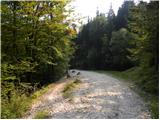 8
8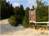 9
9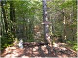 10
10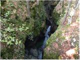 11
11 12
12 13
13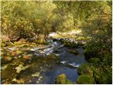 14
14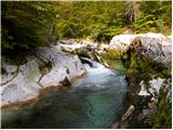 15
15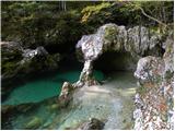 16
16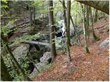 17
17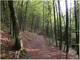 18
18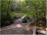 19
19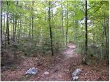 20
20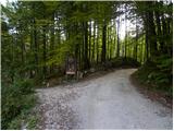 21
21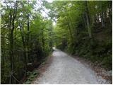 22
22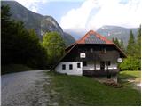 23
23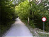 24
24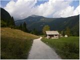 25
25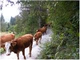 26
26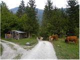 27
27 28
28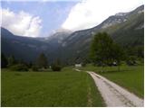 29
29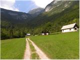 30
30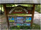 31
31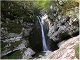 32
32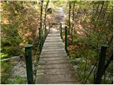 33
33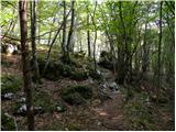 34
34 35
35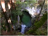 36
36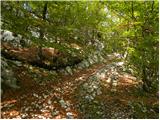 37
37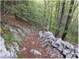 38
38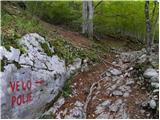 39
39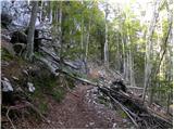 40
40 41
41 42
42 43
43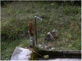 44
44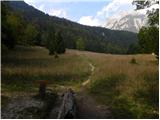 45
45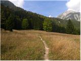 46
46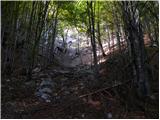 47
47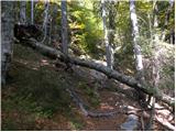 48
48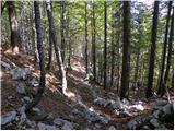 49
49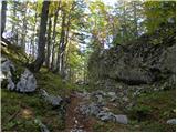 50
50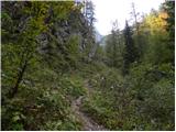 51
51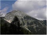 52
52 53
53 54
54 55
55 56
56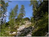 57
57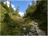 58
58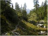 59
59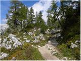 60
60 61
61 62
62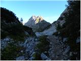 63
63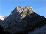 64
64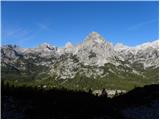 65
65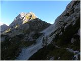 66
66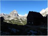 67
67 68
68 69
69 70
70 71
71 72
72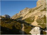 73
73 74
74 75
75 76
76 77
77 78
78 79
79 80
80 81
81 82
82 83
83 84
84 85
85 86
86 87
87 88
88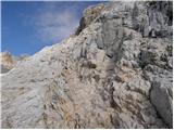 89
89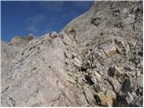 90
90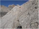 91
91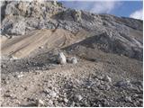 92
92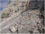 93
93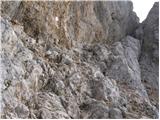 94
94 95
95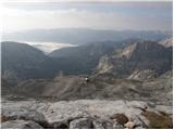 96
96 97
97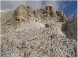 98
98 99
99 100
100 101
101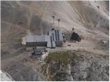 102
102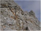 103
103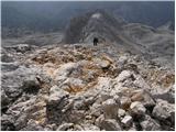 104
104 105
105 106
106 107
107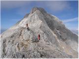 108
108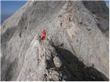 109
109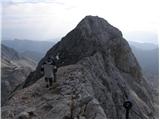 110
110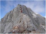 111
111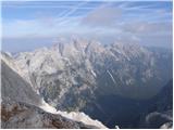 112
112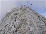 113
113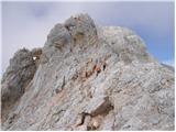 114
114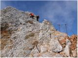 115
115 116
116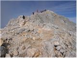 117
117 118
118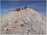 119
119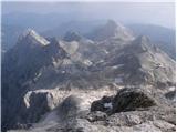 120
120 121
121
Discussion about the trail Stara Fužina - Triglav (via Planika and Mali Triglav)
|
| Nimrod22. 09. 2013 |
Včeraj sem se vrnil s te poti in me čudi, da ni nobenega komentarja. Čudovita pot, ki razkaže vse kar lahko slovenske gore ponudijo. Priporočam tudi ogled izvira-slapa Krope.
|
|
|
|
| mojcav17. 08. 2020 |
V sredo se odpravljam po tej poti, že komaj čakam. Upam da bo vreme res zdržalo.
|
|
|