Selo pri Vodicah - Rašica (Vrh Staneta Kosca)
Starting point: Selo pri Vodicah (335 m)
| Lat/Lon: | 46,158°N 14,5172°E |
| |
Time of walking: 1 h 30 min
Difficulty: easy marked way
Altitude difference: 306 m
Altitude difference po putu: 375 m
Map: Ljubljana - okolica 1:50.000
Recommended equipment (summer):
Recommended equipment (winter):
Views: 4.970
 | 1 person likes this post |
Access to the starting point:
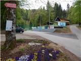
a) From the Ljubljana - Jesenice motorway, take the Ljubljana - Šmartno exit, then continue driving towards Šmartno. In Šmartno, turn right towards Vodice, and follow the main road towards Vodice for a few kilometres, then just before the beginning of Skaručna, turn right towards Vojsko and Selo pri Vodicah. Follow the main road along the Skaruška polje, then before the beginning of Selo pri Vodicah, you will see signs for the Strahovica Ski Association, which will direct you to the right onto the local road. Continue through the village and we follow the road to the parking lot at the foot of the ski jump.
b) Take the motorway Jesenice - Ljubljana to the Vodice exit and continue driving towards Vodice. At the traffic lights in Vodice, go straight ahead and then right at the next junction in the direction of Bukovica pri Vodicah and Utik. At the end of Utik, turn right towards Selo pri Vodicah and then right again at the bus stop at the edge of Sele. From the bus stop, follow the main road for just over 100 m and then the signs for the Strahovica Ski Association direct you left onto the local road. Continue through the village and we follow the road to the parking lot at the foot of the ski jump.
c) First we take the road to Mengeš, then we continue driving towards Komenda. At the end of Mengeš, just after crossing the stream Pšata, turn left onto the local road towards Topole. Before you reach the point, turn left again, this time towards Utik. Continue on the local road, and we follow it to the hamlet of Koseze, where we turn left in the direction of Sela pri Vodice. Soon we reach the bus stop at the edge of Sele, where we continue straight ahead. From the bus stop, follow the main road for just over 100 m, and then the signs for the Strahovica Ski Association will direct you left onto the local road. Continue through the village and we follow the road to the parking lot at the foot of the ski jump.
Path description:
From the starting point, follow the footpath in the direction of Mengeš hut, Dobeno and the ridge path to Rašica. The trail climbs moderately through the forest, then crosses a forest road, after which it leads through a number of crossroads, where you carefully follow the markings. The marked trail crosses the "downhill" cycle track several times further on, so a little extra caution is in order. The trail, which passes through the forest the whole time, is higher up and joins the ridge trail from the Mengeš hut on Gobavica a little further on.
Follow this path to the right in the direction of Rašica, where you will first climb up the unmarked Debeli hill, from which you will quickly descend to the forest road. Follow the road to the first left turn and then continue straight ahead towards the ridge path to Rašica. There are a few more forks, where you follow the signs for Rašica, and after a while the path, which is mainly a gentle to moderate ascent, leads to the lookout tower at Rašice.
At your own risk you can climb the tower, which opens up a beautiful view, otherwise you can continue to the nearby mountain home.
Description and pictures refer to the situation in 2017 (April).

Pictures:
 1
1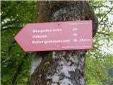 2
2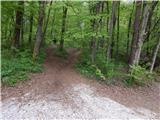 3
3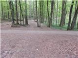 4
4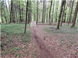 5
5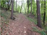 6
6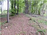 7
7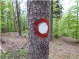 8
8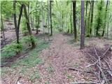 9
9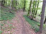 10
10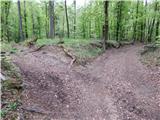 11
11 12
12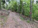 13
13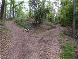 14
14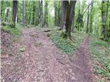 15
15 16
16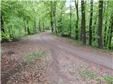 17
17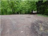 18
18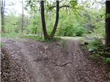 19
19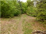 20
20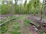 21
21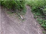 22
22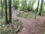 23
23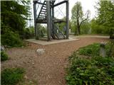 24
24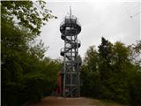 25
25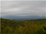 26
26 27
27
Discussion about the trail Selo pri Vodicah - Rašica (Vrh Staneta Kosca)
|
| Darxta15. 01. 2024 11:29:07 |
Pot je dobro markirana, opis je še vedno popolnoma aktualen.
|
|
|