Rifugio Auronzo - Monte Paterno (via east ridge)
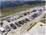
Starting point: Rifugio Auronzo (2320 m)
| Lat/Lon: | 46,6122°N 12,2941°E |
| |
Name of path: via east ridge
Time of walking: 2 h
Difficulty: very difficult marked way
Altitude difference: 424 m
Altitude difference po putu: 600 m
Map: Tabacco 10 1:25.000
Recommended equipment (summer): helmet, self belay set
Recommended equipment (winter): helmet, self belay set, ice axe, crampons
Views: 12.914
 | 1 person likes this post |
Access to the starting point:
At the Auronzo hut, take the macadam road leading slightly east towards the Lavaredo hut. After about 20 minutes' walk along a very scenic road that leads under the mighty walls of the Three Cinquefoils, you will reach the Lavaredo hut.
From the hut, continue along the road, which quickly leads to a crossroads where you turn right towards Piani di Lavaredo. The path, which continues along the mulatiera, descends past a small lake and then, after crossing scree, leads to extensive meadows where, especially in the morning and evening, you can see many marmots. Here, turn left onto the path, which leads slightly to the left and starts to climb quite steeply on the scree (heading north-east). The wide mulatier continues eastwards. After climbing over the scree, join the slightly better-beaten track leading from the Rifugio Pian di Cengia hut.
At the crossroads, turn left and cross the slope below Pian di Cengia in a gentle ascent. The path becomes a little more level and leads to the Forcella dei Laghi. From the notch, continue westwards and soon enter the climbing part of the route. On the south side of the ridge, along a rope, you descend into a steep gully, from which you then climb up the other side, also with the help of a short ladder. Again the slope becomes more gentle for a while and then in a few ascents and descents we cross the precipitous slopes to the west. Finally, cross a short bridge and you will soon reach the Forcella del Camoscio. At the notch, where the path joins the other two, bear left. Use the ropes to climb over the almost vertical wall. This part of the route is short but challenging and it is therefore highly recommended to use self-belaying equipment. The route then becomes less demanding and, via some beautiful passages along the top slope of the mountain, you soon reach a very scenic summit.
Path description:
At the Auronzo hut, take the macadam road leading slightly east towards the Lavaredo hut. After about 20 minutes' walk along a very scenic road that leads under the mighty walls of the Three Cinquefoils, you will reach the Lavaredo hut.
From the hut, continue along the road, which quickly leads to a crossroads where you turn right towards Piani di Lavaredo. The path, which continues along the mulatiera, descends past a small lake and then, after crossing scree, leads to extensive meadows where, especially in the morning and evening, you can see many marmots. Here, turn left onto the path, which leads slightly to the left and starts to climb quite steeply on the scree (heading north-east). The wide mulatier continues eastwards. After climbing over the scree, join the slightly better-beaten track leading from the Rifugio Pian di Cengia hut.
At the crossroads, turn left and cross the slope below Pian di Cengia in a gentle ascent. The path becomes a little more level and leads to the Forcella dei Laghi. From the notch, continue westwards and soon enter the climbing part of the route. On the south side of the ridge, along a rope, you descend into a steep gully, from which you then climb up the other side, also with the help of a short ladder. Again the slope becomes more gentle for a while and then in a few ascents and descents we cross the precipitous slopes to the west. Finally, cross a short bridge and you will soon reach the Forcella del Camoscio. At the notch, where the path joins the other two, bear left. Use the ropes to climb over the almost vertical wall. This part of the route is short but challenging and it is therefore highly recommended to use self-belaying equipment. The route then becomes less demanding and, via some beautiful passages along the top slope of the mountain, you soon reach a very scenic summit.

Pictures:
 1
1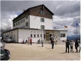 2
2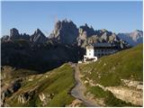 3
3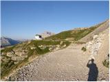 4
4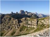 5
5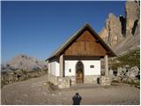 6
6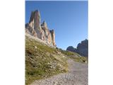 7
7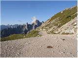 8
8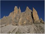 9
9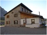 10
10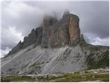 11
11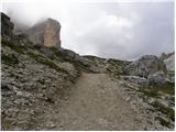 12
12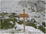 13
13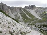 14
14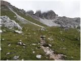 15
15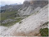 16
16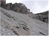 17
17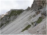 18
18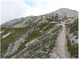 19
19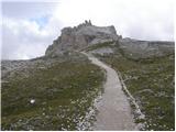 20
20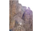 21
21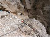 22
22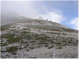 23
23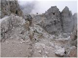 24
24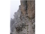 25
25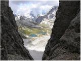 26
26 27
27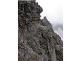 28
28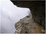 29
29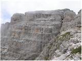 30
30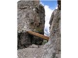 31
31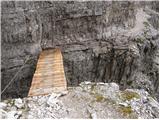 32
32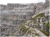 33
33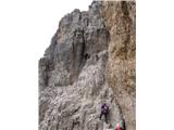 34
34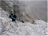 35
35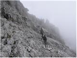 36
36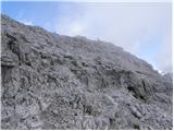 37
37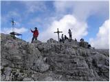 38
38 39
39
Discussion about the trail Rifugio Auronzo - Monte Paterno (via east ridge)
|
| mirank22. 11. 2021 11:29:31 |
Plezalni del opisane poti ima ime Ferata delle Forcelle. V spominu jo imam kot del ene najlepših krožnih tur. Takrat sva začela v Mossu, od Dolomitenhofa nadaljevala na stolpe Toblin mimo koče Locatelli v kaverne in na to ferato v nasprotni smeri ter mimo koč Bulele in Zsigmondy nazaj v dolino-9h hoda=uživanja 
|
|
|
|
| felix22. 11. 2021 14:03:37 |
Sam sem bil letos drugič na Paternu, vedno me pritegne, pa neglede po katerem od treh pristopov se povzpnem na vrh (do sedla - na vrh vodi samo ena pot), ali sestopim.
|
|
|