Povodje - Veliki vrh (Rašica)
Starting point: Povodje (316 m)
| Lat/Lon: | 46,1382°N 14,4791°E |
| |
Time of walking: 45 min
Difficulty: easy unmarked way
Altitude difference: 252 m
Altitude difference po putu: 252 m
Map: Ljubljana - okolica 1:50.000
Recommended equipment (summer):
Recommended equipment (winter):
Views: 6.726
 | 1 person likes this post |
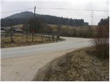
Access to the starting point:
From the Ljubljana - Jesenice motorway, take the Ljubljana - Šmartno exit, and follow the road to the settlement, where you turn right onto the road leading to Vodice. Continue towards Vodice, and at the first junction after the motorway overpass turn right, where after 100 m you will reach the Povodje fish farm. There are no parking spaces at the starting point, but you can find a suitable place somewhere nearby.
Path description:
At the fish farm, you will see signs for Vrh Staneta Kosca (Staneta Kosca Peak), which will direct you to the left on the asphalt road, which will take you to the local houses. Cross the stream over the bridge and then continue along the road, which is closed to public traffic by a road sign. Continue along the road for about 100 m, then signs direct you to the right to cart track, which starts to climb gently. As you enter the wods, the markings cart track direct you right onto a footpath that climbs through the wods. A little higher up, the path turns left and starts to climb steeply. As the path has a few small forks, follow the markings carefully so as not to stray from the right path. Higher up, the path leads us under the steep slopes of Mali vrh, which we bypass on the right hand side. After a few minutes of further walking, the path is laid and leads to a dirt road. Walk along the road for only about 20 m, then continue right on cart track, from which the unofficial marked footpath leading to Veliki vrh branches off immediately to the left.
Continue up the sometimes slightly less visible path, along which there are arrows with spray painted on the trees. Soon the path climbs steeply and leads to a woded ridge. The path is completely laid higher up, and then leads us past the Markon abyss to Veliki vrh in a few minutes.

Pictures:
 1
1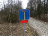 2
2 3
3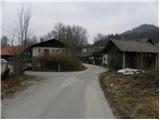 4
4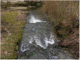 5
5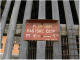 6
6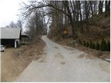 7
7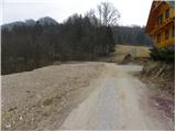 8
8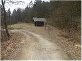 9
9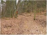 10
10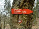 11
11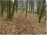 12
12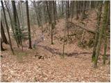 13
13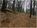 14
14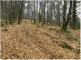 15
15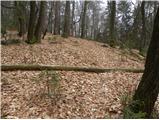 16
16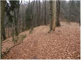 17
17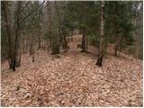 18
18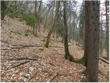 19
19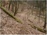 20
20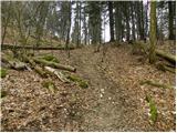 21
21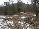 22
22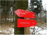 23
23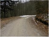 24
24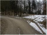 25
25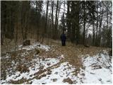 26
26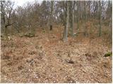 27
27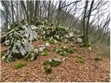 28
28 29
29 30
30 31
31 32
32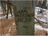 33
33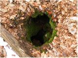 34
34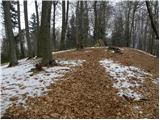 35
35 36
36
Discussion about the trail Povodje - Veliki vrh (Rašica)
|
| Ajda_Zitnik11. 05. 2015 |
Po žledu pred dvema letoma je bilo podrtih ogromno dreves na tej poti, zato je neuradna igled poti od ceste na Veliki vrh popolnoma drugačen kot na fotografijah - posebno veliko je meter visoke podrasti.
Shojena pot se še vedno najde, potrebna pa je večja pozornost.
|
|
|