Planina pod Golico - Kahlkogel/Golica (via Jekljevo sedlo)
Starting point: Planina pod Golico (980 m)
| Lat/Lon: | 46,4624°N 14,0488°E |
| |
Name of path: via Jekljevo sedlo
Time of walking: 3 h
Difficulty: partly demanding unmarked way
Altitude difference: 855 m
Altitude difference po putu: 855 m
Map: Karavanke - osrednji del 1:50.000
Recommended equipment (summer):
Recommended equipment (winter): ice axe, crampons
Views: 17.313
 | 1 person likes this post |
Access to the starting point:
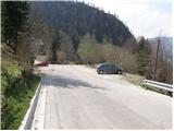
From the motorway Ljubljana - Jesenice take the exit Lipce (also Hrušica) and follow the road in the direction of Jesenice, where the signs for Planina pod Golico direct us to the ascending road (the exit is marked and is located at the health centre in Jesenice). The relatively steep road soon leads us to the above-mentioned village, where in May, in the surrounding meadows, you can admire the bloming of daffodils. Park in one of the car parks at the foot of the Španov vrh ski centre.
Path description:
From the parking lot, continue along the asphalted road, which after a few minutes' walk leads to a marked crossroads, where you continue left downhill towards Rožce (straight Kahlkogel, right Španov vrh). Continue along the road, which leads past the Church of the Holy Cross to an unmarked crossroads (at the cross), where you continue to the right. A marked trail soon branches off to the left from the road to Rožco, and we continue straight on past a few houses.
The road along the White Stream climbs steeply for a short time, then leads to a dilapidated house, where we continue right along the relatively steep cart track (left over the Rožca bridge).
The steep cart track, which passes through a dense forest, soon gives way, and after a few minutes of further walking it leads to a crossroads, where we continue along the right ascending cart track (between the two tracks there is a smaller cairn on a stump).
The track soon leaves the forest on a short rocky and scenic slope and then returns to the forest, where it continues until it reaches a forest road. Cross the road, then climb the avalanche-prone slope straight up (this part of the path was completely destroyed by the avalanche).
Keep to the left as you climb up the avalanche slope, as after about 50 m you will see a track continuing through the forest.
After a few steps through the forest, you will come to a small clearing, at the edge of which stands a small wooden hut. Continue along the wide path that crosses the lane of the forest, which soon leads to the lower part of the mountain pasture, where you come to a small crossroads. Continue to the right, cross the grazing fence and climb a few steps to the Golica shepherd's hut.
From the shepherd's hut, follow mountain pasture upwards, but only as far as the fence at the top of mountain pasture. Here continue left into the wods, where you will come out on a well-traced track which you will then cross and climb. The track, which crosses some avalanche-prone slopes, takes you higher out of the forest, where it turns into a footpath. The path then crosses a shorter lane of forest and joins the marked path from the hut on Kahlkogel towards Rožca. Follow the path to the left and climb steeply to Jekljevo sedlo, where you will reach the border ridge.
Continue sharp right (east), following the initially less visible and relatively poorly marked path, which begins to climb steeply along the boundary ridge. The scenic route, which occasionally crosses a few strips of sparse forest, starts to climb steeply higher up, along a ridge that is slightly exposed in places. Further along, the marked path follows the ridge to the right, where it crosses some steep grassy slopes (a slip hazard in wet conditions). The steepness then soon gives way and the path quickly leads to an undistinguished headland, on which a memorial has been erected. Continue along the increasingly scenic path, which takes a few minutes of further walking to reach the top of Golica.

Pictures:
 1
1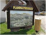 2
2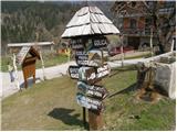 3
3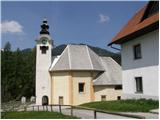 4
4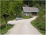 5
5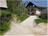 6
6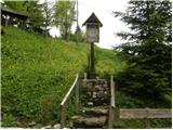 7
7 8
8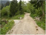 9
9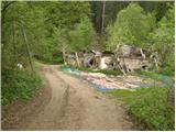 10
10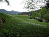 11
11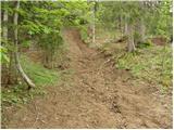 12
12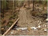 13
13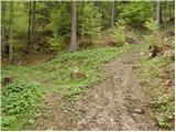 14
14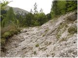 15
15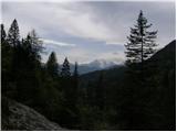 16
16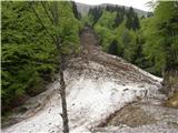 17
17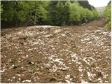 18
18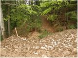 19
19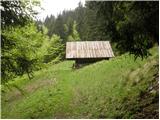 20
20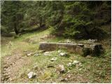 21
21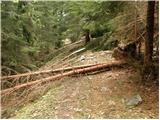 22
22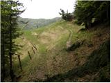 23
23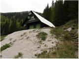 24
24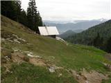 25
25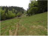 26
26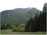 27
27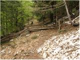 28
28 29
29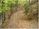 30
30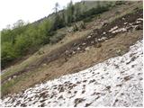 31
31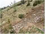 32
32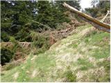 33
33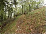 34
34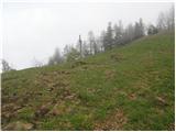 35
35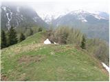 36
36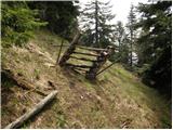 37
37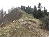 38
38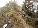 39
39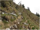 40
40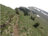 41
41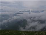 42
42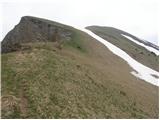 43
43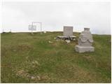 44
44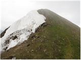 45
45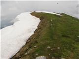 46
46
Discussion about the trail Planina pod Golico - Kahlkogel/Golica (via Jekljevo sedlo)