Planina Blato - Triglav (via Grintovica, Planika and Mali Triglav)
Starting point: Planina Blato (1147 m)
| Lat/Lon: | 46,3112°N 13,8501°E |
| |
Name of path: via Grintovica, Planika and Mali Triglav
Time of walking: 6 h 45 min
Difficulty: easy unmarked way, very difficult marked way
Altitude difference: 1717 m
Altitude difference po putu: 1880 m
Map: Triglav 1:25.000
Recommended equipment (summer): helmet, self belay set
Recommended equipment (winter): helmet, self belay set, ice axe, crampons
Views: 39.698
 | 1 person likes this post |
Access to the starting point:
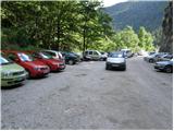
From the Ljubljana - Jesenice motorway, take the Lesce exit and follow the road towards Bled and on to Bohinjska Bistrica. Continue towards Bohinjsko jezero (Ribčev laz), at which you will come to a crossroads where you will turn right towards Stara Fužina. At Stara Fužina, at the crossroads by the chapel, turn sharp left onto the ascending road towards mountain pasture Blato, mountain pasture Vogar and the Voja valley. The road continues to the place where the toll and parking fees are collected, and we follow it to the next crossroads, where we continue to the left (right Voje). We then follow the road to the next crossroads (we drive for some time), where we take a sharp right in the direction of mountain pasture Blato (straight ahead mountain pasture Vogar). Follow this road to the parking lot above mountain pasture Blato.
Path description:
From the parking lot, continue along the dirt road, which takes a few steps past the ramp to a right-hand bend. On the right-hand side of this bend, you will see the start of a hunting trail, which leads us over a short, very steep slope with the help of a jeklenice. The path soon enters the wods and turns slightly to the right, where you come out onto the wide open cart track (you can also follow the road to this point, or the higher cart track). Follow Cart track to the right (the hunting trail continues straight on towards mountain pasture Krstenica), and it climbs steeply for some time. Follow Cart track, from which a few blind branches branch off, to a slightly larger and partially marked crossroads, where you can see the sign Grintovica on one of the trees.
Here, leave the wide cart track and continue along the slightly narrower one on the right, which climbs gently for some time. The path continues slightly downhill a few times, and then we see signs for Grintovica, which direct us right into the dense forest (here we leave the increasingly worse cart track). In the forest, the path disappears completely, and we continue in the same direction, where we come to a large number of fallen trees. Here we cross a marked path leading from the valley of Voja towards mountain pasture Krstenica (the fallen trees make the crossing almost imperceptible, but we must take care not to continue on the marked path). On the other side of the marked trail, cross a small clearing, and the trail returns to the forest and gradually begins to descend more steeply. After a short steep descent, the path is laid and leads to steep slopes, over which we descend mostly crosswise. During the crossing, a few short, slightly exposed slopes are crossed, then the slope is flattened and the route continues with a few short ascents and descents. A little further on, leave the forest and enter the southern part of mountain pasture Zgornja Grintovica, where the first wooden huts can be seen. The path continues through the lane of a forest and leads to a water trough, next to which stands Kef's cottage. We continue on, again through the lane of the forest and follow the path to the upper part of the mountain pasture, where we see some more old shepherd's huts. At the last upper part of mountain pasture, on the right-hand side, near the dilapidated hut, you will see a wide path going into the wods and beginning to descend crosswise towards mountain pasture Spodnja Grintovica. After about 10 minutes of descending, you will reach the above-mentioned mountain pasture, where you will also join the marked path from the Voja valley, which you follow to the left.
The path ahead returns to the forest, where it starts to climb steeply again. The rather monotonous path then leads us into an unmarked valley (Jurjevčeva vrtača), where it gradually flattens out. Further on, the forest becomes a little thinner and the path turns slightly to the right, where after a few minutes of further walking we arrive at a less well-marked crossroads. Continue on the right path (left mountain pasture under Mišelj vrh, Malo polje and Velo polje), which again starts to climb more visibly. The path continues to climb along the undistinguished ridge of the lesser-known peak Na Zagonu (1824 m), then lays down and leads us in a few steps of further walking to a place where we join the considerably more beaten path from Pokljuka.
Continue in the direction of Vodnikov dom and continue the ascent along the gently sloping path that crosses the slopes of Tosc. The path crosses a few more small scree fields (in early summer there are still possible snowfields), and then quickly leads to Vodnikov dom in Velo Polje.
From home, continue straight on in the direction of Triglav (right up Bohinjska vratca). The path climbs moderately and crosses the slopes below Vernar. Soon we come across the first steel cable, which helps us to "overcome" the short ledge. The way forward climbs on scree and then leads us to a steep rock jump. A well-protected path leads us up steep steps to the top of this jump. There are a few metres of scrambling up the steep slope, and then the path leads to the open areas near Konjsko sedlo , which is reached after a short descent.
From the saddle, continue left in the direction of Planika (straight ahead Kredarica and Staničev dom, right Krma) along a relatively steep path that climbs crosswise to the west. Higher up, the increasingly scenic path leads to an undistinguished ridge, where it turns to the right and transiently lays down a little. The marked path then passes a larger sinkhole on the right and then starts to turn to the left. After about 10 minutes of ascent, the path leads to the Planika home below Triglav. From Planika continue on the right side of the mountain home along the marked trail in the direction of Triglav (left Triglav over Triglav notch, right Kredarica). The way forward is first slightly downhill, then gradually begins to climb. After a few minutes of easy walking, you reach a short rocky section where you cross a slightly exposed ledge. The path then turns slightly to the right and from the rocky cliffs it turns into a rubbly world, over which you climb to enter the climbing section.
A marking visible from afar directs us into a distinct gully, through which we climb with the help of a rope to a beautiful viewpoint. The route then turns left, climbs steeply at first and then continues along the broken rocks. Occasionally very steep and in all the more difficult places well guarded, the path leads us higher up to the ridge of the Mali Triglav, where we join a slightly more difficult path from Kredarica on the right.
Continue straight along the ridge path, which leads us to the top of Mali Triglav in a few 10 steps of further walking. From Mali Triglav, from where we have a nice view of the summit and most of the path ahead, the path descends slightly and then leads us to an undistinguished saddle between the two peaks. The path ahead starts to climb again, along a well-protected ridge path. This very scenic and, in some parts, very steep path is then followed all the way to the top of Triglava.
Blato - Spodnja Grintovica 1:45, Spodnja Grintovica - Vodnikov dom 2:00, Vodnikov dom - Planika 1:30, Planika - Triglav 1:30.

Pictures:
 1
1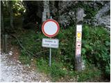 2
2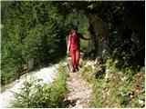 3
3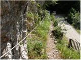 4
4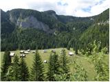 5
5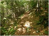 6
6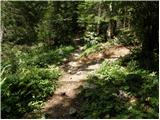 7
7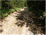 8
8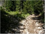 9
9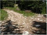 10
10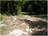 11
11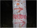 12
12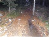 13
13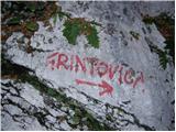 14
14 15
15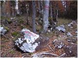 16
16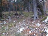 17
17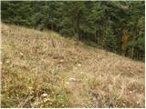 18
18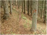 19
19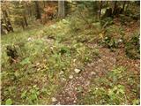 20
20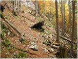 21
21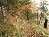 22
22 23
23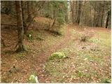 24
24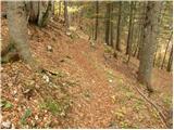 25
25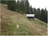 26
26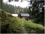 27
27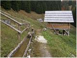 28
28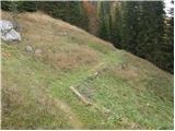 29
29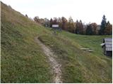 30
30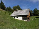 31
31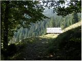 32
32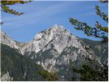 33
33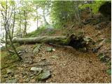 34
34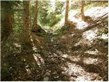 35
35 36
36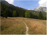 37
37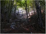 38
38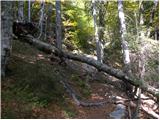 39
39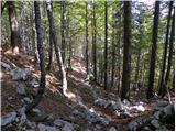 40
40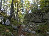 41
41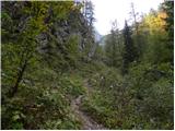 42
42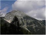 43
43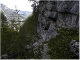 44
44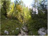 45
45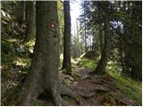 46
46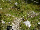 47
47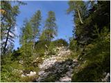 48
48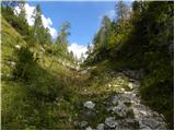 49
49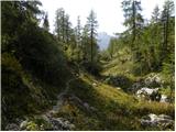 50
50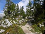 51
51 52
52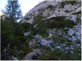 53
53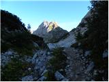 54
54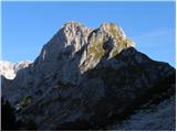 55
55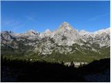 56
56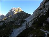 57
57 58
58 59
59 60
60 61
61 62
62 63
63 64
64 65
65 66
66 67
67 68
68 69
69 70
70 71
71 72
72 73
73 74
74 75
75 76
76 77
77 78
78 79
79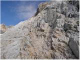 80
80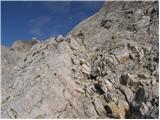 81
81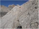 82
82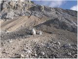 83
83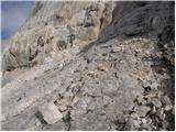 84
84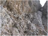 85
85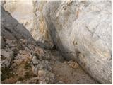 86
86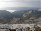 87
87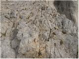 88
88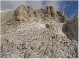 89
89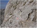 90
90 91
91 92
92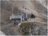 93
93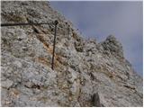 94
94 95
95 96
96 97
97 98
98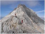 99
99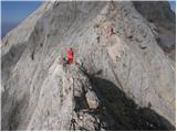 100
100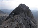 101
101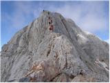 102
102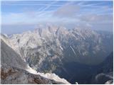 103
103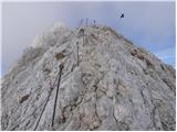 104
104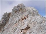 105
105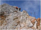 106
106 107
107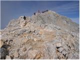 108
108 109
109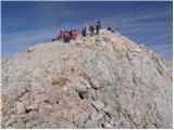 110
110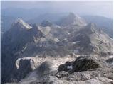 111
111 112
112
Discussion about the trail Planina Blato - Triglav (via Grintovica, Planika and Mali Triglav)
|
| tom31. 07. 2014 |
Je li tko u zadnje vrijeme išao ovim putem od Planine Blato do Grintovice? U kakvom je stanju?
|
|
|
|
| jožko hlede3. 07. 2019 |
odsvetujem pot čez Grintavico ker je konfiguracija zaradi vetroloma iz pred lanskega leta popolnoma spremenjena obstoječe slike ne pridejo več v poštev je več novih razpotji ki so nastali zaradi spravila podrtega drevja na nekaj mestih pa je pot še vedno neprehodna zaradi podrtega drevja. tako da z lahkoto zaideš iz prave poti mi smo bili primorani obrniti na palnino Krstenico ki je sicer tudi zelo slabo označena. Tako da jo odsvetujem dokler se pot in pa ta sicer lep opis in slike ne popravi na dejansko stanje
|
|
|
|
| a7a7a7a1012. 05. 2020 |
Pot ni nič manj zahtevna kot tista iz rudnega polja in planiko in mali Triglav.  Orintacijsko je zahtevna, paziti moramo da najdemo jaso z tremi visokimi drevesi potem pa se pot spusti na Grintovico, in potem še na spodnjo grintovico ki je zapuščena! Lp a7a7a7a10(jst sm otrok:jezik 
|
|
|