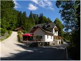
Starting point: Legastja (438 m)
| Lat/Lon: | 46,1072°N 14,3498°E |
| |
Time of walking: 1 h 10 min
Difficulty: easy marked way
Altitude difference: 368 m
Altitude difference po putu: 375 m
Map: Ljubljana - okolica 1:50.000
Recommended equipment (summer):
Recommended equipment (winter):
Views: 27.736
 | 3 people like this post |
Access to the starting point:
a) From Ljubljana, Kranj or Vodice, drive to Medvode and from there continue to Sora. At the crossroads at the beginning of Sora, just after the small bridge, turn left in the direction of Katarina and the village of Trnovec. Continue along the valley of the Ločnica towards Katarina (Topol), and we follow it to the Legastja Inn, near which we park in a suitable place along the road (the parking lot next to the inn is reserved for guests).
b) First we drive to Škofja Loka, and from there we continue our drive to Sora. At the end of Sora, turn right towards Katarina and the village of Trnovec. Continue along the valley of the Ločnica towards Katarina (Topol), and we follow it to the Legastja Inn, near which we park in a suitable place along the road (the parking lot next to the inn is reserved for guests).
Path description:
From the starting point at the Legastja Inn, first cross the road carefully and then take the footpath towards Sv. Jakob. The path first climbs up the grassy cart track, which leads us between hayfields and pastures, and then lays down and leads us to a small hamlet, where we step onto an asphalt road. Continue between a few houses, after which the asphalt road turns into a cart track, which leads up to the nearby goats' huts. At the goats' huts, signs direct us slightly to the left, onto a path which continues to climb through a meadow. The trail is easy to follow, but in times of high grass it is a little overgrown, and after a few minutes it leads to another asphalt road, which is reached at a small crossroads with a cross by it. Continue along the left-hand side of the cross, following the ascending road, which quickly leads to a hamlet of a few houses and a marked crossroads at them.
From the crossroads, continue straight ahead and follow the road for a few minutes (10 minutes shorter on the left). When the road makes a right turn in the forest, leave it and continue straight on the slightly steeper marked path, which climbs through the forest and leads us a little higher past the water tower. From here it is a few minutes' climb through the wods before arriving at the edge of a meadow, where the path turns right. Cart track, which we follow, leaves the path in a slight left turn, as the markings direct us to the right onto a path which crosses the slopes to the right. After a short crossing, take the dirt road and follow it to the right. The dirt road quickly leads to a crossroads, from which you continue along the upper left road in the direction of Sv. Jakob and Brezovica. From the asphalt road, we soon have a view of St. James, which we can see behind us on the left, and we walk along the road to the village of Brezovica, where the signs for St. James direct us to the left. When the settlement ends, we join the marked path (kolovozu s Katarine).
The path continues along a wide track from which we have a beautiful view of our destination and, in good weather, of the Kamnik and Savinja Alps and the Posavje hills. On the other side of the meadow, the trail approaches the forest, where it joins the trail from Sora and Preska. Here we continue to the left, but we walk along the track for only a few more 10 steps, as the markings then lead us to the right on a relatively steep path that continues along the edge of the forest (even if we continue along the track we will reach the summit). During the ascent we have a beautiful view towards Polhograjska Grmada, and from the summit, which we reach after a few minutes, we can also see the other peaks of the Polhograjje hills.

Pictures:
 1
1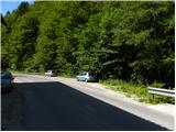 2
2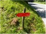 3
3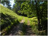 4
4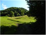 5
5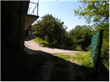 6
6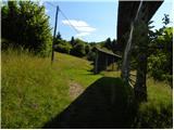 7
7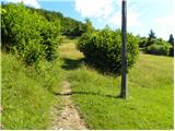 8
8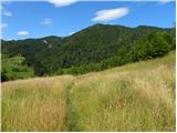 9
9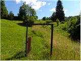 10
10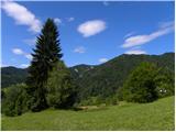 11
11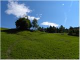 12
12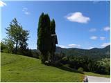 13
13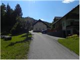 14
14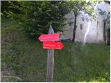 15
15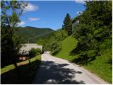 16
16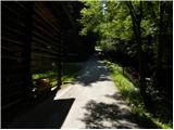 17
17 18
18 19
19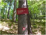 20
20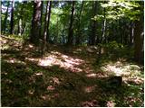 21
21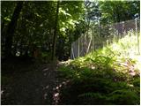 22
22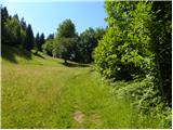 23
23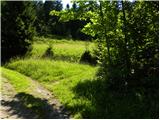 24
24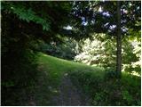 25
25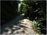 26
26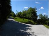 27
27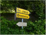 28
28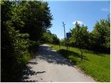 29
29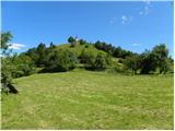 30
30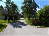 31
31 32
32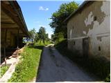 33
33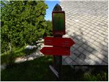 34
34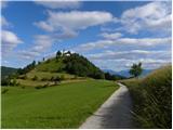 35
35 36
36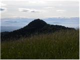 37
37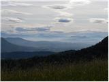 38
38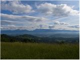 39
39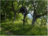 40
40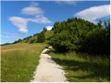 41
41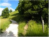 42
42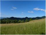 43
43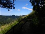 44
44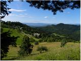 45
45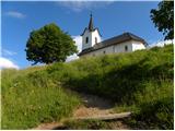 46
46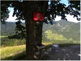 47
47 48
48
Discussion about the trail Legastja - Sveti Jakob
|
| Guest29. 07. 2007 |
v redu izlet tud če greš s bajkom
|
|
|
|
| Guest20. 01. 2008 |
Lep izlet, fantastičen razgled, sonček je bil in prav nič vetra! 
|
|
|
|
| Breda11. 04. 2011 |
Včeraj, 9.4.2011 sem bila gor. Krasno vreme, lep razgled (Nanos, Porezen, Blegoš, Triglav...).
|
|
|
|
| KARAMELICA29. 01. 2013 |
Bila na Svetem Jakobu. Naredila sva krožno turo Sv. Jakob - Katarina - Grmada- Gonte in po cesti nazaj do Legastje. Bilo je krasno vreme in razgled enkraten. Priporočam. 
|
|
|