Koglereck - Huhnerkogel/Košenjak
Starting point: Koglereck (1347 m)
| Lat/Lon: | 46,669°N 15,0097°E |
| |
Time of walking: 1 h
Difficulty: easy marked way
Altitude difference: 175 m
Altitude difference po putu: 225 m
Map: Koroška 1:50.000
Recommended equipment (summer):
Recommended equipment (winter): ice axe, crampons
Views: 8.943
 | 1 person likes this post |
Access to the starting point:
First we drive to Dravograd, then we continue our drive towards Austria. Continue on via Border crossing Vič, and we follow the main road to the start of Labot / Lavamünd, where signs for Graz / Graz and Ivnik / Eibiswald direct us right onto the ascending road. Follow the well-maintained and wide Alpine road to the Koglereck (aka Soboth) pass, where you turn left towards Ettendorf. Just after the crossroads, you will see a large gravel parking area on the left, where you can leave your car.
Path description:
From the parking lot, return to the main road, cross it and continue in the direction of Hühnerkogel (Košenjak). The route continues along the wide cart track, which is surrounded on both sides by vast "groves" of blueberries. The tight lane of blueberry bushes soon comes to an end, but the gently sloping path continues to lead into lane of scrub and sparse woodland, where the path becomes a little more overgrown. At the crossroads, follow the markings, and occasionally the moderately steep path, which offers a fine view towards Golica / Koralpe, leads us into the forest, where the cart track widens again. When the cart track widens, the marked path from Soboth joins us from the left, and we continue in the familiar direction towards Košenjak. A little further on, we reach a wider macadam road, which we reach just at the marked crossroads.
Continue along the narrower dirt road in the direction of Huhnerkogel and the Roßhütte hut, which is only a 3-minute walk away.
From the hut, where the road ends and there is a control stamp, continue in the direction of Huhnerkogel / Hühnerkogel, following the path which leads through a short meadow into the forest. There is a moderate climb through the forest, and then the path leads to a gentle grassy slope, from which a beautiful view of Golica / Koralpe opens up. The path then returns to the forest and leads to the border, where it joins a more beaten track coming from the Slovenian direction. Here, continue to the right and, within 2 minutes of further walking, you will reach the top of Košenjak at the edge of the forest.

Pictures:
 1
1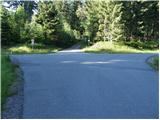 2
2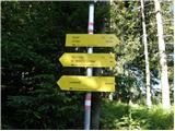 3
3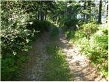 4
4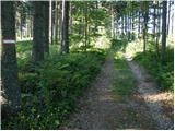 5
5 6
6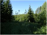 7
7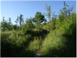 8
8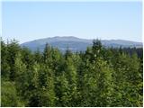 9
9 10
10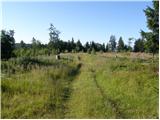 11
11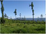 12
12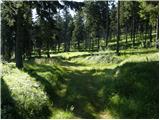 13
13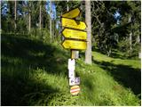 14
14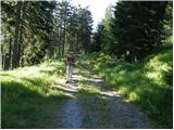 15
15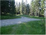 16
16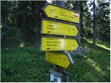 17
17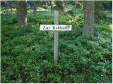 18
18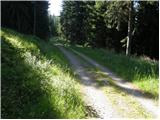 19
19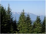 20
20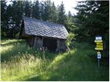 21
21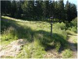 22
22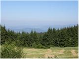 23
23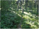 24
24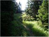 25
25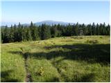 26
26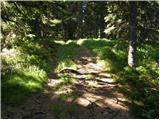 27
27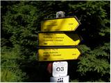 28
28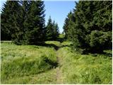 29
29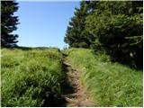 30
30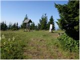 31
31 32
32
Discussion about the trail Koglereck - Huhnerkogel/Košenjak