Dom na Goropekah - Koča na Vrhu Svetih Treh Kraljev (footpath)
Starting point: Dom na Goropekah (742 m)
| Lat/Lon: | 46,0345°N 14,1256°E |
| |
Name of path: footpath
Time of walking: 1 h 30 min
Difficulty: easy marked way
Altitude difference: 81 m
Altitude difference po putu: 200 m
Map: Škofjeloško in Cerkljansko hribovje 1:50.000
Recommended equipment (summer):
Recommended equipment (winter):
Views: 6.143
 | 1 person likes this post |
Access to the starting point:
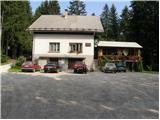
From Škofja Loka, drive through Gorenjska vas to Žire. In Žire, the sign for the village Goropeke directs you up to the left (or right if you are coming from Logatec). The road then takes you past the birth house of Leopold Suhadolčan and goes into the forest shortly afterwards. When it comes out of the forest it leads to the village Goropeke, where you continue to the right past the church. The road has another crossroads a little further on, where you continue along the upper left road, which quickly leads you to the parking lot in front of the Goropeki home.
Path description:
From the parking lot, continue along the forest road on the left side of the house. After a few dozen steps, the road leads to a place where a marked trail branches off to the left towards the mountain hut on the top of Sveti Treh kraljev. The initially beautiful dirt path soon leads us to a rather overgrown part of the path (in summer). The marked but sometimes less visible path then leads us to an asphalted road, where we continue to the left. The road then leads us through a small hamlet to a crossroads, where we continue left along the marked path. The dirt road leads us to the next hamlet, where we continue between the houses. Beware of vicious dogs! The path climbs over a meadow and then goes into the wods again. The way ahead soon leads to a dirt road, where you continue to the left. This road then leads us past a goat house to a tarmac road, where we continue up to the left. The road then leads us past a chapel to the next crossroads, where we continue to the right. There is only a short climb past the fire house to the hut at the top of the Hill of the Holy Three Kings.
PP: The whole route goes up and down again, only the last part of the route is mostly uphill.

Pictures:
 1
1 2
2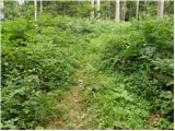 3
3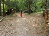 4
4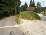 5
5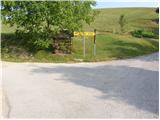 6
6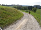 7
7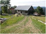 8
8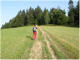 9
9 10
10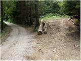 11
11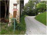 12
12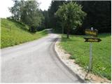 13
13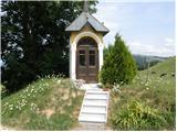 14
14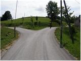 15
15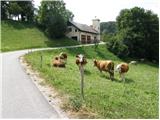 16
16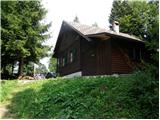 17
17
Discussion about the trail Dom na Goropekah - Koča na Vrhu Svetih Treh Kraljev (footpath)