Koča pri Savici - Dom pri Krnskih jezerih
Starting point: Koča pri Savici (653 m)
| Latitude/Longitude: | 46,2896°N 13,8022°E |
| |
Walking time: 5 h 20 min
Difficulty: easy marked way
Elevation gain: 732 m
Elevation difference along the route: 1175 m
Map: TNP 1:50.000
Recommended equipment (summer):
Recommended equipment (winter): ice axe, crampons
Views: 27.562
 | 1 person like this post |
Access to starting point:
From the Ljubljana - Jesenice highway, take the Lesce exit and follow the road towards Bled and further towards Bohinjska Bistrica. Continue driving towards Bohinj Lake (Ribčev Laz), at which we arrive at a crossroads, where we continue straight along the left (southern) side of the lake in the direction of Ukanc and Savica waterfall. Then follow this increasingly narrow road to the large parking lot at Koča pri Savici. The parking lot is paid.
Route description:
From the parking lot, we head to the wide footpath in the direction of Savica waterfall and Dom na Komni (right the path over Komarča). Already after a shorter gentle ascent, the path brings us to a marked junction, where the tourist path towards Savica waterfall branches off to the right, while we continue slightly left or straight on the wide footpath in the direction of Komna. The path further ascends for a short time along the Savica, then brings us to the first of the marked 48 switchbacks. After an hour and a half of moderate ascent through the forest, the path brings us to the mentioned 48th switchback, from which a beautiful view of Bohinj Lake opens up. Here the path turns somewhat to the right and transitions into the valley called Pekel, where it ascends gently for some time, then turns to the right and ascends somewhat steeper again. Already after a few dozen steps, the path turns left again and then ascends parallel with the valley. Further, the gentle to moderately steep path gradually transitions into a more sparse forest, from which we soon see the Dom na Komni. The path further leads us past a small interesting cave; higher up it brings us to a junction, where the path to Črno jezero branches off to the right, while we continue left and further on the wide path. There follows some traversing ascent; at the natural abyss, which is fenced for safety, the path turns right, then ascends to the next junction, where the path from Črno jezero joins us.
Just a little further, the path splits once again, we choose the left path in the direction of Dom na Komni, or we can also take the somewhat shorter path that continues straight and bypasses the Dom na Komni (right Koča pri Triglavskih jezerih).
There still follows an ascent past the bajta Pri Hubertu and in a few minutes we reach the Dom na Komni.
From the Dom na Komni, we go past the small chapel and follow the signs for Koča pod Bogatinom (left Vogel, Tolminski Kuk and Planina Govnjač), but we soon merge with the aforementioned somewhat shorter path.
We continue slightly left in the direction of Koča pod Bogatinom and on the wide and quite scenic path quickly arrive at Planina na Kraju, where past the pyramid (ossuary at Koča pod Bogatinom - mountain memorial obelisk) we reach the Koča pod Bogatinom, which is located in the middle of the pasture.
We bypass the hut on the right side and quickly arrive at the marked junction, where the path across Lepa Komna branches off to the right, leading further towards Lanževica or Oslova škrbina, while we continue straight, still on the wider gentle path in the direction of Bogatinsko sedlo. On the western part of Planina na Kraju another path branches off to the left towards Planina Govnjač, while we continue for some minutes in a gentle ascent on the southern side of Kozlov rob. The path further completely flattens for some time and transitions to the edge of the valley Gracija, where we begin a traversing ascent, first on the slopes of Srednji vrh, later on the slopes of the pre-summit Vrh nad Gracijo. In the continuation, the path becomes somewhat steeper and with beautiful views brings us to the place where it splits.
We can continue further on the mule track, which makes a longer switchback, or on the somewhat shorter steep path, which ascends directly to Bogatinsko sedlo, where both paths merge.
From the junction on Bogatinsko sedlo, from which a beautiful view opens on Krn and surrounding mountains, we head straight downward in the direction of Lepena, Prehodci, Krn, Krnsko jezero and Dom pri Krnskih jezerih (left Mahavšček and Bogatin, right Lanževica) on the path, which gradually begins to descend.
The path further leads us on the old military mule track, which a few minutes lower brings us to the slopes overgrown with dwarf pine; still lower the path flattens.
We continue past some old objects, which are part of the former Rapallo border.
Here in a kind of small valley a passage opens or an old trail leads towards Velika Montura; we continue on the marked path, which barely noticeably descends to the central part of the valley Za Lepočami, where there still stand some old Italian buildings, which are quite well preserved.
Here the marked path to Krn over Prehodci and Batognica branches off to the left, while we continue further towards the west and namely on the path, which leads through the valley south of Velika Montura; when we arrive in the small valley under Mala Montura, another path branches off to the left towards Prehodci or the source of Tolminka.
The path further temporarily descends through the small valley overgrown with dwarf pine and sparse larches; when the small valley widens, the path to Mali Šmohor branches off to the left.
There follow still some minutes of gentle walking and we arrive at the southern rim of Planina Duplje, where we keep to the right directions, or signs for Lepena and Dom pri Krnskih jezerih (left Krn and Krnsko jezero).
On Planina Duplje we go still past the shepherd's hut, where during the grazing season we can buy some dairy product; on the northeastern part of the pasture the path splits once again.
Again we continue right in the direction of Dom pri Krnskih jezerih (slightly left path bypasses the mountain hut and leads directly towards Lepena), to which we arrive after some minutes of further walk through the spruce forest.
Starting point - branch to Črno jezero 2:15, branch to Črno jezero - Memorial plaque to Matej Koblar 0:10, Memorial plaque to Matej Koblar - Dom na Komni 0:05, Dom na Komni - Koča pod Bogatinom 0:15, Koča pod Bogatinom - Bogatinsko sedlo 1:15, Bogatinsko sedlo - branch for Velika Montura 0:20, branch for Velika Montura - Za Lepočami 0:15, Za Lepočami - branch for Prehodce 0:20, branch for Prehodce - branch for Mali Šmohor 0:10, branch for Mali Šmohor - Planina Duplje 0:05, Planina Duplje - Dom pri Krnskih jezerih 0:10.

Along the route: Jama ob poti na Komno (1303m), Odcep k Črnemu jezeru (1411m), Brezno pod lovsko kočo na Komni (1430m), Spominska plošča Mateju Koblarju (1481m), Pri Hubertu (1492m),
Dom na Komni (1520m), Piramida (1520m),
Koča pod Bogatinom (1513m), Bogatinsko sedlo (1803m), Odcep za Veliko Monturo (1712m), Za Lepočami (1617m), Doliči (1472m), Pod Šmohorjem (1420m), Planina Duplje (1371m)
The trip can be extended to the following destinations: The lake Krnsko jezero,
Planina na Polju,
Rdeči rob,
Mali Šmohor,
Veliki Šmohor,
Bogatin,
Vogel (above Lepena),
Lanževica,
Mahavšček,
Veliki Lemež,
Batognica,
Vrh nad Peski,
Gomiščkovo zavetišče na Krnu,
Krn
Photos:
 1
1 2
2 3
3 4
4 5
5 6
6 7
7 8
8 9
9 10
10 11
11 12
12 13
13 14
14 15
15 16
16 17
17 18
18 19
19 20
20 21
21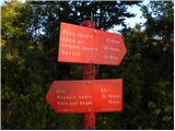 22
22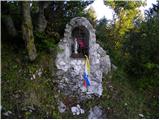 23
23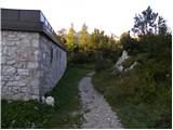 24
24 25
25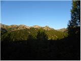 26
26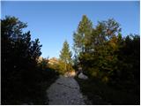 27
27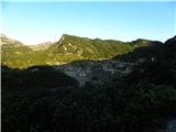 28
28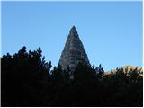 29
29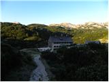 30
30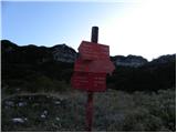 31
31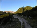 32
32 33
33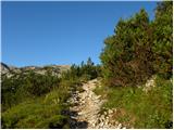 34
34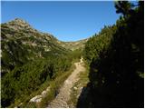 35
35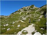 36
36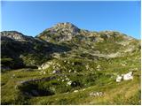 37
37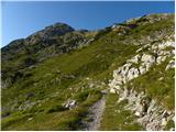 38
38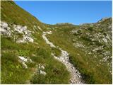 39
39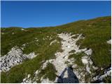 40
40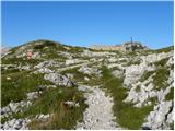 41
41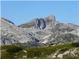 42
42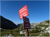 43
43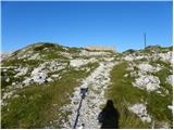 44
44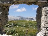 45
45 46
46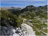 47
47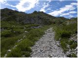 48
48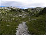 49
49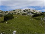 50
50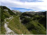 51
51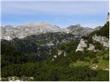 52
52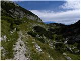 53
53 54
54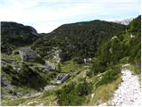 55
55 56
56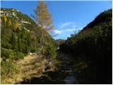 57
57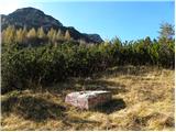 58
58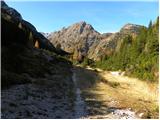 59
59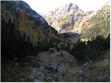 60
60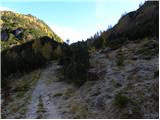 61
61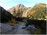 62
62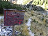 63
63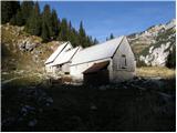 64
64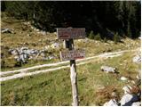 65
65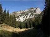 66
66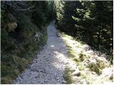 67
67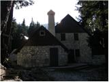 68
68
Discussion about the trip Koča pri Savici - Dom pri Krnskih jezerih
|
| Enka28. 05. 2013 |
Hi! I'm interested if there is any possibility of a circular route - meaning return to Koča pri Savici via a different path. The condition is that it should also be an easy marked trail . .
|
|
|
|
| otiv28. 05. 2013 |
A circular easy path is possible from Koča pod Bogatinom onwards.
|
|
|
|
| velkavrh29. 05. 2013 |
Return via another path is possible only from Komna to Koča pri Savici via Komarča, but it's a difficult path and I don't recommend it. We pass Koča pod Bogatinom in any case. I usually go via Komarča to Komna, back via serpentines. The only detour back can be made at Bogatinsko sedlo, turning left to Lanževica-easy, and from there descend via another path to Koča pod Bogatinom-easy. Best regards!
|
|
|
|
| SuzanaM29. 05. 2013 |
Last year I did a very nice 2-day tour, namely:
Day 1
Slap Savica - Komna - Koča pod Bogatinom - Lepa Komna - Lanževica - Bogatinsko sedlo - Krnsko jezero
Day 2
Krnsko jezero - Batognica (via Peske) - Prehodci - Bogatinsko sedlo - Koča pod Bogatinom - Slap Savica.
The path is easy, varied and very scenic.
In one day I went
Slap Savica - Komna - Koča pod Bogatinom - Bogatinsko sedlo - Lanževica - Velika Baba (from Velika Baba the path goes past Dom pri Krskih jezerih) - Lepena - intersection of the main road Lepena/Trenta.
During summer holidays there was a bus from Nova Gorica via Vršič to Ljubljana, so I could go both ways by public transport (train, bus). But from Dom Klemente Juga in Lepena to the intersection it's 6 km mostly along the road.
|
|
|
|
| SuzanaM29. 05. 2013 |
You can see photos from the second day under Forum/Current conditions/Julijske Alpe/Batognica on 2.5.2013.
|
|
|
|
| Enka1. 06. 2013 |
Thanks everyone. Apparently it's as I predicted - there is no really smart variant of a circular path, except maybe for some shorter section. I'd gladly use your 2nd day, SuzanaM, but there will be some quite vertigo-prone people in the group for whom Batognica could be too much  . .
|
|
|
|
| sh1. 06. 2013 |
Batognica shouldn't cause problems even for those with vertigo. You reach it from the Krn side actually via steps, towards Peski it's not precipitous either, and up top it's completely flat. At least as far as I remember, it's an easy path.
|
|
|
|
| Enka1. 06. 2013 |
Yes, I know. But those who are not so very prone to vertigo can hardly understand . Would you take someone to Batognica who found the path via Prode (Koča pri 7 jezerih - Vogar) extremely unpleasant? . Would you take someone to Batognica who found the path via Prode (Koča pri 7 jezerih - Vogar) extremely unpleasant?
|
|
|
|
| ih_hihi22. 09. 2013 |
Hello! What is the time frame for hiking Savica - Krnsko jezero, to Komna via Komarča?
|
|
|
|
| AndrejRibic22. 09. 2013 |
I walked this path in July 2013.
1 hour - Savica, Črno jezero via Komarča
1.5 hours to Komna
1 hour from Komna to the mulatiera at Bogatinsko sedlo
1:45 hours to the hut at Krnska jezera.
With a stop at Bogatin, it was realistically another hour.
In total, you can count on about 6 hours with a stop that offers nice views of Krn and the Julian Alps.
Bon appétit
|
|
|
|
| mukl31. 08. 2014 |
More than any scolding, let my writing be a warning to those who, during their mountain tour, plan a stop or perhaps an overnight stay at the Dom pri Krnskih jezerih. For you won't be able to contact your loved ones there, because there's no GSM signal. The matter may seem quite marginal, but if you're returning from high mountains, I'm almost sure that the family is glad for your call and the news that you've arrived safely.
Safe steps.
|
|
|
|
| Ruzowski31. 08. 2014 |
You get to the "signal" after less than 10 minutes walk towards the upper cable car station. So, a short walk before bed never hurts. 
|
|
|
|
| mukl31. 08. 2014 |
No, I didn't find it there either, nor at the pillar nor at the first electricity pillar and the walk is more than 10 minutes
|
|
|
|
| francimedved31. 08. 2014 |
In the hut's yard it is, behind the winter room, not strong but you can call.
|
|
|
|
| serajko1. 09. 2014 |
LP
The question is whether you're talking about the same provider
|
|
|
|
| Laščan1. 09. 2014 |
About a month ago I overnighted here and called home from in front of the upper cargo cableway station. Signal (for 040) was in front of the "shed" where the cables are led to the valley. LP
|
|
|
|
| mukl1. 09. 2014 |
You probably get 040, whatever it is, but Telekom's is definitely not and wasn't there.
|
|
|
|
| serajko1. 09. 2014 |
LP
If the phone shows it's possible to call 112, there's signal from one operator present. If that option isn't there, there's no signal at all.
|
|
|
|
| mukl1. 09. 2014 |
Guys and girls, so we don't get sidetracked! With my post I just wanted to say that to save someone's nerves, especially those waiting for a call from someone returning from the mountains. For example, I ruined someone's night because I couldn't call them, as that person was worried....
|
|
|
|
| IgorZlodej1. 09. 2014 |
Quite good signal at planina Duplje (041). For emergency calls, the hut takes care of it anyway 
|
|
|
|
| mukl1. 09. 2014 |
Just out of curiosity, the next day I was watching when a sufficiently strong signal would appear, one that would allow a call, and that happened only a bit below Bogatinsko sedlo, and even there it was spotty, ouch, now I won't comment anymore, I swear
|
|
|
|
| krn522. 01. 2018 |
Mountaineering Association Nova Gorica announces that the Dom pri Krnskih jezerih will be open during the winter season for a longer period, specifically from February 17 to April 3, 2018. For reservations and information, contact the association office during office hours Tuesday and Thursday from 15:00 to 18:00 at tel. 05 30 23 030 or via e-mail: planinskod.novagorica@siol.net. During the opening period of the hut, we will be reachable directly at the hut on tel. 051 328 928 or via e-mail: krnskoj@gmail.com.
|
|
|
|
| krn528. 05. 2018 |
We announce that the Planinski dom pri Krnskih jezerih will be open from Saturday, 2. 6. 2018 onwards.
The hut can be reached at phone number 051 328 928 or at e-mail: krnskoj.gmail.com
You are welcome.
|
|
|
To post a comment you must log in:
If you do not yet have a username, you must first
register.