 | Planina Vetrh - Veliki Javornik (Ženiklovec)
Veliki Javornik (also known as Ženiklovec) is a 1716 m high peak located between Storžič and Stegovnik. From the grassy summit with its registrat...
1 h 30 min |
 | Kališe - Kranjska reber
Kranjska reber, also known as Vrh Kašne planine (1435 m), is a mountain of volcanic origin. From the summit, which has a registration box with a ...
1 h 30 min |
 | Koča na Gozdu - Vršič vrh (on old road)
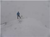
Vršič is a 1,737-metre-high mountain situated between the Poštarski dom hut and the Vršič pass. From the summit, where there is a registration bo...
1 h 30 min |
 | Kozarnice - Srednji Golak (unmarked eastern way)
Srednji Golak is located between Mali and Veliki Golak on the plateau of Trnovski gozd above Predmeja. The peak is covered with dwarf pines, and ...
1 h 45 min |
 | Jezero Sobote / Stausee Soboth - Huhnerkogel/Košenjak (on unmarked path)
Košenjak is located north of Dravograd and the Drava River on the border with neighbouring Austria. Access to Košenjak is possible on foot or by ...
1 h 40 min |
 | Avsa - Mrzli vrh (on Matajur)
Mrzli vrh is a 1358-meter-high peak located in the Matajur range. From the summit, where there is a panorama board and a summit register box with...
1 h 25 min |
 | Zatrnik - Galetovec
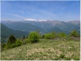
Galetovec is an indistinct peak on the southeastern part of the Pokljuka plateau. From the summit, which has a logbook, there is a nice view of t...
2 h |
 | Preval Hlevišče - Mladi vrh
Mladi vrh is the higher neighbor of the better-known Stari vrh, separated from it by a saddle. Covered in sparse beech forest, the summit offers ...
1 h 45 min |
 | Dom Pristava in Javorniški Rovt - Španov vrh
Španov vrh is a 1,334 m high mountain located between Javorniški Rovt and Planina pod Golico. From the summit, accessible by the eponymous cable ...
1 h 30 min |
 | Koča na planini Stador - Jalovnik
Jalovnik is a grassy peak located southeast of the slightly higher Kobilja glava. From the summit, which has a summit logbook, there is a nice vi...
1 h 30 min |
| Planina Lom - Jalovnik
Jalovnik is a grassy peak located southeast of the slightly higher Kobilja glava. From the summit, which has a summit logbook, there is a nice vi...
1 h 30 min |
 | Hunting cottage Vojkovo - Grmada (Nanos)
Grmada is a 1209-meter-high peak situated northwest of the more famous Pleša. From the summit, which has a stamp box, a nice view opens up onto p...
1 h 35 min |
 | Križovec - Mala Golica
Mala Golica is a less distinct peak located east of Krvavka. From its grassy summit, there is a nice view of the Dravska dolina, Struško, parts o...
1 h 30 min |
 | Makekova Kočna - Javornik above Jezersko
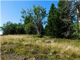
Javornik is a forested peak between the valleys of Ravenska Kočna and Makekove Kočna. There is no view from the summit due to the trees, but near...
1 h 45 min |
 | Solarji - Kuk (Kolovrat)
Kuk is the highest peak of the Kolovrat range at 1243 m. The range extends from Livek to Kambreško. From the summit, which has several transmitte...
2 h 10 min |
 | Javorje - Hunting cottage Na Glinu
The hunting cottage Na Glinu is situated on a panoramic hill between the mountain pastures Suha and Poljana. From the cottage there opens a nice ...
2 h |
| Pod Debelo glavo - Hunting cottage Na Glinu
The hunting cottage Na Glinu is situated on a panoramic hill between the mountain pastures Suha and Poljana. From the cottage there opens a nice ...
2 h 15 min |
 | Tolminske Ravne - Javor (above Tolminske Ravne)
Javor is a 1,363-meter-high peak situated between Tolminske Ravne and Grušnica. From the summit, which features a small cross, nice views open up...
1 h 20 min |
 | Pod Debelo glavo - Gradovec
Gradovec is a 1,692-meter-high peak located north of the ridge of Spodnje Bohinjske gore, specifically above the mountain pasture Poljana. From t...
1 h 35 min |
| Pod Debelo glavo - Gradovec (via hunting cottage)
Gradovec is a 1,692-meter-high peak located north of the ridge of Spodnje Bohinjske gore, specifically above the mountain pasture Poljana. From t...
1 h 50 min |
 | Korensko sedlo - Petelinjek (above Korensko sedlo) (on Austrian side)
Petelinjek is a smaller ridge located west to southwest of Korensko sedlo. The ridge is mostly on the Slovenian side, with only the highest peak ...
1 h 30 min |
 | Polja - Kališje
Kališje is a lesser-known peak in the western part of the Karawanks. From the summit, where transmitters are located, there are some views toward...
1 h 40 min |
 | Bela Peč - Ojstri vrh (above Prevala) (past peak Seduc)
Ojstri vrh is a 1,197-meter-high mountain located between the Seduc peak and Prevala. From the summit, there is a beautiful view of the surroundi...
1 h 30 min |
 | Bela Peč - Ojstri vrh (above Prevala) (via Ovčje jame)
Ojstri vrh is a 1,197-meter-high mountain located between the Seduc peak and Prevala. From the summit, there is a beautiful view of the surroundi...
1 h 45 min |
 | Zatrnik - Turn (above Bohinjska Bela)
Turn is a panoramic and precipitous peak located above Bohinjska Bela. From the summit, there is a nice view of Ratitovec, Jelovica, the Kamnik-S...
1 h 40 min |
 | Pod Peco / Koprein-Petzen - Šoparjev vrh
Šoparjev vrh is a 1,524-meter-high mountain located between Olševa and Peca, more precisely on the ridge separating the Koprivna Valley from the ...
1 h 35 min |
 | Koprivna (Kumer) - Čofatijev vrh (via Šoparjev vrh)
Čofatijev vrh is a panoramic mountain between the Koprivna and Topla valleys. From the top, a beautiful view opens up on the mountains above both...
1 h 45 min |
| Pod Peco / Koprein-Petzen - Čofatijev vrh (via Šoparjev vrh)
Čofatijev vrh is a panoramic mountain between the Koprivna and Topla valleys. From the top, a beautiful view opens up on the mountains above both...
2 h 10 min |
| Topla (Končnik) - Čofatijev vrh (via Šoparjev vrh)
Čofatijev vrh is a panoramic mountain between the Koprivna and Topla valleys. From the top, a beautiful view opens up on the mountains above both...
1 h 50 min |
 | Šumahovo sedlo - Jesenik (Jesenikov vrh) (via Veliki and Pikov vrh)
Jesenik, also known as Jesenikov vrh, is a 1,199-meter-high forested peak situated between Mežica and Podpeca....
1 h 45 min |
 | Završnica (Pri žagi) - Tolsti vrh (at Poljška planina) (via saddle Kališča)
Tolsti vrh is a 1,225-meter-high peak located between Završnica Valley and Draga Valley. The summit lies in forest, but a viewpoint just below of...
1 h 25 min |
 | Slovenji Plajberk / Windisch Bleiberg - Veronjak / Hausberg (via Veronjak / Hausberg)
Veronjak / Hausberg is a 1,348-meter-high peak located above the Poden / Bodental valley on the Austrian side of the Karawanks. From the summit, ...
1 h 25 min |
 | Zatrnik - Berjanca
Berjanca is a 1,264 m high peak above the namesake mountain pasture. An abandoned ski lift from the former Zatrnik ski area used to reach the sum...
1 h 35 min |
 | Slovenji Plajberk / Windisch Bleiberg - Rabenberg
Rabenberg is a 1,465 m high peak located in the Žingarica / Singerberg ridge. From the summit, there is a partial view to the northwest, while fo...
1 h 45 min |
| Plajberški graben / Bleiberger Graben - Rabenberg
Rabenberg is a 1,465 m high peak located in the Žingarica / Singerberg ridge. From the summit, there is a partial view to the northwest, while fo...
1 h 45 min |
 | Medvodje - Penatca
Penatca is a 1,299-meter-high peak located above the right bank of the Tržiška Bistrica. The summit itself is in the forest, but a few steps to t...
1 h 40 min |
 | MHE Zali potok - Primožkovi hribi
Primožkovi hribi is a small ridge above Jelendol, situated between the Tržiška Bistrica, Dolžanka and Zalega potok streams. The ridge's highest p...
1 h 30 min |
 | Medvodje - Medvodnica (via Tržiška Bistrica)
Medvodnica is a 1,202-meter-high mountain situated between the Košutnik and Tržiška Bistrica streams. The summit lies within the forest, offering...
1 h 30 min |
| Medvodje - Medvodnica (via Košutnik)
Medvodnica is a 1,202-meter-high mountain situated between the Košutnik and Tržiška Bistrica streams. The summit lies within the forest, offering...
1 h 25 min |
 | Teichalm (Teichalmsee) - Zachenkreuz
Zachenkreuz is a 1,601-meter-high peak situated above the Teichalm mountain pasture. On the summit, mostly overgrown by sparse forest, stands a w...
1 h 20 min |
 | Feistritzsattel - Großer Pfaff (easier path)
Großer Pfaff is a 1555-meter-high panoramic peak situated between the Pfaffensattel and Feistritzsattel passes. From the summit, where there is a...
1 h 45 min |
 | Feistritzsattel - Kleiner Pfaff
Kleiner Pfaff is a 1539-meter-high peak located southeast of the Pfaffensattel pass. From the summit, where a small cross stands, beautiful views...
1 h 45 min |
 | Feistritzsattel - Schöberlriegel
Schöberlriegel is a 1,704-meter-high peak situated north of Hochwechsel. From the summit, where a large cairn stands, a beautiful view opens up o...
1 h 40 min |
 | Feistritzsattel - Umschussriegel
Umschussriegel is a panoramic peak situated between Feistritzsattel pass and the Hochwechsel peak. From the grassy summit, a beautiful view opens...
2 h |
 | Straßegg - Zechnerschlag (Rohregg)
Zechnerschlag, or Rohregg, is a 1434-meter-high mountain situated in the Almenland nature park. From the summit, where a cross stands, a beautifu...
1 h 30 min |
 | Brneško sedlo - Mala Kopa
Mala Kopa is a 1,524-meter-high peak in the western part of the Pohorje. From the summit, where part of the Kope ski resort is also located, a be...
1 h 35 min |
| Koča Planinc - Mala Kopa
Mala Kopa is a 1,524-meter-high peak in the western part of the Pohorje. From the summit, where part of the Kope ski resort is also located, a be...
1 h 35 min |