Dolinza Alm/Planina Dolnica - Starhand
Starting point: Dolinza Alm/Planina Dolnica (1400 m)
| Lat/Lon: | 46,5741°N 13,4818°E |
| |
Time of walking: 1 h 40 min
Difficulty: easy marked way
Altitude difference: 565 m
Altitude difference po putu: 565 m
Map: Tabacco 19
Recommended equipment (summer):
Recommended equipment (winter): ice axe, crampons
Views: 5.167
 | 1 person likes this post |
Access to the starting point:
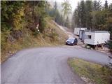
Access from Trbiz/Tarvisio: From Trbiz/Tarvisio, take the old road into Austria. After the village of Vrata/Thorl, the road turns left and crosses the railway with an underpass. Follow the road to the village of Bistrica/Feistritz, where in the centre of the village, at a sharp right turn, the road branches off towards the village of Blače/Vorderberg (continue straight ahead at the crossroads). At Blače/Vorderberg turn left towards the church and follow the road until the next crossroads where you turn right in the route mountain pasture Donice/Dolinza Alm. The asphalted road then takes you past the hut on the Kočiška planina/Koutschitz Alm and leads you just a little further on to the next crossroads, where you continue left along the road below. The road then descends, crosses a stream and then starts climbing again. Park in one of the small car parks on the roadside in front of the No All Traffic sign.
Access from Villach: Take the old road to Trbiz/Tarvisio and after the village of Megvarje/Maglern turn right under the railway. Follow the above description.
Access from Slovenia: Cross the Rateče border crossing to Trbiz/Tarvisio, then follow the above description.
Path description:
From the parking lot, continue along the road along which you parked. After about 15 minutes of walking, the path leads us to the mountain hut at mountain pasture. Continue along the road, which turns right just a few metres before the hut (in the route of arrival) and crosses a short lane of forest and a small torrential spring. Cross mountain pasture to a fork in the path, where you continue sharp left to a house that stands alone at this part of mountain pasture.
The path then ascends gently in a transverse ascent and leads to a pasture fence. Cross the fence and continue through the wods. After a few minutes of walking through the forest, the path leads back to the forest road, but only cross it. After a few steps, the path crosses the road again and continues through the forest, where it crosses a small well. The path then crosses a grassy clearing and then goes back into the forest, where it climbs more steeply for a short time. It crosses a torrent and then slowly moves out of the forest onto wide grassy slopes surrounded by larch trees. The path ahead is a little harder to follow and turns to the left. There is a barely noticeable climb up to a grassy ridge where the path makes a sharp right turn. Crossing just below the top of the grassy ridge to a fork in the path, where you continue in the same direction. The path continues up the gently sloping grassy slope to the foot of the steeper slopes. Here you will see signs directing you right under the steeper slopes to the edge of the forest. There is a short climb through the forest, and then the path ascends just below the ridge to the summit.

Pictures:
 1
1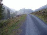 2
2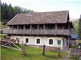 3
3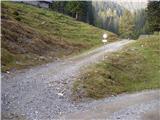 4
4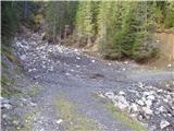 5
5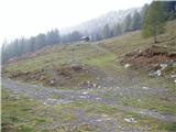 6
6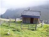 7
7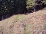 8
8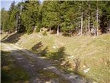 9
9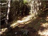 10
10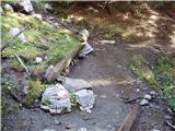 11
11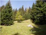 12
12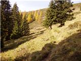 13
13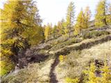 14
14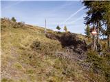 15
15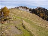 16
16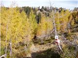 17
17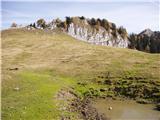 18
18 19
19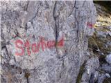 20
20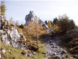 21
21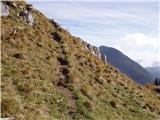 22
22 23
23
Discussion about the trail Dolinza Alm/Planina Dolnica - Starhand
|
| Acibujl15. 12. 2025 22:46:08 |
15.12. 2025, na krasno nedeljo, obisk Starhanda iz Ugovizze(Ukve) mimo koče Nordio Deffar. Parkirava na P6, parking Ex rif. Defar( tu je bila stara koča,ki je pogorela, višje je zdaj nova) privat cesta iz doline gor urejena, prevozna. Parking brezplačen. Poleti enkrat sva plačala 5€ cestine , zdaj ni nihče pobiral. Do koče je 40 min markirano, še dobrih 10 kar naravnost od koče naprej in in si na sedlu Lom. Tam se usmeriš proti Gorjaher planini,pot 403. Ko po tej markirani poti prideš na sedlo, te rumene avstrijske smerne tablice usmerijo proti vrhu Starhanda. Ob poti je tudi napis na veliki skali. Za gor sva šla po markirani poti in gazi, dol sva jo mahnila cez pobočje, direkt na pot, po stopinjah, ki sva jih prej videla, pa nisva upala gor po njih, saj sva bila prvič tu in sva se kar markacij držala. Pot do vrha je bila ok, razgledi pa fantastični, na vse štiri strani neba vrhovi,hribi,gore, krasno! Prav do križa dol na greben pa se nisva spustila. Se nama nekako ni zdelo najbolj varno tam dol v snegu...Nazaj do Loma, od tam še do planine Bistrizza in naprej do cerkvice Marija Snežna. Tam nadaljujeva do sedla Pleccia in nazaj v dolino do avta po poti 507. Krog sklenjen, skoraj 17km in nekaj čez 1100 višincev. Koča Deffar je bila odprta. Razmere idealne za zimsko potepanje po osončenih hribih!
|
|
|