Žlebe - Jeterbenk (western way)
Starting point: Žlebe (410 m)
Name of path: western way
Time of walking: 1 h 15 min
Difficulty: easy marked way
Altitude difference: 364 m
Altitude difference po putu: 364 m
Map: Ljubljana - okolica 1:50.000
Recommended equipment (summer):
Recommended equipment (winter):
Views: 10.229
 | 1 person likes this post |
Access to the starting point:
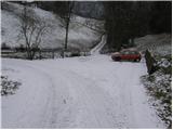
Dostop iz Ljubljane: Iz Ljubljane se peljemo proti Medvodam a le do vasi Medno. Tu zavijemo levo in se peljemo mimo hotela za katerim pa kmalu pridemo v križišče, kjer nadaljujemo levo proti Golem brdu in Žlebam. Cesta nas nato pelje skozi Seničico, kjer nadaljujemo desno v smeri Žleb. Le malo naprej pa se cesta razcepi na dva dela, kjer piše Žlebe levo in desno. Tu nadaljujemo po levi cesti, v naslednjem križišču pa levo po spodnji cesti. Cesta nas nato pelje mimo nekaj hiš za katerimi v ostrem desnem ovinku opazimo označeno parkirišče, kjer parkiramo.
Dostop iz Medvod: Iz Medvod se peljemo proti Ljubljani. Pri zadnjem semaforju v Medvodah zavijemo desno čez železniško progo in nato nadaljujemo levo. V križišču malo pred hotelom v mednem zavijemo desno in cesta nas nato pripelje v vas Seničica. Naprej sledi zgornjemu opisu.
Path description:
From the parking lot continue on the road, which leads us after a 100m walk to the mountain signposts along the road. Here, continue sharp left between the two roads, following the meadow moderately upwards. During the climb across the meadow, cross a small stream from which you can already see the Church of St Marjeta. The way ahead leads us to a macadam road (access is also possible), which we follow upwards. After a few minutes of walking along the road, you will reach the church, next to which there are a few benches and tables. From the church, continue along the wide path ahead, which soon leads to a crossroads, where it says Jeterbenk on the left, Katarina on the right. Here, although we are destined for Jeterbenk, we continue on the right path in the direction of Katarina (the left path is steeper). The wide path, after a further few minutes of gentle ascent, leads us to the next crossroads, where we continue on the upper left path (the two paths join higher up), which begins to climb steeper. After a short climb, the paths merge and the path leads us out of the forest to a larger clearing from which we open a view towards Sveti Jakob. Further on, the path joins a worse forest road which, after a few steps of walking, leads us to a crossroads of several paths.
Here we continue sharp left and past the chapel we climb gently up to the top slope of the mountain. After a few minutes, the path narrows and climbs steeply. The climb does not take long, as after just five minutes the path leads to a scenic peak.

Pictures:
 1
1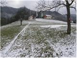 2
2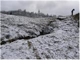 3
3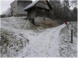 4
4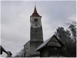 5
5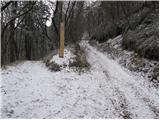 6
6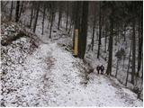 7
7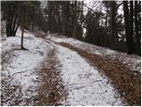 8
8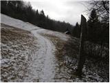 9
9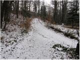 10
10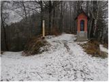 11
11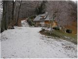 12
12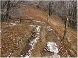 13
13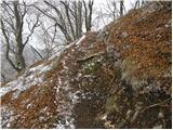 14
14 15
15
Discussion about the trail Žlebe - Jeterbenk (western way)