Starting point: Žiri (487 m)
| Lat/Lon: | 46,0426°N 14,1047°E |
| |
Time of walking: 2 h
Difficulty: easy marked way
Altitude difference: 521 m
Altitude difference po putu: 590 m
Map: Škofjeloško in Cerkljansko hribovje 1:50.000
Recommended equipment (summer):
Recommended equipment (winter):
Views: 13.100
 | 1 person likes this post |
Access to the starting point:
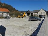
a) First drive to Škofja Loka, then continue to Gorenjska vas and Žire. Just past the parish church of St Martin in Žire, you will arrive at the Lenger pub and pizzeria, where you can park nearby.
b) From the motorway Ljubljana - Koper, take the exit Logatec, then continue in the direction of Rovt and Žire. In Žire, the road from Idrija joins us on the left, and we continue driving just a few more 10 m to the Lenger restaurant and pizzeria, where we park near the restaurant and pizzeria.
c) From the road Idrija - Tolmin, at Spodnja Idrija, take the road towards Žire and Škofja Loka. When you get to Žiri, turn left (right Logatec) and continue driving for only a few 10 m to the Lenger restaurant and pizzeria, where you can park near it.
Path description:
From Žiri, continue along the main road towards Idrija and Logatec, and follow it to the chapel at the crossroads. Here we turn right onto a side road, and after a few metres we see signs for Breznica and Mrzli vrh on the electricity pylon, which direct us left to cart track, which climbs steeply between the houses. Higher up, we cross the road, which gives us a fine view of Žiri, and we continue along cart track. Cart track quickly leads to a small hamlet, after which we continue to the right on a marked footpath, which we follow up to a small saddle. From the small saddle, next to which there is a sign and a bench, continue to the left and after a few steps you will reach a macadam road, which you can only cross. The path continues into the woods, through which it climbs steeply for a short time, and then lays down and leads us to a grassy slope with a view. There is a climb of a few minutes on the cart track and the path leads us to Breznica pri Žireh, where we also get on the asphalt road. Through the village, follow the markings and the road leads past the village church of St. Kancijan, in a slight downhill to a crossroads from which we continue right in the direction of Mrzlega Vrha. Here the road ascends slightly and then begins to descend to the next crossroads, where we again continue to the right (Korita on the left). From the junction onwards, the road loses its asphalt coating and we follow the macadam road across a larger meadow.
When the road returns to the forest, the signs for Mrzli Vrh direct us left onto a marked footpath which climbs moderately through the forest. Continue climbing through the forest for a while, and then the path leads to a grassy ridge, which offers a beautiful view of Blegoš and the surrounding peaks. Here we walk along the road for a short time, and then the signs for Mrzli Vrh direct us slightly to the right onto an ascending path, which lies higher and gradually passes to the right side of the ridge. A short crossing follows and the scenic route leads to a signpost marking Mrzli vrh (the signpost is located just below the summit).
Continue along the marked path, which begins to descend gently towards the nearby road. Once on the road, join the path leading from the village of Ledinica, and we continue left along the road, which initially only crosses the slopes, then begins to descend. After a short downhill we arrive at a marked crossroads where we take a sharp left in the direction of Ledine (slightly right Vodičar farm, where there is a stamp from Sivka - 1 minute). Continue along the gently ascending asphalt road, which leads past a small monument to a crossroads of several roads. Continue straight past the NOB memorial and the chapel, onto the dirt road in the direction of Sivka (this is also the first Sivka marker on the route). Continue along the dirt road for a short distance, and then the markers direct us slightly right onto a meadow, and we walk along it to the edge of the forest, where we see the next Sivka marker. The path ahead leads us into the forest, and we follow it for a further 5 minutes to reach the top of Sivka.

Pictures:
 1
1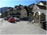 2
2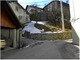 3
3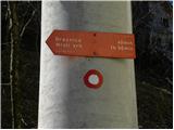 4
4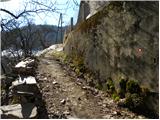 5
5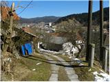 6
6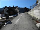 7
7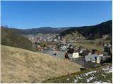 8
8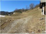 9
9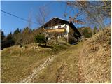 10
10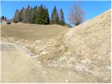 11
11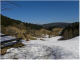 12
12 13
13 14
14 15
15 16
16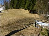 17
17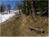 18
18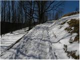 19
19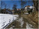 20
20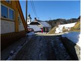 21
21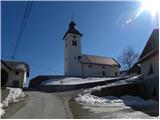 22
22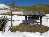 23
23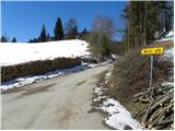 24
24 25
25 26
26 27
27 28
28 29
29 30
30 31
31 32
32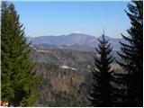 33
33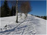 34
34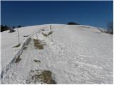 35
35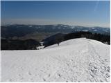 36
36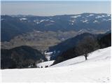 37
37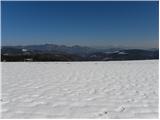 38
38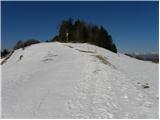 39
39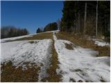 40
40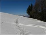 41
41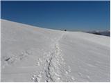 42
42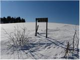 43
43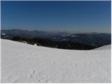 44
44 45
45 46
46 47
47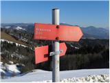 48
48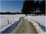 49
49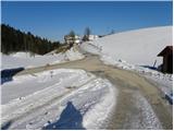 50
50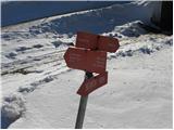 51
51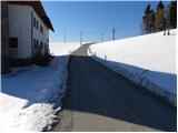 52
52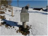 53
53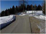 54
54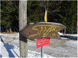 55
55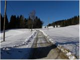 56
56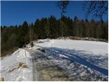 57
57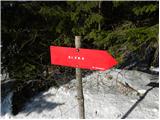 58
58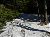 59
59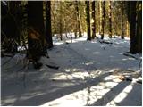 60
60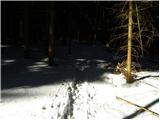 61
61 62
62
Discussion about the trail Žiri - Sivka
|
| ljubitelj gora12. 03. 2011 |
Na tem koncu se je včasih snemala kmetija 1,2. Ko se je snemanje zaključilo je bilo obiska na kmetiji ogromno.
|
|
|
|
| ce_belica23. 07. 2013 |
Zanima me, če je pot dobro markirana?
|
|
|
|
| anazala26. 09. 2020 |
prav rada bi šla, pa po toliko časa ne vem, če je še vse tako lepo označeno. lahko kaj poveste.
|
|
|
|
| Spelcarocket1. 01. 2021 |
Po prvi letošnji štempelj v zimsko idilo na Sivko! Pot je lepa, stran od kotlinske megle in lepo je naletaval sneg  ob vsemu pa še otroško veselje, ko se spuščajo po hribčku s sankami Pot v sneženih razmerah se dobro vidi in je lepo markirana. Bo treba iti naokoli še poleti.
|
|
|